Category:Grade II listed schools in London
Jump to navigation
Jump to search
Subcategories
This category has the following 24 subcategories, out of 24 total.
B
- Bobath Centre, East Finchley (21 F)
- Brandlehow School (6 F)
D
- De Bohun Primary School (21 F)
F
G
- Grey Coat Hospital (27 F)
H
- High View Primary School (6 F)
K
L
- Lansbury Lawrence School (3 F)
- London Nautical School (4 F)
M
P
- Pardes House Grammar School (20 F)
S
- St Marylebone Grammar School (3 F)
- Salcombe Preparatory School (14 F)
- St John's Schools, Wapping (14 F)
T
- Trinity Primary Academy (16 F)
Media in category "Grade II listed schools in London"
The following 34 files are in this category, out of 34 total.
-
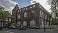
 20 St James's Walk, Clerkenwell, April 2023.jpg 3,024 × 4,032; 5.31 MB
-

-
 All Souls Church Day School, Foley Street, Fitzrovia, May 2023.jpg 4,032 × 3,024; 4.87 MB
-
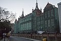
 Building at former Hugh Myddelton Schools, Clerkenwell, April 2023.jpg 4,032 × 3,024; 3.57 MB
-
 Charlotte Sharman School (7327542140).jpg 2,736 × 3,648; 3.06 MB
-
 Christchurch Primary School, Christchurch Passage, Hampstead, August 2022 01.jpg 4,032 × 3,024; 4.74 MB
-
 Christchurch Primary School, Christchurch Passage, Hampstead, August 2022 02.jpg 4,032 × 3,024; 4.38 MB
-
 Columbia Market Nursery School, E2 - geograph.org.uk - 3290542.jpg 640 × 384; 330 KB
-
 Former Infants School (8669113502).jpg 3,648 × 2,736; 3.81 MB
-
 Former infants school, Lambeth Road (geograph 4780902).jpg 640 × 425; 152 KB
-
 Former Rochelle Street School.jpg 4,931 × 3,522; 10.82 MB
-
 Former school on Hunter Close (1) - geograph.org.uk - 1764490.jpg 640 × 480; 149 KB
-
 Goose Green Primary and Nursery School and walls, gates and railings.jpg 4,032 × 3,024; 3.1 MB
-
 Harper Street School - geograph.org.uk - 1766192.jpg 640 × 480; 132 KB
-
 Hartsbrook Primary School, South Tottenham.jpg 4,288 × 3,216; 6.88 MB
-
 Jamiatul Ummah School 56 Bigland Street E1 2ND.jpg 2,336 × 3,504; 4.14 MB
-
 Kennington Boys' School.jpg 6,000 × 4,000; 4.06 MB
-
 Marion Richardson Primary School Senrab Street E1 0QF.jpg 5,312 × 2,988; 4.96 MB
-
 National School for Girls and Infants, Vicarage Crescent - geograph.org.uk - 2656065.jpg 4,000 × 3,000; 4.35 MB
-
 Old Grammar School and railings, Dulwich.jpg 3,024 × 4,032; 2.34 MB
-
 Raine's Foundation School Arbour Square E1 0PP.jpg 5,312 × 2,988; 5.86 MB
-

-
 Rochelle Street Primary School.jpg 6,000 × 3,376; 5.59 MB
-
 Sacred Heart of Mary Girls' School Upminster.JPG 4,278 × 3,210; 3.35 MB
-
 St John's and St Clement's, East Dulwich, 2018.jpg 4,032 × 3,024; 3.32 MB
-
 St Luke's Primary School, Elder Road - geograph.org.uk - 1711463.jpg 640 × 466; 106 KB
-
 St Michaels Primary School, Highgate.jpg 2,496 × 1,080; 1.36 MB
-
-
 Sunnyhill Primary School (9176313471).jpg 3,648 × 2,736; 4.01 MB
-
 The John Roan School (Upper School).jpg 3,202 × 4,301; 15.22 MB
-

-
 The Wisdom School, Philip Lane N15 - geograph.org.uk - 3857910.jpg 640 × 480; 176 KB
-
 Vauxhall Manor School Annexe.jpg 6,000 × 4,000; 12.97 MB
-
 Wisdom School, Philip Lane N15 - geograph.org.uk - 3857906.jpg 640 × 480; 172 KB


.jpg)


.jpg)
.jpg)

_-_geograph.org.uk_-_1764490.jpg)


.jpg)
.jpg)
,_Camp_Road,_Wimbledon_Common_(geograph_2267092).jpg)


