Category:Grade II listed houses in Herefordshire
Jump to navigation
Jump to search
Ceremonial counties of England: Bedfordshire · Berkshire · Buckinghamshire · Cambridgeshire · Cheshire · Cornwall · Cumbria · Derbyshire · Devon · Dorset · Durham · East Riding of Yorkshire · East Sussex · Essex · Gloucestershire · Greater London · Greater Manchester · Hampshire · Herefordshire · Hertfordshire · Kent · Lancashire · Leicestershire · Lincolnshire · Merseyside · North Yorkshire · Northamptonshire · Northumberland · Nottinghamshire · Oxfordshire · Rutland · Shropshire · Somerset · South Yorkshire · Staffordshire · Suffolk · Surrey · Tyne and Wear · Warwickshire · West Midlands · West Sussex · West Yorkshire · Wiltshire · Worcestershire
City-counties: Bristol · City of London
Former historic counties:
Other former counties:
City-counties: Bristol · City of London
Former historic counties:
Other former counties:
Subcategories
This category has the following 23 subcategories, out of 23 total.
1
- 11, The Square, Kington (2 F)
D
- Dinmore Manor (7 F)
H
- Harley House (4 F)
- Henwood, Dilwyn (2 F)
K
- King's Caple Court (6 F)
- Kinsham Court (3 F)
L
O
- Old Crow Cottage (8 F)
- Old Deanery House, Hereford (4 F)
- Old Oak House, Pembridge (3 F)
P
- Paytoe Hall, Adforton (9 F)
- Putley Court (2 F)
S
- Seedley House, Leintwardine (5 F)
T
- The Great House, Dilwyn (4 F)
W
- Wyastone Leys (16 F)
Media in category "Grade II listed houses in Herefordshire"
The following 71 files are in this category, out of 71 total.
-
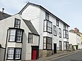
 1, The Square, Kington.jpg 4,000 × 3,000; 942 KB
-
 21 and 22, Church Street, Kington.jpg 4,000 × 3,000; 996 KB
-
 27 and 28, Church Street, Kington.jpg 3,000 × 4,000; 821 KB
-
 29 Church Street, Kington - geograph.org.uk - 1902319.jpg 3,311 × 2,456; 4.56 MB
-
 29, Church Street, Kington.jpg 4,000 × 3,000; 877 KB
-
 29, High Street, Kington.jpg 3,000 × 4,000; 758 KB
-
 32 and 33, Church Street, Kington 02.jpg 4,000 × 3,000; 1.18 MB
-
 32 and 33, Church Street, Kington.jpg 4,000 × 3,000; 890 KB
-
 Chipping Hall - 4486148.jpg 4,320 × 3,240; 4.9 MB
-
 Clencher's Mill - geograph.org.uk - 1088050.jpg 640 × 480; 329 KB
-
 Dunfield House - geograph.org.uk - 760103.jpg 640 × 480; 69 KB
-
 Estate cottages, The Mynde - geograph.org.uk - 2284144.jpg 1,024 × 768; 250 KB
-
 Exchequer Court, Thruxton - geograph.org.uk - 369534.jpg 640 × 427; 250 KB
-
 Farm house at Lewstone - geograph.org.uk - 1205652.jpg 640 × 426; 88 KB
-
 Flanesford Priory Farmhouse.jpg 4,000 × 3,000; 4.9 MB
-
 Former Castle Inn, Kington.jpg 4,000 × 3,000; 1,017 KB
-
 Former stables at Dore Abbey.jpg 4,000 × 3,000; 4.87 MB
-
 Governor's House, Union Walk, Hereford, September 2020.jpg 4,032 × 3,024; 2.29 MB
-

-
 Grade II listed Coughton Mill, Coughton - geograph.org.uk - 5194373.jpg 800 × 469; 178 KB
-

-
 Grade II listed South Lodge, Goodrich - geograph.org.uk - 3848042.jpg 800 × 578; 142 KB
-
 Lower House Farm, Hereford - geograph.org.uk - 445382.jpg 640 × 426; 108 KB
-
 High House, Lugwardine - geograph.org.uk - 969492.jpg 640 × 480; 125 KB
-
 Holly Cottages, Goodrich.jpg 4,000 × 3,000; 1.26 MB
-
 Holly Tree Cottage, Goodrich - geograph.org.uk - 3848023.jpg 800 × 599; 120 KB
-
 Kilpeck Court Farm 01.jpg 4,000 × 3,000; 4.75 MB
-
 Kilpeck Court Farm 02.jpg 4,000 × 3,000; 4.85 MB
-
 Llandinabo Farm - geograph.org.uk - 129008.jpg 426 × 640; 134 KB
-
 Longworth Hall - geograph.org.uk - 722647.jpg 640 × 449; 162 KB
-
 Longworth Hall, Lugwardine - geograph.org.uk - 3385656.jpg 640 × 427; 193 KB
-
 Malt House (Lugwardine) - geograph.org.uk - 6165743.jpg 3,648 × 2,736; 4.96 MB
-

-
 Marsden House, Whitchurch - geograph.org.uk - 3808382.jpg 800 × 664; 93 KB
-
 Marsden House, Whitchurch - geograph.org.uk - 975923.jpg 640 × 480; 76 KB
-
 Newhouse Farmhouse, near Kilpeck 01.jpg 4,000 × 3,000; 5.4 MB
-
 Newhouse Farmhouse, near Kilpeck 02.jpg 4,000 × 3,000; 5.14 MB
-

-
 Portland House Guest House, Whitchurch - geograph.org.uk - 755476.jpg 640 × 480; 100 KB
-
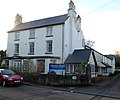
 Portland House, Whitchurch - geograph.org.uk - 3766378.jpg 800 × 461; 96 KB
-
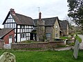
 St Lawrence Church, Preston on Wye - geograph.org.uk - 148864.jpg 640 × 480; 304 KB
-
 Priory Farmhouse, Kilpeck 01.jpg 4,000 × 3,000; 5.23 MB
-
 Priory Farmhouse, Kilpeck 02.jpg 4,000 × 3,000; 5.07 MB
-

-
 Rocklands House Goodrich.jpg 1,800 × 1,158; 416 KB
-

-
 Sugwas Court - geograph.org.uk - 359041.jpg 640 × 480; 148 KB
-
 The Archdeacon’s House, Hereford, July 2019.jpg 4,032 × 3,024; 4.44 MB
-
 The Beeches, Staunton on Wye - geograph.org.uk - 316516.jpg 640 × 426; 195 KB
-
 The old Bakehouse, Yarpole - geograph.org.uk - 532444.jpg 640 × 426; 444 KB
-
 The Old Court, Goodrich 01.jpg 4,000 × 3,000; 4.57 MB
-
 The Old Court, Goodrich 02.jpg 4,000 × 3,000; 4.6 MB
-
 The Old Court, Goodrich 03.jpg 4,000 × 3,000; 4.59 MB
-
 The Old Record House, Bromyard - geograph.org.uk - 4408846.jpg 800 × 633; 123 KB
-
 The Porch House, Kington.jpg 4,000 × 3,000; 1.51 MB
-
 The Precentor's House, Hereford, September 2020.jpg 1,536 × 2,048; 1.12 MB
-
 The Terrace, Kington.jpg 4,000 × 3,000; 957 KB
-
 The Thatch - geograph.org.uk - 530454.jpg 640 × 453; 68 KB
-
 The Upper Lodge To Wyastone Leys, Monmouth.jpg 4,039 × 3,183; 1.93 MB
-
 Upper Granton, Goodrich.jpg 4,000 × 3,000; 1.21 MB
-
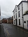 View toward Rowberry Street, Bromyard - geograph.org.uk - 3231602.jpg 2,448 × 3,264; 2.19 MB
-
 Wattle Cottage, Kington.jpg 4,000 × 3,000; 5.26 MB
-
 Winforton Wayside Cross Socket Stone - geograph.org.uk - 229233.jpg 640 × 480; 94 KB
-
 Wyastone Leys, Monmouth. Eastern side of the house.jpg 3,997 × 2,998; 1.7 MB
-
 Wyeastone lodge (cropped).jpg 447 × 447; 57 KB
-
 Wyeastone lodge.jpg 640 × 541; 92 KB
-
 Y Crwys, Goodrich - geograph.org.uk - 3848047.jpg 800 × 770; 154 KB
-
 Yew Tree Farm, Whitchurch - geograph.org.uk - 3868987.jpg 800 × 604; 156 KB
-
 Yew Tree House - geograph.org.uk - 3748145.jpg 3,072 × 2,048; 1.89 MB
-
 Fording Farm - geograph.org.uk - 1530240.jpg 640 × 480; 131 KB
-
 `The Thatch', Holme Lacy - geograph.org.uk - 105964.jpg 640 × 480; 110 KB


_-_geograph.org.uk_-_6165743.jpg)


.jpg)


