Category:Grade II listed buildings in Ceredigion
Jump to navigation
Jump to search

Wikimedia category | |||||
| Upload media | |||||
| Instance of | |||||
|---|---|---|---|---|---|
| |||||
Subcategories
This category has the following 22 subcategories, out of 22 total.
B
- Borth railway station (28 F)
C
- Cwmsymlog Mine chimney (7 F)
D
- Devil's Bridge AA box 289 (19 F)
H
- Harford Fountain, Lampeter (4 F)
L
- Lampeter Post Office (2 F)
- Lampeter Town Hall (8 F)
- Llanbadarn Fawr War Memorial (6 F)
M
N
- New Quay Pier (21 F)
P
- Plynlymon Hall (3 F)
- Pont Aberarth (2 F)
- Pont Einon, Tregaron (6 F)
T
- Talbot Hotel, Tregaron (19 F)
W
- Wellington Monument, Pendinas (43 F)
Media in category "Grade II listed buildings in Ceredigion"
The following 75 files are in this category, out of 75 total.
-
 A surviving mine chimney in Cwmsymlog - geograph.org.uk - 928352.jpg 480 × 640; 156 KB
-
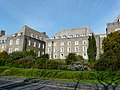 Aber 87568 Pantycelyn.JPG 3,264 × 2,448; 3.22 MB
-
 Aberffrwd.jpg 3,648 × 2,736; 1.78 MB
-
 Belle Vue Royal Hotel (geograph 4682091).jpg 800 × 530; 420 KB
-
 Bridge over the Afon Clettwr - geograph.org.uk - 756711.jpg 640 × 480; 149 KB
-
 Captain's Rendezvous New Quay.jpg 1,000 × 750; 314 KB
-
 Ceinewydd - Pier 20180708-01.jpg 5,472 × 3,648; 12.76 MB
-
 Ceinewydd - Pier 20180708-02.jpg 5,431 × 3,621; 13.08 MB
-
 Ceinewydd - Pier 20180708-03.jpg 5,472 × 3,648; 13.56 MB
-
 Ceinewydd - Pier 20180708-04.jpg 5,472 × 3,648; 7.07 MB
-
 Chimney at Cwmsymlog mine - geograph.org.uk - 924589.jpg 640 × 480; 81 KB
-
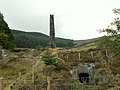 Chimney, Cwmsymlog Mine - geograph.org.uk - 36428.jpg 640 × 480; 140 KB
-
 Church Hall - geograph.org.uk - 54255.jpg 640 × 443; 29 KB
-
 Cofeb Ryfel Llangeitho.jpg 480 × 640; 150 KB
-
 Compton House (Including A.M.Garden Service and Family Video Centre) Albert Street.jpg 4,618 × 3,464; 702 KB
-
 Cwmsymlog Mine - geograph.org.uk - 958205.jpg 640 × 480; 75 KB
-
 Cwmsymlog mine chimney - geograph.org.uk - 925551.jpg 640 × 427; 62 KB
-
 Former vestry, St Michaels Church (geograph 4126226).jpg 800 × 530; 418 KB
-
 Glandwr Country House - geograph.org.uk - 4960074.jpg 2,048 × 1,536; 737 KB
-
 Glandyfi Castle (geograph 2042271 cropped).jpg 1,006 × 754; 257 KB
-
 Glandyfi Castle (geograph 2042271).jpg 2,000 × 3,008; 1.47 MB
-
 Graystone (28145944471).jpg 2,304 × 1,728; 767 KB
-
 Gwesty Cymru (geograph 4568512).jpg 530 × 800; 401 KB
-
 Hotel Penwig, New Quay - geograph.org.uk - 6026757.jpg 2,304 × 1,728; 1.78 MB
-
 Lanbedr Pont Steffan - Lampeter 05.JPG 2,048 × 3,648; 1.65 MB
-
 Lanbedr Pont Steffan - Lampeter 06.JPG 3,648 × 2,048; 1.63 MB
-
 Lych gate, St Michaels Church (geograph 5729717).jpg 640 × 480; 86 KB
-
 Lychgate to SE of Church of St Padarn.jpg 3,456 × 4,608; 5.81 MB
-
 Manchester House,Bridge Street.jpg 4,032 × 3,024; 2.12 MB
-
 Memorial to the Rev. Lewis Edwards (geograph 2924645).jpg 479 × 640; 73 KB
-
 Midland Bank,including No.9 Alban Square, North Road.jpg 3,648 × 2,736; 339 KB
-
 Milestone (3).jpg 3,648 × 2,736; 1.57 MB
-
 Milestone on A 487.jpg 3,648 × 2,736; 2.49 MB
-
 Milestone on A487 (1).jpg 1,976 × 1,482; 636 KB
-
 Milestone on A487.jpg 3,648 × 2,736; 1.86 MB
-
 Milestone, Penglais Road (geograph 3616962).jpg 530 × 800; 654 KB
-
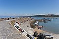
 New Quay - geograph.org.uk - 347540.jpg 640 × 480; 74 KB
-
 New Quay - geograph.org.uk - 742726.jpg 640 × 428; 85 KB
-
 New Quay 2.jpg 2,017 × 1,513; 1.35 MB
-
 New Quay Banner.jpg 5,472 × 782; 4.09 MB
-
 New Quay Marina - panoramio.jpg 1,600 × 1,200; 368 KB
-
 New Quay, quay - geograph.org.uk - 449028.jpg 640 × 429; 90 KB
-
 No.10 Market Street.jpg 3,648 × 2,736; 517 KB
-
 No.11 High Street (Midland Bank).jpg 3,024 × 4,032; 2.19 MB
-
 No.14 High Street (Lloyd's Bank).jpg 3,024 × 4,032; 2.28 MB
-
 No.18 Princess Street.jpg 1,943 × 2,590; 743 KB
-
 No.20 Market Street.jpg 4,618 × 3,464; 747 KB
-
 No.20 Pier Street (Gallery 72).jpg 4,032 × 3,024; 4.21 MB
-
 No.25 North Road.jpg 3,648 × 2,736; 251 KB
-
 No.26 Pier Street (Mandarin Chinese Restaurant).jpg 4,032 × 3,024; 3.87 MB
-
 No.28 Pier Street (Don Gelato).jpg 4,032 × 3,024; 3.53 MB
-
 No.34 Eastgate.jpg 3,711 × 2,782; 1.83 MB
-
 No.34a Pier Street.jpg 4,032 × 3,024; 3.21 MB
-
 No.37 Alban Square.jpg 3,648 × 2,736; 841 KB
-
 No.38 Eastgate.jpg 2,965 × 2,223; 1.17 MB
-
 No.5 New Street.jpg 4,032 × 3,024; 2.82 MB
-
 No.9 Tabernacle Street.jpg 3,648 × 2,736; 339 KB
-
 Nos.16 & 18 Pier Street.jpg 3,221 × 2,415; 1.35 MB
-
 Nos.22 & 24 Pier Street (Mander & Son).jpg 4,032 × 3,024; 3.4 MB
-
 Nos.35-37 (Consec) Marine Terrace (Bay Hotel).jpg 2,500 × 1,875; 886 KB
-
 Outbuildings at Cardigan Castle.jpg 900 × 675; 276 KB
-
 Plaid Cymru, 32 Heol y Wig, Aberystwyth.jpg 455 × 640; 54 KB
-
 Queensbridge Hotel.jpg 2,040 × 2,720; 1.08 MB
-
 Richmond Hotel (geograph 2815214).jpg 425 × 640; 281 KB
-
 Sea Bank Hotel.jpg 2,837 × 2,128; 1.36 MB
-
 Telephone Call Box by the Memorial Hall (01974 298233).jpg 3,000 × 4,000; 4.47 MB
-
 Telephone Call-box (01545 580469).jpg 3,872 × 2,592; 4.68 MB
-
 The Glengower Hotel,Victoria Terrace.jpg 2,098 × 2,797; 1,007 KB
-
 The Harbour, New Quay - geograph.org.uk - 1022885.jpg 640 × 420; 46 KB
-
 The old pier at New Quay - geograph.org.uk - 497038.jpg 640 × 480; 413 KB
-
 Visitor information in Cwmsymlog - geograph.org.uk - 1105983.jpg 480 × 640; 222 KB
-
 Water wheel at Llwyn-ysgaw - geograph.org.uk - 1491933.jpg 640 × 480; 158 KB
-
 Y Garreg Fawr (the Big Stone) (geograph 2104249).jpg 640 × 480; 95 KB
-
 Yr Hen Siop.jpg 2,612 × 3,658; 3.81 MB
-
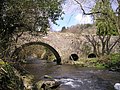
 Pont Llangybi - geograph.org.uk - 668176.jpg 640 × 480; 69 KB


.jpg)


_Albert_Street.jpg)


.jpg)

.jpg)
.jpg)
.jpg)
.jpg)


.jpg)


.jpg)

.jpg)

.jpg)

.jpg)


.jpg)
.jpg)


.jpg)

.jpg)
.jpg)


.jpg)
_Marine_Terrace_(Bay_Hotel).jpg)


.jpg)

.jpg)
.jpg)


_(geograph_2104249).jpg)

