Category:Goyt Way
Jump to navigation
Jump to search
10-mile walking route in Greater Manchester and Derbyshire, UK | |||||
| Upload media | |||||
| Instance of | |||||
|---|---|---|---|---|---|
| Part of | |||||
| Named after | |||||
| Location |
| ||||
| Connects with |
| ||||
| Length |
| ||||
| Terminus |
| ||||
 | |||||
Media in category "Goyt Way"
The following 14 files are in this category, out of 14 total.
-
 Etherow,Goyt valley way - geograph.org.uk - 1579671.jpg 640 × 480; 120 KB
-
 Goyt Valley Way - geograph.org.uk - 1177851.jpg 640 × 461; 119 KB
-
 Goyt Valley Way at Chadkirk - geograph.org.uk - 2732451.jpg 1,280 × 960; 1.09 MB
-
 Goyt Way - geograph.org.uk - 1300275.jpg 640 × 480; 209 KB
-
 Goyt Way - geograph.org.uk - 1300308.jpg 640 × 480; 167 KB
-
 Goyt Way at Richmond Farm - geograph.org.uk - 979660.jpg 640 × 480; 161 KB
-
 Goyt Way near Greenclough Farm - geograph.org.uk - 979652.jpg 640 × 480; 141 KB
-
-
 Path by River Goyt - geograph.org.uk - 2859395.jpg 4,000 × 3,000; 2.54 MB
-
 Path Junction (geograph 5567138).jpg 1,280 × 960; 1.51 MB
-
 River Goyt and Goyt Way at Mousley - geograph.org.uk - 979665.jpg 640 × 480; 129 KB
-

-
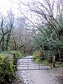
 The start (sort of) of the Goyt Way (33316861641).jpg 4,896 × 3,264; 11.21 MB
-
 Windy Bottom Farm - geograph.org.uk - 1177844.jpg 640 × 480; 143 KB


.jpg)


_of_the_Goyt_Way_(33316861641).jpg)
