Category:Gollierplatz (München)
Jump to navigation
Jump to search
| Object location | | View all coordinates using: OpenStreetMap |
|---|
public square in Schwanthalerhöhe, Germany  | |||||
| Upload media | |||||
| Instance of | |||||
|---|---|---|---|---|---|
| Location | Schwanthalerhöhe, Munich, Upper Bavaria, Bavaria, Germany | ||||
| Heritage designation | |||||
 | |||||
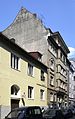
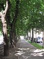
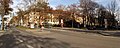
Deutsch: Der Gollierplatz im Münchner Stadtteil Schwanthalerhöhe (bzw. Westend) wird von den Straßen Trappentreustraße im Osten und von der Bergmannstraße im Westen begrenzt.
English: The Gollierplatz in Munich (district: Schwanthalerhöhe - also called: Westend) is bordered by the Trappentreustraße in the east and the Bergmannstraße in the west.
Subcategories
This category has the following 3 subcategories, out of 3 total.
N
- Nymphenbrunnen (Elmar Dietz) (4 F)
S
Media in category "Gollierplatz (München)"
The following 20 files are in this category, out of 20 total.
-
 Gollierplatz 1.jpg 4,416 × 3,312; 5.84 MB
-
 Gollierplatz 10 Muenchen-1.jpg 1,944 × 2,592; 1,006 KB
-
 Gollierplatz 10 Muenchen-2.jpg 2,493 × 1,851; 924 KB
-
 Gollierplatz 10 Muenchen-3.jpg 1,944 × 2,592; 895 KB
-
 Gollierplatz 14 Muenchen-1.jpg 1,803 × 2,328; 695 KB
-
 Gollierplatz 14 Muenchen-2.jpg 2,307 × 1,917; 681 KB
-
 Gollierplatz 14 Muenchen-3.jpg 1,911 × 2,433; 693 KB
-
 Gollierplatz 2.jpg 4,416 × 3,312; 6.64 MB
-
 Gollierplatz 3.jpg 3,312 × 4,416; 6.11 MB
-
 Gollierplatz 4 - München - front detail.jpg 1,900 × 4,560; 5.49 MB
-
 Gollierplatz 4 - München.jpg 2,505 × 3,990; 6.73 MB
-
 Gollierplatz 4.jpg 3,834 × 2,114; 2.43 MB
-
 Gollierplatz 5.jpg 3,312 × 4,416; 5.25 MB
-
 Gollierplatz mit St Rupert Kirche in München Schwanthalerhöhe Westend.JPG 4,416 × 3,312; 9.03 MB
-
 Gollierplatz mit St. Rupert Kirche im Hintergrund München Schwanthalerhöhe Westend.JPG 4,416 × 3,312; 9.31 MB
-
 Gollierplatz Muenchen-1.jpg 5,070 × 3,645; 5.72 MB
-
 Gollierplatz München Schwanthalerhöhe Westend 1.JPG 3,312 × 4,416; 8.2 MB
-
 Gollierplatz München Schwanthalerhöhe Westend.JPG 4,416 × 3,312; 8.78 MB
-
 Gollierplatz.jpg 4,416 × 3,312; 5.75 MB
-
 Trappentreustraße Gollierplatz 2009-11.jpg 2,500 × 1,000; 1.89 MB


