Category:Glengarnock
Jump to navigation
Jump to search
village in North Ayrshire, Scotland, UK | |||||
| Upload media | |||||
| Instance of | |||||
|---|---|---|---|---|---|
| Location |
| ||||
 | |||||
English: Glengarnock ( Gaelic: Gleann Gairneig) is a small village in North Ayrshire that lies near the west coast of Scotland. It forms part of the Garnock Valley area and is approximately 25 miles away for Glasgow, the nearest city.
Gàidhlig: 'S e baile beag ann an Siorrachd Inbhir Àir a tuath, ann an àird an iar-dheas Alba a tha ann an Gleann Gairneig (Beurla: Glengarnock). Tha e 25 mìle air falbh bho Ghlaschu.
Subcategories
This category has the following 2 subcategories, out of 2 total.
G
- Glengarnock railway station (5 F)
- Glengarnock steelworks (2 F)
Media in category "Glengarnock"
The following 66 files are in this category, out of 66 total.
-
 A gift to the people of Beith - geograph.org.uk - 242276.jpg 427 × 640; 102 KB
-
 Auchengree Farm Shop. - geograph.org.uk - 381073.jpg 640 × 480; 77 KB
-
 Carved head of a soldier, Glengarnock, North Ayrshire.jpg 3,323 × 2,683; 2.08 MB
-
 Carving of a lion, Glengarnock, North Ayrshire.jpg 3,065 × 2,243; 1.58 MB
-
 Carvings, old Co-operative Buildings, Glengarnock, North Ayrshire.jpg 2,096 × 2,556; 1.48 MB
-
 Craigends Road, Glengarnock 590569.jpg 640 × 480; 70 KB
-
 Cycle Track - geograph.org.uk - 35970.jpg 640 × 479; 96 KB
-
 Fallen Male Sycamore (Acer pseudoplatanus) flowers.JPG 4,608 × 3,456; 6.39 MB
-
 Glengarnock - geograph.org.uk - 601341.jpg 640 × 480; 63 KB
-
 Glengarnock Business Park - geograph.org.uk - 1443408.jpg 640 × 359; 65 KB
-
 Hazel (Corylus avellana) lenticels.JPG 3,075 × 3,314; 3.01 MB
-
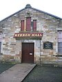 Hebron Hall Glengarnock.JPG 1,712 × 2,288; 1.18 MB
-
 Hebron Hall, Glengarnock, North Ayrshire.jpg 4,309 × 2,716; 2.04 MB
-
 Lochfaulds - geograph.org.uk - 81568.jpg 640 × 479; 66 KB
-
 Old Co-operative Store of 1899, Glengarnock, North Ayrshire.jpg 2,234 × 2,446; 853 KB
-
 Old Kilbirnie Loch site with previous ironworks location.JPG 2,288 × 1,712; 1.13 MB
-
 Old Water Treatment plant at Glengarnock.JPG 2,288 × 1,712; 1.28 MB
-
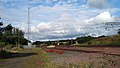 Rail line at Glengarnock - geograph.org.uk - 1431117.jpg 640 × 361; 53 KB
-
 River Garnock, Glengarnock, North Ayrshire.jpg 4,549 × 2,741; 4.16 MB
-
 The Old Co-operative Buildings, Mains Street,Glengarnock, North Ayrshire.jpg 3,742 × 2,162; 1.43 MB
-
 The old Co-operative Store of 1899, Glengarnock, North Ayrshire.jpg 3,812 × 2,331; 1.87 MB
-
 Warehouses - geograph.org.uk - 35958.jpg 640 × 479; 71 KB
-
 Auchengree Farm Shop - geograph.org.uk - 1443758.jpg 480 × 640; 72 KB
-
 B777 - geograph.org.uk - 521720.jpg 480 × 640; 79 KB
-
 Boag Road, Kilbirnie - geograph.org.uk - 601378.jpg 480 × 640; 72 KB
-
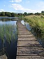 Boardwalk, Kilbirnie Loch - geograph.org.uk - 521781.jpg 480 × 640; 107 KB
-
 Boardwalk, Kilbirnie Loch - geograph.org.uk - 521797.jpg 640 × 480; 170 KB
-
 Brownhill Junction - geograph.org.uk - 1443814.jpg 640 × 480; 88 KB
-
 Crawfield Farm, Longbar - geograph.org.uk - 521717.jpg 640 × 480; 88 KB
-
 Derelict Cottage - geograph.org.uk - 60366.jpg 640 × 479; 113 KB
-
 Development Site - geograph.org.uk - 37533.jpg 640 × 479; 130 KB
-
 Farm Shop - geograph.org.uk - 60336.jpg 640 × 479; 61 KB
-
 Feeding time - geograph.org.uk - 607964.jpg 640 × 480; 81 KB
-

-
 Frosty Morning - geograph.org.uk - 95204.jpg 640 × 479; 98 KB
-
 Frosty Morning Sunrise - geograph.org.uk - 346482.jpg 480 × 640; 61 KB
-
 Garnock MOT Centre - geograph.org.uk - 581168.jpg 640 × 480; 78 KB
-
 Garnock Rugby Pitches - geograph.org.uk - 521738.jpg 480 × 640; 91 KB
-
 Green Pasture - geograph.org.uk - 44298.jpg 640 × 479; 98 KB
-
 Hardcroft Farm and bridge - geograph.org.uk - 607979.jpg 640 × 480; 145 KB
-
 Hebron Hall, Glengarnock - geograph.org.uk - 590555.jpg 640 × 480; 85 KB
-
 Holms Road, Glengarnock - geograph.org.uk - 590590.jpg 640 × 480; 71 KB
-
 Kilbirnie Loch - geograph.org.uk - 521730.jpg 480 × 640; 129 KB
-
 Kilbirnie Loch - geograph.org.uk - 521748.jpg 640 × 480; 114 KB
-
 Kilbirnie Loch - geograph.org.uk - 521763.jpg 640 × 480; 89 KB
-
 Kilbirnie Loch - geograph.org.uk - 521788.jpg 640 × 480; 120 KB
-
 Kilbirnie Loch - geograph.org.uk - 521803.jpg 640 × 480; 126 KB
-
 Kilbirnie Loch - geograph.org.uk - 521818.jpg 640 × 480; 136 KB
-
 Kilbirnie Loch - geograph.org.uk - 521825.jpg 640 × 480; 142 KB
-
 Kilbirnie Loch - geograph.org.uk - 522819.jpg 480 × 640; 147 KB
-
 Land Reclamation - geograph.org.uk - 150798.jpg 640 × 479; 46 KB
-
 Maich Water and Dog - geograph.org.uk - 40881.jpg 479 × 640; 134 KB
-
 Mains Farms, Kilbirnie - geograph.org.uk - 601374.jpg 640 × 480; 68 KB
-
 Misty Morning - geograph.org.uk - 81476.jpg 640 × 479; 61 KB
-
 Mossend Farm - geograph.org.uk - 607992.jpg 640 × 480; 33 KB
-
 New cemetery - geograph.org.uk - 317140.jpg 640 × 480; 112 KB
-
 Peace - geograph.org.uk - 81581.jpg 640 × 479; 78 KB
-
 River Garnock - geograph.org.uk - 43783.jpg 479 × 640; 182 KB
-
 River Garnock at Glengarnock - geograph.org.uk - 44295.jpg 640 × 479; 182 KB
-
 River Garnock Footbridge, Kilbirnie - geograph.org.uk - 601359.jpg 640 × 480; 123 KB
-
 Road Bridge, River Garnock - geograph.org.uk - 601362.jpg 640 × 480; 139 KB
-
 Rough Grazing - geograph.org.uk - 60349.jpg 640 × 479; 59 KB
-
 Swinlees Road - geograph.org.uk - 607973.jpg 640 × 480; 62 KB
-
 The Glendale Arms - geograph.org.uk - 31572.jpg 640 × 480; 90 KB
-
 Track - geograph.org.uk - 97146.jpg 640 × 479; 83 KB
-
 Woodside Lodge - geograph.org.uk - 34374.jpg 640 × 479; 115 KB


_flowers.JPG)


_lenticels.JPG)


