Category:Glencaple, South Lanarkshire
Jump to navigation
Jump to search
Media in category "Glencaple, South Lanarkshire"
The following 17 files are in this category, out of 17 total.
-
 Black Cleuch - geograph.org.uk - 590344.jpg 640 × 480; 115 KB
-
 Forest Track Near Leadhills Road - geograph.org.uk - 178992.jpg 640 × 480; 171 KB
-
 Glencaple Farm - geograph.org.uk - 1467812.jpg 640 × 480; 87 KB
-
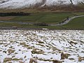
 Sheepfold by Glencaple Burn - geograph.org.uk - 265337.jpg 640 × 480; 103 KB
-
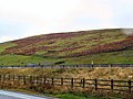 White Hill - geograph.org.uk - 64236.jpg 640 × 480; 151 KB
-
 White Hill toward Kirkton Wood - geograph.org.uk - 736331.jpg 640 × 480; 161 KB
-
 White Hill towards A74(M) and River Clyde - geograph.org.uk - 736310.jpg 640 × 480; 139 KB
-
 Collins Burn - geograph.org.uk - 736460.jpg 640 × 480; 135 KB
-
 Gate, Little Windgate Hass - geograph.org.uk - 590329.jpg 640 × 480; 108 KB
-
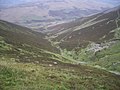
 Glencaple - geograph.org.uk - 134802.jpg 640 × 480; 110 KB
-
 Glencaple - geograph.org.uk - 179546.jpg 640 × 480; 154 KB
-
 Glencaple Burn - geograph.org.uk - 265333.jpg 640 × 480; 96 KB
-
 Glencaple from White Hill - geograph.org.uk - 736297.jpg 640 × 480; 151 KB
-
 Hillside Below Craig Dod - geograph.org.uk - 179552.jpg 480 × 640; 172 KB
-
 Hillside Cairn near Harry Burn - geograph.org.uk - 736473.jpg 640 × 480; 159 KB
-
 Hillside from Lodge Knowe - geograph.org.uk - 669525.jpg 640 × 480; 156 KB
-


_and_River_Clyde_-_geograph.org.uk_-_736310.jpg)


