Category:Glasgow to Loch Lomond Cycleway
Jump to navigation
Jump to search

Subcategories
This category has the following 12 subcategories, out of 12 total.
B
- Bankies Bike (2 F)
- Bonhill Bridge (9 F)
- Bowling (L&D) railway station (14 F)
- Bowling Basin footbridge (3 F)
D
- Dalquhurn north footbridge (3 F)
- Dalquhurn south footbridge (2 F)
G
M
S
W
Media in category "Glasgow to Loch Lomond Cycleway"
The following 57 files are in this category, out of 57 total.
-
 A Dumbarton cycletrack - geograph.org.uk - 960231.jpg 640 × 480; 95 KB
-
 Abandoned railway, abandoned cycleway - geograph.org.uk - 988765.jpg 640 × 480; 87 KB
-

-
 Benches by the River Leven - geograph.org.uk - 620273.jpg 640 × 480; 85 KB
-
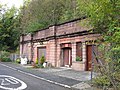 Bowling (Caledonian Railway) station - geograph.org.uk - 960282.jpg 640 × 480; 134 KB
-
 Bowling (L&D) Tunnel.jpeg 1,936 × 2,592; 2.44 MB
-
 Burnham Road, Scotstoun - geograph.org.uk - 987616.jpg 640 × 480; 92 KB
-
-
 Cattle grid, National Cycle Route 7 - geograph.org.uk - 1479494.jpg 640 × 480; 148 KB
-
 Clyde Street, Clydebank - geograph.org.uk - 544447.jpg 640 × 480; 56 KB
-
 Crosslet Road - geograph.org.uk - 1471275.jpg 640 × 480; 115 KB
-
 Cycle path and walkway - geograph.org.uk - 1203857.jpg 640 × 480; 110 KB
-
 Cycle Path at Dalreoch - geograph.org.uk - 443092.jpg 639 × 466; 167 KB
-
 Cycle path barriers - geograph.org.uk - 713035.jpg 640 × 480; 90 KB
-
 Cycle path near Dumbarton - geograph.org.uk - 538163.jpg 640 × 480; 132 KB
-
 Cycle path, north of railway bridge - geograph.org.uk - 1562558.jpg 640 × 480; 128 KB
-
 Cycle route at Cordale Avenue - geograph.org.uk - 1110546.jpg 640 × 480; 71 KB
-
 Cycleway at Scotstoun - geograph.org.uk - 988745.jpg 640 × 480; 104 KB
-
 Cycleway at Whiteinch - geograph.org.uk - 988760.jpg 640 × 480; 83 KB
-
 Decorative gateposts on NCN route 7 - geograph.org.uk - 1423426.jpg 640 × 480; 103 KB
-

-

-
 Dumbarton Road passes under a dismantled railway (geograph 3644985).jpg 1,024 × 768; 160 KB
-
 Footpath leading around Cordale Point - geograph.org.uk - 915004.jpg 640 × 480; 87 KB
-
 Forth and Clyde Canal - geograph.org.uk - 1469757.jpg 640 × 480; 72 KB
-
 Forth and Clyde Canal - geograph.org.uk - 1469795.jpg 640 × 480; 116 KB
-
 Forth and Clyde Canal - geograph.org.uk - 1470772.jpg 640 × 480; 106 KB
-
 Forth and Clyde Canal, Clydebank - geograph.org.uk - 731894.jpg 640 × 428; 101 KB
-
 Glasgow - Loch Lomond Cycleway - geograph.org.uk - 469997.jpg 640 × 480; 134 KB
-
 Glasgow-Loch Lomond Cycleway at Clydebank - geograph.org.uk - 626809.jpg 640 × 480; 104 KB
-

-

-
 Glasgow-Loch Lomond Cycleway in Yoker - geograph.org.uk - 1091553.jpg 640 × 480; 161 KB
-
 Junction of track and cycle path - geograph.org.uk - 1449530.jpg 640 × 480; 97 KB
-
 Lanarkshire and Dunbartonshire Railway (geograph 2942921).jpg 640 × 480; 384 KB
-
 Lanarkshire and Dunbartonshire Railway - geograph.org.uk - 1938067.jpg 640 × 480; 102 KB
-
 Leaves on the line - geograph.org.uk - 960239.jpg 640 × 480; 142 KB
-
 Milepost by Bells Bridge - geograph.org.uk - 553406.jpg 480 × 640; 97 KB
-
 Mill Burn, Yoker - geograph.org.uk - 470001.jpg 640 × 480; 154 KB
-
 National Cycle Route 7 - geograph.org.uk - 1471508.jpg 640 × 480; 112 KB
-
 National Cycle Route 7, Milton - geograph.org.uk - 1471259.jpg 640 × 480; 144 KB
-
 NCN Route 7 - geograph.org.uk - 1349561.jpg 640 × 480; 118 KB
-

-
 New houses, Burns Street - geograph.org.uk - 1471708.jpg 640 × 480; 98 KB
-
 Park between the railway and A82 - geograph.org.uk - 1471250.jpg 640 × 480; 110 KB
-
 Path along the canal - geograph.org.uk - 429829.jpg 640 × 480; 113 KB
-
 Railway arch in Clydebank - geograph.org.uk - 757808.jpg 640 × 480; 95 KB
-
 River Leven - geograph.org.uk - 141459.jpg 640 × 480; 82 KB
-

-
 Scotland’s tallest timber building (geograph 6864489).jpg 1,313 × 1,600; 424 KB
-

-
 Site of old brickworks - geograph.org.uk - 1449522.jpg 640 × 480; 104 KB
-
 The approach to Mains of Cardross - geograph.org.uk - 1449370.jpg 640 × 480; 95 KB
-
 The Black Bridge - geograph.org.uk - 952205.jpg 640 × 480; 110 KB
-
 The universal cycle path sign - geograph.org.uk - 1471009.jpg 640 × 480; 145 KB
-
 Underpass, Greenhead Road - geograph.org.uk - 1471266.jpg 640 × 480; 75 KB
-
 West along canal, Dalmuir - geograph.org.uk - 326604.jpg 640 × 480; 84 KB


_station_-_geograph.org.uk_-_960282.jpg)
_Tunnel.jpeg)


.jpg)


.jpg)


.jpg)


