Category:Glaronisi
Jump to navigation
Jump to search
| Object location | | View all coordinates using: OpenStreetMap |
|---|
island of Naxos and Lesser Cyclades, Greece  | |||||
| Upload media | |||||
| Instance of | |||||
|---|---|---|---|---|---|
| Part of | |||||
| Location |
| ||||
| Located in or next to body of water | |||||
| Width |
| ||||
| Length |
| ||||
| Population |
| ||||
 | |||||
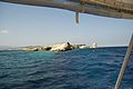
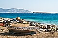
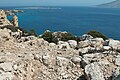
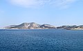
Uninhabited islet between the two Koufonisia and Keros.
Media in category "Glaronisi"
The following 12 files are in this category, out of 12 total.
-
 Amorgos-island-from-naxos-8000px.jpg 8,311 × 2,440; 15.67 MB
-
 Glaronisi 084732.jpg 3,471 × 2,311; 4.17 MB
-
 Glaronisi 084734.jpg 3,471 × 2,311; 4.53 MB
-
 Glaronisi 084738.jpg 3,471 × 2,311; 4.2 MB
-
 Glaronisi 084742.jpg 3,471 × 2,311; 4.23 MB
-
 Glaronisi Cyclades.jpg 3,872 × 2,592; 4.19 MB
-
 Glaronisi Sphinx 084736.jpg 3,471 × 2,311; 3.6 MB
-
 Kastro of Kato Koufonisi, 190057.jpg 5,472 × 3,648; 9.48 MB
-
 Kato Mili 144192.jpg 5,050 × 3,386; 8.59 MB
-
 Kato Mili 144196.jpg 5,130 × 3,420; 9.42 MB
-
 Keros from Pano Koufonisi 060463.jpg 3,320 × 2,186; 5.28 MB
-
 Keros, isola disabitata di fronte a Koufonisi, Piccole Cicladi - panoramio.jpg 5,059 × 3,099; 5.33 MB


