Category:Gisburn
Jump to navigation
Jump to search
English: Gisburn (formerly Gisburne) is a village, civil parish and ward within the Ribble Valley borough of Lancashire, England. It lies northeast of Clitheroe. The parish of Gisburn had a population of 506, and the ward had 1287, recorded in the 2001 census. (→Gisburn)
Nederlands: Gisburn is een plaats en civil parish in het bestuurlijke gebied Ribble Valley, in het Engelse graafschap Lancashire met 506 inwoners. (→Gisburn)
Polski: Gisburn – wieś w Anglii, w hrabstwie Lancashire, w dystrykcie Ribble Valley. Leży 52 km na północ od miasta Manchester i 306 km na północny zachód od Londynu. W 2001 miejscowość liczyła 506 mieszkańców. (→Gisburn)

village in the United Kingdom  | |||||
| Upload media | |||||
| Instance of | |||||
|---|---|---|---|---|---|
| Location | Ribble Valley, Lancashire, North West England, England | ||||
| Said to be the same as | Gisburn (Wikimedia duplicated page, civil parish) | ||||
 | |||||
Subcategories
This category has the following 7 subcategories, out of 7 total.
G
- Gisburn railway station (2 F)
- Gisburn Tunnel (9 F)
T
- Gisburn Telephone Exchange (2 F)
W
- White Bull, Gisburn (8 F)
Media in category "Gisburn"
The following 197 files are in this category, out of 197 total.
-
 "La Locanda " - geograph.org.uk - 412098.jpg 640 × 480; 227 KB
-

-
 17th Century house, Gisburn - geograph.org.uk - 5917864.jpg 4,046 × 3,857; 4.38 MB
-
 47410 runs off Stockbeck Viaduct.jpg 1,024 × 768; 389 KB
-
 47425 emerges from Gisburn Tunnel.jpg 1,024 × 768; 428 KB
-
 47441 crosses Stockbeck Viaduct.jpg 1,024 × 768; 314 KB
-
 47479 approaches Stockbeck Viaduct.jpg 1,024 × 768; 384 KB
-
 A gate at Rough Hill offering a view of Pendle Hill - geograph.org.uk - 4574595.jpg 4,372 × 2,909; 5.51 MB
-
 A track to Willcross - geograph.org.uk - 4638041.jpg 4,592 × 3,056; 7.03 MB
-
 A wild flower has found a precarious home - geograph.org.uk - 3629837.jpg 3,966 × 2,879; 7.74 MB
-
 A59 at Gisburn - geograph.org.uk - 5135783.jpg 1,280 × 948; 925 KB
-
 A59 at Gisburn village boundary - geograph.org.uk - 3337951.jpg 640 × 480; 48 KB
-
 A59 at Gisburn village boundary - geograph.org.uk - 4246630.jpg 640 × 481; 51 KB
-
 A59 at Leewarden Farm - geograph.org.uk - 4246629.jpg 640 × 481; 67 KB
-
 A59 entering Gisburn - geograph.org.uk - 3741361.jpg 1,024 × 763; 136 KB
-
 A59 near Gisburn Cotes - geograph.org.uk - 4246628.jpg 640 × 481; 62 KB
-
 A59 near Leewarden Farm - geograph.org.uk - 2936669.jpg 640 × 480; 145 KB
-
 A59 near Old Sawley Grange - geograph.org.uk - 4246626.jpg 640 × 481; 37 KB
-
 A59 towards Skipton - geograph.org.uk - 5872641.jpg 640 × 480; 59 KB
-
 A59 towards Skipton - geograph.org.uk - 5872696.jpg 640 × 480; 60 KB
-

-
 A59 westbound at Greengates - geograph.org.uk - 3337949.jpg 640 × 481; 42 KB
-
 A59, East of Gisburn - geograph.org.uk - 5638433.jpg 5,184 × 3,888; 4.34 MB
-
 A59, Gisburn - geograph.org.uk - 1924975.jpg 640 × 480; 113 KB
-
 A682 at Stock Beck Bridge - geograph.org.uk - 5135767.jpg 1,280 × 960; 1.28 MB
-
 Access Track from Westby Hall Farm - geograph.org.uk - 3250526.jpg 4,320 × 3,240; 4.42 MB
-
 Approaching Railway Bridge on the Ribble Way - geograph.org.uk - 3250429.jpg 4,320 × 3,240; 4.7 MB
-
 Approaching the railway bridge and Gisburn Cotes Farm - geograph.org.uk - 3142333.jpg 2,048 × 1,536; 457 KB
-
 Back street, Gisburn - geograph.org.uk - 2991521.jpg 3,872 × 2,592; 4.2 MB
-
 Below Walter Hill Plantation - geograph.org.uk - 2761377.jpg 4,320 × 3,240; 4.24 MB
-

-
 Benchmark at Gisburn Cotes Farm - geograph.org.uk - 3142353.jpg 2,048 × 1,536; 512 KB
-
 Benchmark on the railway bridge near Gisburn Cotes Farm - geograph.org.uk - 3142344.jpg 2,048 × 1,536; 562 KB
-
 Benchmark on the railway bridge near Gisburn Cotes Hall - geograph.org.uk - 3142367.jpg 2,048 × 1,536; 519 KB
-
 Bentlea Road, Gisburn - geograph.org.uk - 2518256.jpg 1,496 × 1,122; 657 KB
-
 Bridge over Stock Beck - geograph.org.uk - 1192196.jpg 640 × 480; 141 KB
-
 Bridge over Stock Beck at Little Painley - geograph.org.uk - 3141834.jpg 2,048 × 1,536; 521 KB
-
 Bridge under the Clitheroe-Hellifield Line - geograph.org.uk - 3250332.jpg 4,320 × 3,240; 6.17 MB
-

-
 Clearing up after a road incident - geograph.org.uk - 3563500.jpg 4,592 × 2,209; 5.71 MB
-

-

-
 Coal Pit Lane - geograph.org.uk - 5870701.jpg 640 × 480; 63 KB
-
 Coal Pit Lane on Talbot Hill - geograph.org.uk - 2762779.jpg 4,320 × 3,240; 4.44 MB
-
 Coal Pit Lane, Gisburn - geograph.org.uk - 107680.jpg 426 × 640; 161 KB
-
 Coppy Hill - geograph.org.uk - 3628064.jpg 4,592 × 3,056; 6.86 MB
-
 Cottages on Main Street, Gisburn - geograph.org.uk - 5872632.jpg 640 × 480; 66 KB
-
 Cottages, Main Street, Gisburn - geograph.org.uk - 5917805.jpg 5,109 × 3,709; 5.38 MB
-
 Cromwell House - geograph.org.uk - 3563420.jpg 4,145 × 2,798; 7.86 MB
-
 Cromwell House, Gisburn - geograph.org.uk - 5917902.jpg 4,455 × 3,660; 5.41 MB
-
 Drainage ditch through the fields - geograph.org.uk - 2060562.jpg 3,872 × 2,480; 3.03 MB
-
 Dudland Hollins - geograph.org.uk - 3629975.jpg 4,298 × 2,857; 7.97 MB
-
 Dunbia abattoir, Sawley, back entrance - geograph.org.uk - 4120341.jpg 3,264 × 2,448; 2.02 MB
-
 Entrance to Gisburn Business Park - geograph.org.uk - 2936667.jpg 640 × 480; 154 KB
-
 Entrance to Gisburn Cotes - geograph.org.uk - 2936677.jpg 640 × 480; 144 KB
-
 Farmstead at Gisburn Cotes Hall - geograph.org.uk - 2732411.jpg 1,600 × 1,198; 369 KB
-
 Five barred gate on Mill Lane, Gisburn - geograph.org.uk - 5135749.jpg 1,280 × 929; 1.05 MB
-
 Footbridge below Walter Hill - geograph.org.uk - 1193345.jpg 640 × 480; 143 KB
-
 Footpath to Gisburn - geograph.org.uk - 1193359.jpg 640 × 480; 130 KB
-
 Frosty Pastures in the Ribble Valley - geograph.org.uk - 3250477.jpg 4,320 × 3,240; 5.63 MB
-
 Gawber Plantation - geograph.org.uk - 3250553.jpg 4,320 × 3,240; 4.37 MB
-
 Gisburn 01.JPG 3,456 × 2,592; 4.19 MB
-
 Gisburn 02.JPG 3,456 × 2,592; 3.75 MB
-
 Gisburn 03.JPG 3,456 × 2,592; 4.26 MB
-
 Gisburn 04.JPG 3,456 × 2,592; 4.02 MB
-
 Gisburn 06.JPG 3,456 × 2,592; 4.39 MB
-
 Gisburn Bridge - geograph.org.uk - 3566163.jpg 4,502 × 2,894; 7.8 MB
-
 Gisburn Bridge.jpg 2,048 × 1,536; 507 KB
-
 Gisburn Church - geograph.org.uk - 4211298.jpg 3,600 × 2,400; 4.09 MB
-
 Gisburn Church Cemetery - geograph.org.uk - 4211327.jpg 3,600 × 2,400; 4.01 MB
-
 Gisburn Close Farm - geograph.org.uk - 5002184.jpg 4,000 × 3,000; 2.39 MB
-
 Gisburn Cotes Farm - geograph.org.uk - 3250421.jpg 4,320 × 3,240; 2.91 MB
-
 Gisburn Cotes Farm.jpg 2,048 × 1,536; 550 KB
-
 Gisburn Moor Trig Point - geograph.org.uk - 3643009.jpg 2,560 × 1,920; 2.08 MB
-
 Gisburn Park Hospital - geograph.org.uk - 3568835.jpg 4,370 × 2,193; 4.67 MB
-
 Gisburn railway tunnel - geograph.org.uk - 5135746.jpg 1,280 × 960; 1.24 MB
-
 Gisburn War Memorial (geograph 1924974).jpg 480 × 640; 118 KB
-
 Gisburn war memorial - geograph.org.uk - 5917942.jpg 4,000 × 3,975; 4.56 MB
-
 Gisburn War Memorial and garden - geograph.org.uk - 2630440.jpg 4,000 × 3,000; 5.78 MB
-
 Gisburn, Coal Pit Lane - geograph.org.uk - 3121982.jpg 3,456 × 2,304; 4.97 MB
-
 Gisburn, Driveway to Greengates Farm - geograph.org.uk - 3580980.jpg 3,456 × 2,304; 4.43 MB
-
 Gisburn, Sheep pasture on Talbot Hill - geograph.org.uk - 3121956.jpg 3,456 × 2,304; 3.75 MB
-
 Gisburn, Track opposite Willcross Farm - geograph.org.uk - 3580973.jpg 3,456 × 2,304; 5.51 MB
-
 Gisburne Park Abbey Hospital - geograph.org.uk - 3017040.jpg 4,320 × 3,240; 7.21 MB
-

-
 Gisburne Park. Gisburn - geograph.org.uk - 3392309.jpg 640 × 418; 175 KB
-

-
 Grassland towards Gawber Plantation - geograph.org.uk - 5870705.jpg 640 × 480; 57 KB
-
 Graveyard in Gisburn - panoramio.jpg 2,443 × 2,536; 1.47 MB
-
 Grazing horses in Gisburne Park - geograph.org.uk - 5135756.jpg 1,280 × 960; 1.29 MB
-
 Grazing near Greengates - geograph.org.uk - 5872644.jpg 640 × 445; 55 KB
-
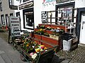
 Greengrocer shop on Main Street, Gisburn, Lancashire.jpg 640 × 480; 254 KB
-
 Hillside grazing, Crow Park Hill - geograph.org.uk - 5872640.jpg 640 × 480; 60 KB
-
 House near Gisburne Mill - geograph.org.uk - 5870712.jpg 640 × 480; 86 KB
-
 I'm the pied piper - geograph.org.uk - 3629757.jpg 4,592 × 3,056; 5.49 MB
-
 Inside St. Mary the Virgin - panoramio.jpg 2,720 × 2,592; 794 KB
-
 Locomotive on the Clitheroe Hellifield line - geograph.org.uk - 5135777.jpg 1,280 × 960; 1.27 MB
-
 Long Holme Row - geograph.org.uk - 3250454.jpg 4,320 × 3,240; 4.52 MB
-
 Long Holme Row - geograph.org.uk - 5002194.jpg 4,000 × 3,000; 3.21 MB
-
 Main Street through Gisburn - geograph.org.uk - 4816872.jpg 1,500 × 999; 153 KB
-
 Main Street, Gisburn - geograph.org.uk - 2630450.jpg 4,000 × 1,997; 3.12 MB
-
 Mill Bridge Cottage, Gisburn.jpg 640 × 480; 169 KB
-
 Mill Lane at the entrance to Ribblesdale Park - geograph.org.uk - 3566144.jpg 4,275 × 2,742; 7.7 MB
-
 Mill Lane near Ribblesdale Park - geograph.org.uk - 4246631.jpg 640 × 480; 88 KB
-

-
 On Greenber Hill - geograph.org.uk - 3250495.jpg 4,320 × 3,240; 3.38 MB
-
 Ordnance Survey Cut Mark - geograph.org.uk - 5002162.jpg 4,000 × 3,000; 3.87 MB
-
 Ordnance Survey Cut Mark - geograph.org.uk - 5002192.jpg 4,000 × 3,000; 5.11 MB
-
 Ordnance Survey Cut Mark - geograph.org.uk - 5003460.jpg 4,000 × 3,000; 5.09 MB
-
 Part of a stricken tree has fallen across the path - geograph.org.uk - 3628135.jpg 4,045 × 2,880; 7.7 MB
-
 Pasture near Dudland Farm - geograph.org.uk - 3250342.jpg 4,320 × 3,240; 4.02 MB
-
 Pasture north of Dudland Hollins - geograph.org.uk - 2936675.jpg 640 × 478; 105 KB
-
 Pedestrian railway crossing at Cow Gill Farm - geograph.org.uk - 2732418.jpg 1,600 × 1,198; 450 KB
-
 Pennine Bridleway at Gisburne Park - geograph.org.uk - 5135754.jpg 1,280 × 960; 1.01 MB
-
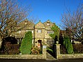
 Pimlico House, Gisburn - geograph.org.uk - 5918896.jpg 4,854 × 3,562; 4.25 MB
-

-

-
 Railway bridge near Gisburn Cotes Hall - geograph.org.uk - 3142362.jpg 2,048 × 1,536; 651 KB
-
 River Ribble at Gisburn Bridge - geograph.org.uk - 5135751.jpg 1,280 × 960; 1.17 MB
-

-
 River Ribble viewed from Gisburn Bridge - geograph.org.uk - 5003468.jpg 4,000 × 3,000; 3.75 MB
-
 Road to Dudland Hollins - geograph.org.uk - 2936672.jpg 640 × 480; 113 KB
-
 Rough grazing at Gisburn - geograph.org.uk - 2630460.jpg 2,667 × 1,997; 2.7 MB
-
 Roundabout - A59 Gisburn - geograph.org.uk - 1893442.jpg 4,224 × 3,168; 5.74 MB
-
 Shady path in Gisburne Park - geograph.org.uk - 5135758.jpg 1,280 × 960; 1.51 MB
-
 Sheep grazing - geograph.org.uk - 3631030.jpg 640 × 426; 86 KB
-
 Sheep trying to escape the rain - geograph.org.uk - 5135771.jpg 1,280 × 959; 1.41 MB
-
 Sheep-grazing fields near Dudland Hollins Farm - geograph.org.uk - 2060559.jpg 3,872 × 2,480; 2.8 MB
-
 Shuttleworth Hall - geograph.org.uk - 5870709.jpg 640 × 480; 73 KB
-
 Side street off the A59, Gisburn - geograph.org.uk - 1924976.jpg 640 × 480; 129 KB
-
 Sika deer at Gisburne Park - geograph.org.uk - 5135764.jpg 1,280 × 960; 1.24 MB
-
 Skipton 11 Miles - geograph.org.uk - 5872638.jpg 640 × 480; 68 KB
-
 St Mary The Virgin, Gisburn - geograph.org.uk - 2518213.jpg 1,496 × 1,122; 631 KB
-
 St Mary The Virgin, Gisburn - geograph.org.uk - 3643038.jpg 2,560 × 1,920; 2.51 MB
-
 St Mary's Church, Gisburn - geograph.org.uk - 2991516.jpg 3,872 × 2,592; 3.8 MB
-
 St Mary's Church, Gisburn - geograph.org.uk - 5872629.jpg 640 × 480; 65 KB
-
 St Mary's church, Gisburn - geograph.org.uk - 5916483.jpg 4,405 × 3,301; 3.9 MB
-
 St. Mary the Virgin, Gisburn - geograph.org.uk - 2630454.jpg 3,918 × 2,888; 4.31 MB
-
 Stirk House Hotel, Gisburn.jpg 4,320 × 3,240; 5.18 MB
-
 Stock Beck Bridge - geograph.org.uk - 4211275.jpg 3,600 × 2,400; 4.18 MB
-
 Stone Barns at Gisburn Cotes - geograph.org.uk - 3250426.jpg 4,320 × 3,240; 3.5 MB
-
 Strawberry Fields - geograph.org.uk - 5872637.jpg 640 × 480; 58 KB
-
 Strawberry Fields, Gisburn - geograph.org.uk - 1377768.jpg 640 × 468; 94 KB
-

-
 The A59 entering Gisburn - geograph.org.uk - 4816871.jpg 1,500 × 999; 128 KB
-
 The A59 out of Gisburn - geograph.org.uk - 4816876.jpg 1,500 × 998; 124 KB
-
 The A59 through Gisburn - geograph.org.uk - 1377713.jpg 640 × 431; 85 KB
-
 The A59 to Clitheroe - geograph.org.uk - 4816879.jpg 1,500 × 999; 186 KB
-
 The A59 to Clitheroe - geograph.org.uk - 4816881.jpg 1,500 × 999; 161 KB
-
 The A59 to Clitheroe - geograph.org.uk - 4816884.jpg 1,500 × 999; 238 KB
-
 The A59 to Clitheroe - geograph.org.uk - 4816886.jpg 1,500 × 980; 212 KB
-
 The A59 to Clitheroe - geograph.org.uk - 4816889.jpg 1,500 × 999; 115 KB
-
 The A59 to Clitheroe - geograph.org.uk - 4816891.jpg 1,500 × 999; 122 KB
-
 The A59 to Gisburn - geograph.org.uk - 4816865.jpg 1,500 × 999; 129 KB
-
 The A59 to Gisburn - geograph.org.uk - 4816866.jpg 1,500 × 999; 137 KB
-
 The A59 to Gisburn - geograph.org.uk - 4816868.jpg 1,500 × 999; 151 KB
-
 The A682 north from Gisburn - geograph.org.uk - 3563572.jpg 4,449 × 2,961; 6.45 MB
-

-
 The Clitheroe to Hellifield Railway Line - geograph.org.uk - 5002178.jpg 4,000 × 3,000; 4.3 MB
-
 The Cumbrian Mountain Express - geograph.org.uk - 2802180.jpg 1,000 × 669; 175 KB
-
 The Driveway from Coppice Farm to Mill Lane - geograph.org.uk - 5003441.jpg 4,000 × 3,000; 3.63 MB
-
 The entrance to Stirk House Country Hotel - geograph.org.uk - 3631092.jpg 3,725 × 2,356; 7.7 MB
-
 The Footbridge below Walter Hill - geograph.org.uk - 2761390.jpg 4,320 × 3,240; 4.57 MB
-
 The Parish Church of St Mary the Virgin - geograph.org.uk - 3568890.jpg 4,055 × 2,472; 6.75 MB
-
 The Parish Church of St Mary the Virgin, Gisburn - geograph.org.uk - 2557012.jpg 1,280 × 960; 629 KB
-
 The Pennine bridleway at Gisburn Park - geograph.org.uk - 3563140.jpg 4,584 × 3,056; 6.24 MB
-
 The Post Office, Gisburn - geograph.org.uk - 1377502.jpg 640 × 445; 86 KB
-
 The Priory, Gisburn - geograph.org.uk - 5916490.jpg 4,863 × 3,650; 5.29 MB
-
 The railway towards Blackburn near Cow Gill - geograph.org.uk - 2732425.jpg 1,600 × 1,198; 562 KB
-
 The railway towards Hellifield from Gisburn Cotes bridge - geograph.org.uk - 2732413.jpg 1,600 × 1,198; 667 KB
-
 The Ribble Way east of Coppice Farm - geograph.org.uk - 4221178.jpg 640 × 480; 144 KB
-
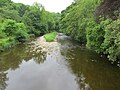
 The River Ribble - geograph.org.uk - 5870713.jpg 640 × 480; 80 KB
-
 Track in Gisburne Park - geograph.org.uk - 5135760.jpg 1,280 × 960; 1.28 MB
-
 Tunnel mouth - geograph.org.uk - 5918947.jpg 4,537 × 2,602; 2.94 MB
-
 View from Gisburn Bridge - geograph.org.uk - 2802375.jpg 1,000 × 669; 263 KB
-
 Walter Hill - geograph.org.uk - 2760325.jpg 4,320 × 3,240; 1.93 MB
-
 War memorial garden, Gisburn - geograph.org.uk - 2991520.jpg 3,872 × 2,592; 5.39 MB
-
 Wash day in Lyndale Terrace, Gisburn - geograph.org.uk - 539184.jpg 640 × 480; 214 KB
-
 A pub no longer ... - geograph.org.uk - 1192176.jpg 640 × 480; 85 KB
-
 Bridge No 91 - geograph.org.uk - 155727.jpg 640 × 480; 111 KB
-
 Clitheroe to Hellifield Railway - geograph.org.uk - 412125.jpg 640 × 480; 222 KB
-
 Entrance to Ribblesdale Park - geograph.org.uk - 412131.jpg 640 × 480; 232 KB
-
 Entrance to Willcross - geograph.org.uk - 540459.jpg 640 × 480; 212 KB
-
 Gisburn - geograph.org.uk - 123667.jpg 640 × 480; 93 KB
-
 Gisburn - geograph.org.uk - 246654.jpg 400 × 281; 9 KB
-
 Gisburn Depot - geograph.org.uk - 540450.jpg 640 × 480; 214 KB
-
 Gisburn Police Station - geograph.org.uk - 145389.jpg 640 × 480; 78 KB
-
 Leewarden Farm - geograph.org.uk - 155740.jpg 640 × 444; 101 KB
-
 Lyndale Terrace, Gisburn - geograph.org.uk - 539180.jpg 640 × 480; 214 KB
-
 Main Street, Gisburn - geograph.org.uk - 540444.jpg 640 × 480; 228 KB
-
 Mast, Coal Pit Lane Gisburn - geograph.org.uk - 105799.jpg 640 × 426; 83 KB
-
 Pasture and trees - geograph.org.uk - 155623.jpg 640 × 480; 98 KB
-
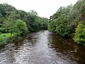
 River Ribble from Gisburn Bridge - geograph.org.uk - 123573.jpg 640 × 480; 130 KB
-
 Stirk House, near Gisburn, Yorkshire - geograph.org.uk - 155619.jpg 640 × 480; 80 KB
-
 Stock Beck - geograph.org.uk - 124914.jpg 640 × 480; 164 KB
-
 Stock Beck Bridge - geograph.org.uk - 123664.jpg 640 × 480; 149 KB
-
 Towards Sullside Hill - geograph.org.uk - 123556.jpg 640 × 480; 80 KB


.jpg)


.jpg)


