Category:Gilberdyke
Jump to navigation
Jump to search
English: Gilberdyke is a village and civil parish in the East Riding of Yorkshire, England. It is situated approximately 16 miles (26 km) west of Hull city centre and 5 miles (8 km) east of Howden town centre.
village in the United Kingdom  | |||||
| Upload media | |||||
| Instance of | |||||
|---|---|---|---|---|---|
| Location | East Riding of Yorkshire, Yorkshire and the Humber, England | ||||
 | |||||
Subcategories
This category has the following 5 subcategories, out of 5 total.
Media in category "Gilberdyke"
The following 200 files are in this category, out of 253 total.
(previous page) (next page)-
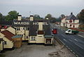
 "The Rose and Crown", Slipper Bridge - geograph.org.uk - 3260986.jpg 4,479 × 2,688; 2.48 MB
-
 "The White Horse Inn", Gilberdyke - geograph.org.uk - 3260989.jpg 4,431 × 2,954; 2.83 MB
-
 3 metre spot height on Mill Lane - geograph.org.uk - 5675162.jpg 1,024 × 768; 273 KB
-
 A drain off Mill Lane - geograph.org.uk - 3734374.jpg 1,024 × 681; 331 KB
-
 A tyre company in Scalby, Gilberdyke - geograph.org.uk - 2112409.jpg 800 × 600; 197 KB
-
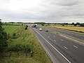
 A63 Gilberdyke ,Looking East - geograph.org.uk - 235957.jpg 640 × 426; 119 KB
-
 Anserdam Lane - geograph.org.uk - 4623114.jpg 1,024 × 768; 117 KB
-
 Anserdam Lane - geograph.org.uk - 5663473.jpg 640 × 480; 63 KB
-
 Anserdam Lane is not metaled from this point - geograph.org.uk - 5060153.jpg 4,608 × 3,456; 4.22 MB
-
 Anserdam Lane looking south - geograph.org.uk - 5060169.jpg 4,608 × 3,456; 3.61 MB
-
 Anserdam Lane with Ing Nook Plantation on the right - geograph.org.uk - 5060180.jpg 4,608 × 3,456; 4.57 MB
-
 Arable field, Bennetland - geograph.org.uk - 5675145.jpg 1,024 × 768; 229 KB
-

-
 Avenue to Blacktoft Grange - geograph.org.uk - 4623129.jpg 1,024 × 768; 316 KB
-
 B1230 approaching Gilberdyke from the west - geograph.org.uk - 4556350.jpg 4,608 × 3,456; 4.25 MB
-
 B1230 towards Howden - geograph.org.uk - 1603714.jpg 640 × 480; 58 KB
-
 B1230 towards Howden - geograph.org.uk - 5662971.jpg 640 × 480; 60 KB
-
 B1230 towards Howden - geograph.org.uk - 5662990.jpg 640 × 480; 50 KB
-
 Banchory Fields - geograph.org.uk - 1365142.jpg 640 × 480; 60 KB
-
 Beech Farm, Hive - geograph.org.uk - 2325071.jpg 1,600 × 1,200; 401 KB
-
 Bellasize Crossing House, Gilberdyke - geograph.org.uk - 5048943.jpg 1,200 × 799; 467 KB
-
 Bellasize Lane - geograph.org.uk - 6021501.jpg 640 × 480; 69 KB
-
 Bellasize Lane and Mill Lane junction - geograph.org.uk - 6186389.jpg 4,608 × 3,456; 5.9 MB
-
 Bellasize Lane, Staddlethorpe - geograph.org.uk - 2208969.jpg 800 × 600; 218 KB
-
 Bellasize Lane, Staddlethorpe - geograph.org.uk - 3787305.jpg 640 × 427; 60 KB
-
 Bellasize Lane, Staddlethorpe, looking west - geograph.org.uk - 5675199.jpg 1,024 × 768; 153 KB
-
 Bennetland Lane, Gilberdyke - geograph.org.uk - 5048912.jpg 1,200 × 799; 288 KB
-
 Bennetland Lane, looking east towards Gilberdyke - geograph.org.uk - 5674975.jpg 1,024 × 768; 132 KB
-
 Bennetland Lane, looking west - geograph.org.uk - 5675127.jpg 1,024 × 768; 190 KB
-
 Bennetland Level Crossing - geograph.org.uk - 6187164.jpg 1,024 × 768; 182 KB
-
 Bishopsoil Drain or Carr Drain - geograph.org.uk - 6100621.jpg 4,608 × 3,456; 4.97 MB
-
 Bishopsoil Drain recently cleaned out - geograph.org.uk - 5060221.jpg 3,456 × 4,608; 5.32 MB
-
 Bosky embankment - geograph.org.uk - 3688831.jpg 1,024 × 768; 153 KB
-
 Brick outbuilding at Sandholme with Victorian letterbox - geograph.org.uk - 5060060.jpg 4,608 × 3,456; 4.61 MB
-
 Bridge over the railway line Gilberdyke.jpg 640 × 480; 85 KB
-
 Bridleway near Hive - geograph.org.uk - 6079283.jpg 1,024 × 768; 314 KB
-
 Bungalows on Station Road, Gilberdyke - geograph.org.uk - 5048877.jpg 1,200 × 799; 234 KB
-
 By Delph Drain - geograph.org.uk - 6079269.jpg 1,024 × 768; 197 KB
-
 Canalside footpath - geograph.org.uk - 6182068.jpg 1,024 × 768; 152 KB
-
 Clementhorpe Lane Public footpath - geograph.org.uk - 1365267.jpg 640 × 480; 68 KB
-
 Clementhorpe Lane, Gilberdyke - geograph.org.uk - 5048907.jpg 1,200 × 799; 348 KB
-
 Clementhorpe Road Gilberdyke - geograph.org.uk - 4486092.jpg 1,024 × 768; 115 KB
-
 Clementhorpe Road, Gilberdyke - geograph.org.uk - 5048882.jpg 1,200 × 799; 315 KB
-
 Clementhorpe Road, Gilberdyke - geograph.org.uk - 5664065.jpg 2,730 × 1,924; 1.13 MB
-
 Close up, Elizabeth II postbox on Hive Lane, Hive - geograph.org.uk - 5664087.jpg 1,295 × 2,385; 558 KB
-

-
 Communications mast beside the M62 - geograph.org.uk - 5663524.jpg 480 × 640; 75 KB
-
 Communications mast near Sandholme - geograph.org.uk - 2023821.jpg 480 × 640; 60 KB
-
 Contracting Farmland - geograph.org.uk - 253380.jpg 640 × 480; 101 KB
-
 Countryside near Bennetland Crossing - geograph.org.uk - 4561813.jpg 640 × 432; 37 KB
-
 Cow Bridge - geograph.org.uk - 6187157.jpg 1,024 × 768; 270 KB
-
 Cross Keys Inn Gilberdyke.jpg 800 × 600; 232 KB
-
 Crossroads at Townend Sandholme - geograph.org.uk - 5060031.jpg 4,608 × 3,456; 3.93 MB
-
 Deer in Gilberdyke Field - geograph.org.uk - 5053866.jpg 1,200 × 799; 362 KB
-
 Dodgy footbridge over Bishopsoil Drain - geograph.org.uk - 5060208.jpg 4,608 × 3,456; 5.28 MB
-
 Dodgy footbridge to Drain Lane - geograph.org.uk - 5060196.jpg 3,456 × 4,608; 4.59 MB
-
 Drain Lane towards Sandholme Lodge - geograph.org.uk - 2023828.jpg 640 × 480; 91 KB
-
 Drain near Hive Lane Cottage - geograph.org.uk - 5663446.jpg 640 × 480; 80 KB
-
 Drain off Marr Lane - geograph.org.uk - 4239282.jpg 1,024 × 768; 175 KB
-
 Drain, Cow Bridge - geograph.org.uk - 5664121.jpg 640 × 480; 115 KB
-
 Drainage ditch beside Drain Lane - geograph.org.uk - 2023836.jpg 640 × 480; 124 KB
-
 Dyke between the River Foulness and Carr Drain - geograph.org.uk - 6079260.jpg 1,024 × 768; 242 KB
-
 Elizabeth II postbox on Clementhorpe Road, Gilberdyke - geograph.org.uk - 5664063.jpg 1,398 × 2,732; 750 KB
-
 Elizabeth II postbox on Hive Lane, Hive - geograph.org.uk - 5664085.jpg 2,848 × 2,136; 1.47 MB
-
 Elizabeth II postbox on Thornton Dam Lane, Gilberdyke - geograph.org.uk - 5664101.jpg 2,848 × 2,136; 1.35 MB
-
 Entering Gilberdyke - geograph.org.uk - 6187165.jpg 1,024 × 768; 195 KB
-
 Entering Gilberdyke on the B1230 - geograph.org.uk - 2209267.jpg 800 × 600; 208 KB
-
 Entering Hive along Hive Lane - geograph.org.uk - 5110542.jpg 4,514 × 3,326; 7.24 MB
-
 Entering Hive from Sandholme - geograph.org.uk - 5060094.jpg 4,608 × 3,456; 3.58 MB
-
 Estate off Sandholme Road - geograph.org.uk - 1365208.jpg 640 × 480; 66 KB
-

-

-
 Farm building, Hive - geograph.org.uk - 2325064.jpg 1,600 × 1,200; 399 KB
-
 Farm building, Quaker's Farm - geograph.org.uk - 2023807.jpg 640 × 480; 68 KB
-
 Farm buildings - geograph.org.uk - 4561859.jpg 640 × 426; 39 KB
-

-
 Farm track near Owsthorpe - geograph.org.uk - 2325057.jpg 1,600 × 1,200; 501 KB
-
 Farm track, Cow Bridge - geograph.org.uk - 5663518.jpg 640 × 480; 82 KB
-
 Farms Drain near Carter's Plantation - geograph.org.uk - 5053855.jpg 1,200 × 799; 423 KB
-
 Farms Drain near Carter's Plantation - geograph.org.uk - 5053859.jpg 1,200 × 799; 596 KB
-
 Field beside drain north of Greenoak - geograph.org.uk - 5662993.jpg 640 × 410; 42 KB
-
 Field drain north of Greenoak - geograph.org.uk - 2023793.jpg 640 × 480; 110 KB
-
 Field entrance off Landing Lane - geograph.org.uk - 5663516.jpg 640 × 362; 66 KB
-
 Fish and chip shop, Post Office and butcher's - geograph.org.uk - 4638411.jpg 1,024 × 768; 116 KB
-
 Flat farmland near the Delph Drain - geograph.org.uk - 5663487.jpg 640 × 480; 61 KB
-
 Footbridge over a drain - geograph.org.uk - 4623087.jpg 1,024 × 768; 218 KB
-
 Footbridge over Bishopsoil Drain - geograph.org.uk - 6100627.jpg 4,608 × 3,456; 4.31 MB
-
 Footpath at Sandholme - geograph.org.uk - 4623183.jpg 1,024 × 768; 230 KB
-
 Footpath beside Delph Drain - geograph.org.uk - 5663478.jpg 640 × 480; 60 KB
-
 Footpath east of Gilberdyke - geograph.org.uk - 2185625.jpg 4,000 × 3,000; 4.36 MB
-
 Footpath on top of flood defence bank - geograph.org.uk - 6100632.jpg 4,608 × 3,456; 5.41 MB
-
 Footpath to Sandholme - geograph.org.uk - 2023832.jpg 640 × 480; 137 KB
-
 From a train - field with no fence - geograph.org.uk - 4070391.jpg 1,024 × 768; 226 KB
-
 Gilberdyke Box (33184005158).jpg 5,236 × 3,735; 12.78 MB
-
 Gilberdyke Junction - geograph.org.uk - 4561807.jpg 640 × 426; 50 KB
-
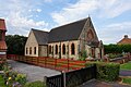
 Gilberdyke Methodist Church - geograph.org.uk - 6021850.jpg 640 × 472; 66 KB
-
 Gilberdyke railway station - geograph.org.uk - 6021859.jpg 640 × 480; 102 KB
-
 Gilberdyke railway station, Yorkshire - geograph.org.uk - 3258641.jpg 1,024 × 768; 230 KB
-
 Gilberdyke Train Station - geograph.org.uk - 6167375.jpg 1,600 × 1,065; 618 KB
-
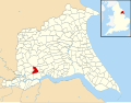 Gilberdyke UK parish locator map.svg 1,425 × 1,107; 1.68 MB
-
 Gilberdyke village boundary signs - geograph.org.uk - 6021853.jpg 640 × 480; 78 KB
-

-
 Gilberdyke.jpg 640 × 480; 98 KB
-
 Glasshouses at Scalby - geograph.org.uk - 3688877.jpg 1,024 × 768; 190 KB
-

-
 Goole line toward Gilberdyke Station. - geograph.org.uk - 2185669.jpg 4,000 × 3,000; 2.31 MB
-
 Grazing land near Sandholme - geograph.org.uk - 2023813.jpg 640 × 480; 71 KB
-
 Grazing near Sandholme - geograph.org.uk - 5663508.jpg 640 × 480; 85 KB
-
 Grazing off Anserdam Lane - geograph.org.uk - 5663471.jpg 640 × 480; 75 KB
-

-
 Greenoak Crossing from Black Bridge - geograph.org.uk - 6180739.jpg 4,608 × 3,456; 4.7 MB
-
 Greenoak Lane heading south - geograph.org.uk - 2023796.jpg 640 × 480; 52 KB
-
 Heading east on Landing Lane - geograph.org.uk - 5663511.jpg 640 × 480; 68 KB
-
 Hive Lane - geograph.org.uk - 5663450.jpg 640 × 480; 48 KB
-
 Hive Lane - geograph.org.uk - 6079276.jpg 1,024 × 768; 194 KB
-
 Hive Lane, Hive - geograph.org.uk - 5664089.jpg 2,848 × 2,136; 1.17 MB
-
 Hive Lane, Hive - geograph.org.uk - 5664090.jpg 2,724 × 1,873; 1.08 MB
-

-
 House at Bennetland Crossing - geograph.org.uk - 4561822.jpg 532 × 640; 61 KB
-
 House next to Gilberdyke Train Station - geograph.org.uk - 5048838.jpg 1,200 × 799; 375 KB
-
 House on Old Trough Lane, Sandholme - geograph.org.uk - 5663461.jpg 640 × 480; 67 KB
-
 Houses on Chapel Meadows, Gilberdyke - geograph.org.uk - 4158223.jpg 1,600 × 1,064; 501 KB
-
 Houses on Clementhorpe Lane, Gilberdyke - geograph.org.uk - 5048909.jpg 1,200 × 799; 329 KB
-
 Houses on Clementhorpe Lane, Staddlethorpe - geograph.org.uk - 5048952.jpg 1,200 × 799; 351 KB
-
 Houses on Main Street, Gilberdyke - geograph.org.uk - 4158255.jpg 1,600 × 1,064; 491 KB
-
 Houses on Staddlethorpe Broad Lane - geograph.org.uk - 5675206.jpg 1,194 × 896; 554 KB
-
 Houses on Station Road, Gilberdyke - geograph.org.uk - 5048872.jpg 1,200 × 799; 240 KB
-
 Hull Trains 180 First Class Interior.JPG 3,264 × 2,448; 1.44 MB
-
 Industrial Unit west of Gilberdyke - geograph.org.uk - 2023801.jpg 640 × 328; 28 KB
-

-
 Jubilee Pond Gilberdyke.jpg 640 × 419; 79 KB
-
 Jubilee Pond, Gilberdyke - geograph.org.uk - 5048850.jpg 1,200 × 799; 328 KB
-
 Jubilee Pond, Gilberdyke - geograph.org.uk - 590170.jpg 640 × 498; 178 KB
-
 Jubilee Pond, Gilberdyke - geograph.org.uk - 739941.jpg 640 × 480; 77 KB
-
 Landing Lane near Sandholme - geograph.org.uk - 2112378.jpg 800 × 600; 213 KB
-
 Landscape near Clubhill - geograph.org.uk - 4623131.jpg 1,024 × 768; 139 KB
-
 Lane to Blacktoft Grange - geograph.org.uk - 1365111.jpg 640 × 480; 103 KB
-
 Lane to Faxfleet - geograph.org.uk - 2185598.jpg 4,000 × 3,000; 2.11 MB
-
 Layby on the B1230 - geograph.org.uk - 4486097.jpg 1,024 × 675; 127 KB
-
 Leavens Lane or Fish Lane - geograph.org.uk - 4623135.jpg 1,024 × 768; 167 KB
-
 Leavens or Fish Lane - geograph.org.uk - 1365105.jpg 640 × 480; 89 KB
-
 Leaving Hive on Hive Lane - geograph.org.uk - 5110540.jpg 4,608 × 3,456; 5.52 MB
-
 Level crossing on Clementhorpe Lane, Gilberdyke - geograph.org.uk - 5048936.jpg 1,200 × 799; 375 KB
-

-

-
 M62 eastbound towards Hull - geograph.org.uk - 2023810.jpg 640 × 480; 59 KB
-
 M62 from Leavens Lane Bridge - geograph.org.uk - 173403.jpg 640 × 480; 27 KB
-
 M62 through Carters Plantation - geograph.org.uk - 1466668.jpg 640 × 480; 37 KB
-
 M62 westbound from Sandholme Road bridge - geograph.org.uk - 5059979.jpg 4,608 × 3,456; 3.33 MB
-
 Main Line Hull to Selby - geograph.org.uk - 2185659.jpg 4,000 × 3,000; 2.68 MB
-
 Main Road (B1230) - geograph.org.uk - 5662988.jpg 640 × 480; 54 KB
-
 Main Road Gilberdyke.jpg 640 × 432; 73 KB
-
 Methodist Church Gilberdyke.jpg 640 × 480; 73 KB
-
-

-
 Mill Lane - geograph.org.uk - 3717831.jpg 1,024 × 768; 244 KB
-
 Mill Lane - geograph.org.uk - 6127785.jpg 1,024 × 768; 331 KB
-
 Mill Lane to Mill farm - geograph.org.uk - 1365147.jpg 640 × 480; 125 KB
-
 Mill Lane, Newport, East Yorkshire - geograph.org.uk - 3734369.jpg 1,024 × 681; 198 KB
-
 Mill Lane, Newport, East Yorkshire - geograph.org.uk - 3734370.jpg 1,024 × 681; 223 KB
-
 Mill Lane, Newport, East Yorkshire - geograph.org.uk - 3734372.jpg 1,024 × 681; 179 KB
-
 Mill Lane, Newport, East Yorkshire - geograph.org.uk - 3734373.jpg 1,024 × 681; 183 KB
-
 Milton House, Gilberdyke - geograph.org.uk - 5053907.jpg 1,200 × 799; 355 KB
-
 Minor Road towards Gilberdyke - geograph.org.uk - 1603704.jpg 640 × 480; 68 KB
-
 Minor road towards Metham Grange - geograph.org.uk - 2325072.jpg 1,600 × 1,200; 491 KB
-
 New house near the Delph Drain - geograph.org.uk - 5663482.jpg 640 × 480; 94 KB
-
 New house near Yokefleet Grange - geograph.org.uk - 4623101.jpg 1,024 × 768; 185 KB
-
 Old Trough Lane, Hive - geograph.org.uk - 2325067.jpg 1,600 × 1,200; 291 KB
-
 Old Trough Lane, Sandholme - geograph.org.uk - 5663464.jpg 640 × 496; 54 KB
-
 Overgrown siding, Gilberdyke Station - geograph.org.uk - 4561799.jpg 640 × 426; 74 KB
-
 Oxmardyke crossing on Tongue Lane - geograph.org.uk - 2208602.jpg 800 × 600; 176 KB
-
 Oxmardyke Level Crossing - geograph.org.uk - 3786581.jpg 640 × 427; 48 KB
-
 Packman Lane - geograph.org.uk - 1365156.jpg 640 × 480; 80 KB
-
 Path and wind turbine - geograph.org.uk - 4623092.jpg 1,024 × 768; 138 KB
-
 Path at Bellasize Lane - geograph.org.uk - 5048960.jpg 1,200 × 799; 322 KB
-
 Path leading to Gilberdyke - geograph.org.uk - 5053869.jpg 1,200 × 799; 384 KB
-
 Path leading to Gilberdyke - geograph.org.uk - 5053874.jpg 1,200 × 799; 606 KB
-
 Path leading towards Sober Hill - geograph.org.uk - 5048956.jpg 1,200 × 799; 384 KB
-
 Pond and Anserdam House - geograph.org.uk - 4623105.jpg 1,024 × 768; 309 KB
-
 Pond behind trees - geograph.org.uk - 4561801.jpg 640 × 426; 75 KB
-
 Pond by the road junction - geograph.org.uk - 4623119.jpg 1,024 × 768; 337 KB
-
 Post Office on Clementhorpe Road, Gilberdyke - geograph.org.uk - 5664064.jpg 2,848 × 2,136; 1.23 MB
-
 Quaker's Farm - geograph.org.uk - 1365149.jpg 640 × 480; 65 KB
-
-

-
-
 Railway towards Selby - geograph.org.uk - 5662980.jpg 640 × 480; 51 KB
-
 Recently ploughed field near Beech Farm - geograph.org.uk - 5110536.jpg 4,554 × 3,384; 7.35 MB
-
 Reedbed Near Hasholme Grange.jpg 640 × 426; 152 KB
-
 Resting Ducks - geograph.org.uk - 739948.jpg 640 × 480; 118 KB
-
 River Foulness - geograph.org.uk - 234359.jpg 640 × 426; 128 KB
-
 River Foulness 1.jpg 640 × 426; 132 KB
-
 River Foulness 2.jpg 640 × 480; 65 KB
-

-

-
 Road to Blacktoft Grange - geograph.org.uk - 6187162.jpg 1,024 × 768; 270 KB
-
 Roadside drain at Greenoak - geograph.org.uk - 4638397.jpg 1,024 × 768; 224 KB
-
 Rose and Crown on the B1230 approaching Slipper Bridge - geograph.org.uk - 4556363.jpg 2,920 × 2,085; 1.82 MB
-
 Rowlands, Bennetland Lane - geograph.org.uk - 4561852.jpg 640 × 347; 38 KB
-
 Rural signpost in a natural setting - geograph.org.uk - 5060012.jpg 4,608 × 3,456; 4.7 MB


.jpg)


_-_geograph.org.uk_-_5662988.jpg)


