Category:Ger (Manche)
Jump to navigation
Jump to search
commune in Manche, France  .svg)  | |||||
| Upload media | |||||
| Instance of | |||||
|---|---|---|---|---|---|
| Located in protected area | |||||
| Location |
| ||||
| Population |
| ||||
| Area |
| ||||
| Different from | |||||
 | |||||
Subcategories
This category has the following 3 subcategories, out of 3 total.
E
- Église Saint-Matthieu de Ger (16 F)
M
- Maps of Ger (Manche) (3 F)
T
- Town hall of Ger (Manche) (2 F)
Media in category "Ger (Manche)"
The following 17 files are in this category, out of 17 total.
-
 Blason ville fr Ger (Manche).svg 600 × 660; 31 KB
-
 Bocage normand.jpg 4,000 × 3,000; 3.61 MB
-
 Entrée de bourg.jpg 4,000 × 3,000; 3.59 MB
-
 Four Legrain en cours de fouille.jpg 4,985 × 3,330; 6.14 MB
-
 FranceNormandieGerMuseePoterieFontenayLeMarmion.jpg 2,285 × 1,714; 1.89 MB
-
 FranceNormandieGerMuséeDeLaPoterieChateauCaen.jpg 2,448 × 1,958; 2.32 MB
-
 FranceNormandieGerYvrandesLEgrenne.jpg 2,448 × 3,264; 5.46 MB
-
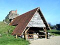
 Ger - Mairie et église Saint-Matthieu.jpg 5,184 × 3,456; 6.09 MB
-
 Ger - Monument aux Morts.jpg 3,456 × 5,184; 7.35 MB
-
 Ger Séchage des poteries avant la cuisson Poterie Dumaine La Louverie MPN.jpg 3,282 × 2,112; 1.19 MB
-
 Ger.jpg 600 × 450; 93 KB
-
 MAIRIE DE GER.jpg 4,000 × 3,000; 3.67 MB
-
 Musee regional de la poterie.jpg 1,924 × 1,252; 881 KB
-
 Musée de la Poterie.jpg 4,000 × 3,000; 3.79 MB
-
 Population - Municipality code 50200.svg 475 × 355; 13 KB
-
 Yannec Tomada Tournage France3.jpg 1,024 × 700; 180 KB
-
 Écorché four Placître Ger 02 08 058.jpg 8,429 × 5,075; 6.84 MB


