Category:Georgia State Route 56
Jump to navigation
Jump to search
 | number: | (fifty-six) |
|---|---|---|
| State highways in Georgia (U.S. state): | 36 · 37 · 38 · 39 · 40 · 41 · 42 · 43 · 44 · 45 · 46 · 47 · 48 · 49 · 50 · 51 · 52 · 53 · 54 · 55 · 56 · 57 · 59 · 60 · 61 · 62 · 63 · 64 · 68 · 70 · 72 · 73 · 74 · 75 · 76 |
State highway in southeastern and east-central Georgia  | |||||
| Upload media | |||||
| Instance of | |||||
|---|---|---|---|---|---|
| Location | Georgia | ||||
| Transport network | |||||
| Owned by | |||||
| Maintained by | |||||
| Length |
| ||||
| |||||
English: State Route 56 (SR 56) is a state highway that travels south-to-north in an upside down question mark, with a western loop around Vidalia. It travels through portions of Tattnall, Toombs, Montgomery, Treutlen, Emanuel, Burke, and Richmond counties in the southeastern and east-central parts of the U.S. state of Georgia. The route connects the Reidsville and Augusta areas, via Swainsboro and Waynesboro.
閩南語 / Bân-lâm-gú:Chiu Lō͘-sòaⁿ 56 ( Eng-bûn: ; SR 56) sī chi̍t tiâu tī Bí-kok Georgia Chiu ê chiu-kip kong-lō͘.
Subcategories
This category has the following 2 subcategories, out of 2 total.
V
Media in category "Georgia State Route 56"
The following 11 files are in this category, out of 11 total.
-
 GA56EB end, Reidsville.jpg 5,184 × 3,456; 7.5 MB
-
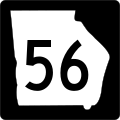 Georgia 56.svg 600 × 600; 5 KB
-
 Georgia state route 56 map.png 948 × 711; 210 KB
-
 Georgia State Route 56 Ohoopee River bridge, Tattnall County.jpg 5,184 × 3,456; 5.75 MB
-
 Old buildings GA56, Mount Vernon.jpg 5,184 × 3,456; 9.28 MB
-
 Old buildings US221, Uvalda.jpg 5,184 × 3,456; 9.07 MB
-
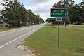 Reidsville limit GA56EB.jpg 5,184 × 3,456; 7.75 MB
-
 Tattnall County border, GA 56 EB.jpg 5,184 × 3,456; 7.1 MB
-
 Thriftway Galaxy Food Store, Mount Vernon.jpg 5,184 × 3,456; 7.46 MB
-
 Toombs County border, GA 56 WB.jpg 5,184 × 3,456; 7.17 MB
-
 Uvalda city limit US221EB.jpg 5,184 × 3,456; 9.24 MB


