Category:Georgia State Route 158
Jump to navigation
Jump to search
 | number: | (one hundred fifty-eight) |
|---|---|---|
| State highways in Georgia (U.S. state): | 138 · 139 · 140 · 141 · 144 · 147 · 149 · 150 · 154 · 155 · 156 · 157 · 158 · 159 · 165 · 166 · 168 · 169 · 177 · 178 |
highway in Georgia  | |||||
| Upload media | |||||
| Instance of | |||||
|---|---|---|---|---|---|
| Location | Georgia | ||||
| Transport network | |||||
| Owned by | |||||
| Maintained by | |||||
| Length |
| ||||
| |||||
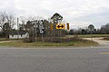
English: State Route 158 is a highway that runs west-to-east through portions of Irwin and Berrien counties, where it forms part of the county line between the two counties, as well as Coffee and Ware counties in southeastern Georgia. The route runs from its western terminus at US 129 and SR 11 north of Alapaha, through Douglas, to its eastern terminus at US 82 and SR 520 west of Waycross.
Subcategories
This category has only the following subcategory.
G
Media in category "Georgia State Route 158"
The following 9 files are in this category, out of 9 total.
-
 Aden's Minit Market, GA158, Douglas.jpg 5,184 × 3,456; 6.07 MB
-
 GA158 end, Irwin County.jpg 5,184 × 3,456; 7.99 MB
-
 GA158 NB at Ameris Dr.jpg 5,184 × 3,456; 5.58 MB
-
 GA90 SB at GA158 Coffee County border.jpg 5,184 × 3,456; 4.42 MB
-
 Georgia 158.svg 750 × 600; 7 KB
-
 Georgia state route 158 map.png 654 × 342; 61 KB
-
 Georgia State Route 64, eastern terminus.JPG 5,152 × 3,864; 7.85 MB
-
 Walmart Distribution Center, Douglas.jpg 5,184 × 3,456; 5.36 MB
-
 Wiregrass Georgia Technical College Douglas.jpg 3,072 × 2,304; 1.45 MB


