Category:Georgia (U.S. state) State Route shields
Jump to navigation
Jump to search
English: Photographs of "Georgia Route" signs: markers for state highways of Georgia (U.S. state)
Subcategories
This category has only the following subcategory.
Media in category "Georgia (U.S. state) State Route shields"
The following 200 files are in this category, out of 762 total.
(previous page) (next page)-
 2011.03.12.085920 Main Square Cuthbert Georgia.jpg 1,920 × 1,280; 1.09 MB
-
-
 3 US Routes; 4 GA State Routes, Folkston, GA.jpg 3,648 × 2,736; 2.07 MB
-
 Albany U.S. 82 Business NB End.jpg 5,184 × 3,456; 4.62 MB
-
 Approaching roundabout w signs, US84 WB, Clinch County.jpg 5,184 × 3,456; 5.33 MB
-
 Atkinson County border, GA64WB.JPG 5,152 × 3,864; 7.93 MB
-
 Berrien County welcome sign, GA 122 WB.JPG 4,320 × 3,240; 4.5 MB
-
 Bowdon, Georgia.JPG 3,851 × 2,887; 4.06 MB
-
 Bruster's, N Ashley St, Valdosta.JPG 4,320 × 3,240; 4.43 MB
-
 Business US441 US129 GA24 South Signs - US441 South (28245487098).jpg 2,400 × 1,600; 1.82 MB
-
 Colquitt Street Clock.JPG 4,320 × 3,240; 4.38 MB
-
 Colquitt Towers (SE corner).JPG 3,072 × 2,304; 3.03 MB
-
 Courtland Ave, GA333 Inntersection, Quitman.JPG 4,320 × 3,240; 4.46 MB
-
 DogwoodDrive-Int20ewGA20nsGA138ewOverheads (34346887391).jpg 2,400 × 1,600; 1.84 MB
-
 Downtown Connector sb Exit 243 1 mile.jpg 5,184 × 3,456; 4.37 MB
-
 Downtown Connector sb Exit 243 Right Lane Exit Only.jpg 5,184 × 3,456; 4.41 MB
-
 Downtown Connector sb Exit 248C.jpg 5,184 × 3,456; 4.61 MB
-
 Downtown Connector sb Exit 249A, Peachtree St Overpass.jpg 5,184 × 3,456; 4.63 MB
-
 Downtown Connector sb Exit 249C.jpg 5,184 × 3,456; 5.03 MB
-
 Downtown Connector sb GA166 Overpass.jpg 5,184 × 3,456; 3.92 MB
-
 EB US 82 near E End of US 1-23 Concurrency.jpg 3,648 × 2,736; 2.06 MB
-
 End US 84 GA 38 Sign in Midway GA.JPG 2,592 × 1,944; 1.08 MB
-
 Folkston Seven-Way (31869167703).jpg 2,400 × 1,600; 2.94 MB
-
 GA 111 Sign (29171350656).jpg 2,400 × 1,600; 1.89 MB
-
 GA 112 133 Junction, Worth County.JPG 4,320 × 3,240; 4.49 MB
-
 GA 121 and 23 joins US 1-23-301 with GA 4 and 15.jpg 3,648 × 2,736; 2.06 MB
-
 GA 122 Church St Intersection, Hahira,.JPG 4,320 × 3,240; 4.43 MB
-
 GA 135 GA 376 Northbound 2.JPG 3,072 × 2,304; 3.13 MB
-
 GA 135 GA 376 Northbound.JPG 3,072 × 2,304; 3.15 MB
-
 GA 139 Sign (33635053544).jpg 2,400 × 1,600; 1.95 MB
-
 GA 31 North (29109705331).jpg 1,200 × 800; 597 KB
-
 GA 31 Right in Valdosta (28568132843).jpg 1,200 × 800; 751 KB
-
 GA 32 300 Junction, Worth County.JPG 4,320 × 3,240; 4.4 MB
-
 GA 32 33 Junction, Worth County.JPG 4,320 × 3,240; 4.47 MB
-
 GA 33 133 Junction, Colquitt County.JPG 4,320 × 3,240; 4.5 MB
-
 GA 362 End, Spalding County.JPG 5,184 × 3,456; 5.96 MB
-
 GA 37 133 US 319 Junction, Moultrie.JPG 4,320 × 3,240; 4.6 MB
-
 GA 376 End Clyattville.JPG 3,072 × 2,304; 3.12 MB
-
 GA 377 Sign (30973194716).jpg 2,400 × 1,600; 2.1 MB
-
 GA 38 33 intersection.JPG 4,320 × 3,240; 4.53 MB
-
 GA 400 northern terminus sign, April 2017.jpg 1,348 × 1,731; 811 KB
-
 GA 45, Morgan.JPG 4,320 × 3,240; 4.52 MB
-
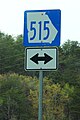 GA 515 Blue Sign - Ellijay (32901847876).jpg 1,600 × 2,400; 1.61 MB
-
 GA 74 85 NB at Meriwether Fire Station 4.JPG 4,320 × 3,240; 4.46 MB
-
 GA 76 133 Intersection, Morven.JPG 4,320 × 3,240; 4.48 MB
-
 GA 93 111 connector, Grady County.JPG 4,320 × 3,240; 4.49 MB
-
 GA 93 111 split, Grady County.JPG 4,320 × 3,240; 4.53 MB
-
 GA 94 GA 135 Junction Eastbound.JPG 3,072 × 2,304; 3.13 MB
-
 GA 94 GA 135 Junction Northbound.JPG 3,072 × 2,304; 3.15 MB
-
 GA I75 North-Exit 333.jpg 640 × 480; 57 KB
-
 GA Midway US 17 south02.jpg 4,288 × 3,216; 2.78 MB
-
 GA Riceboro US 17 south01.jpg 4,288 × 3,216; 1.92 MB
-
 GA SR 45 SB end, Iron City.jpg 5,184 × 3,456; 9.17 MB
-
 GA SR 94 Begin.JPG 3,072 × 2,304; 2.93 MB
-
 GA100sRoadSign-Roadside (37036418734).jpg 2,400 × 1,600; 2.33 MB
-
 GA107 South - Jct GA268 Sign (32785399541).jpg 2,400 × 1,600; 2.19 MB
-
 GA107 turn left, US441N.jpg 5,184 × 3,456; 5.55 MB
-
 GA107rightGA112signs (31008601605).jpg 1,600 × 2,400; 2.4 MB
-
 GA107sRoadSign (32868740376).jpg 2,400 × 1,600; 1.57 MB
-
 GA107sUS319US129GA90signsFitzgerald (32868746416).jpg 2,400 × 1,600; 2.22 MB
-
 GA109eRoadSign (32528092620).jpg 2,400 × 1,600; 1.77 MB
-
 GA111, Church St. intersection, Meigs.JPG 4,320 × 3,240; 4.47 MB
-
 GA111EB terminus at GA33, Moultrie.jpg 5,184 × 3,456; 8.11 MB
-
 GA112 end Grady County.jpg 5,184 × 3,456; 7.92 MB
-
 GA112nRoadCurveSign (25372812289).jpg 2,400 × 1,600; 2.16 MB
-
 GA114 East - AL Border (37713873182).jpg 2,400 × 1,600; 1.74 MB
-
 GA115nGA52eSignsRoad (32098995334).jpg 2,400 × 1,600; 2.25 MB
-
 GA121 GA169 South + GA144 West (32066426944).jpg 2,400 × 1,600; 2.56 MB
-
 GA121 South - US341 GA27 Signs (32755615122).jpg 2,400 × 1,600; 1.97 MB
-
 GA121nRoadSign-GA185sign (33835257471).jpg 2,400 × 1,600; 2.48 MB
-
 GA121s-GA15nsSigns (32755617162).jpg 2,400 × 1,600; 1.72 MB
-
 GA122 133 intersection, Brooks County.jpg 5,184 × 3,456; 6.53 MB
-
 GA122 end Ware County.jpg 5,184 × 3,456; 8.98 MB
-
 GA122 end, Thomasville.jpg 5,184 × 3,456; 7.87 MB
-
 GA122 turns east from GA168, Clinch County.jpg 5,184 × 3,456; 9 MB
-
 GA122 turns east from US221, Lanier County.jpg 5,184 × 3,456; 7.19 MB
-
 GA122 turns south onto GA168, Clinch County.jpg 5,184 × 3,456; 7.95 MB
-
 GA133NB, Brooks County.jpg 5,184 × 3,456; 6 MB
-
 GA133sRoadSign-EndGA234 (31008552985).jpg 2,400 × 1,600; 1.62 MB
-
 GA135 Bypass at GA135, Lakeland.jpg 5,184 × 3,456; 4.96 MB
-
 GA135 bypass terminus, Lanier County.jpg 5,184 × 3,456; 6.36 MB
-
 GA135 SB 7 miles before Lakeland.jpg 5,184 × 3,456; 5.16 MB
-
 GA135 SB Jct GA64 GA168.jpg 5,184 × 3,456; 4.91 MB
-
 GA135 SB Jct GA76.jpg 5,184 × 3,456; 5.17 MB
-
 GA135 SB, GA64 turn right ahead.jpg 5,184 × 3,456; 5.18 MB
-
 GA135 SB, GA64 turn right.jpg 5,184 × 3,456; 5.49 MB
-
 GA135 SB, GA76 turn right.jpg 5,184 × 3,456; 4.3 MB
-
 GA135 turn in Alston.JPG 5,152 × 3,864; 7.73 MB
-
 GA135SB GA168 intersection.jpg 5,184 × 3,456; 4.99 MB
-
 GA135sRoadSignDownhill (32867765886).jpg 2,400 × 1,600; 1.82 MB
-
 GA136eRoad-GA193nsSign (32784219931).jpg 2,400 × 1,600; 2.07 MB
-
 GA136eRoad-GA201sign (32908192595).jpg 2,400 × 1,600; 1.84 MB
-
 GA136eRoadSign-EastOfInt59 (32784216021).jpg 2,400 × 1,600; 2 MB
-
 GA139sRoad-GA314sSign (28245466858).jpg 2,400 × 1,600; 2.63 MB
-
 GA13nRoadSignUphill (31297979975).jpg 2,400 × 1,600; 2.11 MB
-
 GA140eRoad-GA53ewToInt75signs (32942682425).jpg 2,400 × 1,600; 1.41 MB
-
 GA140eRoadSign-Adairsville (32561636380).jpg 2,400 × 1,600; 1.64 MB
-
 GA140wRoad-GA372JctSign (33667560226).jpg 2,400 × 1,600; 2.12 MB
-
 GA140wRoadSign-Curves (33324248650).jpg 2,400 × 1,601; 2.28 MB
-
 GA141nRoad-Int285overpass (30929836520).jpg 2,400 × 1,600; 1.26 MB
-
 GA141nRoad-JonesMillRoad-GA140ahead (30929840200).jpg 2,400 × 1,600; 1.44 MB
-
 GA141nRoad-TillyMillRoad (31182899211).jpg 2,400 × 1,600; 1.31 MB
-
 GA141nRoad-TillyMillRoad2-GA141GA400above (30929838240).jpg 2,400 × 1,600; 1.35 MB
-
 GA141nRoad-ToGA400-PeachtreeIndustrialBlvdSplit (31182905051).jpg 2,400 × 1,600; 1.3 MB
-
 GA141nRoad-ToGA400-PeachtreeIndustrialBlvdSplit2 (30929841960).jpg 2,400 × 1,600; 1.41 MB
-
 GA141nRoad-WintersChapelRoad (31182902111).jpg 2,400 × 1,600; 1.48 MB
-
 GA141sFrontageRoad-ButtonCopy1 (31261433726).jpg 2,400 × 1,600; 2.28 MB
-
 GA141sFrontageRoad-ButtonCopy2 (31297967655).jpg 2,400 × 1,600; 1.73 MB
-
 GA141sFrontageRoad-ButtonCopy3b (31261437536).jpg 2,400 × 1,600; 2.02 MB
-
 GA141sFrontageRoad-ButtonCopy4 (31297969695).jpg 2,400 × 1,600; 1.65 MB
-
 GA141sFrontageRoad-ButtonCopy5 (31261441416).jpg 2,400 × 1,600; 1.71 MB
-
 GA141sRoad-GA140ewSigns (31297965775).jpg 2,400 × 1,600; 1.63 MB
-
 GA147 End, Reidsville.jpg 5,184 × 3,456; 6.32 MB
-
 GA15 121 SB at GA32 intersection, Bristol.jpg 5,184 × 3,456; 7.56 MB
-
 GA158 end, Irwin County.jpg 5,184 × 3,456; 7.99 MB
-
 GA159nGA90nRoadSigns (22830068618).jpg 2,400 × 1,600; 1.76 MB
-
 GA159nRoadSign (25372768909).jpg 2,400 × 1,600; 2.18 MB
-
 GA16 GA212 West GA11 GA83 South Signs - Monticello (41397977024).jpg 2,400 × 1,600; 2.07 MB
-
 GA16 West - Broad Street or Luther Bailey Road (41217180095).jpg 2,400 × 1,600; 1.9 MB
-
 GA16 West - GA212 East West Signs (28245493508).jpg 2,400 × 1,600; 2 MB
-
 GA16 West - GA74 GA85 North South Signs (27247743637).jpg 2,400 × 1,600; 1.85 MB
-
 GA16 West US27Alt - US29 GA14 GA34 North Signs (27247744997).jpg 2,400 × 1,600; 1.93 MB
-
 GA166 GA154 West GA70 GA92 South (35222467043).jpg 2,400 × 1,600; 2.09 MB
-
 GA166 West (35193035404).jpg 2,400 × 1,600; 2.82 MB
-
 GA166wGA154wGA70wSigns (35193030974).jpg 1,600 × 2,400; 1.77 MB
-
 GA16SR GA212 West Signs - Eatonton (41397976714).jpg 2,400 × 1,600; 2.93 MB
-
 GA177 begin, Clinch County.JPG 4,320 × 3,240; 4.51 MB
-
 GA177 end, Clinch County.JPG 4,320 × 3,240; 4.49 MB
-
 GA178eRoadSign (32785381351).jpg 2,400 × 1,600; 1.78 MB
-
 GA17AltEnd-GA17sSignRoad (31180184062).jpg 2,400 × 1,600; 1.98 MB
-
 GA17sRoadSign-LavoniaGA (30955722240).jpg 2,400 × 1,600; 1.7 MB
-
 GA18 GA219 I-85 I-185 Signs (32093502173).jpg 2,400 × 1,600; 2.58 MB
-
 GA188 end Grady County.jpg 5,184 × 3,456; 7.23 MB
-
 GA18eRoad-GA103sDetourSign (32784298701).jpg 2,400 × 1,600; 1.92 MB
-
 GA18eRoadSign-OffInt85n (32908262635).jpg 2,400 × 1,600; 1.57 MB
-
 GA200WB end, Blakely.jpg 5,184 × 3,456; 8.33 MB
-
 GA202 end, Thomas County.jpg 5,184 × 3,456; 6.78 MB
-
 GA202NB terminus at GA111, Colquitt County.jpg 5,184 × 3,456; 8.4 MB
-
 GA206 Conn EB end.jpg 5,184 × 3,456; 7.71 MB
-
 GA206 Conn WB end.jpg 5,184 × 3,456; 10.01 MB
-
 GA206 Connector EB End.jpg 5,184 × 3,456; 7.71 MB
-
 GA206 end, Douglas.jpg 5,184 × 3,456; 7.73 MB
-
 GA20eRoad-GA100nsSigns (30929817460).jpg 2,400 × 1,600; 2.21 MB
-
 GA20eUS27US411nGA101Signs-Rome (30929820320).jpg 2,400 × 1,600; 2.13 MB
-
 GA215 end, Ben Hill County.jpg 5,184 × 3,456; 7.99 MB
-
 GA233EndSign-GA90ew (30707030500).jpg 2,400 × 1,600; 2.3 MB
-
 GA234wRoad-GA45nsSigns (32785404151).jpg 2,400 × 1,600; 2.46 MB
-
 GA253 at GA38 offramp, Bainbridge.jpg 5,184 × 3,456; 5.42 MB
-
 GA253SpurNB end.jpg 5,184 × 3,456; 7.16 MB
-
 GA253WB at GA374, Seminole County.jpg 5,184 × 3,456; 6.86 MB
-
 GA256 end at GA33, Sylvester.jpg 5,184 × 3,456; 9.13 MB
-
 GA25sRoad-GrateAhead-JamesHouilhanBridge (31350742832).jpg 2,400 × 1,600; 1.39 MB
-
 GA262nSign-FromUS27s (29205551325).jpg 2,400 × 1,600; 2.57 MB
-
 GA26eRoad-GA224nSigns (32868710196).jpg 2,400 × 1,600; 1.77 MB
-
 GA26eRoad-GA240signs (32754682912).jpg 2,400 × 1,600; 1.89 MB
-
 GA26eRoad-GA329signs (32094461743).jpg 2,400 × 1,600; 1.77 MB
-
 GA26eRoad-GA355signs (32754678582).jpg 2,400 × 1,600; 2.03 MB
-
 GA26eRoadSign-SchleyCounty (32754680362).jpg 2,400 × 1,600; 1.59 MB
-
 GA283signRoad (32099016434).jpg 2,400 × 1,600; 2.18 MB
-
 GA284nGA283signs (32127820633).jpg 2,400 × 1,600; 2.35 MB
-
 GA284sRoadSign (32942700545).jpg 2,400 × 1,600; 2.73 MB
-
 GA285 EB end, Decatur County.jpg 5,184 × 3,456; 8.22 MB
-
 GA293 Sign (30929822470).jpg 2,400 × 1,600; 2.44 MB
-
 GA297nRoad-GA298signsSunset (32065513664).jpg 2,400 × 1,600; 2.16 MB
-
 GA297nRoadSign (32528081960).jpg 2,400 × 1,600; 1.8 MB
-
 GA3 NB GA520 WB US19 NB US82 WB Albany.jpg 5,184 × 3,456; 4.71 MB
-
 GA30-87 Int, Dodge County.JPG 4,608 × 3,456; 4.5 MB
-
 GA300EndSignRoad-InvertedNumeralThree (25372766979).jpg 2,400 × 1,600; 1.63 MB
-
 GA300nGA520eUS82eSignsRoad (25372765459).jpg 2,400 × 1,600; 2.13 MB
-
 GA313 Sign (31008605915).jpg 2,400 × 1,600; 2.41 MB
-
 GA313SB End, Sylvester.jpg 5,184 × 3,456; 8.12 MB
-
 GA313SB GA32 intersection, Doles.jpg 5,184 × 3,456; 5.77 MB
-
 GA31n-US41GA7ns-US41bGA7bSigns (28565713594).jpg 1,200 × 800; 572 KB
-
 GA32wRoad-GA125sign (30973225796).jpg 2,400 × 1,600; 1.67 MB
-
 GA32wRoad-GA203sign (32868728796).jpg 2,400 × 1,600; 2.1 MB
-
 GA32wRoadCurveSign (22830130298).jpg 2,400 × 1,600; 2.02 MB
-
 GA32wRoadSign-BaconCounty (32755619652).jpg 2,400 × 1,600; 2.04 MB
-
 GA33 end Thomas County.jpg 5,184 × 3,456; 7.59 MB
-
 GA333NB end, Brooks County.jpg 5,184 × 3,456; 9.39 MB
-
 GA33ConnectorEnd-US41-GA7 (25372816239).jpg 2,400 × 1,600; 2.91 MB
-
 GA34wRoad-GA34BypSigns (28598010905).jpg 1,200 × 800; 692 KB
-
 GA34wRoad-US27A-GA16wGA14US29GA34bypSigns (28598010525).jpg 1,200 × 800; 543 KB
-
 GA34wRoad-US27AnsUS29nsGA14nsGA16ewOverheads (28491164492).jpg 1,200 × 800; 588 KB
-
 GA35 end Grady County.jpg 5,184 × 3,456; 11.13 MB
-
 GA35 GA520 US82 US319, Tift County.jpg 5,184 × 3,456; 5.53 MB
-
 GA35 MM21, Norman Park.jpg 5,184 × 3,456; 8.6 MB
-
 GA354eRoadSign (32867705216).jpg 2,400 × 1,600; 1.55 MB
-
 GA35Conn NB end, Thomas County.jpg 5,184 × 3,456; 8.01 MB
-
 GA35Conn SB end, Thomas County.jpg 5,184 × 3,456; 7.85 MB
-
 GA365 US23 NB Traffic Light .5 mile ahead.jpg 5,184 × 3,456; 5.26 MB
-
 GA37eRoadSign (22830115478).jpg 2,400 × 1,600; 1.9 MB
-
 GA37wGA45sRoadSigns-MorganGA (32785411761).jpg 2,400 × 1,600; 2.68 MB
-
 GA37wRoadSign-Morgan (32529076380).jpg 2,400 × 1,600; 2.17 MB
-
 GA39 GA62 US27Bus Blakely Square.jpg 5,184 × 3,456; 6.2 MB
-
 GA39eRoadSign-LoggingTruck (32755643392).jpg 2,400 × 1,600; 2.32 MB
-
 GA39wSpurRoadSign (32785431741).jpg 2,400 × 1,600; 1.85 MB
-
 GA400 Toll - End Sign (28491163352).jpg 1,200 × 800; 547 KB
-
 GA400nRoad-GA369signs (32561637880).jpg 2,400 × 1,600; 1.37 MB
-
 GA41sGA36wRoadSigns (32093506413).jpg 2,400 × 1,600; 1.43 MB
-
 GA42signGantry-Int85north (31297978465).jpg 2,400 × 1,600; 1.36 MB

_between_Exit_250_and_Exit_251_in_Atlanta,_Georgia.jpg)


.jpg)

.JPG)

.jpg)


.jpg)
.jpg)


.jpg)
.jpg)
.jpg)


.jpg)


.jpg)


.jpg)
.jpg)

.jpg)
.jpg)
.jpg)
.jpg)


.jpg)
.jpg)
.jpg)
.jpg)
.jpg)
.jpg)
.jpg)


.jpg)


.jpg)
.jpg)
.jpg)
.jpg)
.jpg)
.jpg)
.jpg)
.jpg)
.jpg)
.jpg)
.jpg)
.jpg)
.jpg)
.jpg)
.jpg)
.jpg)
.jpg)
.jpg)
.jpg)
.jpg)
.jpg)
.jpg)
.jpg)


.jpg)
.jpg)
.jpg)
.jpg)
.jpg)
.jpg)
.jpg)
.jpg)
.jpg)
.jpg)
.jpg)


.jpg)
.jpg)
.jpg)
.jpg)

.jpg)
.jpg)


.jpg)
.jpg)

.jpg)
.jpg)


.jpg)
.jpg)
.jpg)
.jpg)
.jpg)
.jpg)
.jpg)
.jpg)
.jpg)
.jpg)

.jpg)
.jpg)
.jpg)


.jpg)
.jpg)
.jpg)


.jpg)
.jpg)
.jpg)
.jpg)
.jpg)


.jpg)
.jpg)
.jpg)
.jpg)


.jpg)


.jpg)
.jpg)
.jpg)

.jpg)
.jpg)
.jpg)
.jpg)
.jpg)
.jpg)
_State_Route_shields&filefrom=GA45-DawsonPlains-GA41-ShellmanPrestonSigns+%2832529069690%29.jpg#mw-category-media)