Category:Geological maps of France
Jump to navigation
Jump to search
Countries of Europe: Albania · Andorra · Armenia‡ · Austria · Azerbaijan‡ · Belgium · Bosnia and Herzegovina · Bulgaria · Croatia · Cyprus‡ · Czech Republic · Denmark · Estonia · Finland · France‡ · Georgia‡ · Germany · Greece · Hungary · Iceland · Republic of Ireland · Italy · Kazakhstan‡ · Latvia · Liechtenstein · Lithuania · Luxembourg · Moldova · Montenegro · Netherlands‡ · Norway · Poland · Portugal‡ · Romania · Russia‡ · Serbia · Slovakia · Slovenia · Spain‡ · Sweden · Switzerland · Turkey‡ · Ukraine · United Kingdom
Specific status: Svalbard
‡: partly located in Europe
Specific status: Svalbard
‡: partly located in Europe
| Upload media | |||||
| Subclass of | |||||
|---|---|---|---|---|---|
| Main subject | |||||
| |||||
Subcategories
This category has the following 32 subcategories, out of 32 total.
*
C
G
- Geological maps of Marseille (3 F)
H
- Hydrological maps of France (1 F)
M
- Maps of coal mines in France (55 F)
- Maps of Paris Basin (5 F)
P
S
V
Media in category "Geological maps of France"
The following 86 files are in this category, out of 86 total.
-
 France geological map-fr.svg 1,636 × 1,753; 3.27 MB
-
 "Carte géologique de la France a l'époque actuelle". (4513835873).jpg 4,524 × 3,046; 2.92 MB
-
 "France à l'epoque tertiaire". (4513834115).jpg 4,529 × 3,104; 2.95 MB
-
 "France à l'èpoque de la mer cretacée". (4514473204).jpg 4,752 × 3,168; 3.33 MB
-
 "France à l'époque de la mer jurassique". (4513785635).jpg 4,572 × 3,063; 2.82 MB
-
 1 - 1.000.000. Craie et carbonate de chaux. Carrières, usines - btv1b53195534x.jpg 12,228 × 14,482; 17.05 MB
-

-
-
 76 of 'La France Illustrée- géographie générale ... Par F. J' (11293425093).jpg 1,095 × 1,128; 361 KB
-
 78 of 'La France Illustrée- géographie générale ... Par F. J' (11292680314).jpg 1,271 × 1,442; 597 KB
-
 Afloramientos sílex País Vasco.jpg 1,056 × 816; 247 KB
-
 Alps geology map en.jpg 3,338 × 1,607; 1.86 MB
-
 Alps geology map.jpg 3,338 × 1,607; 1.84 MB
-
 BassinminierglobalNordPDC.svg 946 × 604; 419 KB
-
 Bourgogne-Franche-Comté - Charbon.svg 2,037 × 1,559; 2.4 MB
-
 Carte des bassins d'extraction de la pierre.jpg 440 × 536; 48 KB
-
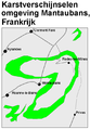
 Carte geol pic-Midi-Ossau.svg 2,968 × 1,280; 6.61 MB
-
 Carte géologique C&C.png 380 × 296; 232 KB
-
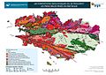
 Carte géologique de la France.jpg 1,724 × 1,681; 407 KB
-

-
 Carte géologique du Massif central.jpg 1,123 × 794; 133 KB
-
 Carte géologique du Massif central.png 360 × 502; 407 KB
-
 Carte géologique du Morvan.svg 1,104 × 1,154; 193 KB
-
 Carte géologique simplifiée du Géoparc Beaujolais.pdf 5,102 × 7,158; 143.33 MB
-
 Chaine de Lure 1.jpg 504 × 462; 74 KB
-
 Chaine de Lure 2.jpg 472 × 566; 88 KB
-
 Chaine de Lure 3.jpg 460 × 519; 81 KB
-
 Corsica satellitare geologia.jpg 614 × 1,238; 114 KB
-
 Domaines geologiques france.png 800 × 554; 64 KB
-
 Domanioù douarouriezhel Frañs.png 800 × 554; 63 KB
-
 Dora-Maira-Massiv.png 595 × 518; 76 KB
-

-
 France relief-es.png 1,000 × 961; 57 KB
-
 France relief.png 1,000 × 961; 102 KB
-
 France-(geological)-EB1911.png 1,065 × 1,327; 84 KB
-
 France1911geo.png 1,050 × 1,302; 976 KB
-
 French Hercynian massifs BR.svg 850 × 590; 274 KB
-
 French Hercynian massifs EN.svg 850 × 590; 274 KB
-
 French Hercynian massifs NL.svg 850 × 590; 273 KB
-
 Geol Benelux.png 295 × 278; 118 KB
-
 Geologic map SE England & Channel EN.svg 1,374 × 890; 1.65 MB
-
 Geologic map SE England & NW France FR.svg 1,374 × 890; 1.44 MB
-
 Geological map germany 1869.jpg 1,823 × 2,132; 921 KB
-
 Geological map of the Paris Basin.jpg 728 × 523; 95 KB
-
 Geological units of the Iberian Peninsula EN.svg 542 × 603; 184 KB
-
 Geologie massif du Jura.svg 882 × 1,170; 178 KB
-
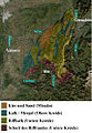 Geologie Sat Kopie.jpg 342 × 495; 194 KB
-
 Geoloogie frankrijk voorbeeld doelgroep geoloog.PNG 981 × 613; 47 KB
-
 Geoloogie frankrijk voorbeeld doelgroep toerist.PNG 480 × 690; 26 KB
-
 Geomorphologic map Morgat.jpg 600 × 445; 258 KB
-
 Granites du Massif central.jpg 1,123 × 794; 770 KB
-
 Génis-Unit.jpg 2,437 × 820; 178 KB
-
 Géologie auvergne.gif 621 × 778; 81 KB
-
 Géologie auvergne.png 621 × 778; 216 KB
-
 Géologie bretagne.jpg 742 × 525; 110 KB
-
 Géologie du bassin houiller.jpg 1,143 × 949; 430 KB
-
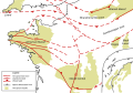
 Hercynian structures Europe-en.svg 850 × 555; 131 KB
-
 Hercynian structures Europe-es.svg 2,239 × 1,455; 516 KB
-
 Hercynian structures Europe-fr.svg 850 × 575; 129 KB
-
 Hercynian structures Europe-it.svg 850 × 555; 104 KB
-
 Iberian Peninsula geological map ES.svg 559 × 603; 3.76 MB
-
 Iberian Tectonic EN.svg 382 × 485; 695 KB
-
 Karte Geologische Strukturen des Rheinischen Schiefergebirges.png 2,341 × 1,329; 5.14 MB
-
 Kerguelen geologic map-fr.svg 1,832 × 1,832; 110 KB
-
 Le Jardin des Plantes, Grande galerie de l'évolution, Paris 2008.jpg 1,600 × 1,200; 775 KB
-
 LimousinGeol.PNG 817 × 550; 344 KB
-
 Lorraine geologic map andra.svg 1,300 × 1,300; 338 KB
-
 Lorraine geologic map.svg 1,300 × 1,300; 358 KB
-
 Map of Alpine Glaciations.png 1,026 × 657; 1.43 MB
-
 Montagne Noire - Geology.png 1,756 × 1,304; 532 KB
-
 Montblanc-Massiv.png 4,137 × 3,417; 3.73 MB
-
 Nw europe grav plot 2.png 742 × 841; 880 KB
-
 Nw europe grav plot.png 475 × 548; 318 KB
-
 ParisBasin.jpg 2,172 × 2,074; 2.58 MB
-
 Rhinegraben fessenheim.png 1,235 × 1,740; 8.72 MB
-
 Saint-Mathieu-Dome.png 1,006 × 1,094; 192 KB
-
 Schema tettonico delle Alpi.jpg 1,250 × 833; 532 KB
-
 Schéma des 2 marges continentales des alpes.png 705 × 454; 127 KB
-
 Sous-sol2.png 1,173 × 528; 63 KB
-
 Tectonic map Mediterranean DE.svg 1,280 × 715; 622 KB
-
 Tectonic map Mediterranean EN.svg 1,280 × 715; 623 KB
-
 Tectonic map Mediterranean He.jpg 1,324 × 770; 218 KB
-
 The age of mammals in Europe, Asia and North America (1910) (17324622953).jpg 1,808 × 1,264; 564 KB
-
 Upper Rhine plain with Fessenheim location - photomap-fr.svg 1,237 × 1,742; 1.05 MB
-
 Varisztidák.png 603 × 288; 116 KB
-
 Ypresis carte.jpg 540 × 275; 134 KB

.jpg)
.jpg)
.jpg)
.jpg)

.jpg)
.jpg)
.jpg)
.jpg)


.jpg)


.jpg)


-EB1911.png)


_(17324622953).jpg)


