Category:Geological maps of Canada
Jump to navigation
Jump to search
Countries of the Americas: Argentina · Belize · Bolivia · Brazil · Canada · Chile · Colombia · Costa Rica · Ecuador · El Salvador · Guatemala · Mexico · Nicaragua · Panama · Paraguay · Peru · United States of America · Uruguay · Venezuela
Other areas: French Guiana · Greenland · Guadeloupe · Martinique · Puerto Rico
Other areas: French Guiana · Greenland · Guadeloupe · Martinique · Puerto Rico
Subcategories
This category has the following 34 subcategories, out of 34 total.
Media in category "Geological maps of Canada"
The following 68 files are in this category, out of 68 total.
-

-
 1872 North Cascades Isoseismal Map.png 1,464 × 1,544; 508 KB
-

-
 Acasta Acasta.png 1,926 × 910; 1.68 MB
-
 Acasta.png 2,301 × 910; 1.72 MB
-
 Animikie Group and Marquette Range and Huronian supergroups.PNG 386 × 436; 59 KB
-
 Animikie Group, Marquette Range and Huronian supergroups2.PNG 692 × 776; 183 KB
-
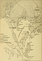
 Annual report (1902) (14577381448).jpg 3,896 × 2,144; 1.27 MB
-
 Annual report (1913) (14801011613).jpg 2,528 × 2,834; 1.37 MB
-
 Annual report (1920) (14592483169).jpg 1,362 × 2,848; 583 KB
-
-
 Approximate area of the Niagara Escarpment 2.PNG 514 × 458; 30 KB
-
 Bedrock of Wernecke Mountains in the Yukon.png 595 × 767; 701 KB
-
 Burgess shale location.png 500 × 405; 87 KB
-
 Canada geol.jpg 2,000 × 1,414; 464 KB
-
 Canada geological map-WCSB.JPG 2,000 × 1,557; 2.07 MB
-
 Canada geological map.JPG 2,000 × 1,557; 2.25 MB
-
 Canada kimberlite locations.png 706 × 599; 133 KB
-
 Contributions to Canadian biology (1915) (14589422859).jpg 2,016 × 2,876; 740 KB
-

-
 Faille de Cadillac.png 963 × 464; 393 KB
-
 Geological Map of portions of Saskatchewan, Athabaska, and Keewatin Districts 1902.pdf 5,022 × 4,256; 4.58 MB
-
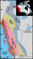 Geology belts of western Canada.png 376 × 665; 40 KB
-
 Grand Manan Geology Map.jpg 2,550 × 3,300; 927 KB
-
 Great Lakes Tectonic Zone map.PNG 233 × 104; 6 KB
-
 Grenville extent.gif 1,110 × 890; 91 KB
-
 Grouse Creek block location1.jpg 1,131 × 1,206; 565 KB
-
 Gunnar Mine geologic map and cross section.png 365 × 573; 59 KB
-
 Itcha Range geology.png 571 × 370; 66 KB
-
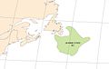 Jeanne dArc Basin.jpg 820 × 521; 58 KB
-
 Juan de fuca plate.png 536 × 652; 46 KB
-
 Main Endeavour hydrothermal map.png 250 × 226; 21 KB
-
 Map of the Circum-Superior Belt highlighting location of the Winnipegosis Komatiite Belt.png 5,640 × 3,583; 2.12 MB
-
 Map, Wopmay Orogen, Canada gov.pdf 6,506 × 5,770; 11.97 MB
-
 Marcellus Shale USGS.png 300 × 350; 78 KB
-
 Midcontinent Rift map.PNG 774 × 675; 55 KB
-
 Montney Formation.jpg 2,550 × 3,300; 1.19 MB
-
 Mount Cayley volcanic field.png 308 × 725; 181 KB
-
 Nazko volcanics.png 533 × 424; 148 KB
-
 NEPTUNE Canada overview map.jpg 544 × 445; 220 KB
-
 Niagara Escarpment map.png 931 × 535; 29 KB
-
 Non-Ferrous Metals - Eastern Canada map.pdf 3,975 × 2,975; 1.31 MB
-
 North america and scandinavia basement rocks.png 484 × 429; 15 KB
-
 North American provinces and orogens.PNG 497 × 583; 237 KB
-
 Northern Canada and Greenland Paleogene tectonics.jpg 448 × 1,613; 304 KB
-
 Northwestern Canadian Shield.jpg 799 × 617; 259 KB
-
 Oil shale in Canada.png 1,062 × 944; 145 KB
-
 Onondaga Formation.jpg 752 × 384; 60 KB
-
 Ottawabonnecheregrabenmap.png 600 × 525; 446 KB
-
 PrairiePotholeRegionMap.gif 295 × 302; 5 KB
-
 Report of the Canadian Arctic Expedition 1913-18 (1919) (20602297159).jpg 3,116 × 3,904; 590 KB
-
 South BC-NW USA-relief CaribooPlateau2.png 708 × 600; 963 KB
-
 Tectonic forces in Cascadia.png 800 × 425; 113 KB
-
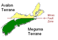 Terranes of Nova Scotia.PNG 281 × 194; 11 KB
-
 The Crystal Falls iron-bearing district of Michigan (1899) (20091627914).jpg 3,299 × 2,719; 810 KB
-
 The Michipicoten iron ranges (1902) (14579747000).jpg 3,328 × 4,176; 1.97 MB
-
 The Michipicoten iron ranges (1902) (14579985017).jpg 4,312 × 1,958; 1,002 KB
-
 The Michipicoten iron ranges (1902) (14764089544).jpg 2,176 × 4,116; 1,005 KB
-
 The Michipicoten iron ranges (1902) (14766124382).jpg 3,328 × 4,220; 2.28 MB
-
 The Michipicoten iron ranges (1902) (14766127952).jpg 3,182 × 4,310; 1.74 MB
-
 The Michipicoten iron ranges (1902) (14786315663).jpg 3,328 × 3,094; 1.45 MB
-
 The Onondaga Formation.png 3,162 × 2,405; 166 KB
-
 The Quarterly journal of the Geological Society of London (12684665984).jpg 1,480 × 1,021; 358 KB
-

-
 Ungava magmatic event He.jpg 346 × 547; 43 KB
-
 Ungava magmatic event.png 346 × 547; 22 KB
-
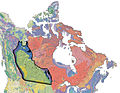
 Williston Basin tectonic map.jpg 635 × 748; 83 KB
-
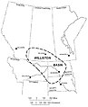 WillistonBasinLocation.jpg 650 × 800; 52 KB


_(14577381448).jpg)
_(14801011613).jpg)
_(14592483169).jpg)
_(14596748360).jpg)


_(14589422859).jpg)
_(20841301505).jpg)


_(20602297159).jpg)


_(20091627914).jpg)
_(14579747000).jpg)
_(14579985017).jpg)
_(14764089544).jpg)
_(14766124382).jpg)
_(14766127952).jpg)
_(14786315663).jpg)

.jpg)
_(14773680482).jpg)


.jpg)
%27_(11110409564).jpg)