<nowiki>Category:Geography of Nara; Category:奈良市の地理; 분류:나라시의 지리; विकिमिडिया श्रेणी; categoria de Wikimedia; κατηγορία εγχειρημάτων Wikimedia; Wikimedia-kategorie; Wikimedia:Klassys; kategorija na Wikimediji; Викимедиина категорија; Wikimedia category; kategori Wikimedia; categurìa 'e nu pruggette Wikimedia; Wikimedia-categorie; Wikimedia:Ronnaghys; Wikimedia category; د ويکيمېډيا وېشنيزه; Уикимедия категория; kategoria w projekcie Wikimedia; Vikimedya kategorisi; ویکیمیڈیا زمرہ; หน้าหมวดหมู่วิกิมีเดีย; categoría de Wikimedia; Wikimedia-kategori; Wikimedia-Kategorie; категорія проєкту Вікімедіа; kawan Wikimèdia; 維基媒體專案分類; 维基媒体分类; Wikimedia-Kategorie; 위키미디어 분류; Wikimedia-bólkur; kategorio en Vikimedio; kategorie na projektech Wikimedia; Wikimedia-Kategorie; विकिपीडिया:श्रेणी; উইকিমিডিয়া বিষয়শ্রেণী; page de catégorie d'un projet Wikimedia; kategori Wikimedia; kategorija na Wikimediji; kategorya ng Wikimedia; 维基媒体分类; катэгорыя ў праекце Вікімедыя; 維基媒體分類; विकिपीडिया वर्ग; kategorija w projektach Wikimedije; thể loại Wikimedia; 维基媒体项目分类; Wikimedia projekta kategorija; kategoria ti Wikimedia; категорија на Викимедији; гурӯҳи Викимедиа; Wikimedia категориясы; categoria de um projeto da Wikimedia; 维基媒体分类; категорияд Ангилал; Wikimedia-kategori; Wikimedia-kategori; kategori Wikimédia; kategori Wikimedia; Wikimedia-Kategorie; kategori Wikimedia; پۆلی ویکیمیدیا; Wikimedia category; تصنيف ويكيميديا; Vikimédia ñemohenda; pajenn rummata eus Wikimedia; Wikimedia:ကဏ္ဍခွဲခြင်း; 維基媒體分類; Wikimédia-kategória; વિકિપીડિયા શ્રેણી; Wikimedia-kategoriija; Wikimediako kategoria; 維基媒體分類; categoría de Wikimedia; категория в проекте Викимедиа; Wikimedia-Kategorie; Wikimedia-Kategorie; kategori e Wikimedias; Viciméid catagóir; ردهٔ ویکیپدیا; Wikimedia-kategorie; Wîkîmediya:Kategorî; विकिमिडिया श्रेणी; ウィキメディアのカテゴリ; categoria Wikimedia; tudalen categori Wikimedia; تصنيف بتاع ويكيميديا; Wikimedia kategooria; විකිමීඩියා ප්රභේද පිටුව; Викимедиа проектындагы төркем; катэгорыя ў праекце Вікімэдыя; विकिमीडिया श्रेणी; kategória projektov Wikimedia; Wikimedia-luokka; гурӯҳ дар лоиҳаи Викимедиа; Wikimedia-categorie; Wikimedia-categorie; விக்கிமீடியப் பகுப்பு; categoria di un progetto Wikimedia; gurühi Vikimedia; Vikipidiya:Shopni; Wikimedia category; 維基媒體分類; categorie în cadrul unui proiect Wikimedia; Викимедиа проектындагы төркем; categoria Vicimediorum; קטגוריה בוויקיפדיה; ẹ̀ka Wikimedia; catigurìa di nu pruggettu Wikimedia; categoria de um projeto da Wikimedia; ვიკიპედია:კატეგორიზაცია; Wikimedia-kategory; tumbung Wikimedia; Վիքիմեդիայի նախագծի կատեգորիա; kategorija Wikimedie; Wikimedia proyektındağı törkem; Викимедиа категорияһы; categoría de Wikimedia; kategori Wikimedia; jamii ya Wikimedia; വിക്കിമീഡിയ വർഗ്ഗം; Wikimedia:Kategorija; kategori Wikimedia; Kategoriya ning Wikimedia; زمرو:وڪيپيڊيا زمرا بندي; Wikimedia-Kategorie; categoría de Wikimedia; Wikimedia-kategori; 维基媒体项目分类; Wikimedia-Kategorie</nowiki>
Category:Geography of Nara Wikimedia category |
| Upload media |
|
| Instance of | |
|---|
|
 |
Subcategories
This category has the following 10 subcategories, out of 10 total.

 Aerial panorama of Nara Park.jpg 8,192 × 3,304; 10.2 MB
 Aerial panorama of Nora Park facing the old town.jpg 8,192 × 3,302; 9.75 MB
 Aerial perspective of Nara Park.jpg 8,192 × 3,310; 10.41 MB
 Aerial photo of Nara 10-Aug-2019.jpg 4,666 × 3,105; 3.13 MB
 Asuka Country Club, Nara Aerial photograph.2008.jpg 4,367 × 3,276; 5.62 MB
 Kodaijiike Pond - panoramio (1).jpg 1,600 × 1,200; 859 KB
 Kodaijiike Pond - panoramio.jpg 1,600 × 1,200; 895 KB
 KOMA Country Club, Nara Nara Aerial photograph.2011.jpg 3,286 × 2,464; 2.8 MB
 Kounoike Pond - panoramio.jpg 2,272 × 1,704; 1.23 MB
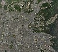 Nara city center area Aerial photograph.2008.jpg 9,815 × 8,855; 33.56 MB
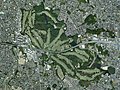 Nara Kokusai Golf Club, Nara Aerial photograph.2008.jpg 4,501 × 3,376; 5.46 MB
 Shooping- in Nara.jpg 836 × 716; 560 KB
 Takabatakecho - panoramio (1).jpg 2,272 × 1,704; 1.05 MB
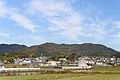 Takamadoyama 201611.jpg 6,016 × 4,016; 10.28 MB
 The border between prefectures in Kyoto and Nara.JPG 1,600 × 1,200; 1.13 MB
 乾川と秋篠川の合流地点 奈良市六条町 Jan 25, 2005.jpg 1,600 × 1,200; 1.17 MB
 富雄川01.JPG 1,024 × 768; 168 KB
 山辺の道 - panoramio.jpg 3,312 × 4,416; 6.36 MB
 阿字万字町の町並みIMG 1643.jpg 3,024 × 4,032; 3.94 MB

.jpg)


.jpg)


