<nowiki>Category:Geography of Minato-ku, Nagoya; Category:名古屋市港区の地理; categoría de Wikimedia; Wikimedia category; категория на Уикимедия; categorie a unui proiect Wikimedia; 維基媒體分類; kategória projektov Wikimedia; категорія проєкту Вікімедіа; kawan Wikimèdia; 維基媒體分類; 维基媒体分类; Wikimedia-Kategorie; 위키미디어 분류; kategorio en Vikimedio; Викимедиина категорија; kategorija na Wikimediji; categoría de Wikimedia; উইকিমিডিয়া বিষয়শ্রেণী; page de catégorie de Wikimedia; kategorija na Wikimediji; 维基媒体分类; וויקימעדיע קאַטעגאָריע; thể loại Wikimedia; Wikimedia projekta kategorija; Wikimedia-kategorie; категорија на Викимедији; categoria de um projeto da Wikimedia; Wikimedia category; Wikimedia-Kategorie; Wikimedia-kategori; Wikimedia-kategori; پۆلی ویکیمیدیا; Wikimedia category; تصنيف ويكيميديا; pajenn rummata eus Wikimedia; 維基媒體分類; Wikimedia категориясы; વિકિપીડિયા શ્રેણી; Wikimediako kategoria; categoría de Wikimedia; Wikimedia-categorie; Викимедиа категорияһы; tudalen categori Wikimedia; катэгорыя ў праекце Вікімедыя; Վիքիմեդիայի նախագծի կատեգորիա; 维基媒体分类; Wikimedia-kategory; ウィキメディアのカテゴリ; Wikimedia-Kategorie; катэгорыя ў праекце Вікімэдыя; קטגוריה במיזמי ויקימדיה; κατηγορία εγχειρημάτων Wikimedia; Wikimedia-Kategorie; विकिमीडिया श्रेणी; categurìa 'e nu pruggette Wikimedia; Wikimedia-luokka; гурӯҳи Викимедиа; Wikimedia-categorie; kategorie na projektech Wikimedia; guruhi Vikimedia; categoria di un progetto Wikimedia; Wikimedia category; Wikimedia-kategori; Vikimedya kategorisi; 維基媒體分類; Wikimedia-categorie; ردهٔ ویکیپدیا; kategoria w projekcie Wikimedia; kategori e Wikimedias; ẹ̀ka Wikimedia; Wikimedia-Kategorie; categoria de um projeto da Wikimedia; Wikimedia-Kategorie; categoria de Wikimedia; tumbung Wikimedia; kategoria ti Wikimedia; kategorija Wikimedie; Wikimédia-kategória; категория в проекте Викимедиа; Wikimedia-kategoriija; kategori Wikimedia; jamii ya Wikimedia; Wikimedia-kategori; 維基媒體分類; kategori Wikimedia; Wikimedia kategooria; विकिपीडिया:श्रेणी; Wikimedia-Kategorie; categoría de Wikimedia; гурӯҳи Викимедиа; 维基媒体分类; 维基媒体分类</nowiki>

 Location of Minato ward Nagoya city Aichi prefecture Japan.svg 480 × 532; 31 KB
 Horikawaguchi Station-Aerial photography 1977.png 1,236 × 1,932; 4.03 MB
 Mouth of Oe river from Nagoya Port Building.jpg 4,237 × 2,383; 8.91 MB
 Mouth of Yamazaki river from Nagoya Port Building - 1.jpg 4,896 × 3,672; 15.39 MB
 Mouth of Yamazaki river from Nagoya Port Building - 2.jpg 4,896 × 3,672; 15.44 MB
 Mouth of Yamazaki river from Nagoya Port Building - 3.jpg 4,896 × 3,672; 18.77 MB
 Nagoya Expwy. Tokai Route 20160210B.JPG 5,071 × 3,349; 11.02 MB
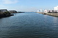 Oe river 20160111A.JPG 5,110 × 3,361; 10.71 MB
 Oe river.jpg 1,600 × 1,200; 641 KB
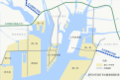 Port of Nagoya 20170814.png 4,609 × 3,086; 782 KB
 東海橋橋梁上 - panoramio (1).jpg 1,600 × 1,200; 237 KB


.jpg)