Category:Geography of Mangalore
Jump to navigation
Jump to search
Wikimedia category | |||||
| Upload media | |||||
| Instance of | |||||
|---|---|---|---|---|---|
| |||||
Subcategories
This category has the following 9 subcategories, out of 9 total.
A
- Adyar Falls (6 F)
B
K
- Konaje Kallu (7 F)
L
M
- Maps of Mangalore (12 F)
P
- Panoramas of Mangalore (12 F)
S
Media in category "Geography of Mangalore"
The following 19 files are in this category, out of 19 total.
-
 Ajikunje.jpg 2,000 × 1,500; 5.05 MB
-
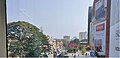
 Falnir skylines viewed from Kankanady.jpg 4,000 × 2,536; 1.88 MB
-
 Greenery of Mangalore city viewed from Forum Fiza Mall.jpg 4,608 × 3,456; 3.22 MB
-
 Gurupura river viewed from the Forum Fiza Mall in Mangalore.jpg 4,608 × 3,456; 4.09 MB
-
 Kankanady skylines at Mangalore CBD region, Kankanady, Mangalore.jpg 3,992 × 2,552; 2.76 MB
-
 Mangalore City.jpg 1,024 × 603; 338 KB
-
 Mangalore city.jpg 4,096 × 2,304; 3.29 MB
-
 Mangalore skyline from Forum Fiza Mall.jpg 3,264 × 2,448; 875 KB
-
 Mangalore skylines.jpg 4,608 × 3,456; 2.26 MB
-
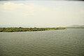
 Netravathi 2.jpg 4,080 × 3,060; 6.51 MB
-
 Netravathi 3.jpg 4,080 × 3,060; 6.22 MB
-
 Netravathi.jpg 4,080 × 3,060; 6.76 MB
-
 Pandeshwar skyline from Forum Fiza Mall, Mangalore.jpg 3,972 × 2,188; 1.82 MB
-
 Pilikula guhe.jpg 2,319 × 1,691; 739 KB
-
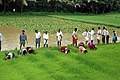 Rice-paddy-cult-mangalore-thulunad-india.jpg 550 × 366; 77 KB
-
 Sea-manglore.JPG 5,184 × 3,456; 5.25 MB
-
 Shambhavi River - panoramio - Saurabh Shetty.jpg 1,600 × 1,200; 720 KB
-
 Shambhavi River - panoramio.jpg 1,600 × 1,200; 908 KB
-
 The Forum Fiza mall.jpg 4,004 × 1,944; 1.8 MB


