Category:Geography of Chita, Aichi
Jump to navigation
Jump to search
日本語: 愛知県知多市の地理。
Wikimedia category | |||||
| Upload media | |||||
| Instance of | |||||
|---|---|---|---|---|---|
| |||||
Subcategories
This category has the following 4 subcategories, out of 4 total.
Media in category "Geography of Chita, Aichi"
The following 25 files are in this category, out of 25 total.
-
 Aichi chita it.png 1,181 × 901; 71 KB
-
 Aichi-chita-city.svg 561 × 506; 26 KB
-
 Asakurahashigo.jpg 6,000 × 4,000; 4.9 MB
-
 Chita Aichi Map.png 786 × 600; 93 KB
-
 Chita city center area Aerial photograph.1987.jpg 6,291 × 5,077; 19.32 MB
-
 Chita City Skyline.jpg 386 × 309; 37 KB
-
 Chita daichiin ookusu.jpg 3,488 × 5,232; 3.92 MB
-
 Chita in Aichi Prefecture Ja.svg 539 × 484; 21 KB
-
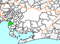
 Chita in Aichi Prefecture.PNG 660 × 672; 61 KB
-
 Chita Okada cityscape ac.jpg 5,748 × 3,822; 3.14 MB
-
 Chita Okada in Taisyo era.jpg 1,464 × 950; 326 KB
-
 Chita Owari Hachiman-jinja in c.1935.jpg 1,525 × 921; 386 KB
-
 Chita.png 210 × 155; 6 KB
-
 Chitamomen.JPG 6,000 × 4,000; 5.26 MB
-
 Jiunji3(chita).jpg 4,901 × 3,998; 4.71 MB
-
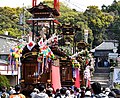
 Okada festival.jpg 6,016 × 4,016; 5.14 MB
-
 Shinmaiko Beach.jpg 4,032 × 3,024; 2.11 MB
-
 Shinmaiko Beach01.jpg 1,242 × 970; 125 KB
-
 Shinmaiko Beach02.jpg 4,032 × 3,024; 1.75 MB
-
 Sourike1.JPG 3,600 × 2,400; 2.24 MB
-
 Streetscape of Okada.jpg 6,016 × 4,016; 6.29 MB
-
 地図-愛知県知多市-2006.png 300 × 205; 6 KB
-
 基礎自治体位置図 23224-2.svg 539 × 484; 13 KB
-
 大野海岸 - panoramio.jpg 3,888 × 2,592; 3.09 MB
-
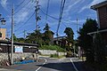
 知多市新知虎馬付近の風景 ac.jpg 6,016 × 4,000; 6.01 MB


.jpg)


