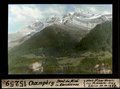
Category:Geography of Champéry
Jump to navigation
Jump to search
Subcategories
This category has the following 17 subcategories, out of 17 total.
C
- Col de Cou (Champéry) (10 F)
D
- Dent de la Chaux (1 F)
G
- Galerie Défago (13 F)
L
- La Saufla (6 F)
- Lacs d’Antème (4 F)
M
- Maps of Champéry (3 F)
P
- Pas d'Encel (Champéry) (2 F)
- Pas de Chavanette (8 F)
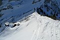
- Planachaux (Champéry) (31 F)
- Pointe de Chavanette (1 F)
- Pointe de Fornet (4 F)
S
V
Media in category "Geography of Champéry"
The following 18 files are in this category, out of 18 total.
-
 Champery-01.jpg 1,200 × 800; 253 KB
-
 Champéry 0001 02.jpg 1,488 × 1,984; 608 KB
-
 Champéry 0001 04.jpg 1,984 × 1,488; 642 KB
-
 Champéry 0001 07.jpg 1,984 × 1,488; 633 KB
-
 Champéry 2017.jpg 4,000 × 3,000; 4.7 MB
-
 Col De Bertolet.JPG 3,776 × 2,520; 2.26 MB
-
 Dent de Rossétan - panoramio.jpg 2,272 × 1,704; 1.23 MB
-
 ETH-BIB-Champéry, Dent du Midi in Abendsonne-Dia 247-15259.tif 3,628 × 2,696; 28.1 MB
-
 ETH-BIB-Champéry, Téléférique vor der Kreuzung-Dia 247-15269.tif 3,704 × 2,709; 28.85 MB
-
 ETH-BIB-Champéry, Übersicht aus dem Téléférique-Dia 247-15270.tif 3,640 × 2,610; 27.26 MB
-
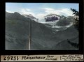 ETH-BIB-Planachaux, Tour Sallière-Dia 247-15267.tif 3,624 × 2,692; 28 MB
-
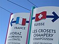 France and Suisse.JPG 2,272 × 1,704; 1.31 MB
-
 La Mure - Muren - panoramio.jpg 3,872 × 2,592; 2.6 MB
-
 Les Crosets Porte Du Soleil (120407499).jpeg 2,048 × 1,365; 968 KB
-
 Les Crosets Portes Du Soleil Suisse Swiss Schwz (120636565).jpeg 2,048 × 1,366; 996 KB
-
 Mur de suisse - panoramio.jpg 3,264 × 2,448; 3.66 MB
-
 Portes Du Soleil Les Crosets Suisse (120700979).jpeg 2,048 × 1,366; 918 KB
-
 Vue sur les dents du midi, Barme - panoramio.jpg 902 × 600; 142 KB


.jpeg)
.jpeg)

.jpeg)
