Category:GeoPark Harz – Braunschweiger Land – Ostfalen
Jump to navigation
Jump to search
| Upload media | |||||
| Instance of | |||||
|---|---|---|---|---|---|
| Location |
| ||||
| official website | |||||
| |||||
Subcategories
This category has the following 54 subcategories, out of 54 total.
A
- Ahrentsklint (6 F)
B
- Blockhalden am Brocken (16 F)
- Butterberg (Bad Harzburg) (6 F)
C
E
- Schwefelkiesgrube Elbingerode (50 F)
- Elfenstein (8 F)
F
- Feuersteinklippe (12 F)
G
- Gläserner Mönch (7 F)
- Granetalsperre (57 F)
H
- Hahnenkleeklippen (29 F)
- Harzhorn Informationsgebäude (14 F)
- Hübichenstein (25 F)
I
J
- Jagdschloss Seesen (5 F)
K
- Kästeklippen (7 F)
L
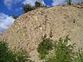
- Kalksteinbruch Langenberg (13 F)
- Lutterer Sattel (1 F)
M
- Carlswerk (Mägdesprung) (11 F)
N
O
- Ottofelsen (Wernigerode) (17 F)
P
R
S
- Sandhöhlen (Blankenburg) (56 F)
- Scherstorklippen (8 F)
- Schurre (Bodetal) (14 F)
- Schwefelstollen (8 F)
- Steinbruch Fuchshalle (5 F)
- Steinbruch Winterberg (14 F)
- Steinkammer von Großsteinum (6 F)
- Strulle (Meisdorf) (6 F)
T
- Teufelskanzel und Hexenaltar (16 F)
- Tönneckenkopf (1 F)
- Trudenstein (6 F)
V
Media in category "GeoPark Harz – Braunschweiger Land – Ostfalen"
The following 200 files are in this category, out of 270 total.
(previous page) (next page)-
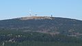
 Achtermannkuppe.jpg 3,200 × 1,798; 844 KB
-
 AchtermannKuppeRehberg.jpg 2,034 × 1,027; 347 KB
-
 Am Kruzifix.JPG 3,000 × 4,000; 4.63 MB
-
 Asse bei Wolfenbüttel.jpg 4,288 × 2,848; 7.25 MB
-
 AsseVomGroßenFallsteinAus201507.JPG 1,920 × 904; 656 KB
-
 Auf dem Brockenplateau.JPG 4,000 × 3,000; 2.53 MB
-
 Auf dem Hoppelberg.JPG 2,400 × 1,600; 5.1 MB
-
 Auf den Rabenklippen - panoramio.jpg 4,320 × 3,240; 3.03 MB
-
 Aufschluss Kellwassertal.jpeg 3,648 × 2,736; 4.3 MB
-
 Ausblick vom Grossen Knollen (Turm) - panoramio.jpg 2,048 × 1,536; 682 KB
-
 Aussicht Brocken Harz.JPG 3,888 × 2,592; 3.66 MB
-
 Aussicht vom Brocken, Sachsen-Anhalt, Nationalpark Harz.JPG 4,608 × 3,072; 3.47 MB
-
 Bad Harzburg (1).jpg 4,128 × 2,322; 2.84 MB
-
 Bad Harzburg (3).jpg 2,322 × 4,128; 3.71 MB
-
 Bad-Harzburg Ecker-unterhalb-Talsperre Feb-2016 IMG 7222.JPG 3,000 × 4,000; 3.61 MB
-
 Bad-Harzburg Ecker-unterhalb-Talsperre Feb-2016 IMG 7225.JPG 4,000 × 3,000; 3.45 MB
-

-
 Brocken Baumgrenze.jpg 1,136 × 852; 349 KB
-
 Bewegte Brocken-Geschichte.JPG 4,000 × 3,000; 2.19 MB
-
 Birkenkopf.jpg 1,051 × 1,732; 458 KB
-
 Blick auf die Wurmbergschanze vom Brocken.JPG 2,304 × 1,728; 1.64 MB
-
 Blick vom Brocken zum Wurmberg 3.jpg 400 × 275; 31 KB
-
 Blick vom Hessenkopf bei Goslar Richtung Rammelsberg 07.JPG 4,608 × 3,456; 6.42 MB
-
 Blick vom Treppenstein.jpg 3,072 × 2,304; 528 KB
-
 Blick von der Rabenklippe zum Brocken.JPG 4,608 × 3,456; 5.41 MB
-
 Blick zum Brocken.jpg 1,000 × 750; 188 KB
-
 Bodetal Blick Hexentanzplatz.jpg 1,316 × 675; 777 KB
-
 Bodetal Blick.JPG 4,608 × 3,456; 3.39 MB
-
 Bodetal Ramberggranit.jpg 2,720 × 2,040; 988 KB
-
 Braunlage Wurmberg Blick zum Brocken - panoramio.jpg 3,072 × 2,304; 1.03 MB
-
 Brockeblick1.jpg 400 × 268; 31 KB
-
 Brockeblick2.jpg 400 × 273; 36 KB
-
 Brocken (30.01.2014).jpg 3,264 × 2,448; 2.49 MB
-
 Brocken - 01.jpg 4,000 × 3,000; 1.96 MB
-
 Brocken - 02.jpg 4,000 × 3,000; 2.11 MB
-
 Brocken - 03.jpg 4,000 × 3,000; 2.18 MB
-
 Brocken - 04.jpg 4,000 × 3,000; 1.8 MB
-
 Brocken - 05.jpg 4,000 × 3,000; 2.15 MB
-
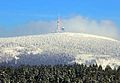
 Brocken 20081214 152101.jpg 3,072 × 2,304; 2.82 MB
-
 Brocken 20121001 121844.jpg 2,133 × 1,200; 759 KB
-
 Brocken 20121001 133549.jpg 2,133 × 1,200; 907 KB
-
 Brocken banner 1.jpg 2,304 × 768; 645 KB
-
 Brocken blick wernigerode ds 07 2007.jpg 2,592 × 1,944; 602 KB
-
 Brocken Luftbild (2007).JPG 2,560 × 1,920; 921 KB
-
 Brocken plattenweg eckertalsperre wv ds 07 2007.jpg 1,600 × 2,133; 432 KB
-
 Brocken vom Torfhaus.jpg 786 × 544; 125 KB
-
 Brocken, 2014 (03).JPG 3,776 × 2,520; 5.08 MB
-
 Brocken, 2014 (04).JPG 3,776 × 2,520; 5.58 MB
-
 Brocken, April 2010 (4493061757).jpg 3,872 × 2,592; 3.27 MB
-
 Brockenaussicht.jpg 4,032 × 3,024; 2.02 MB
-
 Brockengarten.JPG 2,560 × 1,920; 551 KB
-
 Brockenteich.jpg 2,560 × 1,920; 315 KB
-
 Bückeberg bei Gernrode.jpg 2,048 × 1,536; 1.2 MB
-
 Distal flysch.jpg 900 × 1,044; 390 KB
-
 Drei Annen Hohne, Infotafel Geschichte und Geopark.jpg 3,000 × 4,000; 2.46 MB
-
 Eckerstausee 01.jpg 5,020 × 2,978; 5.92 MB
-
 Eckerstausee 02.jpg 5,169 × 3,057; 6.77 MB
-
 Elfenstein.jpg 2,112 × 2,816; 1.31 MB
-
 Erzschlacke-harz hg.jpg 5,594 × 4,387; 6.18 MB
-
 Felswand Backetrog Nationalpark Harz.JPG 424 × 640; 205 KB
-
 Ferdinandsstein.JPG 4,000 × 3,000; 4.49 MB
-
 Fold in proximal flysch.jpg 1,290 × 912; 755 KB
-
 Friedrichshohenberg Informationstafel Geopoark Harz Nr. 15.jpg 4,371 × 3,334; 3.24 MB
-
 Froschfelsen.jpg 3,072 × 2,304; 883 KB
-
 GabbroSteinbruchHarzburg.jpg 3,669 × 2,747; 2.72 MB
-
 Geopark Harz Scheerenberger Straße (Osterode am Harz).jpg 2,891 × 3,855; 4.56 MB
-
 Geopark Infotafel Gegensteine bei Ballenstedt.jpg 4,032 × 3,024; 1.42 MB
-
 Gipfel des Hübichenstein (Harz).jpg 1,416 × 1,938; 701 KB
-
 Halde der Grube Glücksrad.JPG 2,560 × 1,920; 1.03 MB
-
 Harz Brocken Sept-2015 IMG 6362.JPG 4,000 × 3,000; 4.72 MB
-
 Harz Brocken Sept-2015 IMG 6370.JPG 4,000 × 3,000; 4.62 MB
-
 Harz Brocken Sept-2015 IMG 6398.JPG 4,000 × 2,248; 2.15 MB
-
 Harz Brocken Sept-2015 IMG 6399.JPG 4,000 × 2,248; 2.03 MB
-
 Harz Eckerlochstieg.jpg 1,984 × 1,488; 820 KB
-
 Harz Eckertalsperre Sept-2015 IMG 6437.JPG 4,000 × 3,000; 2.63 MB
-
 Harz Eckertalsperre Sept-2015 IMG 6442.JPG 4,000 × 2,248; 2.08 MB
-
 Harz Feuersteinklippen.JPG 2,592 × 3,888; 4.75 MB
-
 Harz ilsetal mit brocken kurz unterhalb bremer huette ds wv 28 04 2012.jpg 1,000 × 1,776; 471 KB
-
 Harz ilsetal wmc ds 28 04 2012.jpg 1,200 × 2,132; 1.24 MB
-
 Harz Kalte-Bode Feb-2015 IMG 4466.JPG 4,000 × 3,000; 4.14 MB
-
 Harz Kalte-Bode Feb-2015 IMG 4475.JPG 4,000 × 3,000; 4.03 MB
-
 Harz leistenklippe blick wernigerode d schmidt 06 2007.jpg 1,750 × 1,313; 319 KB
-
 Harz maerchenweg torfhaus richtung oderteich eins ds wv 06 2007.jpg 1,000 × 1,333; 550 KB
-
 Harz maerchenweg torfhaus richtung oderteich zwei ds wv 06 2007.jpg 1,000 × 1,333; 461 KB
-
 Harz wanderung braunlage brocken an der baerenbruecke ds wv 02 2008.jpg 1,000 × 1,333; 530 KB
-
 Harz wanderung braunlage brocken oberer bodefall ds wv 02 2008.jpg 1,400 × 1,050; 427 KB
-
 Harz wanderung braunlage brocken unterer bodefall ds wv 02 2008.jpg 1,400 × 1,050; 340 KB
-
 Harz Wanderung Stecklenberg - Hexentanzplatz - Thale - Am Glockenstein - panoramio.jpg 2,592 × 3,888; 5.98 MB
-
 Harzhorn Ausgrabungsbereich 2012 abgedeckt.jpg 1,255 × 572; 925 KB
-
 Harzhorn Ausgrabungsbereich.jpg 1,255 × 572; 898 KB
-
 Harzhorn Blick Nordhang.jpg 1,137 × 765; 836 KB
-
 Harzhorn Blick Seite Nordhang.jpg 1,303 × 571; 937 KB
-
 Harzhorn Geländeschnitt Ostbereich.jpg 926 × 557; 716 KB
-
 Harzhorn Geländeschnitte Ostbereich Sommer.jpg 1,050 × 787; 1.14 MB
-
 Harzhorn Grabung Pferdteile Geländer.jpg 1,251 × 626; 1.06 MB
-
 Harzhorn Infostelen in Gold und Holz.jpg 1,324 × 968; 1.57 MB
-
 Harznordrandstoerung Langenberg.jpg 801 × 534; 399 KB
-

-

-

-

-
 Heidberg bei Harsleben.jpg 2,400 × 1,602; 3.87 MB
-
 Hessonit wurmberg-braunlage hg.jpg 3,730 × 2,601; 1.3 MB
-
 Hilssandstein Ostlutter.JPG 4,000 × 3,000; 4.53 MB
-
 Hirschhoerner.jpg 480 × 640; 75 KB
-
 Huebichenstein01s.jpg 1,056 × 1,408; 431 KB
-
 Huy (Saxony-Anhalt), the Daneils Cave.jpg 2,551 × 1,701; 1.01 MB
-
 Hübichenstein IMG 5468.jpg 3,888 × 2,592; 3.34 MB
-
 Hübichenstein IMG 5469.jpg 2,479 × 3,736; 5.62 MB
-
 Hübichenstein IMG 5472.jpg 3,888 × 2,592; 5.62 MB
-
 Ilsefälle im Harz.JPG 3,600 × 2,400; 6.75 MB
-
 Ilsenburg Eiszapfen-im-Ilsetal Feb-2016 IMG 7324.JPG 4,000 × 3,000; 3.85 MB
-
 Ilsenburg Ilse Feb-2016 IMG 7117.JPG 3,000 × 4,000; 4.21 MB
-
 Ilsenburg Ilse Feb-2016 IMG 7122.JPG 4,000 × 3,000; 4.35 MB
-
 Ilsenburg Ilse Feb-2016 IMG 7125.JPG 4,000 × 3,000; 3.78 MB
-
 Ilsenburg Ilse Feb-2016 IMG 7130.JPG 4,000 × 3,000; 4.45 MB
-
 Ilsenburg Ilse Feb-2016 IMG 7136.JPG 4,000 × 3,000; 4.3 MB
-
 Ilsenburg Ilse Feb-2016 IMG 7137.JPG 4,000 × 3,000; 2.89 MB
-
 Ilsenburg Ilse Feb-2016 IMG 7141.JPG 4,000 × 3,000; 3.27 MB
-
 Ilsenburg Ilse Feb-2016 IMG 7147.JPG 4,000 × 3,000; 3.79 MB
-
 Ilsenburg Ilse Feb-2016 IMG 7152.JPG 4,000 × 3,000; 4.03 MB
-
 Ilsenburg Ilse Feb-2016 IMG 7161.JPG 4,000 × 2,248; 3 MB
-
 Ilsenburg Ilse Feb-2016 IMG 7163.JPG 4,000 × 3,000; 3.85 MB
-
 Ilsenburg Ilse Feb-2016 IMG 7177.JPG 4,000 × 3,000; 3.9 MB
-
 Ilsenburg Ilse Feb-2016 IMG 7190.JPG 3,000 × 4,000; 4.29 MB
-
 Ilsenburg Ilse Feb-2016 IMG 7273.JPG 4,000 × 3,000; 4.42 MB
-
 Ilsenburg Ilse Feb-2016 IMG 7282.JPG 3,000 × 4,000; 5 MB
-
 Ilsenburg Ilse Feb-2016 IMG 7287.JPG 3,000 × 4,000; 3.84 MB
-
 Ilsenburg Ilse Feb-2016 IMG 7292.JPG 4,000 × 3,000; 4.85 MB
-
 Ilsenburg Ilse Feb-2016 IMG 7307.JPG 3,000 × 4,000; 4.17 MB
-
 Ilsenburg Ilse Feb-2016 IMG 7311.JPG 4,000 × 3,000; 3.95 MB
-
 Ilsenburg Ilse Feb-2016 IMG 7314.JPG 4,000 × 3,000; 3.61 MB
-
 Ilsenburg Ilse Feb-2016 IMG 7336.JPG 4,000 × 2,248; 3.22 MB
-
 Ilsenburg Ilse Sept-2015 IMG 6494.JPG 4,000 × 3,000; 4.51 MB
-
 Ilsenburg Ilse Sept-2015 IMG 6505.JPG 4,000 × 3,000; 4.86 MB
-
 Ilsenburg Ilse Sept-2015 IMG 6515.JPG 4,000 × 3,000; 4.72 MB
-
 Ilsenburg Ilse Sept-2015 IMG 6517.JPG 4,000 × 3,000; 5.07 MB
-
 Ilsenburg Ilse Sept-2015 IMG 6521.JPG 4,000 × 3,000; 5.54 MB
-
 Ilsenburg Ilse Sept-2015 IMG 6528.JPG 3,000 × 4,000; 4.37 MB
-
 Ilsenburg Ilse Sept-2015 IMG 6535.JPG 4,000 × 3,000; 4.55 MB
-
 Ilsenburg Ilse Sept-2015 IMG 6541.JPG 4,000 × 2,248; 3.76 MB
-
 Ilsenburg Ilse Sept-2015 IMG 6543.JPG 4,000 × 3,000; 3.92 MB
-
 Ilsenburg Ilse Sept-2015 IMG 6546.JPG 4,000 × 3,000; 4.85 MB
-
 Ilsenburg Ilse Sept-2015 IMG 6572.JPG 4,000 × 3,000; 4.22 MB
-
 Ilsenburg Ilse Sept-2015 IMG 6577.JPG 4,000 × 3,000; 4.69 MB
-
 Ilsenburg Ilsestein Feb-2016 IMG 7171.JPG 4,000 × 3,000; 2.63 MB
-
 Ilsenburg Ilsetal Feb-2016 IMG 7172.JPG 3,000 × 4,000; 3.94 MB
-
 Ilsenburg Ilsetal Feb-2016 IMG 7288.JPG 3,000 × 4,000; 4.78 MB
-
 Ilsenburg Ilsetal IMG 6482.JPG 4,000 × 2,248; 2.55 MB
-
 Ilsenburg Ilsetal Sept-2015 IMG 6479.JPG 4,000 × 3,000; 5.2 MB
-
 Ilsenburg Ilseufer Feb-2016 IMG 7167.JPG 4,000 × 3,000; 3.93 MB
-
 Ilsenburg untere-Ilsefälle Feb-2016 IMG 7295.JPG 4,000 × 3,000; 4.25 MB
-
 Ilsenburg untere-Ilsefälle Feb-2016 IMG 7303.JPG 4,000 × 2,248; 3.75 MB
-

-
 Infotafel Eckertal 1.jpg 1,925 × 1,374; 309 KB
-
 Kahlberg von Westen Sebexen.jpg 1,817 × 768; 900 KB
-
 Kanstein Langelsheim 01.JPG 2,592 × 1,936; 2.02 MB
-
 Kanstein Langelsheim 02.JPG 2,592 × 1,936; 1.84 MB
-
 Kanstein Ohmgebirge.jpg 5,821 × 2,946; 7.04 MB
-
 Knesebeck-Schacht 02.JPG 2,448 × 3,264; 3.35 MB
-
 Kohlenschacht Opperode.jpg 4,032 × 3,024; 1.73 MB
-

-
-

-

-

-

-

-

-
-

-

-

-

-

-
 Harz Leistenklippe Brocken.jpg 1,850 × 1,410; 444 KB
-
 Lutter Sandstein.jpg 1,671 × 2,405; 1.14 MB
-
 Melierterz4-rammelsberg hg.jpg 3,461 × 2,601; 1.29 MB
-
 Merseburg schloss قلعة ميرزيبورغ.jpg 3,888 × 2,592; 4.58 MB
-
 Mixed-ore bad-grund hg.jpg 3,428 × 2,820; 1.2 MB
-
 Museum Reich der Kristalle - Gebänderter Erzgang.JPG 3,880 × 2,880; 5.02 MB
-
 Nationalpark Harz - Blick nach Norden (1).JPG 5,267 × 3,502; 3.94 MB
-
 Nationalpark Harz - Blick nach Norden (2).JPG 5,471 × 3,638; 4.9 MB
-
 Nationalpark Harz - Blick nach Norden (3).JPG 5,641 × 3,750; 5.11 MB
-
 Nationalpark Harz - Blick nach Nordosten.JPG 5,524 × 3,673; 4.3 MB
-
 Nationalpark Harz - Blick vom Brocken.JPG 5,558 × 3,696; 5.21 MB
-
 Nationalpark Harz - Brocken -Plateau (1).JPG 5,495 × 3,654; 6.17 MB
-
 Nationalpark Harz - Brocken-Plateau (4).JPG 5,849 × 3,889; 6.56 MB
-
 Nationalpark Harz - Brocken-Plateau (6).JPG 5,670 × 3,770; 7.01 MB
-
 Nationalpark Harz - Brocken-Plateau (7).JPG 5,520 × 3,670; 5.62 MB
-
 Nationalpark Harz - Brocken-Sendemast im Nebel (2).JPG 4,831 × 3,212; 3.72 MB
-
 Nationalpark Harz - Brocken-Sendemast im Nebel (3).JPG 5,025 × 3,341; 4.09 MB
-

-

-

-

-

-

-

-


_-_panoramio.jpg)


.jpg)
.jpg)


_tritt_aus_dem_Berg_(Oberhalb_der_Augenquelle),_Bad_Lauterberg_-_panoramio.jpg)


.jpg)


.JPG)


.JPG)
.JPG)
.jpg)


.jpg)

.jpg)


.jpg)
.jpg)
.jpg)


,_the_Daneils_Cave.jpg)


_-_Finkenkuhle_(1).jpg)
_-_Finkenkuhle_(10).jpg)
_-_Finkenkuhle_(13).jpg)
_-_Finkenkuhle_(24).jpg)
_-_Finkenkuhle_(42).jpg)
_-_Finkenkuhle_(44).jpg)
_-_Finkenkuhle_(46).jpg)
_-_Finkenkuhle_(6).jpg)
_-_Finkenkuhle_(7).jpg)
_-_Finkenkuhle_-_Unterkreide_Tonschiefer_(1).jpg)
_-_Finkenkuhle_-_Unterkreide_Tonschiefer_(2).jpg)
_-_Finkenkuhle_-_Unterkreide_Tonschiefer_(3).jpg)
_-_Finkenkuhle_-_Unterkreide_Tonschiefer_(6).jpg)
_-_Finkenkuhle_-_Unterkreide_Tonschiefer_(8).jpg)


.JPG)
.JPG)
.JPG)


.JPG)
.JPG)
.JPG)
.JPG)
.JPG)
.JPG)


.JPG)
.JPG)

