Category:Garford
Jump to navigation
Jump to search
village and civil parish in Vale of White Horse district, Oxfordshire, England  | |||||
| Upload media | |||||
| Instance of | |||||
|---|---|---|---|---|---|
| Location | Vale of White Horse, Oxfordshire, South East England, England | ||||
| Said to be the same as | Garford (Wikimedia duplicated page, civil parish) | ||||
 | |||||
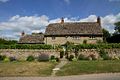
English: Garford is a village and civil parish near the River Ock, about 4 miles west of Abingdon-on-Thames. It was part of Berkshire until the 1974 boundary changes.
Subcategories
This category has the following 3 subcategories, out of 3 total.
L
- Church of St Luke, Garford (9 F)
V
- Venn Mill (24 F)
- Venn Mill House (3 F)
Media in category "Garford"
The following 94 files are in this category, out of 94 total.
-
 A Bend in the Road - geograph.org.uk - 3512522.jpg 4,068 × 2,994; 2.59 MB
-
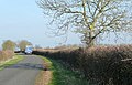
 A Leafy Lane - geograph.org.uk - 3526889.jpg 4,056 × 3,036; 4.05 MB
-
 A water meadow near Marcham - geograph.org.uk - 4889625.jpg 1,500 × 1,125; 237 KB
-
 A water meadow near Marcham - geograph.org.uk - 4889626.jpg 1,500 × 1,125; 231 KB
-
 A338 towards Frilford - geograph.org.uk - 6269084.jpg 800 × 600; 99 KB
-
 Across the fields - geograph.org.uk - 91522.jpg 640 × 481; 25 KB
-
 Arable field near Garford - geograph.org.uk - 2864271.jpg 1,500 × 977; 286 KB
-
 Arable field near Garford - geograph.org.uk - 2864291.jpg 1,500 × 1,000; 224 KB
-
 Arable field near Garford - geograph.org.uk - 2864294.jpg 1,500 × 1,000; 211 KB
-
 Arable field near Garford - geograph.org.uk - 2864296.jpg 1,500 × 996; 240 KB
-
 Baled hay - geograph.org.uk - 2052208.jpg 2,304 × 1,704; 1.55 MB
-
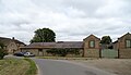
 Barn Conversion, Garford - geograph.org.uk - 3512484.jpg 4,320 × 2,832; 2.94 MB
-
 Bridleway - road junction at Nor Brook bridge - geograph.org.uk - 2628248.jpg 1,024 × 683; 226 KB
-
 Byway through Garford Field - geograph.org.uk - 2052247.jpg 2,304 × 1,704; 1.76 MB
-
 Cereal crop near Chadwicks Farm - geograph.org.uk - 6269468.jpg 800 × 600; 110 KB
-
 Cereal crop off the A338 - geograph.org.uk - 6269082.jpg 800 × 600; 99 KB
-
 Childrey Brook from bridge near Venn Mill - geograph.org.uk - 2628241.jpg 683 × 1,024; 332 KB
-
 Common Barn - geograph.org.uk - 113749.jpg 640 × 481; 49 KB
-
 Cottages, Garford - geograph.org.uk - 6269463.jpg 800 × 600; 91 KB
-
 Cottages, Garford - geograph.org.uk - 6269464.jpg 796 × 800; 122 KB
-

-
 Farm access road - geograph.org.uk - 2052275.jpg 2,304 × 1,704; 1.75 MB
-
 Farmland near Chaldwick's Farm - geograph.org.uk - 2833361.jpg 640 × 406; 218 KB
-
 Farmland near Chaldwick's Farm - geograph.org.uk - 2833362.jpg 640 × 412; 225 KB
-
 Farmland near Chaldwick's Farm - geograph.org.uk - 2833365.jpg 640 × 427; 153 KB
-
 Farmland near Garford - geograph.org.uk - 3713953.jpg 1,500 × 999; 176 KB
-
 Farmland, Garford - geograph.org.uk - 2678780.jpg 640 × 480; 121 KB
-
 Farmland, Garford - geograph.org.uk - 2678785.jpg 640 × 480; 107 KB
-
 Farmland, Garford - geograph.org.uk - 2678843.jpg 640 × 480; 176 KB
-
 Farmland, Garford - geograph.org.uk - 2679578.jpg 640 × 480; 134 KB
-
 Farmland, Garford - geograph.org.uk - 6185688.jpg 1,024 × 683; 227 KB
-
 Farmland, Garford - geograph.org.uk - 6185689.jpg 1,024 × 683; 219 KB
-
 Field and Woods - geograph.org.uk - 4466055.jpg 1,600 × 1,200; 386 KB
-
 Field by Chaldwicks Farm - geograph.org.uk - 2864301.jpg 1,500 × 1,000; 258 KB
-
 Field by Garford - geograph.org.uk - 2864280.jpg 1,500 × 1,000; 281 KB
-
 Floods near Garford - geograph.org.uk - 3808587.jpg 1,600 × 1,200; 425 KB
-
 Footpath Bridge near Garford - geograph.org.uk - 3512474.jpg 2,778 × 3,234; 2.55 MB
-
 Footpath to Fyfield Wick - geograph.org.uk - 113759.jpg 640 × 481; 54 KB
-
 Footpath Under Water - geograph.org.uk - 3808627.jpg 1,600 × 1,180; 592 KB
-
 Cottages in Garford - geograph.org.uk - 113757.jpg 640 × 481; 53 KB
-
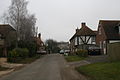
 Cottages on a bend in Garford - geograph.org.uk - 1116253.jpg 640 × 427; 44 KB
-
 Garford - geograph.org.uk - 2678844.jpg 640 × 480; 119 KB
-
 Garford MillettsFarmCottages.jpg 1,024 × 683; 458 KB
-
 Garford Village Hall - geograph.org.uk - 6269854.jpg 5,166 × 3,544; 3.83 MB
-
 Garford, Agritechnica 2023, Hanover (P1140824).jpg 4,608 × 3,456; 10.95 MB
-
 Gates to the fields - geograph.org.uk - 2864298.jpg 1,500 × 1,000; 261 KB
-
 Hares in the Rapeseed - geograph.org.uk - 3500124.jpg 800 × 645; 154 KB
-
 High Levels in the Ock - geograph.org.uk - 3808598.jpg 1,600 × 1,171; 487 KB
-
 House in Garford - geograph.org.uk - 3601285.jpg 4,320 × 3,240; 3.89 MB
-
 Juxtaposed sign and environment - geograph.org.uk - 2052262.jpg 2,304 × 1,704; 1.62 MB
-
 Lane ^ Footpath near Garford - geograph.org.uk - 3512492.jpg 4,320 × 3,240; 3.87 MB
-
 Looking over a field towards Garford - geograph.org.uk - 2864284.jpg 1,500 × 975; 221 KB
-
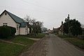
 Main (only) road through Garford - geograph.org.uk - 6269466.jpg 800 × 600; 99 KB
-
 Manor Farm, Garford - geograph.org.uk - 6269090.jpg 800 × 461; 61 KB
-
 Manor Farm, Garford - geograph.org.uk - 6269461.jpg 800 × 522; 79 KB
-

-
 Minor road junction near Garford - geograph.org.uk - 6269086.jpg 800 × 600; 75 KB
-
 Minor road towards Charney Bassett - geograph.org.uk - 6269474.jpg 800 × 600; 160 KB
-
 Minor road towards Garford - geograph.org.uk - 6269089.jpg 800 × 600; 71 KB
-

-
 Oilseed rape crop towards woodland - geograph.org.uk - 6269481.jpg 800 × 494; 80 KB
-
 Oxfordshire lane - geograph.org.uk - 2833369.jpg 640 × 409; 196 KB
-
 River Ock near Garford - geograph.org.uk - 3512468.jpg 4,320 × 3,240; 4.12 MB
-
 Road through Garford - geograph.org.uk - 1116263.jpg 640 × 427; 44 KB
-
 Road through Garford - geograph.org.uk - 1116276.jpg 640 × 427; 52 KB
-
 Road to Garford - geograph.org.uk - 1878074.jpg 640 × 480; 45 KB
-
 Road to the A338 - geograph.org.uk - 2864267.jpg 1,500 × 1,000; 241 KB
-
 South Oxfordshire Crematorium - geograph.org.uk - 5535770.jpg 2,592 × 1,944; 1.37 MB
-
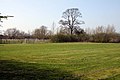 Sports field in Garford - geograph.org.uk - 2864278.jpg 1,500 × 1,000; 206 KB
-
 St Luke Garford - geograph.org.uk - 5886372.jpg 1,024 × 683; 213 KB
-
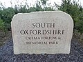 Stone at South Oxfordshire Crematorium - geograph.org.uk - 5535778.jpg 2,592 × 1,944; 1.3 MB
-
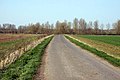
 Stubble field towards the River Ock - geograph.org.uk - 6269472.jpg 800 × 549; 80 KB
-
 The Nor Brook - geograph.org.uk - 3808615.jpg 1,600 × 1,200; 749 KB
-
 The road to Charney Bassett - geograph.org.uk - 2864293.jpg 1,500 × 1,000; 244 KB
-
 The road to Garford - geograph.org.uk - 2864269.jpg 1,500 × 1,000; 249 KB
-
 The road to Garford - geograph.org.uk - 2864273.jpg 1,500 × 1,000; 344 KB
-
 The road to Garford - geograph.org.uk - 2864285.jpg 1,500 × 1,000; 187 KB
-
 The road to Garford - geograph.org.uk - 2864299.jpg 1,500 × 992; 239 KB
-
 The road to Garford - geograph.org.uk - 3713950.jpg 1,500 × 999; 242 KB
-
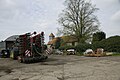 Through the farmyard - geograph.org.uk - 5886370.jpg 1,024 × 683; 141 KB
-
 Victorian postbox, Garford - geograph.org.uk - 6269849.jpg 1,719 × 2,834; 838 KB
-
 Wood beside bridleway at Garford Field - geograph.org.uk - 2628260.jpg 1,024 × 683; 314 KB
-
 East along Landmead Lane - geograph.org.uk - 309162.jpg 640 × 480; 69 KB
-

-
 Farmland at Garford - geograph.org.uk - 113752.jpg 640 × 481; 38 KB
-

-

-
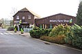 Millets Farm Shop - geograph.org.uk - 293494.jpg 640 × 427; 72 KB
-
 Over the flooded fields - geograph.org.uk - 309163.jpg 640 × 480; 67 KB
-
 Stanborough Covert - geograph.org.uk - 59228.jpg 640 × 480; 132 KB
-
 Stubble, Landmead Farm - geograph.org.uk - 290117.jpg 640 × 480; 174 KB
-
 Stubble, Landmead Farm - geograph.org.uk - 290119.jpg 640 × 480; 148 KB
-
 The road to Garford School House - geograph.org.uk - 113753.jpg 640 × 481; 59 KB
-
 Vale view - geograph.org.uk - 309300.jpg 640 × 480; 114 KB


.jpg)


_road_through_Garford_-_geograph.org.uk_-_6269466.jpg)


