Category:Gamlingay
Jump to navigation
Jump to search
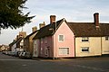
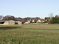
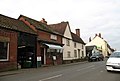
English: Gamlingay is a village and civil parish in South Cambridgeshire, England, near the border with Bedfordshire, and the traditional county of Huntingdonshire. It is 14 miles (22 km) from Cambridge and the population in 2001 was 3,535 people.
Nederlands: Gamlingay is een plaats en civil parish in het bestuurlijke gebied South Cambridgeshire, in het Engelse graafschap Cambridgeshire. De plaats telt 3.535 inwoners.
village in the United Kingdom  | |||||
| Upload media | |||||
| Instance of | |||||
|---|---|---|---|---|---|
| Location | South Cambridgeshire, Cambridgeshire, East of England, England | ||||
 | |||||
Subcategories
This category has the following 6 subcategories, out of 6 total.
E
- The Emplins (3 F)
G
- Gamlingay Cinques (8 F)
- Gamlingay railway station (2 F)
- Gamlingay Wood (25 F)
M
T
- The Wheatsheaf, Gamlingay (2 F)
Media in category "Gamlingay"
The following 98 files are in this category, out of 98 total.
-
 Approaching former railway bridge - geograph.org.uk - 3098387.jpg 1,600 × 1,200; 720 KB
-
 Bridge parapet and the trackbed of The Varsity Line - geograph.org.uk - 5282245.jpg 1,024 × 768; 1.12 MB
-
 Bridleway to Fuller's Hill - geograph.org.uk - 3088097.jpg 1,600 × 1,200; 715 KB
-
 Bridleway to Hatley Park - geograph.org.uk - 3088106.jpg 1,600 × 1,200; 777 KB
-
 Bridleway to Hatley Park - geograph.org.uk - 3088129.jpg 1,600 × 1,200; 693 KB
-
 Bridleway to Waresley Wood - geograph.org.uk - 5940978.jpg 1,600 × 1,214; 376 KB
-
 Church End, Gamlingay - geograph.org.uk - 4295084.jpg 4,320 × 3,240; 4.42 MB
-
 Colourful row of houses at Gamlingay Cinques - geograph.org.uk - 5819363.jpg 4,608 × 3,456; 4.52 MB
-
 Cottage being thatched - geograph.org.uk - 5988557.jpg 1,825 × 1,825; 800 KB
-
 Cottages, Gamlingay Cinques - geograph.org.uk - 6209179.jpg 1,024 × 768; 129 KB
-
 Drove Road, Gamlingay - geograph.org.uk - 5793203.jpg 2,048 × 1,536; 1.99 MB
-
 East Lane, Gamlingay Cinques - geograph.org.uk - 3098454.jpg 1,600 × 1,200; 562 KB
-
 East Lane, Gamlingay Cinques - geograph.org.uk - 3098476.jpg 1,600 × 1,200; 754 KB
-
 Entering Gamlingay - geograph.org.uk - 3098433.jpg 1,600 × 1,200; 541 KB
-
 Entrance to Gamlingay Wood - geograph.org.uk - 5934540.jpg 1,600 × 1,200; 584 KB
-
 Entrance track for Gamlingay Wood - geograph.org.uk - 5932684.jpg 1,600 × 1,200; 453 KB
-

-
 Farm on Waresley Road, Gamlingay - geograph.org.uk - 6249230.jpg 1,906 × 1,260; 1.3 MB
-
 Farm track - geograph.org.uk - 385242.jpg 640 × 481; 56 KB
-
 Farmland - geograph.org.uk - 382645.jpg 640 × 481; 70 KB
-
 Farmland - geograph.org.uk - 382647.jpg 640 × 481; 72 KB
-
 Farmland - geograph.org.uk - 382652.jpg 640 × 481; 56 KB
-
 Farmland near Hatley Park - geograph.org.uk - 3098364.jpg 1,600 × 1,200; 699 KB
-
 Field and houses in East Lane - geograph.org.uk - 6209180.jpg 1,024 × 768; 228 KB
-
 Fields south of Long Lane - geograph.org.uk - 3098417.jpg 1,600 × 1,200; 702 KB
-
 Footpath to Potton - geograph.org.uk - 382638.jpg 640 × 481; 43 KB
-
 Former railway bridge - geograph.org.uk - 3098394.jpg 1,600 × 1,200; 727 KB
-
 Former railway line - geograph.org.uk - 3088147.jpg 1,600 × 1,200; 928 KB
-
 Former railway line - geograph.org.uk - 3098402.jpg 1,600 × 1,200; 831 KB
-
 Gamlimgay Cinques - geograph.org.uk - 3098495.jpg 1,600 × 1,200; 592 KB
-
 Old Church - geograph.org.uk - 372738.jpg 640 × 481; 89 KB
-
-

-
 Gamlingay Baptist Church - geograph.org.uk - 3804859.jpg 4,320 × 3,240; 2.87 MB
-
 Gamlingay Baptist Church and Graveyard - geograph.org.uk - 3804864.jpg 4,320 × 3,240; 4.66 MB
-
 Gamlingay Baptist Church, Cambridgeshire - geograph.org.uk - 2140383.jpg 1,600 × 1,079; 434 KB
-
 Gamlingay Cinques - geograph.org.uk - 632201.jpg 640 × 477; 62 KB
-
 Gamlingay Convenience Store - geograph.org.uk - 6249238.jpg 1,920 × 1,280; 1.06 MB
-
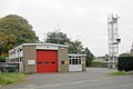 Gamlingay fire station - geograph.org.uk - 584302.jpg 640 × 427; 202 KB
-
 Gamlingay Pharmacy - geograph.org.uk - 4496301.jpg 1,024 × 1,024; 1.24 MB
-
 Gamlingay Woods - geograph.org.uk - 5988570.jpg 3,264 × 2,448; 2.38 MB
-
 Gamlingay, Church End - geograph.org.uk - 4496548.jpg 1,024 × 732; 935 KB
-
 Gamlingay, cottages - geograph.org.uk - 5613565.jpg 1,024 × 768; 120 KB
-
 Gamlingay, garage - geograph.org.uk - 5613567.jpg 1,024 × 762; 136 KB
-
 Gamlingay, Stocks Lane - geograph.org.uk - 4496303.jpg 1,024 × 833; 1.1 MB
-
 Gamlingay, War Memorial Bench - geograph.org.uk - 4496202.jpg 1,024 × 731; 1.09 MB
-
 Gamlingay- Church Street (geograph 4496209).jpg 1,024 × 1,024; 1.13 MB
-
 Gamlingay- Sir John Jacobs Almshouses (geograph 4496565).jpg 1,024 × 732; 917 KB
-
 Gamlingay1.jpg 2,000 × 1,400; 354 KB
-
 Gamlingay2.jpg 1,472 × 2,000; 368 KB
-
 Ghost Sign - geograph.org.uk - 5525258.jpg 1,024 × 683; 209 KB
-
 Ghost Sign - geograph.org.uk - 5525270.jpg 683 × 1,024; 151 KB
-
 Green End from the junction of Waresley Road - geograph.org.uk - 2971376.jpg 1,600 × 1,200; 511 KB
-
 Hardwicke Arms Gamlingay - geograph.org.uk - 266432.jpg 640 × 455; 115 KB
-
 J Chapman garage, Potton Road - geograph.org.uk - 2971377.jpg 1,600 × 1,200; 503 KB
-
 J Chapman garage, Potton Road - geograph.org.uk - 2971379.jpg 1,600 × 1,200; 580 KB
-
 Jannah Indian restaurant, Gamlingay - geograph.org.uk - 3480048.jpg 4,320 × 3,240; 2.91 MB
-
 Knibbs 3178.jpg 1,000 × 673; 150 KB
-
 Long Lane - geograph.org.uk - 3098414.jpg 1,600 × 1,200; 510 KB
-
 Long Lane - geograph.org.uk - 3098420.jpg 1,600 × 1,200; 586 KB
-
 Milestone, Gamlingay (geograph 5612907).jpg 768 × 1,024; 188 KB
-
 Mill Street, Gamlingay - geograph.org.uk - 2971365.jpg 1,600 × 1,200; 546 KB
-
 Minor road - geograph.org.uk - 3098374.jpg 1,600 × 1,200; 610 KB
-
 Moongate detail, Gamlingay Cinques - geograph.org.uk - 267116.jpg 480 × 640; 276 KB
-
 Moongate, Gamlingay Cinques - geograph.org.uk - 267111.jpg 640 × 480; 240 KB
-
 New buildings by Long Lane - geograph.org.uk - 3098425.jpg 1,600 × 1,200; 738 KB
-
 Northfield Close, Gamlingay - geograph.org.uk - 3098437.jpg 1,600 × 1,200; 563 KB
-
 Old Building With Ghost Signs - geograph.org.uk - 5525293.jpg 1,024 × 683; 178 KB
-
 Old Milepost - geograph.org.uk - 5525242.jpg 1,024 × 683; 161 KB
-

-

-
 Old railway bridge outside Gamlingay - geograph.org.uk - 371805.jpg 636 × 428; 82 KB
-
 Old railway line - geograph.org.uk - 3098399.jpg 1,600 × 1,200; 585 KB
-
 Once the Cambridge to Bedford railway - geograph.org.uk - 5282230.jpg 1,024 × 768; 930 KB
-
 Parking for Gamlingay Wood - geograph.org.uk - 5934461.jpg 1,600 × 1,200; 345 KB
-
 Partial roadblock on Potton Road, Gamlingay - geograph.org.uk - 2971363.jpg 1,600 × 1,200; 611 KB
-
 Planning application - geograph.org.uk - 3098370.jpg 1,200 × 1,600; 584 KB
-
 Potton Road, Gamlingay - geograph.org.uk - 2971361.jpg 1,600 × 1,200; 586 KB
-
 Potton Road, Gamlingay - geograph.org.uk - 2971378.jpg 1,600 × 1,200; 563 KB
-
 Private track to Cocayne Hatley Wood - geograph.org.uk - 3098369.jpg 1,600 × 1,200; 858 KB
-
 Road blockage on Waresley Road, Gamlingay - geograph.org.uk - 2971374.jpg 1,600 × 1,200; 583 KB
-
 Steep on a bike^ - geograph.org.uk - 382650.jpg 640 × 481; 46 KB
-
 Telephone and post box - geograph.org.uk - 3098497.jpg 1,600 × 1,200; 877 KB
-
 The Co-operative, Gamlingay.jpg 3,072 × 2,304; 1.4 MB
-
 The Conifers, Long Lane - geograph.org.uk - 3098430.jpg 1,600 × 1,200; 605 KB
-
 The entrance to Green Man Farm, Gamlingay - geograph.org.uk - 5793204.jpg 2,048 × 1,536; 1.48 MB
-
 The lane from Tetworth Hall to Gamlingay - geograph.org.uk - 533312.jpg 640 × 480; 126 KB
-
 The Old Bakehouse, Gamlingay - geograph.org.uk - 6294718.jpg 3,648 × 2,736; 4.12 MB
-
 To St. Ives 14 - geograph.org.uk - 5525245.jpg 683 × 1,024; 205 KB
-
 Up and over a narrow bridge - geograph.org.uk - 5282254.jpg 1,024 × 732; 1,003 KB
-
 Varsity Line - geograph.org.uk - 5907233.jpg 1,024 × 683; 144 KB
-
 View of Gamlingay Housing - geograph.org.uk - 267630.jpg 640 × 426; 167 KB
-
 Waresley Road, Gamlingay - geograph.org.uk - 2971165.jpg 1,600 × 1,200; 537 KB
-
 Waresley Road, Gamlingay - geograph.org.uk - 2971375.jpg 1,600 × 1,200; 582 KB
-
 Weak bridge, northern approach - geograph.org.uk - 5282221.jpg 1,024 × 768; 1.12 MB
-
 West Lodge, Hatley Estate - geograph.org.uk - 4295104.jpg 4,320 × 3,240; 5.89 MB
-
 West Road, Gamlingay - geograph.org.uk - 6294727.jpg 3,648 × 2,736; 3.56 MB
-
 Woods by Waresley Road, Gamlingay - geograph.org.uk - 6249235.jpg 1,858 × 1,178; 1.49 MB


.jpg)
.jpg)


.jpg)


.jpg)


