Category:Fulwood Wetland
Jump to navigation
Jump to search
| Object location | | View all coordinates using: OpenStreetMap |
|---|
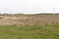
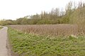
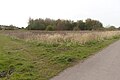
Fulwood Wetland is a low-lying area in the north of Rimrose Valley.
Media in category "Fulwood Wetland"
The following 7 files are in this category, out of 7 total.
-
 Fulwood Wetland 1.jpg 5,198 × 3,462; 24.48 MB
-
 Fulwood Wetland 2.jpg 5,157 × 3,435; 23.43 MB
-
 Fulwood Wetland 3.jpg 5,011 × 3,337; 20.88 MB
-
 Fulwood Wetland 4.jpg 5,198 × 3,462; 22.57 MB
-
 Fulwood Wetland 5.jpg 4,939 × 3,289; 27.93 MB
-
 Fulwood Wetland 6.jpg 5,198 × 3,307; 26.34 MB
-
 Fulwood Wetlands 20210530.jpg 4,862 × 3,249; 23.15 MB


