Category:Frocester
Jump to navigation
Jump to search
village and civil parish in Gloucestershire, United Kingdom  | |||||
| Upload media | |||||
| Instance of | |||||
|---|---|---|---|---|---|
| Location | Stroud, Gloucestershire, South West England, England | ||||
| official website | |||||
 | |||||
English: Frocester is a village and civil parish in Stroud District, Gloucestershire, England. It lies below the Cotswold escarpment, 10 miles south of Gloucester and 4 miles west of Stroud. In the 2001 census the parish had a population of 194.
Subcategories
This category has the following 8 subcategories, out of 8 total.
F
- Frocester Court (3 F)
- Frocester Court Tithe Barn (7 F)
- Frocester War Memorial (3 F)
N
- Nympsfield Long Barrow (30 F)
S
- St Peter's church, Frocester (11 F)
Media in category "Frocester"
The following 195 files are in this category, out of 195 total.
-

-
 A refreshing place on a very hot day - geograph.org.uk - 1958022.jpg 1,024 × 768; 263 KB
-

-
 Arable land near Frocester - geograph.org.uk - 2673666.jpg 1,024 × 680; 197 KB
-
 Baling while the weather is good - geograph.org.uk - 2562451.jpg 640 × 408; 96 KB
-

-

-

-

-
 Bath Road railway bridge, Frocester - geograph.org.uk - 5073634.jpg 800 × 517; 132 KB
-
 Bath Road, Frocester - geograph.org.uk - 5064975.jpg 800 × 718; 151 KB
-
 Bridge over railway near Frocester - geograph.org.uk - 5849156.jpg 1,600 × 1,067; 646 KB
-
 Bucketwell, Frocester - geograph.org.uk - 5073752.jpg 800 × 603; 161 KB
-
 Buckholt Wood on the escarpment of Frocester Hill - geograph.org.uk - 5489998.jpg 3,776 × 2,520; 3.89 MB
-
 Cam Long Down - geograph.org.uk - 3739876.jpg 1,024 × 680; 173 KB
-
 Cam Long Down - geograph.org.uk - 5995287.jpg 1,024 × 576; 139 KB
-
 Cam Long Down and Dursley - geograph.org.uk - 5995981.jpg 1,024 × 576; 140 KB
-
 Capehall Farm - geograph.org.uk - 2741703.jpg 640 × 260; 29 KB
-
 Capehall Farm - geograph.org.uk - 6407119.jpg 4,032 × 1,816; 970 KB
-

-
 Coaley Peak car park entrance - geograph.org.uk - 2128370.jpg 3,648 × 2,736; 3.74 MB
-
 Coaley Peak Picnic Area, Gloucestershire 2013 - geograph.org.uk - 6391360.jpg 1,265 × 782; 243 KB
-
 Coaley Peak Viewpoint - geograph.org.uk - 2128149.jpg 3,648 × 2,736; 3.25 MB
-

-

-

-

-

-
 Cotswold Way, Coaley Peak, Gloucestershire 2013 - geograph.org.uk - 5825817.jpg 2,234 × 1,406; 1 MB
-
 Cotswold Way, Coaley Peak, Gloucestershire 2013 - geograph.org.uk - 5825818.jpg 2,240 × 1,488; 768 KB
-
 Court Road, Frocester - geograph.org.uk - 5073781.jpg 800 × 701; 147 KB
-

-
 Directions sign on a Frocester corner - geograph.org.uk - 5677059.jpg 730 × 800; 151 KB
-

-

-
 Driveway into Frocester Manor, Frocester - geograph.org.uk - 5677073.jpg 800 × 600; 175 KB
-
 Driveway to Cape Hall Farm - geograph.org.uk - 2800221.jpg 1,024 × 680; 200 KB
-
 Early August in Frocester - geograph.org.uk - 5173613.jpg 800 × 540; 131 KB
-

-
 Eastern end of Peter's Street, Frocester - geograph.org.uk - 5073796.jpg 800 × 612; 153 KB
-
 Elmtree Farm - geograph.org.uk - 4699086.jpg 2,140 × 996; 276 KB
-
 Elmtree Farm access road, Frocester - geograph.org.uk - 5064930.jpg 800 × 600; 121 KB
-
 Elmtree Kennels ^ Cattery, Frocester - geograph.org.uk - 5064945.jpg 800 × 545; 112 KB
-
 End of the 30 zone in Frocester - geograph.org.uk - 5173645.jpg 800 × 633; 132 KB
-
 End of the 30 zone, Bath Road, Frocester - geograph.org.uk - 5065005.jpg 800 × 655; 180 KB
-
 Entrance to Frocester Court - geograph.org.uk - 6222429.jpg 1,600 × 900; 488 KB
-
 Entrance to Frocester Manor, Frocester - geograph.org.uk - 5677072.jpg 800 × 745; 179 KB
-
 Entrance to Osborne House - geograph.org.uk - 6223265.jpg 1,600 × 900; 555 KB
-
 Farm buildings, Frocester - geograph.org.uk - 5677029.jpg 640 × 469; 85 KB
-
 Farm track on Frocester Hill - geograph.org.uk - 6221258.jpg 1,600 × 900; 581 KB
-
 Farmland near Bridge Farm - geograph.org.uk - 4388955.jpg 640 × 430; 47 KB
-
 Farmland near Frocester - geograph.org.uk - 2672222.jpg 1,024 × 680; 158 KB
-
 Farmland, Stroud District - geograph.org.uk - 4387852.jpg 640 × 404; 39 KB
-
 Field gates in the east of Frocester - geograph.org.uk - 5173604.jpg 800 × 611; 173 KB
-
 Field of sunflowers near Stanley Downton - geograph.org.uk - 3622454.jpg 4,000 × 3,000; 3.95 MB
-
 Five-way junction - geograph.org.uk - 6223242.jpg 1,600 × 900; 500 KB
-
 Frocester , Grassy Field - geograph.org.uk - 6283891.jpg 6,000 × 4,000; 4.84 MB
-

-
 Frocester Fayre - geograph.org.uk - 6223247.jpg 1,600 × 901; 454 KB
-
 Frocester George car park, Frocester - geograph.org.uk - 5677078.jpg 800 × 615; 151 KB
-
 Frocester Hill - geograph.org.uk - 6221272.jpg 1,600 × 1,068; 555 KB
-
 Frocester station site geograph-3538918-by-Ben-Brooksbank.jpg 2,359 × 1,605; 3.78 MB
-
 Frocester War Memorial - geograph.org.uk - 5173804.jpg 800 × 621; 171 KB
-

-

-
 Glider and tow-plane ^1 - geograph.org.uk - 5180723.jpg 800 × 600; 28 KB
-
 Glider and tow-plane ^2 - geograph.org.uk - 5180725.jpg 800 × 600; 16 KB
-
 Grass for silage - geograph.org.uk - 6223256.jpg 1,600 × 900; 431 KB
-
 Grass for silage, 2 - geograph.org.uk - 6223258.jpg 1,600 × 900; 439 KB
-
 Grassy field opposite Church Farm - geograph.org.uk - 6223251.jpg 1,600 × 900; 439 KB
-
 Grazing land in Frocester - geograph.org.uk - 5173528.jpg 800 × 600; 168 KB
-
 Grazing near Elmtree Farm - geograph.org.uk - 4387848.jpg 640 × 420; 42 KB
-
 Heading towards Buckholt Wood - geograph.org.uk - 3445352.jpg 800 × 600; 132 KB
-
 Hillside at Coaley Peak - geograph.org.uk - 5061753.jpg 5,700 × 3,800; 3.67 MB
-
 Houses in the east of Frocester - geograph.org.uk - 5173563.jpg 800 × 612; 142 KB
-
 Houses on the outskirts of Frocester - geograph.org.uk - 316685.jpg 640 × 480; 95 KB
-
 Junction in Frocester - geograph.org.uk - 5676977.jpg 800 × 611; 150 KB
-
 King George V postbox, Frocester - geograph.org.uk - 5073819.jpg 356 × 800; 92 KB
-
 Looking towards Coaley Peak, Gloucestershire - geograph.org.uk - 2222590.jpg 1,024 × 691; 140 KB
-
 Lower slopes of Sandford's Knoll - geograph.org.uk - 2672219.jpg 1,024 × 680; 252 KB
-
 M5 at marker A104.5 - geograph.org.uk - 4117997.jpg 1,600 × 1,046; 275 KB
-
 M5 Motorway north of Elmcote Farms - geograph.org.uk - 2045832.jpg 640 × 480; 53 KB
-
 M5 northbound towards junction 13 - geograph.org.uk - 4324120.jpg 1,600 × 1,200; 921 KB
-
 M5 northbound towards junction 13 - geograph.org.uk - 4324127.jpg 1,600 × 1,200; 1.03 MB
-
 M5 southbound near Elmcote Farm - geograph.org.uk - 3260935.jpg 640 × 481; 30 KB
-

-
 Nympsfield Long Barrow - geograph.org.uk - 5493601.jpg 3,264 × 2,448; 3.55 MB
-

-
 Nympsfield Long Barrow near Dursley - geograph.org.uk - 5607149.jpg 5,184 × 2,920; 7.53 MB
-

-

-
 Old Toll House, Frocester - geograph.org.uk - 6115340.jpg 640 × 454; 108 KB
-
 Open grassland on Frocester Hill - geograph.org.uk - 5061743.jpg 6,000 × 4,000; 5.85 MB
-
 Osborne Cottage, Frocester - geograph.org.uk - 5064809.jpg 800 × 527; 147 KB
-
 Panorama - Coaley Peak - 1 - geograph.org.uk - 2128168.jpg 3,648 × 2,048; 2.36 MB
-
 Panorama - Coaley Peak - 2 - geograph.org.uk - 2128176.jpg 3,648 × 2,048; 2.33 MB
-
 Panorama - Coaley Peak - 3 - geograph.org.uk - 2128206.jpg 3,648 × 2,048; 2.49 MB
-
 Panorama - Coaley Peak - 4 - geograph.org.uk - 2128218.jpg 3,648 × 2,048; 2.68 MB
-
 Panorama - Coaley Peak - 5 - geograph.org.uk - 2128350.jpg 3,648 × 2,048; 3.1 MB
-
 Panorama view from Coaley Peak - geograph.org.uk - 5179390.jpg 800 × 342; 57 KB
-
 Path to St Andrew's Church, Frocester - geograph.org.uk - 5677104.jpg 800 × 526; 175 KB
-
 People watching a paraglider on Frocester Hill - geograph.org.uk - 5581815.jpg 1,024 × 683; 237 KB
-
 Picnic Area, Coaley Peak, Gloucestershire 2013 - geograph.org.uk - 5825834.jpg 2,240 × 769; 349 KB
-
 Picnic Area, Coaley Peak, Gloucestershire 2013 - geograph.org.uk - 5825835.jpg 2,240 × 1,394; 743 KB
-
 Picnic site on Coaley Peak - geograph.org.uk - 5179375.jpg 800 × 600; 159 KB
-
 Ploughed field - geograph.org.uk - 2803321.jpg 1,024 × 680; 294 KB
-

-
 Power cables crossing M5 near Wicksters Brook - geograph.org.uk - 3185821.jpg 1,024 × 768; 513 KB
-
 Power lines cross the M5 motorway - geograph.org.uk - 2045837.jpg 640 × 480; 59 KB
-

-

-

-
 Railway bridge - geograph.org.uk - 334243.jpg 480 × 640; 128 KB
-

-
 Red phonebox, Frocester - geograph.org.uk - 5073770.jpg 800 × 745; 184 KB
-
 Rooftop solar panels, Frocester - geograph.org.uk - 5173589.jpg 800 × 594; 156 KB
-
 Signpost, X-Roads, Frocester, Gloucestershire 2013 - geograph.org.uk - 5821332.jpg 2,193 × 1,380; 1.17 MB
-

-

-
 South Gloucestershire , M5 Motorway Northbound - geograph.org.uk - 2793958.jpg 4,288 × 2,848; 5.05 MB
-
 Southbound M5 - geograph.org.uk - 6114075.jpg 800 × 533; 636 KB
-
 Southbound M5 in Gloucestershire - geograph.org.uk - 6113892.jpg 800 × 534; 595 KB
-
 Southern edge of Elmtree Farm, Frocester - geograph.org.uk - 5065034.jpg 800 × 749; 241 KB
-
 Spring Farm buildings, Frocester - geograph.org.uk - 5173581.jpg 800 × 431; 116 KB
-
 Spring Farm, Frocester - geograph.org.uk - 2671308.jpg 1,024 × 680; 199 KB
-

-
 Stream and Wall - geograph.org.uk - 1956336.jpg 768 × 1,024; 269 KB
-

-
 Stroud , Ploughed Field - geograph.org.uk - 2794297.jpg 4,288 × 2,848; 5.09 MB
-
 Stroud , The M5 Motorway Southbound - geograph.org.uk - 2795432.jpg 4,288 × 2,848; 4.82 MB
-
 Stroud , The M5 Motorway Southbound - geograph.org.uk - 2795433.jpg 4,288 × 2,848; 4.82 MB
-
 Stroud District , Grassy Field - geograph.org.uk - 5951348.jpg 6,000 × 4,000; 5.96 MB
-
 Stroud District , M5 Motorway - geograph.org.uk - 5951347.jpg 6,000 × 4,000; 6.56 MB
-
 Stroud District , The M5 Motorway - geograph.org.uk - 3724111.jpg 4,288 × 2,848; 4.96 MB
-
 Thatched cottages, Frocester - geograph.org.uk - 5064881.jpg 800 × 618; 184 KB
-
 The 34th Frocester Beer Festival - geograph.org.uk - 3622470.jpg 3,787 × 2,838; 3.59 MB
-
 The Bristol to Birmingham line - geograph.org.uk - 2562447.jpg 640 × 427; 122 KB
-
 The Cotswold Way alongside the B4066 - geograph.org.uk - 3445503.jpg 800 × 600; 140 KB
-
 The Cotswold Way at Buckholt Wood - geograph.org.uk - 3445468.jpg 800 × 600; 175 KB
-
 The Cotswold Way at Buckholt Wood - geograph.org.uk - 3445475.jpg 800 × 600; 161 KB
-
 The Cotswold Way at Coaley Peak - geograph.org.uk - 3445944.jpg 800 × 600; 151 KB
-
 The Cotswold Way at Coaley Peak - geograph.org.uk - 3445950.jpg 800 × 600; 142 KB
-
 The Cotswold Way at Long Barrow - geograph.org.uk - 3445941.jpg 800 × 600; 146 KB
-
 The Cotswold Way in Buckholt Wood - geograph.org.uk - 3445494.jpg 800 × 600; 219 KB
-
 The Cotswold Way in Buckholt Wood - geograph.org.uk - 5061734.jpg 6,000 × 4,000; 4.74 MB
-
 The Cotswold Way towards Long Barrow - geograph.org.uk - 3445911.jpg 800 × 600; 197 KB
-
 The Cotswold Way towards Long Barrow - geograph.org.uk - 3445919.jpg 800 × 600; 181 KB
-
 The Cotswolds Way at Long Barrow - geograph.org.uk - 3445926.jpg 800 × 600; 158 KB
-
 The Frocester - geograph.org.uk - 6222439.jpg 1,600 × 900; 435 KB
-
 The Frocester George - geograph.org.uk - 5173695.jpg 800 × 539; 129 KB
-
 The Frocester George, Frocester - geograph.org.uk - 5173855.jpg 800 × 704; 109 KB
-
 The Frocester name sign, Frocester - geograph.org.uk - 5173885.jpg 655 × 800; 101 KB
-
 The George inn at Frocester - geograph.org.uk - 5849158.jpg 1,600 × 1,067; 744 KB
-
 The George Inn, Frocester - geograph.org.uk - 1040914.jpg 640 × 426; 75 KB
-
 The George Inn, Frocester, Gloucestershire 2013 - geograph.org.uk - 5821329.jpg 2,196 × 1,406; 1.22 MB
-
 The information board at Coaley Peak - geograph.org.uk - 3445947.jpg 800 × 600; 157 KB
-
 The information board at Long Barrow - geograph.org.uk - 3445929.jpg 800 × 600; 178 KB
-
 The River Severn and Frocester Hill - geograph.org.uk - 5169518.jpg 1,024 × 768; 210 KB
-
 The Severn at Frampton-on-Severn - geograph.org.uk - 3743719.jpg 1,024 × 680; 152 KB
-
 The Vale of Berkeley - geograph.org.uk - 5581826.jpg 1,024 × 683; 255 KB
-
 The View from Coaley Peak - geograph.org.uk - 3445952.jpg 800 × 600; 146 KB
-
 The view from Coaley Peak Viewpoint - geograph.org.uk - 5451831.jpg 640 × 481; 280 KB
-
 Tithe Barn Doors, Frocester, Gloucestershire 2002 - geograph.org.uk - 5821817.jpg 2,358 × 1,579; 504 KB
-
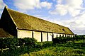 Tithe Barn, Frocester, Gloucestershire 2002 - geograph.org.uk - 5821815.jpg 2,453 × 1,613; 860 KB
-
 Toposcope at Coaley Peak, Frocester Hill - geograph.org.uk - 5489987.jpg 3,776 × 2,520; 4.12 MB
-
 Tree on Coaley Peak - geograph.org.uk - 3740718.jpg 1,024 × 680; 205 KB
-
 Up the escarpment, near Nympsfield - geograph.org.uk - 2866000.jpg 640 × 480; 87 KB
-
 View down the Vale of Berkeley - geograph.org.uk - 3739893.jpg 1,024 × 680; 192 KB
-
 View from Frocester Hill, Gloucestershire 2013 - geograph.org.uk - 5821801.jpg 2,240 × 1,488; 646 KB
-
 View from Frocester Hill, Gloucestershire 2013 - geograph.org.uk - 5821803.jpg 2,217 × 1,403; 610 KB
-
 View from Frocester Hill, Gloucestershire 2013 - geograph.org.uk - 5821804.jpg 2,240 × 752; 371 KB
-
 View from Frocester Hill, Gloucestershire 2013 - geograph.org.uk - 5821806.jpg 2,158 × 1,412; 566 KB
-
 View information, Coaley Peak - geograph.org.uk - 3739887.jpg 1,024 × 680; 209 KB
-
 View over Coaley to the Severn estuary - geograph.org.uk - 5995984.jpg 1,024 × 576; 142 KB
-
 View over Frocester - geograph.org.uk - 6221264.jpg 1,600 × 900; 515 KB
-
 View to Cam Long Down - geograph.org.uk - 5581825.jpg 1,024 × 683; 200 KB
-
 View to Cam Long Down - geograph.org.uk - 5995285.jpg 1,024 × 576; 144 KB
-
 View to Wales from Frocester Hill - geograph.org.uk - 3739880.jpg 1,024 × 680; 157 KB
-
 Viewpoint at Coaley Peak - geograph.org.uk - 3908338.jpg 1,024 × 698; 212 KB
-
 Waiting to take off - geograph.org.uk - 5581813.jpg 1,024 × 683; 209 KB
-
 War Memorial, Frocester, Gloucestershire 2013 - geograph.org.uk - 5821328.jpg 2,240 × 1,488; 769 KB
-
 Warning sign - crossroads, Frocester - geograph.org.uk - 5073762.jpg 800 × 698; 181 KB
-

-
 West along Peter's Street, Frocester - geograph.org.uk - 5073808.jpg 759 × 800; 149 KB
-

-
 White arrow on Bath Road, Frocester - geograph.org.uk - 5073705.jpg 800 × 647; 144 KB
-

-

-

-
 X-Roads, Frocester, Gloucestershire 2013 - geograph.org.uk - 5821331.jpg 2,240 × 991; 822 KB
-
 Farmland west of Frocester - geograph.org.uk - 316758.jpg 640 × 480; 98 KB
-
 Pasture below Frocester Hill - geograph.org.uk - 316698.jpg 640 × 480; 130 KB
-
 Railway line NW of Frocester - geograph.org.uk - 103499.jpg 640 × 480; 135 KB
-
 Severn Water - geograph.org.uk - 113583.jpg 640 × 427; 79 KB
-
 Stanley Downton Sewage Treatment Works - geograph.org.uk - 316659.jpg 640 × 473; 100 KB


