Category:Fritwell
Jump to navigation
Jump to search
village and civil parish in Cherwell district, Oxfordshire, England  | |||||
| Upload media | |||||
| Instance of | |||||
|---|---|---|---|---|---|
| Location | Cherwell, Oxfordshire, South East England, England | ||||
| Population |
| ||||
| Area |
| ||||
| Said to be the same as | Fritwell (Wikimedia duplicated page, civil parish) | ||||
| official website | |||||
 | |||||
Subcategories
This category has the following 2 subcategories, out of 2 total.
A
- Ardley Tunnel (3 F)
C
- St Olave's Church, Fritwell (39 F)
Media in category "Fritwell"
The following 48 files are in this category, out of 48 total.
-
 B4100 at Ploughley Hill - geograph.org.uk - 2836381.jpg 640 × 480; 38 KB
-
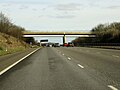
 Bridge over the M40 South of Souldern - geograph.org.uk - 3555710.jpg 640 × 426; 205 KB
-
 Butcher's and Post Office - geograph.org.uk - 4354054.jpg 640 × 480; 99 KB
-
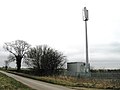 Communication mast - geograph.org.uk - 4353929.jpg 640 × 480; 47 KB
-
 Country road - geograph.org.uk - 4353920.jpg 640 × 480; 62 KB
-
 Country road - geograph.org.uk - 4353934.jpg 640 × 480; 95 KB
-
 Country road - geograph.org.uk - 4353947.jpg 640 × 480; 53 KB
-
 East Street crosses the M40 - geograph.org.uk - 4962432.jpg 1,500 × 1,125; 149 KB
-
 Entrance to Fritwell - geograph.org.uk - 4353888.jpg 640 × 480; 61 KB
-

-
 Fritwell Parish Council Cemetery - geograph.org.uk - 4788415.jpg 640 × 480; 79 KB
-
 Fritwell Telephone Exchange, Oxon - geograph.org.uk - 2167731.jpg 3,072 × 2,304; 1.79 MB
-
 Fritwell-Local Shop - geograph.org.uk - 6194401.jpg 1,600 × 1,306; 607 KB
-
 Fritwell-The Kings Head - geograph.org.uk - 6194395.jpg 1,600 × 1,200; 657 KB
-
 Kings Head - geograph.org.uk - 4354051.jpg 640 × 480; 105 KB
-
 Kings Head, Fritwell - geograph.org.uk - 433979.jpg 640 × 480; 113 KB
-

-
 M40 - geograph.org.uk - 1019771.jpg 640 × 421; 60 KB
-
 M40 looking south-east - geograph.org.uk - 398517.jpg 640 × 480; 72 KB
-

-

-
 M40 motorway north of Fritwell - geograph.org.uk - 3022740.jpg 640 × 480; 57 KB
-
 M40 near Foxwell Barn - geograph.org.uk - 2461334.jpg 640 × 412; 32 KB
-
 M40 northbound - geograph.org.uk - 3223660.jpg 640 × 480; 37 KB
-
 M40 northbound - geograph.org.uk - 3224273.jpg 640 × 480; 36 KB
-
 M40 northbound - geograph.org.uk - 3224284.jpg 640 × 480; 33 KB
-
 M40 southbound nearing junction 10 (1) - geograph.org.uk - 2212969.jpg 640 × 360; 240 KB
-
 M40 southbound nearing junction 10 (2) - geograph.org.uk - 2212973.jpg 640 × 400; 255 KB
-
 M40, overbridge near Fritwell - geograph.org.uk - 2461002.jpg 640 × 385; 25 KB
-

-

-
 New Houses in Fritwell - geograph.org.uk - 3295371.jpg 640 × 480; 54 KB
-
 Northbound M40, Bridge near Fritwell - geograph.org.uk - 3296979.jpg 640 × 427; 318 KB
-
 Overbridge by Foxhill Barn, M40 - geograph.org.uk - 2461338.jpg 640 × 391; 34 KB
-
 Raghouse Lane - geograph.org.uk - 4354049.jpg 640 × 480; 62 KB
-
 Sad sight (passim) - geograph.org.uk - 4669634.jpg 640 × 480; 50 KB
-
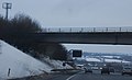
 Southbound M40 near Fritwell - geograph.org.uk - 3555717.jpg 640 × 480; 211 KB
-
 Southbound M40 near Fritwell - geograph.org.uk - 3555724.jpg 640 × 480; 219 KB
-
 Southbound M40, East Street Bridge - geograph.org.uk - 3296732.jpg 640 × 480; 346 KB
-
 Southbound M40, East Street Bridge - geograph.org.uk - 3296968.jpg 640 × 480; 369 KB
-
 Telephone Kiosk, Fritwell - geograph.org.uk - 2167724.jpg 3,072 × 2,304; 1.78 MB
-
 The George ^ Dragon - geograph.org.uk - 4353899.jpg 640 × 480; 53 KB
-
 The M40 - geograph.org.uk - 1019758.jpg 640 × 451; 89 KB
-
 The M40 heading southbound - geograph.org.uk - 4962442.jpg 1,500 × 1,125; 117 KB
-
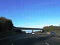
 The M40 near Fritwell - geograph.org.uk - 1588923.jpg 640 × 480; 54 KB
-
 Town Well End - geograph.org.uk - 4353908.jpg 640 × 480; 60 KB
-
 Wesleyan Reform Church, Fritwell - geograph.org.uk - 4665032.jpg 1,024 × 768; 151 KB
-
 The George and Dragon, Fritwell - geograph.org.uk - 114036.jpg 640 × 481; 45 KB


_-_geograph.org.uk_-_2212969.jpg)
_-_geograph.org.uk_-_2212973.jpg)


_-_geograph.org.uk_-_4669634.jpg)


