Category:Fridaythorpe
Jump to navigation
Jump to search
English: Fridaythorpe is a village and civil parish in the East Riding of Yorkshire, England. It is situated approximately 8 miles (13 km) north east of Pocklington town centre
village in the United Kingdom  | |||||
| Upload media | |||||
| Instance of | |||||
|---|---|---|---|---|---|
| Location | East Riding of Yorkshire, Yorkshire and the Humber, England | ||||
 | |||||
Subcategories
This category has the following 7 subcategories, out of 7 total.
Media in category "Fridaythorpe"
The following 107 files are in this category, out of 107 total.
-
 ABN Fridaythorpe - geograph.org.uk - 4150329.jpg 2,710 × 1,936; 832 KB
-
 Across fields to Fridaythorpe - geograph.org.uk - 2782191.jpg 3,264 × 2,448; 1.55 MB
-
 At the head of Holm Dale - geograph.org.uk - 1096778.jpg 516 × 640; 118 KB
-
 Brubber Dale - geograph.org.uk - 285393.jpg 640 × 364; 54 KB
-
 Brubber Dale - geograph.org.uk - 359502.jpg 640 × 480; 119 KB
-
 Brubber Dale - geograph.org.uk - 359509.jpg 640 × 480; 100 KB
-
 Brubber Dale - geograph.org.uk - 4150320.jpg 2,609 × 1,864; 783 KB
-
 Brubber Dale - geograph.org.uk - 5984546.jpg 1,024 × 768; 131 KB
-
 Brubber Dale - geograph.org.uk - 6231133.jpg 640 × 480; 117 KB
-
 Brubberdale North and East Yorkshire meet - geograph.org.uk - 5008655.jpg 4,608 × 3,456; 5.18 MB
-
 Cattle in Brubber Dale - geograph.org.uk - 4692280.jpg 640 × 427; 506 KB
-
 Chalk pit near Fridaythorpe - geograph.org.uk - 4692277.jpg 640 × 450; 596 KB
-
 Chalk pit near Fridaythorpe - geograph.org.uk - 6022106.jpg 1,024 × 768; 176 KB
-
 Cowpasture Road - geograph.org.uk - 1541361.jpg 640 × 480; 92 KB
-
 Cowpasture Road - geograph.org.uk - 591074.jpg 640 × 480; 89 KB
-
 Disused Quarry, Brubber Dale - geograph.org.uk - 1374902.jpg 640 × 480; 99 KB
-
 Early morning at Brubberdale - geograph.org.uk - 3109463.jpg 3,264 × 2,448; 2 MB
-

-

-
 East of Fridaythorpe - geograph.org.uk - 125361.jpg 640 × 480; 133 KB
-
 Entering Fridaythorpe (geograph 3110637).jpg 640 × 437; 96 KB
-
 Farmland near Fridaythorpe - geograph.org.uk - 1541367.jpg 640 × 480; 77 KB
-
 Farmland, Fridaythorpe Field - geograph.org.uk - 1374909.jpg 640 × 480; 67 KB
-
 Farmland, Holmdale Farm - geograph.org.uk - 1374852.jpg 640 × 480; 67 KB
-
 Field Boundary near Holmdale Farm - geograph.org.uk - 1374851.jpg 640 × 480; 93 KB
-
 Field Entrance off Thixendale Road - geograph.org.uk - 1374860.jpg 640 × 480; 60 KB
-
 Fieldside Footpath toward Fimber - geograph.org.uk - 2422017.jpg 3,264 × 2,448; 1.65 MB
-
 Former Board School, Fridaythorpe - geograph.org.uk - 1374854.jpg 640 × 480; 90 KB
-
 Fridaythorpe churchyard - geograph.org.uk - 6231136.jpg 640 × 480; 196 KB
-
 Fridaythorpe Factory - geograph.org.uk - 285396.jpg 640 × 404; 60 KB
-
 Fridaythorpe Field - geograph.org.uk - 359411.jpg 640 × 480; 142 KB
-
 Fridaythorpe Field, East Yorks - geograph.org.uk - 4456336.jpg 447 × 640; 194 KB
-
 Fridaythorpe pond - geograph.org.uk - 4113093.jpg 640 × 479; 100 KB
-
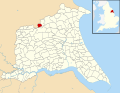 Fridaythorpe UK parish locator map.svg 1,425 × 1,107; 1.68 MB
-
 Fridaythorpe village (geograph 5984605).jpg 1,024 × 768; 185 KB
-
 Frosty Wold Valley - geograph.org.uk - 2772050.jpg 3,264 × 2,448; 1.9 MB
-
 Gate in Brubber Dale looking towards Ings Plantation - geograph.org.uk - 3000849.jpg 3,527 × 2,519; 3.78 MB
-
 Gate in West Dale, near Fridaythorpe - geograph.org.uk - 4692089.jpg 495 × 640; 556 KB
-
 Green Lane (geograph 3991880).jpg 1,024 × 768; 204 KB
-
 Green Lane (geograph 5017696).jpg 1,024 × 768; 379 KB
-
 Green Lane (geograph 5017705).jpg 1,024 × 768; 249 KB
-
 Green Lane (geograph 5017709).jpg 1,024 × 768; 214 KB
-
 Green Lane south of the A166 (geograph 4762389).jpg 4,488 × 3,290; 5.87 MB
-
 Green Lane, Holm Field - geograph.org.uk - 359315.jpg 640 × 480; 231 KB
-
 Green Lane, Holm Field - geograph.org.uk - 359323.jpg 640 × 480; 150 KB
-
 Halfway Point, Ish. - geograph.org.uk - 2369771.jpg 3,264 × 2,448; 2.16 MB
-
 Halifax Memorial - geograph.org.uk - 6022203.jpg 1,024 × 768; 344 KB
-
 Heading down into Wan Dale - geograph.org.uk - 2413208.jpg 800 × 600; 341 KB
-
 Hedgerow and Farmland, near Fimber - geograph.org.uk - 1374917.jpg 640 × 480; 88 KB
-
 Holmdale Farm, Holm Field - geograph.org.uk - 359303.jpg 640 × 480; 102 KB
-
 Holmfield Farmland - geograph.org.uk - 359330.jpg 640 × 480; 126 KB
-
 Huggate Lane - geograph.org.uk - 591073.jpg 480 × 640; 114 KB
-
 Lady Graves towards Wan Dale - geograph.org.uk - 2413206.jpg 800 × 600; 234 KB
-
 Looking back up West Dale - geograph.org.uk - 4804902.jpg 4,602 × 3,448; 5.67 MB
-
 Looking Down Holm Dale - geograph.org.uk - 2216661.jpg 2,736 × 3,648; 3.52 MB
-
 Looking down into Wan Dale - geograph.org.uk - 4254383.jpg 1,024 × 768; 316 KB
-
 Looking down West Dale - geograph.org.uk - 10217.jpg 480 × 640; 125 KB
-
 Looking north in Brubber Dale - geograph.org.uk - 3000854.jpg 3,340 × 2,386; 1.8 MB
-
 Looking south into Brubber Dale from Thixendale Road - geograph.org.uk - 3000841.jpg 3,328 × 2,377; 1.54 MB
-
 Looking towards the head of Wan Dale - geograph.org.uk - 4254387.jpg 1,024 × 768; 193 KB
-
 Minor Road Towards Brubber Dale - geograph.org.uk - 1374899.jpg 640 × 480; 110 KB
-

-
 Old pit near Fridaythorpe - geograph.org.uk - 5017674.jpg 1,024 × 768; 231 KB
-
 Old snow blown tree with Owl nesting box - geograph.org.uk - 4804916.jpg 3,456 × 4,608; 6.17 MB
-
 Ordnance Survey Flush Bracket S6520 (geograph 3057992).jpg 3,264 × 2,448; 1.64 MB
-
 Over field to Holmdale Farm (geograph 4762381).jpg 4,608 × 3,456; 5.67 MB
-
 Panoramic view across HorseDale - geograph.org.uk - 1361143.jpg 640 × 480; 73 KB
-
 Path down into Brubber Dale - geograph.org.uk - 4150319.jpg 2,660 × 1,900; 827 KB
-
 Path into Brubber Dale - geograph.org.uk - 4692082.jpg 640 × 443; 437 KB
-
 Path up the side of Wan Dale - geograph.org.uk - 4254379.jpg 1,024 × 768; 184 KB
-
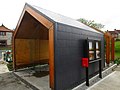 Public shelter by the pond - geograph.org.uk - 3991874.jpg 1,024 × 768; 149 KB
-
 Road from Fridaythorpe - geograph.org.uk - 359420.jpg 480 × 640; 112 KB
-
 Running deer by Ings Plantation - geograph.org.uk - 4692085.jpg 640 × 450; 581 KB
-
 Rural landscape - Dale - geograph.org.uk - 356447.jpg 640 × 480; 145 KB
-
 Rural landscape - Dale - geograph.org.uk - 356450.jpg 640 × 480; 108 KB
-
 Ruts and cross-ruts, York Road Green Lane (geograph 6837411).jpg 1,600 × 1,200; 509 KB
-
 Seaways Cafe Fridaythorpe.jpg 640 × 480; 72 KB
-
 Southwest end of West Dale - geograph.org.uk - 4804897.jpg 4,598 × 3,442; 5.31 MB
-
 St Mary's Church gravestone flag - geograph.org.uk - 5329761.jpg 2,208 × 3,047; 2.32 MB
-
 St Mary's Parish Church Fridaythorpe - geograph.org.uk - 4187015.jpg 3,456 × 4,608; 3.78 MB
-
 St Marys church Fridaythorpe. - geograph.org.uk - 4016475.jpg 640 × 480; 66 KB
-
 SW of Fridaythorpe - geograph.org.uk - 125355.jpg 640 × 480; 139 KB
-
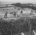 The British Army in the United Kingdom 1939-1945 H32528.jpg 800 × 793; 146 KB
-
 The Farmers Arms well and truly boarded up - geograph.org.uk - 6004991.jpg 4,608 × 3,456; 3.8 MB
-
 The way to Homedale Farm - geograph.org.uk - 2138605.jpg 800 × 600; 190 KB
-
 Thixendale Road at Burdale - geograph.org.uk - 2287327.jpg 800 × 600; 295 KB
-
 Thixendale Road toward Fridaythorpe - geograph.org.uk - 5008647.jpg 3,832 × 2,862; 5.25 MB
-
 Thixendale Road, near Fridaythorpe - geograph.org.uk - 1374859.jpg 640 × 480; 57 KB
-
 Through The Gate - geograph.org.uk - 359342.jpg 480 × 640; 141 KB
-
 Track and Tree above Holm Dale (geograph 4565290).jpg 4,592 × 3,448; 4.7 MB
-
 Track to Lodge Farm - geograph.org.uk - 1374849.jpg 640 × 480; 64 KB
-
 View above West Dale. - geograph.org.uk - 4016482.jpg 640 × 352; 40 KB
-
 View towards Lodge Farm (geograph 5017786).jpg 1,024 × 768; 169 KB
-
 View towards Lodge Farm - geograph.org.uk - 5017677.jpg 1,024 × 768; 229 KB
-
 Village pond, Fridaythorpe, E Yorks - geograph.org.uk - 4457658.jpg 640 × 480; 174 KB
-
 Wan Dale - geograph.org.uk - 1847677.jpg 2,304 × 1,728; 1.76 MB
-
 Wan Dale - geograph.org.uk - 2413211.jpg 800 × 600; 231 KB
-
 Wan Dale - geograph.org.uk - 2413214.jpg 800 × 600; 197 KB
-
 Wandale, aerial - geograph.org.uk - 3128329.jpg 640 × 427; 58 KB
-
 Welcome to North Yorkshire - geograph.org.uk - 3000859.jpg 3,448 × 2,463; 1.59 MB
-
 West Dale - geograph.org.uk - 285302.jpg 640 × 494; 96 KB
-
 West Dale - geograph.org.uk - 3991357.jpg 1,024 × 768; 164 KB
-
 West dale and Ings Plantation - geograph.org.uk - 3991403.jpg 1,024 × 768; 121 KB
-
 West Dale Wolds Way Walkers - geograph.org.uk - 285301.jpg 640 × 480; 116 KB
-
 West Dale, near Fridaythorpe - geograph.org.uk - 4692088.jpg 640 × 427; 313 KB
-
 Wheatfield with electricity pole (geograph 5017726).jpg 1,024 × 768; 192 KB
-
 Yorkshire Wolds Way half way point.jpg 640 × 480; 126 KB


.jpg)


.jpg)


.jpg)
.jpg)
.jpg)
.jpg)
.jpg)


.jpg)
.jpg)


.jpg)


.jpg)


.jpg)


.jpg)
