Category:Frampton, Dorset
Jump to navigation
Jump to search
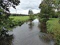
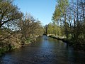
English: Frampton is a village in west Dorset, England, situated in the Frome valley three miles north west of Dorchester at .
village and civil parish in Dorset, UK  | |||||
| Upload media | |||||
| Instance of | |||||
|---|---|---|---|---|---|
| Location | Dorset, South West England, England | ||||
| Said to be the same as | Frampton (Wikimedia duplicated page, civil parish) | ||||
 | |||||
Subcategories
This category has the following 4 subcategories, out of 4 total.
Media in category "Frampton, Dorset"
The following 152 files are in this category, out of 152 total.
-
 A356 at Frampton - geograph.org.uk - 4982278.jpg 1,600 × 1,109; 710 KB
-
 A356 Dorchester Road - geograph.org.uk - 6263904.jpg 1,024 × 684; 358 KB
-
 A356 Dorchester Road towards Maiden Newton - geograph.org.uk - 4982154.jpg 1,600 × 1,082; 527 KB
-
 A356 Dorchester Road, Frampton - geograph.org.uk - 6263897.jpg 1,024 × 684; 233 KB
-
 A356 Dorchester Road, Frampton - geograph.org.uk - 6263900.jpg 1,024 × 684; 213 KB
-
 A356 meets A37 - geograph.org.uk - 3286543.jpg 640 × 480; 94 KB
-
 A356 southbound - geograph.org.uk - 3286541.jpg 640 × 480; 80 KB
-
 A37 northbound - geograph.org.uk - 3002440.jpg 640 × 480; 62 KB
-
 A37 northbound - geograph.org.uk - 3002452.jpg 640 × 449; 45 KB
-
 A37 northbound - geograph.org.uk - 4399145.jpg 640 × 475; 58 KB
-
 A37 westbound - geograph.org.uk - 4399130.jpg 640 × 480; 59 KB
-
 A37, A356 turning - geograph.org.uk - 3002444.jpg 640 × 480; 52 KB
-
 A37, Texaco Petrol Station - geograph.org.uk - 3002448.jpg 640 × 469; 45 KB
-
 Barrow near Compton Valence - geograph.org.uk - 1242515.jpg 640 × 428; 87 KB
-
 Barrow Plantation - geograph.org.uk - 1242483.jpg 640 × 428; 95 KB
-
 Benchmark, Magiston Farm - geograph.org.uk - 4331569.jpg 640 × 427; 109 KB
-
 Bridge over the River Frome at Frampton - geograph.org.uk - 151949.jpg 640 × 480; 141 KB
-
 Bridle Path at Steppes farm - geograph.org.uk - 1242485.jpg 640 × 428; 143 KB
-

-
 Bridleway Near Grimstone - geograph.org.uk - 1319781.jpg 640 × 480; 119 KB
-

-
 Bridleway through Hampton Plantation - geograph.org.uk - 5722377.jpg 427 × 640; 108 KB
-
 Bridleway to New Littlewood Farm - geograph.org.uk - 5722382.jpg 640 × 427; 69 KB
-
 Bristol to Weymouth rail line at Frampton - geograph.org.uk - 6257947.jpg 1,024 × 768; 268 KB
-
 Bristol to Weymouth rail line at Frampton - geograph.org.uk - 6257954.jpg 1,024 × 768; 309 KB
-
 Bus shelter on Dorchester Road, Frampton - geograph.org.uk - 4982946.jpg 1,600 × 1,089; 496 KB
-
 Celandine in the woods - geograph.org.uk - 1242486.jpg 640 × 480; 172 KB
-
 Church Bottom - geograph.org.uk - 1242467.jpg 640 × 428; 79 KB
-
 Church Bottom - geograph.org.uk - 551747.jpg 640 × 480; 141 KB
-
 Church Bottom - geograph.org.uk - 552974.jpg 640 × 480; 100 KB
-
 Colourful spring trees with Frampton Church in the distance - geograph.org.uk - 5868488.jpg 3,264 × 2,448; 3.65 MB
-
 Compton Bottom - geograph.org.uk - 5036903.jpg 640 × 480; 58 KB
-
 Compton Bottom - geograph.org.uk - 551788.jpg 640 × 480; 137 KB
-
 Cottage and Dovecote in Frampton - geograph.org.uk - 534059.jpg 640 × 480; 83 KB
-
 Cottages in Frampton - geograph.org.uk - 6179886.jpg 4,000 × 3,000; 4.65 MB
-
 Cottages in Frampton - geograph.org.uk - 6179891.jpg 4,000 × 3,000; 4.5 MB
-
 Cottages on Dorchester Road, Frampton - geograph.org.uk - 4982944.jpg 1,600 × 1,065; 748 KB
-
 Countryside near Winterbourne Abbas - geograph.org.uk - 995809.jpg 640 × 428; 59 KB
-
 Countryside near Winterbourne Abbas - geograph.org.uk - 995810.jpg 640 × 428; 88 KB
-
 Cows Grazing near Steppes Farm - geograph.org.uk - 1242484.jpg 640 × 443; 82 KB
-
-

-

-

-
-

-

-

-

-

-

-
 Entrance to Frampton - geograph.org.uk - 3286525.jpg 640 × 480; 53 KB
-
 Entrance to Grimstone - geograph.org.uk - 3286556.jpg 640 × 480; 54 KB
-
 Entrance to Pigeon House - geograph.org.uk - 1319782.jpg 640 × 480; 94 KB
-
 Estate Cottages at Frampton - geograph.org.uk - 534068.jpg 640 × 480; 107 KB
-
 Farm buildings by the road on Knowle Hill - geograph.org.uk - 3799204.jpg 1,536 × 878; 709 KB
-
 Farm track through Hampton Plantations - geograph.org.uk - 5750564.jpg 427 × 640; 106 KB
-
 Fields beside the road to Muckleford - geograph.org.uk - 3799265.jpg 1,536 × 1,152; 926 KB
-
 Footpath west from Longlands Farm - geograph.org.uk - 5036892.jpg 640 × 480; 71 KB
-
 Frampton Cemetery and Allotments - geograph.org.uk - 895192.jpg 640 × 428; 93 KB
-
 Frampton Park - geograph.org.uk - 3224496.jpg 640 × 480; 114 KB
-
 Frampton Tunnel - geograph.org.uk - 6400999.jpg 730 × 454; 292 KB
-
 Frampton Village Hall - geograph.org.uk - 4581652.jpg 1,024 × 768; 200 KB
-
 Frampton, Browne's Corner - geograph.org.uk - 1382448.jpg 640 × 480; 84 KB
-
 Frampton, footpath - geograph.org.uk - 4581641.jpg 1,024 × 768; 225 KB
-
 Frampton, former almshouses - geograph.org.uk - 4581709.jpg 1,024 × 763; 145 KB
-
 Frampton, River Frome - geograph.org.uk - 4581491.jpg 1,024 × 768; 266 KB
-
 Frampton, Rose Cottage - geograph.org.uk - 4581677.jpg 1,024 × 768; 146 KB
-
 Frampton, Rural Lane - geograph.org.uk - 4581662.jpg 1,024 × 768; 212 KB
-
 Frampton, Samways Bridge - geograph.org.uk - 4581470.jpg 1,024 × 768; 282 KB
-
 Frampton, the pretty bridge over the River Frome - geograph.org.uk - 2346208.jpg 1,280 × 960; 549 KB
-
 Frompton , Texaco Petrol Station - geograph.org.uk - 1229509.jpg 640 × 480; 36 KB
-
 Gardener's Cottage - geograph.org.uk - 914537.jpg 640 × 479; 102 KB
-
 Gate at Steppes Farm - geograph.org.uk - 5722397.jpg 640 × 427; 133 KB
-
 Gateway to small reservoir on Knowle Hill - geograph.org.uk - 3799197.jpg 1,536 × 1,152; 1.21 MB
-
-

-
 Hampton Farm - geograph.org.uk - 4751289.jpg 1,024 × 768; 169 KB
-
 Hampton Farmhouse - geograph.org.uk - 4751279.jpg 1,024 × 782; 123 KB
-
 Hampton Lodge and track into Hampton Plantations - geograph.org.uk - 3799218.jpg 1,536 × 1,153; 1.21 MB
-
 Hampton, crossroads - geograph.org.uk - 4751266.jpg 1,024 × 768; 153 KB
-
 Hampton, footpath - geograph.org.uk - 4751300.jpg 1,024 × 768; 178 KB
-
 Hampton, minor road - geograph.org.uk - 4751292.jpg 1,024 × 768; 150 KB
-
 Hampton, reservoir - geograph.org.uk - 4751274.jpg 1,024 × 769; 181 KB
-
 Hampton, Roman road - geograph.org.uk - 4751260.jpg 1,024 × 768; 144 KB
-
 Hampton, stile - geograph.org.uk - 4751295.jpg 1,024 × 768; 257 KB
-
 Hogleaze Cottages - geograph.org.uk - 388129.jpg 640 × 480; 37 KB
-
 Houses in Frampton - geograph.org.uk - 534056.jpg 640 × 480; 88 KB
-
 Knowle Hill - geograph.org.uk - 995808.jpg 640 × 428; 59 KB
-

-
 Langford Farm - geograph.org.uk - 5416669.jpg 640 × 480; 162 KB
-
 Lime Kiln in South Slip - geograph.org.uk - 1242517.jpg 640 × 428; 146 KB
-
 Long Bottom - geograph.org.uk - 551754.jpg 640 × 480; 146 KB
-
 Looking towards Town Hill Farm - geograph.org.uk - 388111.jpg 640 × 480; 24 KB
-

-
 Metlands Wood, near Frampton - geograph.org.uk - 5758346.jpg 427 × 640; 146 KB
-
 Milestone and road to Muckleford - geograph.org.uk - 3799246.jpg 1,536 × 1,152; 1.02 MB
-
 Milestone south of Muckleford - geograph.org.uk - 3799241.jpg 1,152 × 1,536; 1.24 MB
-
 Muddy track near Longlands Farm - geograph.org.uk - 5036870.jpg 640 × 480; 114 KB
-
 Murco Filling Station - geograph.org.uk - 4399159.jpg 640 × 461; 32 KB
-
 New Littlewood Farm - geograph.org.uk - 4034622.jpg 640 × 480; 75 KB
-
 New Track in Church Bottom - geograph.org.uk - 1242514.jpg 640 × 428; 88 KB
-
 North Slip, Church Bottom - geograph.org.uk - 3219297.jpg 640 × 543; 114 KB
-
 Old houses, Frampton - geograph.org.uk - 4331560.jpg 640 × 427; 69 KB
-
 Old houses, Frampton - geograph.org.uk - 4331562.jpg 640 × 427; 50 KB
-
 Ordnance Survey Flush Bracket 214 - geograph.org.uk - 3930093.jpg 4,000 × 3,000; 4.56 MB
-
 Pasture land near Southover (Longlands Farm) - geograph.org.uk - 2346235.jpg 1,280 × 960; 332 KB
-
 Pasture land near Southover - geograph.org.uk - 2346247.jpg 1,280 × 960; 346 KB
-
 Pigeon House and greenhouse - geograph.org.uk - 918765.jpg 640 × 499; 119 KB
-
 Pigeon House, New Littlewood Farm - geograph.org.uk - 5722384.jpg 640 × 427; 59 KB
-
 Railway Cutting, Frampton - geograph.org.uk - 895193.jpg 477 × 640; 137 KB
-
 Railway cutting, Frampton - geograph.org.uk - 895194.jpg 640 × 426; 99 KB
-
 Reservoir at Hampton Farm - geograph.org.uk - 995811.jpg 640 × 428; 99 KB
-
 River Frome at Frampton - geograph.org.uk - 534063.jpg 640 × 480; 122 KB
-
 River Frome at Frampton - geograph.org.uk - 6257964.jpg 1,024 × 768; 239 KB
-
 River Frome from Frampton Bridge - geograph.org.uk - 2346213.jpg 1,280 × 960; 519 KB
-
 River Frome near Frampton - geograph.org.uk - 4331557.jpg 640 × 427; 93 KB
-
 Road Junction near Grimstone - geograph.org.uk - 895188.jpg 640 × 426; 83 KB
-
 Roman Road - geograph.org.uk - 388085.jpg 480 × 640; 20 KB
-
 Sandways Bridge over the River Frome - geograph.org.uk - 308206.jpg 640 × 480; 152 KB
-
 Second entrance to Frampton - geograph.org.uk - 3286528.jpg 640 × 410; 49 KB
-

-
 South Slip, Church Bottom - geograph.org.uk - 3219296.jpg 640 × 480; 135 KB
-
 Stream near Compton Valence - geograph.org.uk - 1242516.jpg 640 × 443; 110 KB
-
 Sydling Valley, water meadows - geograph.org.uk - 2344267.jpg 1,280 × 960; 407 KB
-
 Sydling Water - geograph.org.uk - 723252.jpg 640 × 480; 125 KB
-
 Sydling Water, watercress beds at Magiston - geograph.org.uk - 2344274.jpg 1,280 × 960; 346 KB
-
 The A356 near Grimstone - geograph.org.uk - 895189.jpg 640 × 398; 78 KB
-
 The footpath to Magiston Farm - geograph.org.uk - 4331549.jpg 640 × 427; 34 KB
-
 The Frome Valley - geograph.org.uk - 895191.jpg 640 × 429; 117 KB
-
 The road to Hampton and Muckleford - geograph.org.uk - 1951665.jpg 640 × 480; 199 KB
-
 Town Hill Farm - geograph.org.uk - 1242463.jpg 640 × 457; 113 KB
-
 Track in the Woods - geograph.org.uk - 1242464.jpg 640 × 470; 176 KB
-
 Track into Hampton Plantations - geograph.org.uk - 3799220.jpg 1,536 × 1,152; 1.36 MB
-
 Track near Longlands Farm - geograph.org.uk - 5036898.jpg 640 × 480; 85 KB
-
 Track to Longlands Farm - geograph.org.uk - 5036875.jpg 480 × 640; 71 KB
-
 View towards Great Hogleaze - geograph.org.uk - 388099.jpg 640 × 480; 31 KB
-
 Water Cress Beds - geograph.org.uk - 723261.jpg 640 × 480; 145 KB
-
 Watercress Bed Irrigation channel - geograph.org.uk - 723290.jpg 640 × 458; 140 KB
-
 Watercress Beds, Lower Magiston - geograph.org.uk - 723277.jpg 640 × 444; 156 KB
-
 Woodland at Long Bottom - geograph.org.uk - 5758340.jpg 640 × 427; 65 KB
-
 Cows near Littlewood Farm Dairy, Frampton - geograph.org.uk - 151953.jpg 640 × 480; 162 KB
-

-
 Footpath through Metlands Wood - geograph.org.uk - 154636.jpg 480 × 640; 207 KB
-

-

-

-
 View across South Field Down - geograph.org.uk - 311456.jpg 640 × 480; 51 KB
-

-
 View down Southover footpath - geograph.org.uk - 311148.jpg 480 × 640; 50 KB
-

-
 View from Grimstone Down southwest - geograph.org.uk - 308902.jpg 640 × 480; 54 KB


_-_geograph.org.uk_-_4841960.jpg)
_-_geograph.org.uk_-_4841966.jpg)
_-_geograph.org.uk_-_4841973.jpg)
_-_geograph.org.uk_-_4841982.jpg)
_-_geograph.org.uk_-_4841988.jpg)
_-_geograph.org.uk_-_4841994.jpg)
_-_geograph.org.uk_-_4841998.jpg)
_-_geograph.org.uk_-_4842004.jpg)
_-_geograph.org.uk_-_4842008.jpg)
_-_geograph.org.uk_-_4842011.jpg)
_-_geograph.org.uk_-_4842014.jpg)


_-_geograph.org.uk_-_2346235.jpg)


