Category:Foy, Herefordshire
Jump to navigation
Jump to search
village and civil parish in Herefordshire, England  Eglwys y Santes Fair, Foy | |||||
| Upload media | |||||
| Instance of | |||||
|---|---|---|---|---|---|
| Location | Herefordshire, West Midlands, England | ||||
 | |||||
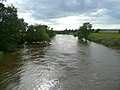
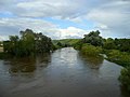
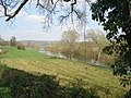
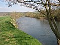
English: Foy is a hamlet and parish in Herefordshire, England. By road, it is south west of Ledbury. The hamlet lies in a loop of the River Wye with the nearest vehicle bridges at Ross and Hoarwithy. (→Foy, Herefordshire)
Polski: Foy – wieś i civil parish w Anglii, w hrabstwie Herefordshire. W 2011 roku civil parish liczyła 158 mieszkańców. (→Foy (Herefordshire))
Main Wikipedia article: Foy, Herefordshire.

Subcategories
This category has the following 3 subcategories, out of 3 total.
Media in category "Foy, Herefordshire"
The following 184 files are in this category, out of 184 total.
-

-
 A rain splattered River Wye from the Foy Bridge - geograph.org.uk - 3111324.jpg 4,000 × 3,000; 3.61 MB
-
 A specimen beech tree - geograph.org.uk - 4957608.jpg 1,198 × 1,600; 1.16 MB
-
 Arable field in spring - geograph.org.uk - 1253940.jpg 640 × 480; 170 KB
-
 Armorial Bearings of the ABRAHALL family of Ingestone, Foye, Herefordshire.png 1,200 × 1,200; 707 KB
-
 Avenue of trees near Perrystone - geograph.org.uk - 694312.jpg 640 × 480; 199 KB
-
 B4224 approaching junction at Cross in Hand - geograph.org.uk - 3710566.jpg 2,601 × 1,593; 1.81 MB
-
 Barn at Foy - geograph.org.uk - 558186.jpg 640 × 480; 81 KB
-
 Beech avenue, Perrystone Hill - geograph.org.uk - 4957627.jpg 1,600 × 899; 1.12 MB
-
 Bend in the Wye - geograph.org.uk - 931763.jpg 640 × 480; 64 KB
-
-
 Boathouse - geograph.org.uk - 6029734.jpg 4,667 × 3,111; 3.31 MB
-
 Boathouse and boat - geograph.org.uk - 6029741.jpg 3,777 × 2,518; 1.9 MB
-
 Boathouse by River Wye - geograph.org.uk - 3423825.jpg 1,024 × 768; 107 KB
-
 Boathouse by the River Wye - geograph.org.uk - 4880194.jpg 3,091 × 2,048; 1.63 MB
-
 Brick End houses - geograph.org.uk - 6029769.jpg 4,896 × 3,264; 4.05 MB
-
 Bridge near Foy - geograph.org.uk - 5462848.jpg 529 × 640; 269 KB
-
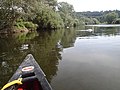
 Canoeists passing under Foy Bridge - geograph.org.uk - 3111340.jpg 4,000 × 3,000; 3.7 MB
-
 Cottage at Hill of Eaton - geograph.org.uk - 4089871.jpg 3,872 × 2,592; 4.58 MB
-
 Country road near How Caple (1) - geograph.org.uk - 5464915.jpg 640 × 468; 143 KB
-
 Country road near How Caple (2) - geograph.org.uk - 5464934.jpg 486 × 640; 238 KB
-
 Cows and gate - geograph.org.uk - 4089882.jpg 2,592 × 3,872; 3.78 MB
-
 Farm buildings at Hill of Eaton - geograph.org.uk - 3423748.jpg 1,024 × 769; 145 KB
-
 Farm land west of Park Farm - geograph.org.uk - 938386.jpg 640 × 480; 79 KB
-
 Farm shop no longer - geograph.org.uk - 865867.jpg 640 × 395; 40 KB
-
 Farm track and footpath near Hill of Eaton - geograph.org.uk - 3423759.jpg 1,024 × 768; 127 KB
-
 Farm track and the Wye Valley Walk - geograph.org.uk - 3111463.jpg 4,000 × 3,000; 3.37 MB
-
 Farm track near Foy Bridge - geograph.org.uk - 6270942.jpg 1,024 × 768; 186 KB
-
 Farm track near Vicarage Wood - geograph.org.uk - 4441523.jpg 3,696 × 2,448; 2.31 MB
-
 Farmland at Foy - geograph.org.uk - 980229.jpg 640 × 380; 37 KB
-
 Farmland between Foy and Ingestone - geograph.org.uk - 557545.jpg 640 × 480; 122 KB
-
 Farmland between Foy and Ingestone - geograph.org.uk - 557549.jpg 640 × 480; 118 KB
-
 Field boundary near Foy - geograph.org.uk - 1009800.jpg 640 × 480; 84 KB
-
 Field edge by The Gaff - geograph.org.uk - 5889019.jpg 1,600 × 901; 706 KB
-
 Fields leading down to the River Wye - geograph.org.uk - 4241760.jpg 2,592 × 1,944; 1.52 MB
-
 Fields near Court Farm - geograph.org.uk - 4241712.jpg 2,592 × 1,944; 1.69 MB
-
 Fine display of geraniums - geograph.org.uk - 1009790.jpg 640 × 480; 140 KB
-
 Fishermen and canoeists at Foy Bridge - geograph.org.uk - 4089873.jpg 3,872 × 2,592; 4.13 MB
-
 Fishermen at Foy - geograph.org.uk - 4089874.jpg 3,872 × 2,592; 4.22 MB
-
 Fishing hut with verandah - geograph.org.uk - 3111120.jpg 4,000 × 3,000; 3.18 MB
-
 Footpath through a field of maize - geograph.org.uk - 6270973.jpg 1,024 × 768; 279 KB
-
 Footpath to Foy - geograph.org.uk - 55553.jpg 640 × 426; 142 KB
-
 Footpath to Foy - geograph.org.uk - 963394.jpg 640 × 480; 186 KB
-
 Footpath to the river - geograph.org.uk - 1009772.jpg 640 × 480; 67 KB
-
 Footpath to the River Wye - geograph.org.uk - 6034806.jpg 1,024 × 768; 176 KB
-
 Former vicarage, Foy - geograph.org.uk - 5462854.jpg 640 × 463; 228 KB
-
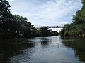
 Foy Bridge from the west bank of the River Wye - geograph.org.uk - 3423774.jpg 1,024 × 768; 254 KB
-
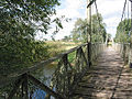
 Foy Bridge over River Wye - geograph.org.uk - 3423764.jpg 1,024 × 768; 218 KB
-
 Foy Bridge over the River Wye - geograph.org.uk - 3111344.jpg 4,000 × 3,000; 3.19 MB
-
 Foy road - geograph.org.uk - 980217.jpg 640 × 480; 89 KB
-
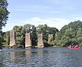
 Foy suspension bridge - geograph.org.uk - 4089879.jpg 2,592 × 3,872; 2.84 MB
-
 Foy suspension bridge - geograph.org.uk - 6029774.jpg 4,719 × 3,145; 3.71 MB
-
 Foy suspension bridge - geograph.org.uk - 6029792.jpg 4,896 × 3,264; 6.81 MB
-
 Foy suspension bridge over the river Wye - geograph.org.uk - 55552.jpg 640 × 426; 184 KB
-
 Foy vicarage - geograph.org.uk - 1009783.jpg 640 × 480; 110 KB
-
 Foy, UK - panoramio (1).jpg 3,968 × 2,976; 3.03 MB
-
 Foy, UK - panoramio (2).jpg 1,948 × 1,587; 981 KB
-
 Foy, UK - panoramio (3).jpg 3,968 × 2,976; 2.56 MB
-
 Foy, UK - panoramio (4).jpg 2,067 × 1,379; 711 KB
-
 Foy, UK - panoramio (5).jpg 3,021 × 2,016; 1.06 MB
-
 Foy, UK - panoramio.jpg 3,968 × 2,976; 2.72 MB
-
 Foye Court - geograph.org.uk - 5807093.jpg 1,024 × 768; 135 KB
-
 Foye Court - geograph.org.uk - 6034841.jpg 1,024 × 768; 168 KB
-
 Frozen pool beside the River Wye - geograph.org.uk - 100627.jpg 640 × 426; 129 KB
-
 Haymaking near Foy, Herefordshire - geograph.org.uk - 1004457.jpg 640 × 426; 101 KB
-
 Himalayan Balsam, Impatiens glandulifera - geograph.org.uk - 931744.jpg 640 × 480; 156 KB
-
 Himalayan Balsam, Impatiens glandulifera - geograph.org.uk - 931755.jpg 640 × 480; 169 KB
-
 Horses at Foy - geograph.org.uk - 558189.jpg 640 × 480; 84 KB
-
 House at The Gaff - geograph.org.uk - 1009804.jpg 640 × 480; 95 KB
-
 Ingestone - geograph.org.uk - 1253944.jpg 640 × 480; 214 KB
-
 Ingestone Only - geograph.org.uk - 1253933.jpg 480 × 640; 203 KB
-
 Ingestone, 2018 - geograph.org.uk - 5888973.jpg 1,600 × 901; 721 KB
-
 Iron gate post - geograph.org.uk - 1009808.jpg 480 × 640; 154 KB
-
 Junction of B4225 (leading to B4224) with A449 - geograph.org.uk - 3796396.jpg 3,840 × 2,772; 2.74 MB
-
 Line of willow trees by the River Wye - geograph.org.uk - 558204.jpg 640 × 480; 139 KB
-
 Lyndor Cottages - geograph.org.uk - 931767.jpg 640 × 369; 55 KB
-
 Maker's plaque on Foy Bridge - geograph.org.uk - 4089881.jpg 2,592 × 3,872; 4.49 MB
-
 Narrow strip of land on Perrystone Hill - geograph.org.uk - 5806703.jpg 1,024 × 768; 166 KB
-
 Nearing the end of the road - geograph.org.uk - 3521475.jpg 1,024 × 680; 259 KB
-
 New and old - geograph.org.uk - 1274783.jpg 640 × 480; 223 KB
-
 New kissing gate at the entrance to Monks Grove - geograph.org.uk - 3111471.jpg 4,000 × 3,000; 3.31 MB
-
 Oak tree near Foy (17091648917).jpg 3,696 × 2,448; 2.31 MB
-
 October bloom at Inglestone^ - geograph.org.uk - 1004475.jpg 640 × 426; 68 KB
-
 Old Gore B-road towards the A449 - geograph.org.uk - 4676972.jpg 800 × 560; 128 KB
-
 On Foy Bridge - geograph.org.uk - 5381984.jpg 1,024 × 680; 315 KB
-
 On the Wye Valley Walk, north of Brampton Abbotts - geograph.org.uk - 4241746.jpg 2,592 × 1,944; 1.69 MB
-
 Ordnance Survey Cut Mark - geograph.org.uk - 6128200.jpg 1,024 × 837; 247 KB
-
 Parasol mushroom by a hedgerow - geograph.org.uk - 963423.jpg 480 × 640; 189 KB
-
 Park Farm house - geograph.org.uk - 4673616.jpg 800 × 451; 286 KB
-
 Path across a wheat field - geograph.org.uk - 4089870.jpg 3,872 × 2,592; 4.66 MB
-
 Perrystone driveway 1 - geograph.org.uk - 1054814.jpg 640 × 474; 167 KB
-
 Perrystone driveway 2 - geograph.org.uk - 1054815.jpg 640 × 461; 140 KB
-
 Perrystone driveway 3 - geograph.org.uk - 1054816.jpg 640 × 480; 176 KB
-
 Pipeline activity looking west - geograph.org.uk - 483511.jpg 640 × 480; 340 KB
-
 Pipeline construction - geograph.org.uk - 566730.jpg 640 × 480; 56 KB
-
 Pipeline installation heading for Tirley - geograph.org.uk - 483506.jpg 640 × 480; 323 KB
-
 Pipeline zigzags through the landscape - geograph.org.uk - 483501.jpg 640 × 454; 278 KB
-
 Pointless gate - geograph.org.uk - 6029782.jpg 4,896 × 3,264; 6.81 MB
-
 Postbox at Carthage Farm - geograph.org.uk - 558183.jpg 480 × 640; 86 KB
-
 Reflections on the Wye in Herefordshire - geograph.org.uk - 5141437.jpg 800 × 636; 144 KB
-
 River Wye - downstream - geograph.org.uk - 931762.jpg 640 × 480; 74 KB
-
 River Wye - geograph.org.uk - 931741.jpg 640 × 480; 53 KB
-
 River Wye at Backney - geograph.org.uk - 980207.jpg 640 × 480; 96 KB
-
 River Wye at Foy - geograph.org.uk - 454185.jpg 640 × 480; 153 KB
-
 River Wye at Foy - geograph.org.uk - 454197.jpg 640 × 480; 149 KB
-

-
 River Wye from Foy Bridge - geograph.org.uk - 3423768.jpg 1,024 × 768; 114 KB
-
 River Wye from Foy Footbridge - geograph.org.uk - 4441258.jpg 3,696 × 2,448; 2.26 MB
-
 River Wye near Foy (1) - geograph.org.uk - 5464158.jpg 567 × 640; 168 KB
-
 River Wye near Foy (2) - geograph.org.uk - 5464164.jpg 640 × 487; 197 KB
-
 River Wye near Foy (3) - geograph.org.uk - 5464661.jpg 640 × 480; 255 KB
-
 River Wye near Lyndor - geograph.org.uk - 3001452.jpg 1,024 × 577; 289 KB
-
 River Wye upstream from Foy Bridge - geograph.org.uk - 557570.jpg 480 × 640; 76 KB
-

-
 River Wye, How Caple - geograph.org.uk - 6029717.jpg 4,896 × 3,264; 6.51 MB
-
 River Wye, near Foy, Herefordshire (17298620041).jpg 3,696 × 2,448; 2.29 MB
-
 Road and river run close together - geograph.org.uk - 558203.jpg 640 × 480; 96 KB
-
 Sheep in the shade - geograph.org.uk - 6034816.jpg 1,024 × 768; 158 KB
-
 Sloping field above the Wye, near Brampton Abbotts - geograph.org.uk - 4241726.jpg 2,592 × 1,944; 1.83 MB
-
 Spring green - geograph.org.uk - 1253929.jpg 640 × 480; 207 KB
-
 Spring green 2 - geograph.org.uk - 1253948.jpg 640 × 480; 249 KB
-
 Stubble and bales - geograph.org.uk - 1009803.jpg 640 × 480; 85 KB
-
 Stubble and bales - geograph.org.uk - 1009811.jpg 640 × 480; 91 KB
-
 The bank of the River Wye at Lyndor Wood - geograph.org.uk - 3423818.jpg 1,024 × 767; 119 KB
-
 The Old Vicarage, Foy - geograph.org.uk - 3525099.jpg 1,024 × 680; 225 KB
-
 The River Wye and Foy - geograph.org.uk - 5381991.jpg 1,024 × 680; 220 KB
-
 The River Wye below How Caple - geograph.org.uk - 5381955.jpg 1,024 × 680; 252 KB
-
 The River Wye below Lyndor Wood - geograph.org.uk - 4241666.jpg 2,592 × 1,944; 1.21 MB
-
 The River Wye below Lyndor Wood - geograph.org.uk - 5381968.jpg 1,024 × 680; 260 KB
-
 The River Wye near Foy - geograph.org.uk - 1004444.jpg 640 × 426; 91 KB
-
 The River Wye near Foy - geograph.org.uk - 71414.jpg 426 × 640; 148 KB
-
 The River Wye near Lyndor - geograph.org.uk - 4241654.jpg 2,592 × 1,944; 1.39 MB
-
 The road to Phocle Green - geograph.org.uk - 3422493.jpg 1,024 × 768; 143 KB
-
 The Vicarage at Foy - geograph.org.uk - 566708.jpg 640 × 480; 66 KB
-
 The village of Foy - geograph.org.uk - 963391.jpg 640 × 480; 148 KB
-
 The Wye near Foy - geograph.org.uk - 5890385.jpg 1,600 × 900; 494 KB
-
 The Wye Valley Walk on the road to Brampton Abbots - geograph.org.uk - 3111138.jpg 4,000 × 3,000; 3.77 MB
-
 Track to Hillcrest and Underhill - geograph.org.uk - 1009813.jpg 640 × 480; 75 KB
-
 Treescape at Foy - geograph.org.uk - 1009767.jpg 480 × 640; 98 KB
-
 Two oak trees and a buzzard - geograph.org.uk - 5890397.jpg 1,600 × 900; 387 KB
-
 Upright on the Foy Bridge - geograph.org.uk - 3423779.jpg 768 × 1,024; 154 KB
-
 Valley below Hill of Eaton - geograph.org.uk - 6270964.jpg 1,024 × 768; 194 KB
-

-
 View to Carthage Farm - geograph.org.uk - 1009760.jpg 640 × 365; 60 KB
-
 View to Lyndor Cottages - geograph.org.uk - 1274777.jpg 640 × 480; 218 KB
-
 View towards Carthage (geograph 6034870).jpg 1,024 × 768; 142 KB
-
 Wheat field north of the Wye - geograph.org.uk - 931748.jpg 640 × 480; 122 KB
-
 Wye Valley Walk crossing grassy field - geograph.org.uk - 3111442.jpg 4,000 × 3,000; 3.52 MB
-
 Wye Valley Walk near Monks Grove - geograph.org.uk - 6270935.jpg 1,024 × 768; 206 KB
-
 Wye valley, near Foy (16676633514).jpg 3,696 × 2,448; 2.25 MB
-
 Boathouse near Lyndor Wood - geograph.org.uk - 483523.jpg 447 × 640; 432 KB
-
 Boathouse on the Wye near Lyndor Wood - geograph.org.uk - 483524.jpg 640 × 454; 330 KB
-
 Caravan site at Lyndor - geograph.org.uk - 566750.jpg 640 × 480; 95 KB
-
 Carthage Farm - geograph.org.uk - 566691.jpg 640 × 480; 68 KB
-
 Corrugated barn at Ingestone - geograph.org.uk - 557528.jpg 640 × 480; 84 KB
-
 Entrance to Coles Farm - geograph.org.uk - 558185.jpg 640 × 480; 89 KB
-
 Entrance to Lyndor Cottages - geograph.org.uk - 566748.jpg 640 × 480; 128 KB
-
 Farmland near the end of the road - geograph.org.uk - 557526.jpg 640 × 480; 114 KB
-
 Footbridge at Foy - geograph.org.uk - 557575.jpg 640 × 480; 125 KB
-
 Footpath across farmland near Foy - geograph.org.uk - 557536.jpg 640 × 480; 100 KB
-
 Footpath by the River Wye - geograph.org.uk - 558181.jpg 640 × 462; 82 KB
-
 Footpath from Foy Bridge to the road - geograph.org.uk - 557568.jpg 488 × 640; 140 KB
-
 Footpath to Foy Bridge - geograph.org.uk - 557564.jpg 480 × 640; 134 KB
-
 Footpath to Perrystone - geograph.org.uk - 483518.jpg 640 × 480; 496 KB
-
 Footpath to Strangford - geograph.org.uk - 558199.jpg 640 × 523; 77 KB
-
 Hacking down the hedgerow - geograph.org.uk - 557551.jpg 640 × 503; 128 KB
-
 House opposite St Mary's Church - geograph.org.uk - 566697.jpg 640 × 480; 112 KB
-

-
 Lane at Lyndor Wood - geograph.org.uk - 566743.jpg 640 × 480; 75 KB
-
 Lyndor Cottages - geograph.org.uk - 566745.jpg 640 × 480; 125 KB
-
 Maize crop by the River Wye - geograph.org.uk - 558206.jpg 640 × 511; 127 KB
-
 Pasture by the Wye - geograph.org.uk - 483979.jpg 640 × 455; 332 KB
-
 Perrystone - geograph.org.uk - 55268.jpg 640 × 426; 161 KB
-
 Public notice about pipeline installation - geograph.org.uk - 483497.jpg 640 × 450; 319 KB
-
 Rape and trees near Foy - geograph.org.uk - 454191.jpg 640 × 480; 153 KB
-
 Rape field at Foy - geograph.org.uk - 453844.jpg 640 × 480; 149 KB
-
 River Wye at Lyndor - geograph.org.uk - 566753.jpg 640 × 480; 110 KB
-
 Road from Foy to Ingestone - geograph.org.uk - 558200.jpg 480 × 640; 65 KB
-
 Road to Foy from Ingestone - geograph.org.uk - 557540.jpg 480 × 640; 133 KB
-
 Root crop planted on sloping land - geograph.org.uk - 558202.jpg 640 × 480; 65 KB
-
 Start of the footpath to Foy Bridge - geograph.org.uk - 557559.jpg 640 × 471; 92 KB
-
 Suspension Bridge at Foy - geograph.org.uk - 453826.jpg 640 × 480; 145 KB
-

-
 The road to Underhill - geograph.org.uk - 557555.jpg 640 × 480; 83 KB


_-_geograph.org.uk_-_5464915.jpg)
_-_geograph.org.uk_-_5464934.jpg)


.jpg)
.jpg)
.jpg)
.jpg)
.jpg)


_with_A449_-_geograph.org.uk_-_3796396.jpg)


.jpg)


_-_geograph.org.uk_-_5464158.jpg)
_-_geograph.org.uk_-_5464164.jpg)
_-_geograph.org.uk_-_5464661.jpg)


.jpg)


.jpg)


.jpg)


