Category:Fownhope
Jump to navigation
Jump to search
village in Herefordshire, UK  | |||||
| Upload media | |||||
| Instance of | |||||
|---|---|---|---|---|---|
| Location | Herefordshire, West Midlands, England | ||||
 | |||||
English: Fownhope is a village in Herefordshire, England, an area of outstanding natural beauty on the banks of the River Wye. The population of the village at the 2011 Census was 999.
Polski: Fownhope – wieś w Anglii, w hrabstwie Herefordshire. Leży 11 km na południowy wschód od miasta Hereford i 179 km na zachód od Londynu.

Subcategories
This category has the following 4 subcategories, out of 4 total.
Media in category "Fownhope"
The following 200 files are in this category, out of 376 total.
(previous page) (next page)-

-
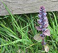 A single spear of Bugle - geograph.org.uk - 1270949.jpg 640 × 580; 288 KB
-
 A thin carpet of bluebells - geograph.org.uk - 1274342.jpg 640 × 457; 310 KB
-
 Approaching Fownhope from Common Hill - geograph.org.uk - 3022981.jpg 640 × 480; 109 KB
-
 Approaching Holme Lacy turn on B4224 - geograph.org.uk - 3710524.jpg 2,464 × 1,651; 2.59 MB
-
 Armorial Bearings of the CHAUNDOS of Fownhope and Snodhill Castle, Herefordshire.png 1,200 × 1,200; 1.19 MB
-
 B4224 approaching Fownhope - geograph.org.uk - 3710538.jpg 2,421 × 1,629; 2.43 MB
-
 B4224 at Oldway - geograph.org.uk - 2044707.jpg 640 × 480; 235 KB
-
 B4224 at Oldway - geograph.org.uk - 2044728.jpg 640 × 480; 204 KB
-
 B4224 below Cherry Hill - geograph.org.uk - 3710533.jpg 2,593 × 1,645; 2.76 MB
-
 B4224 distances from central Fownhope - geograph.org.uk - 4989658.jpg 800 × 560; 123 KB
-
 B4224 east of Fownhope - geograph.org.uk - 1196072.jpg 640 × 480; 106 KB
-
 B4224 east of Fownhope - geograph.org.uk - 4971513.jpg 800 × 600; 170 KB
-
 B4224 layby east of Fownhope - geograph.org.uk - 4971510.jpg 780 × 800; 217 KB
-
 B4224 towards Fownhope - geograph.org.uk - 3710546.jpg 2,538 × 1,614; 2.58 MB
-
 B4224 towards the centre of Fownhope - geograph.org.uk - 4970853.jpg 800 × 650; 160 KB
-
 B4224, Oldway, Herefordshire - geograph.org.uk - 4972273.jpg 800 × 765; 148 KB
-
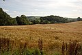 Barley growing near Fishpool Hill - geograph.org.uk - 1434406.jpg 640 × 426; 84 KB
-

-

-
 Bend in the River Wye - geograph.org.uk - 693800.jpg 640 × 480; 146 KB
-
 Biggs Lane, Fownhope - geograph.org.uk - 5185900.jpg 800 × 660; 242 KB
-
 Blue crop near Capler Camp - geograph.org.uk - 548292.jpg 640 × 480; 107 KB
-
 Bluebells in Fownhope Park Wood - geograph.org.uk - 1309318.jpg 426 × 640; 132 KB
-
 Bluebells in Fownhope Park Wood - geograph.org.uk - 1310206.jpg 640 × 426; 141 KB
-
 Bluebells in Fownhope Park Wood - geograph.org.uk - 1310212.jpg 640 × 426; 145 KB
-
 Brook draining from Common Hill - geograph.org.uk - 1196128.jpg 480 × 640; 194 KB
-
 Brook running down to join the Wye - geograph.org.uk - 722509.jpg 507 × 640; 260 KB
-
 Brook through a tangle of branches - geograph.org.uk - 722496.jpg 480 × 640; 218 KB
-
 Butcher's shop, Fownhope - geograph.org.uk - 1196113.jpg 640 × 442; 81 KB
-
 Butterfly Trail - Red trail marker - geograph.org.uk - 1205473.jpg 480 × 640; 190 KB
-
 Camp site near Fownhope - geograph.org.uk - 5215981.jpg 1,024 × 768; 440 KB
-
 Capler Lane - geograph.org.uk - 3589331.jpg 3,696 × 2,448; 2.31 MB
-
 Capler Lane meets the B4224, Fownhope - geograph.org.uk - 532844.jpg 640 × 480; 71 KB
-
 Capler Lane, Fownhope - geograph.org.uk - 4428361.jpg 5,307 × 3,435; 2.34 MB
-
 Capler Lane, Fownhope - geograph.org.uk - 4604554.jpg 3,089 × 2,048; 3.03 MB
-
 Capler Lane, Fownhope - geograph.org.uk - 4989327.jpg 800 × 731; 153 KB
-
 Capler Lane, Fownhope - geograph.org.uk - 5132304.jpg 800 × 658; 186 KB
-
 Cemetery, Oldway Baptist Church - geograph.org.uk - 1196021.jpg 640 × 438; 149 KB
-
 Church Croft, Fownhope - geograph.org.uk - 1196120.jpg 640 × 445; 85 KB
-
 Churchyard at St. Mary's Church (Fownhope) - geograph.org.uk - 5881832.jpg 3,648 × 2,736; 4.58 MB
-
 Clematis reaches dizzy heights - geograph.org.uk - 532894.jpg 446 × 640; 67 KB
-
 Common Hill above Fownhope - geograph.org.uk - 4427994.jpg 6,016 × 4,000; 3.44 MB
-
 Common Hill Lane - geograph.org.uk - 1196209.jpg 640 × 480; 183 KB
-
 Common Hill Lane, Fownhope - geograph.org.uk - 4428076.jpg 5,410 × 3,538; 3 MB
-
 Common Hill Lane, Fownhope - geograph.org.uk - 4428105.jpg 5,431 × 3,665; 3.4 MB
-
 Common Hill Lane, Fownhope - geograph.org.uk - 4989633.jpg 800 × 600; 134 KB
-

-
 Cotoneaster 'Coral Beauty' - geograph.org.uk - 2044741.jpg 640 × 480; 313 KB
-
 Cottage at Rudge End, 1 - geograph.org.uk - 4820345.jpg 1,600 × 901; 547 KB
-
 Cottage at Rudge End, 2 - geograph.org.uk - 4820347.jpg 1,600 × 1,200; 930 KB
-
 Cottage garden - geograph.org.uk - 3021539.jpg 640 × 480; 108 KB
-

-
 Cottage on Hawker's Lane - geograph.org.uk - 3022953.jpg 640 × 480; 125 KB
-
 Country Lane south of Fownhope - geograph.org.uk - 2142838.jpg 640 × 480; 110 KB
-
 Country road south of Fownhope - geograph.org.uk - 5984876.jpg 1,024 × 768; 275 KB
-
 Countryside south of Fownhope - geograph.org.uk - 2142830.jpg 640 × 480; 74 KB
-
 Court Orchard, Fownhope - geograph.org.uk - 4970543.jpg 800 × 638; 125 KB
-
 Dappled shade at Capler Wood - geograph.org.uk - 547557.jpg 640 × 480; 150 KB
-
 Detritus trapped on the bridge parapet - geograph.org.uk - 3134767.jpg 1,200 × 1,037; 622 KB
-

-
 Direction signs on a Fownhope corner - geograph.org.uk - 4989692.jpg 800 × 800; 142 KB
-
 Disused railway bridge, near Holme Lacy - geograph.org.uk - 116040.jpg 640 × 426; 183 KB
-

-

-
 Empty Tomb at St. Mary's Church (Fownhope) - geograph.org.uk - 5862744.jpg 3,648 × 2,736; 4.95 MB
-

-
 Entrance Gate to St. Mary's Church (Fownhope) - geograph.org.uk - 5881865.jpg 3,648 × 2,736; 4.64 MB
-
 Entrance Gates to St. Mary's Church (Fownhope) - geograph.org.uk - 5881889.jpg 3,648 × 2,736; 4.9 MB
-

-
 Entrance to Manor Farmhouse, Fownhope - geograph.org.uk - 4989617.jpg 800 × 704; 172 KB
-
 Farmland at Fownhope - geograph.org.uk - 1309298.jpg 640 × 426; 119 KB
-
 Farmland in the Wye valley - geograph.org.uk - 5984873.jpg 1,024 × 768; 289 KB
-
 Farmland near Paget's Wood - geograph.org.uk - 1196003.jpg 640 × 457; 143 KB
-
 Farmland on Common Hill - geograph.org.uk - 3724647.jpg 2,592 × 1,944; 942 KB
-
 Farmland south of Mordiford - geograph.org.uk - 3724597.jpg 2,592 × 1,944; 1.48 MB
-
 Farmland south of Mordiford - geograph.org.uk - 3724607.jpg 2,592 × 1,944; 1.41 MB
-
 Felled beeches and a few oaks - geograph.org.uk - 1270940.jpg 640 × 480; 218 KB
-
 Ferry Lane, Fownhope - geograph.org.uk - 4316278.jpg 3,872 × 2,592; 3.72 MB
-
 Field edge memorial to Tom Spring - geograph.org.uk - 3068586.jpg 640 × 480; 117 KB
-
 Field gate east of Fownhope - geograph.org.uk - 6119828.jpg 1,024 × 768; 350 KB
-
 Fields towards Heddfan - geograph.org.uk - 2142846.jpg 640 × 480; 79 KB
-
 Flower meadow on Common Hill - geograph.org.uk - 3022960.jpg 640 × 480; 150 KB
-
 Flowering stage of the bilberry plant - geograph.org.uk - 1274494.jpg 640 × 443; 251 KB
-
 Footpath below Capler Hill - geograph.org.uk - 5984871.jpg 1,024 × 768; 346 KB
-
 Footpath between two houses - geograph.org.uk - 4316283.jpg 2,592 × 3,872; 3.78 MB
-
 Footpath north from Hawkers Lane - geograph.org.uk - 1196421.jpg 640 × 416; 136 KB
-
 Fownhope - Baptist Cemetery - geograph.org.uk - 159216.jpg 640 × 480; 94 KB
-
 Fownhope - geograph.org.uk - 5215837.jpg 1,024 × 768; 343 KB
-

-
 Fownhope Fire Station - geograph.org.uk - 460820.jpg 640 × 427; 227 KB
-
 Fownhope Fire Station - geograph.org.uk - 4970533.jpg 800 × 602; 139 KB
-
 Fownhope from Common Hill - geograph.org.uk - 2946102.jpg 1,600 × 1,067; 411 KB
-
 Fownhope House, Fownhope - geograph.org.uk - 5185877.jpg 800 × 646; 150 KB
-
 Fownhope Medical Centre - geograph.org.uk - 1196126.jpg 640 × 480; 99 KB
-
 Fownhope Motors - geograph.org.uk - 929594.jpg 640 × 480; 71 KB
-
 Fownhope New Memorial Hall - geograph.org.uk - 5185914.jpg 800 × 608; 121 KB
-
 Fownhope Parish milepost - geograph.org.uk - 6120353.jpg 599 × 1,024; 212 KB
-
 Fownhope Park - geograph.org.uk - 5215843.jpg 1,024 × 768; 332 KB
-
 Fownhope Park Wood - geograph.org.uk - 1310197.jpg 640 × 426; 151 KB
-
 Fownhope Park woodland - geograph.org.uk - 5837656.jpg 1,024 × 768; 262 KB
-
 Fownhope stocks - geograph.org.uk - 4604547.jpg 3,089 × 2,048; 3.46 MB
-
 Fownhope Telephone Exchange - geograph.org.uk - 5185962.jpg 800 × 639; 138 KB
-
 Fownhope to Woolhope road - geograph.org.uk - 5215761.jpg 1,024 × 768; 314 KB
-
 Fownhope tourist information board - geograph.org.uk - 5185857.jpg 800 × 595; 173 KB
-
 Fownhope tourist information board - geograph.org.uk - 5186016.jpg 600 × 800; 105 KB
-
 Fownhope viewed from the Recreation Ground - geograph.org.uk - 5958464.jpg 1,024 × 768; 201 KB
-

-
 Funup beside the Wye - Fownhope, Herefordshire - geograph.org.uk - 5977445.jpg 1,024 × 646; 139 KB
-
 Gate and path near Nupend Farm - geograph.org.uk - 3068551.jpg 640 × 480; 120 KB
-
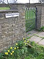 Gate into the cemetery - geograph.org.uk - 1196016.jpg 480 × 640; 168 KB
-
 George V postbox on the B4224 - geograph.org.uk - 1196434.jpg 640 × 480; 162 KB
-
 George V postbox, Common Hill - geograph.org.uk - 1196205.jpg 420 × 640; 150 KB
-
 George V postbox, Nash Farm - geograph.org.uk - 1196454.jpg 480 × 640; 138 KB
-

-
 Grade II listed Stone House, Fownhope - geograph.org.uk - 5132342.jpg 800 × 629; 183 KB
-
 Grade II listed The Rowans, Fownhope - geograph.org.uk - 5132332.jpg 800 × 686; 167 KB
-
 Greenery on a Fownhope house - geograph.org.uk - 5186098.jpg 730 × 800; 124 KB
-
 Hawkers Lane - geograph.org.uk - 1196352.jpg 640 × 480; 187 KB
-
 Hawkers Lane, Fownhope - geograph.org.uk - 6119710.jpg 1,024 × 878; 345 KB
-
 Hedge-lined B4224 NW of Fownhope - geograph.org.uk - 4970809.jpg 800 × 714; 179 KB
-
 Herefordshire countryside - geograph.org.uk - 3077725.jpg 1,200 × 676; 447 KB
-
 High Street, Fownhope - geograph.org.uk - 373666.jpg 640 × 480; 77 KB
-
 Highland Place, 1866 - geograph.org.uk - 4428326.jpg 5,692 × 3,670; 2.37 MB
-
 Highland Place, Fownhope - geograph.org.uk - 4989649.jpg 800 × 606; 125 KB
-
 Hillside footpath - geograph.org.uk - 1196068.jpg 640 × 480; 139 KB
-
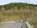 Holme Lacy Bridge - geograph.org.uk - 5215985.jpg 1,024 × 768; 410 KB
-
 Holt monuments, Fownhope churchyard - geograph.org.uk - 5688478.jpg 2,209 × 3,322; 3.69 MB
-
 Hope Springs Farm - geograph.org.uk - 1205443.jpg 640 × 480; 141 KB
-
 Hope Springs, Mordiford - geograph.org.uk - 3724589.jpg 2,592 × 1,944; 1.24 MB
-
 Houses near Rudge End Farm, Woolhope - geograph.org.uk - 4512677.jpg 640 × 427; 71 KB
-
 Houses near Sheershill Common - geograph.org.uk - 1196159.jpg 640 × 480; 164 KB
-

-
 Information stop 3, Butterfly Trail - geograph.org.uk - 1205476.jpg 438 × 640; 69 KB
-
 John A Pritchard ^ Son, Fownhope - geograph.org.uk - 4989625.jpg 800 × 577; 86 KB
-

-

-
 K6 Phone box, GR V postbox, Common Hill - geograph.org.uk - 1196197.jpg 640 × 480; 171 KB
-

-
 King George VI pillarbox, Fownhope - geograph.org.uk - 4970697.jpg 449 × 800; 91 KB
-
 Kingswell Cottage, Fownhope - geograph.org.uk - 4970619.jpg 800 × 687; 169 KB
-
 Lady's smock - geograph.org.uk - 5356720.jpg 1,024 × 768; 416 KB
-
 Land at Upper Buckenhill - geograph.org.uk - 1372156.jpg 640 × 424; 63 KB
-
 Lane and path down to the River Wye - geograph.org.uk - 3021549.jpg 640 × 480; 115 KB
-
 Lane at Rudge End - geograph.org.uk - 4820350.jpg 1,600 × 1,200; 897 KB
-
 Lane in Fownhope - geograph.org.uk - 1309290.jpg 640 × 426; 98 KB
-
 Lane near Common Hill, Herefordshire - geograph.org.uk - 1434431.jpg 640 × 426; 114 KB
-
 Late May greenery east of Fownhope - geograph.org.uk - 6119837.jpg 1,024 × 768; 175 KB
-

-
 Looking east from West Wood - geograph.org.uk - 5837648.jpg 1,024 × 768; 232 KB
-
 Lower Buckenhill - geograph.org.uk - 1372382.jpg 640 × 424; 64 KB
-
 Lower slopes of Common Hill - geograph.org.uk - 722513.jpg 640 × 480; 166 KB
-
 Lucksall Caravan ^ Camping Park - geograph.org.uk - 2961160.jpg 1,350 × 898; 141 KB
-
 Magnificent beech tree off Hawkers Lane - geograph.org.uk - 1196391.jpg 480 × 640; 154 KB
-
 Main road through Fownhope - geograph.org.uk - 5185965.jpg 800 × 761; 133 KB
-
 Manor Farmhouse, Fownhope - geograph.org.uk - 4426241.jpg 6,016 × 4,000; 4.53 MB
-
 Maple Barn and Lime Tree House, Fownhope - geograph.org.uk - 4970845.jpg 800 × 472; 120 KB
-
 Maple House, Fownhope - geograph.org.uk - 4989280.jpg 800 × 643; 98 KB
-
 Mistletoe invasion - geograph.org.uk - 673215.jpg 480 × 640; 160 KB
-
 Modern footbridge, Fownhope - geograph.org.uk - 532469.jpg 640 × 490; 114 KB
-
 Mount Pleasant east of Fownhope - geograph.org.uk - 4972115.jpg 800 × 568; 134 KB
-
 Muddy hillside entrance - geograph.org.uk - 722494.jpg 640 × 480; 169 KB
-

-
 Nash Cottages, Fownhope - geograph.org.uk - 6119409.jpg 1,024 × 944; 309 KB
-
 Nash Farm postbox, Fownhope - geograph.org.uk - 6119732.jpg 1,005 × 1,024; 340 KB
-
 Nash Hill - geograph.org.uk - 1196466.jpg 640 × 442; 128 KB
-
 New Inn Close, Fownhope - geograph.org.uk - 4989183.jpg 800 × 545; 122 KB
-
 New Inn name sign, Fownhope - geograph.org.uk - 4989189.jpg 554 × 640; 90 KB
-
 New Inn, Fownhope - geograph.org.uk - 4989178.jpg 800 × 519; 112 KB
-
 Newish pavement in Fownhope - geograph.org.uk - 4989685.jpg 800 × 600; 133 KB
-

-
 Nover Wood - geograph.org.uk - 1196151.jpg 640 × 457; 120 KB
-
 Oak trees at Leabrink - geograph.org.uk - 3524900.jpg 680 × 1,024; 283 KB
-
 Old cider press in a Fownhope wall - geograph.org.uk - 5185890.jpg 800 × 522; 129 KB
-
 Old School, Fownhope - geograph.org.uk - 5185934.jpg 800 × 673; 166 KB
-
 On Common Hill - geograph.org.uk - 3724657.jpg 2,592 × 1,944; 1.34 MB
-
 On the ridge above Fownhope - geograph.org.uk - 3724637.jpg 2,480 × 1,859; 940 KB
-

-
 One lane meets another - geograph.org.uk - 1196344.jpg 640 × 463; 171 KB
-

-
 Overdine Farm near Fownhope - geograph.org.uk - 1434395.jpg 640 × 426; 76 KB
-

-
 Part of Hope Springs farm - geograph.org.uk - 3068534.jpg 640 × 480; 88 KB
-
 Pasture near Nupend Farm - geograph.org.uk - 3068546.jpg 640 × 480; 97 KB
-
 Path through bluebells - geograph.org.uk - 1310217.jpg 640 × 426; 133 KB
-
 Path through Lea Wood - geograph.org.uk - 2700928.jpg 2,448 × 3,264; 3.38 MB
-
 Plaque on the Tom Spring memorial - geograph.org.uk - 3068682.jpg 640 × 480; 118 KB
-
 Plaque on Ye Olde Parish Stocks - geograph.org.uk - 1196086.jpg 604 × 640; 163 KB
-

-

-
 Public Footpath and track - geograph.org.uk - 3589341.jpg 3,696 × 2,448; 2.34 MB
-
 Quarry off Woolhope Road - geograph.org.uk - 5215835.jpg 1,024 × 768; 583 KB
-

-
 Recently-built houses in Fownhope - geograph.org.uk - 5185838.jpg 800 × 589; 85 KB
-
 Renovations in Fownhope - geograph.org.uk - 4316277.jpg 3,872 × 2,592; 3.59 MB
-

-
 Rider waits at the crossroads - geograph.org.uk - 1205483.jpg 640 × 480; 102 KB
-
 Ridge top path in woods on Common Hill - geograph.org.uk - 3022957.jpg 640 × 480; 133 KB
-
 Ringfield, Fownhope - geograph.org.uk - 4428345.jpg 6,016 × 4,000; 4.65 MB
-
 Rise Farm near Fownhope - geograph.org.uk - 55617.jpg 640 × 426; 103 KB


_-_geograph.org.uk_-_5881832.jpg)


_-_geograph.org.uk_-_5881865.jpg)
_-_geograph.org.uk_-_5881889.jpg)


_-_geograph.org.uk_-_5862744.jpg)