Category:Foss Islands branch line
Jump to navigation
Jump to search
Main Wikipedia article: Foss Islands branch line.
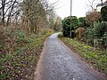
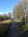
English: Foss Islands branch line, a disused railway line connecting the York–Scarborough line to Layerthorpe, now the Foss Islands Path, a Sustrans shared pedestrian and cycle route.
disused railway line in Yorkshire, England .jpg) | |||||
| Upload media | |||||
| Instance of | |||||
|---|---|---|---|---|---|
| Location |
| ||||
| |||||
Subcategories
This category has the following 4 subcategories, out of 4 total.
H
- Heworth Green bridge, York (3 F)
- Huntington Road bridge, York (5 F)
Y
Media in category "Foss Islands branch line"
The following 11 files are in this category, out of 11 total.
-
 Foss Islands Path Apr24 01.jpg 4,608 × 3,456; 7.27 MB
-
 Foss Islands Path Jan24 01.jpg 4,608 × 3,456; 9.14 MB
-
 Foss Islands Path Jan24 02.jpg 4,608 × 3,456; 8.32 MB
-
 Foss Islands Path Jan24 03.jpg 4,608 × 3,456; 9.13 MB
-
 Foss Islands Path.jpg 4,608 × 3,456; 8.37 MB
-
 Haxby Road Bridge - geograph.org.uk - 484103.jpg 640 × 480; 158 KB
-
 Layerthorpe cycle path - geograph.org.uk - 3833616.jpg 480 × 640; 130 KB
-
 Part of the Foss Way - geograph.org.uk - 3230869.jpg 3,872 × 2,592; 5.54 MB
-
 Rowntree Halt railway station (site), Yorkshire (geograph 3272242).jpg 1,024 × 768; 283 KB
-
 Snow on Sustrans Route 66 - geograph.org.uk - 696684.jpg 640 × 480; 116 KB
-


,_Yorkshire_(geograph_3272242).jpg)