Category:Fornham St Genevieve
Jump to navigation
Jump to search
village and civil parish in Suffolk, United Kingdom  | |||||
| Upload media | |||||
| Instance of | |||||
|---|---|---|---|---|---|
| Location |
| ||||
 | |||||
Subcategories
This category has the following 3 subcategories, out of 3 total.
F
- Fornham Hall (2 F)
Media in category "Fornham St Genevieve"
The following 26 files are in this category, out of 26 total.
-
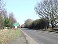
 A134 near to Fornham St Genevieve - geograph.org.uk - 4708939.jpg 640 × 480; 373 KB
-
 Approaching Hengrave Belt - geograph.org.uk - 4709477.jpg 640 × 480; 61 KB
-
 Approaching the B1106 - geograph.org.uk - 4709478.jpg 640 × 480; 75 KB
-
 Crop field, Timworth Carr - geograph.org.uk - 4703153.jpg 640 × 480; 72 KB
-
 Crossroads - geograph.org.uk - 2758099.jpg 1,024 × 768; 270 KB
-
 Crossroads and telephone exchange - geograph.org.uk - 2758103.jpg 1,024 × 768; 207 KB
-
 Field entrance near Little Farm - geograph.org.uk - 4709474.jpg 640 × 480; 67 KB
-
 Fornham Park - geograph.org.uk - 814923.jpg 640 × 426; 91 KB
-
 Fornham Park Gated Entrance - geograph.org.uk - 5772842.jpg 2,104 × 1,184; 565 KB
-
 Frosty morning - geograph.org.uk - 631590.jpg 640 × 427; 84 KB
-
 Great Alder Carr - geograph.org.uk - 814941.jpg 640 × 425; 70 KB
-
 Heading south east, Timworth Carr - geograph.org.uk - 4709479.jpg 640 × 480; 130 KB
-
 Mill Lane - geograph.org.uk - 2758121.jpg 1,024 × 768; 360 KB
-
 Mill Lane near Hengrave - geograph.org.uk - 2784871.jpg 3,648 × 2,736; 1.91 MB
-
 Minor Road - geograph.org.uk - 2758113.jpg 1,024 × 768; 332 KB
-

-
 Northbound A134 - geograph.org.uk - 4708949.jpg 640 × 480; 401 KB
-
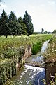 Old lock on River Lark - geograph.org.uk - 20738.jpg 427 × 640; 123 KB
-
 Part of Fornham Park - geograph.org.uk - 2783544.jpg 3,648 × 2,736; 2.76 MB
-
 Part of the B1106 just south of Culford - geograph.org.uk - 2784834.jpg 3,648 × 2,736; 1.89 MB
-
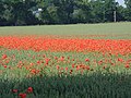 Poppy field at Fornham St Genevieve - geograph.org.uk - 121029.jpg 640 × 480; 132 KB
-
 Private Farm Track - geograph.org.uk - 2758108.jpg 1,024 × 768; 155 KB
-
 Road Junction - geograph.org.uk - 2823803.jpg 1,024 × 768; 344 KB
-
 The A143 looking north - geograph.org.uk - 2823810.jpg 1,024 × 768; 263 KB
-
 Village sign - geograph.org.uk - 870049.jpg 480 × 640; 91 KB
-
 Westward Down Mill Lane - geograph.org.uk - 1433483.jpg 640 × 480; 130 KB


