Category:Footpaths in Falkirk council area
Jump to navigation
Jump to search
Media in category "Footpaths in Falkirk council area"
The following 59 files are in this category, out of 59 total.
-
 Bonnybridge by the Back Door - geograph.org.uk - 1449763.jpg 640 × 480; 96 KB
-
-
 Coastal Path, Blackness Bay - geograph.org.uk - 1246067.jpg 640 × 480; 110 KB
-
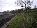
 Coastal pathway to Bo'ness - geograph.org.uk - 529265.jpg 640 × 421; 78 KB
-

-
 Footpath alongside Winchester Avenue - geograph.org.uk - 1589915.jpg 640 × 480; 126 KB
-
 Footpath beside the River Carron - geograph.org.uk - 1770000.jpg 640 × 480; 152 KB
-
 Footpath beside the River Carron - geograph.org.uk - 1770130.jpg 640 × 480; 152 KB
-
 Footpath from Torwood - geograph.org.uk - 1588054.jpg 640 × 480; 150 KB
-
 Footpath from Torwood - geograph.org.uk - 1588133.jpg 640 × 480; 110 KB
-
 Footpath in Chacefield Wood - geograph.org.uk - 930476.jpg 640 × 480; 148 KB
-
 Footpath junction - geograph.org.uk - 1587993.jpg 640 × 480; 135 KB
-
 Footpath meeting Plean Road - geograph.org.uk - 1591145.jpg 640 × 480; 116 KB
-
 Footpath meets Plean Road - geograph.org.uk - 1569191.jpg 640 × 480; 101 KB
-
 Footpath off Newton Rd, Skinflats - geograph.org.uk - 987539.jpg 640 × 480; 134 KB
-
 Footpath to Bo'ness - geograph.org.uk - 1092361.jpg 640 × 480; 79 KB
-
 Footpath to Broad Street - geograph.org.uk - 1590204.jpg 640 × 480; 150 KB
-
 Footpath to Denovan - geograph.org.uk - 1747673.jpg 640 × 480; 156 KB
-
 Footpath to Denovan - geograph.org.uk - 1747727.jpg 640 × 480; 153 KB
-
 Footpath to Denovan - geograph.org.uk - 1747744.jpg 640 × 480; 157 KB
-
 Footpath to Denovan - geograph.org.uk - 1747837.jpg 640 × 480; 101 KB
-
 Footpath to Denovan Road - geograph.org.uk - 1589873.jpg 640 × 480; 80 KB
-
 Footpath to Larbert - geograph.org.uk - 1747667.jpg 640 × 480; 160 KB
-
 Footpath to Larbert - geograph.org.uk - 1747730.jpg 640 × 480; 156 KB
-
 Footpath to Larbert - geograph.org.uk - 1747839.jpg 640 × 457; 101 KB
-
 Footpath to Larbert - geograph.org.uk - 1748007.jpg 640 × 457; 88 KB
-
 Footpath to Larbert - geograph.org.uk - 1748021.jpg 640 × 427; 112 KB
-
 Footpath to Plean Road - geograph.org.uk - 1569109.jpg 640 × 480; 99 KB
-
 Footpath to Plean Road - geograph.org.uk - 1569152.jpg 640 × 480; 78 KB
-
 Footpath to Plean Road - geograph.org.uk - 1569153.jpg 640 × 457; 111 KB
-
 Footpath to Plean Road - geograph.org.uk - 1587941.jpg 640 × 480; 91 KB
-
 Footpath to Torwood - geograph.org.uk - 1588001.jpg 640 × 480; 128 KB
-
 Footpath to Torwood - geograph.org.uk - 1588069.jpg 640 × 480; 140 KB
-
 Footpath to Torwood - geograph.org.uk - 1588087.jpg 640 × 480; 137 KB
-
 Footpath to Torwood - geograph.org.uk - 1588145.jpg 640 × 480; 78 KB
-
 Footpath to Torwood - geograph.org.uk - 1747723.jpg 640 × 427; 95 KB
-
 Footpath to Winchester Avenue - geograph.org.uk - 1589917.jpg 640 × 480; 142 KB
-

-
 Footpath, Glen Village - geograph.org.uk - 1462166.jpg 640 × 480; 98 KB
-
 From Falkirk wheel to Roughcastle woods - geograph.org.uk - 1133924.jpg 640 × 512; 164 KB
-
 Gate to footpath, Barleyside - geograph.org.uk - 986855.jpg 640 × 480; 85 KB
-
 Junction of footpath with the A706 - geograph.org.uk - 1092363.jpg 640 × 480; 135 KB
-
 Looking to junction of footpath and road - geograph.org.uk - 1587928.jpg 640 × 480; 121 KB
-
 Old Railway Line Path - geograph.org.uk - 930460.jpg 640 × 480; 90 KB
-

-
 Path near Rough Castle - geograph.org.uk - 1449011.jpg 640 × 480; 75 KB
-
 Path to B803 - geograph.org.uk - 184180.jpg 480 × 640; 148 KB
-
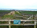
 Path to Easter Whin - geograph.org.uk - 1327313.jpg 640 × 480; 108 KB
-
 Path to Rough Castle - geograph.org.uk - 1460045.jpg 640 × 480; 106 KB
-
 Path, Limerigg - geograph.org.uk - 1525962.jpg 640 × 480; 118 KB
-
 Path, near Maddiston - geograph.org.uk - 1188246.jpg 640 × 480; 122 KB
-
 Plean Road, start of a footpath - geograph.org.uk - 1587924.jpg 640 × 480; 75 KB
-
 Public footpath West Lothian Golf course - geograph.org.uk - 1092356.jpg 640 × 480; 145 KB
-
 Railway bridge at Denny - geograph.org.uk - 948004.jpg 2,592 × 1,944; 3.34 MB
-
 Railway trackbed near Slamannan - geograph.org.uk - 1593919.jpg 640 × 480; 177 KB
-
 River Avon path - geograph.org.uk - 243526.jpg 480 × 640; 125 KB
-
 Shore path to Bo'ness - geograph.org.uk - 82875.jpg 480 × 640; 147 KB
-
 Starks Brae - geograph.org.uk - 820968.jpg 640 × 480; 125 KB
-


_-_geograph.org.uk_-_930447.jpg)


