Category:Floods in Gloucestershire
Jump to navigation
Jump to search
Ceremonial counties of England: Cambridgeshire · Cornwall · Derbyshire · Devon · Dorset · East Riding of Yorkshire · Gloucestershire · Greater London · Hampshire · Lancashire · Leicestershire · Lincolnshire · Norfolk · North Yorkshire · Northamptonshire · Nottinghamshire · Oxfordshire · Shropshire · Somerset · South Yorkshire · Staffordshire · Surrey · Warwickshire · West Midlands · West Sussex · West Yorkshire · Worcestershire
City-counties:
Former historic counties:
Other former counties:
City-counties:
Former historic counties:
Other former counties:
Subcategories
This category has the following 2 subcategories, out of 2 total.
G
- Flooding in Gloucester (10 F)
T
- Floods in Tewkesbury (25 F)
Media in category "Floods in Gloucestershire"
The following 22 files are in this category, out of 22 total.
-
 A417 towards Ledbury (showing roadsign) - geograph.org.uk - 503016.jpg 640 × 482; 113 KB
-
 A417 towards Ledbury - geograph.org.uk - 503012.jpg 640 × 482; 88 KB
-
 Bourton-in-the-Water - geograph.org.uk - 505532.jpg 640 × 480; 105 KB
-
 Bridges over the Windrush - geograph.org.uk - 505533.jpg 640 × 480; 134 KB
-
 Broadboard meadows sunset, 3 (geograph 3248096).jpg 1,200 × 823; 422 KB
-
 Fircroft Road, Longford - geograph.org.uk - 502926.jpg 640 × 482; 97 KB
-
 Flooded ford - geograph.org.uk - 505530.jpg 640 × 480; 102 KB
-
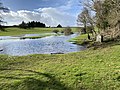
 Flooded meadows at Apperley - geograph.org.uk - 644801.jpg 640 × 413; 64 KB
-
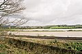
 Flooded Twyning Meadow - geograph.org.uk - 318662.jpg 426 × 640; 83 KB
-
-

-
 Meadvale Close, Longford - geograph.org.uk - 502929.jpg 640 × 482; 107 KB
-
 Playing fields and recreation area - geograph.org.uk - 502909.jpg 640 × 482; 91 KB
-
 Plock Court flooded - geograph.org.uk - 504216.jpg 640 × 480; 55 KB
-
 River Severn in flood at the Gloucester Lock.jpg 4,592 × 3,448; 2.6 MB
-
 River Windrush - geograph.org.uk - 505521.jpg 640 × 480; 92 KB
-
 Sandhurst Lane, Walham - geograph.org.uk - 502893.jpg 640 × 482; 99 KB
-
 Thames Head In Flood.jpg 4,032 × 3,024; 7.58 MB
-
 The entrance to Gloucester Docks - geograph.org.uk - 2028.jpg 640 × 480; 45 KB
-
 The M5 motorway across Twyning Meadow - geograph.org.uk - 319350.jpg 640 × 426; 94 KB
-
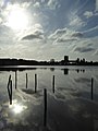 The sun reflected in floodwater on The Ham (geograph 4827000).jpg 768 × 1,024; 118 KB
-
 Floodwater on Twyning Meadow - geograph.org.uk - 319333.jpg 640 × 426; 67 KB
_-_geograph.org.uk_-_503016.jpg)


.jpg)


_-_geograph.org.uk_-_502922.jpg)


.jpg)
