Category:Fleur (ship, 1942)
Jump to navigation
Jump to search
Media in category "Fleur (ship, 1942)"
The following 19 files are in this category, out of 19 total.
-
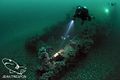
 Ascending the shotline from the Fleur.jpg 1,280 × 960; 521 KB
-
 Bow gantry close up.jpg 1,280 × 960; 719 KB
-
 Bow gantry roller enh.jpg 1,280 × 960; 870 KB
-
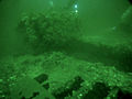 Divers over Fleur quarterdeck.jpg 1,280 × 960; 676 KB
-
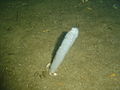 Feathery sea pen at the Fleur wreck DSC00532.JPG 2,048 × 1,536; 1.39 MB
-
 Fleur (2).jpg 500 × 332; 38 KB
-
 Fleur (3).jpg 500 × 332; 41 KB
-
 Fleur (4).jpg 500 × 332; 42 KB
-
 Fleur (5).jpg 500 × 332; 40 KB
-
 Fleur aft superstructure port side.jpg 1,280 × 960; 711 KB
-
 Fleur Barbrake.jpg 638 × 308; 66 KB
-
 Fleur forward end of superstructure port.jpg 1,280 × 960; 609 KB
-
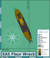 Fleur map.png 2,000 × 2,278; 483 KB
-
 Fleur quarterdeck.jpg 1,280 × 960; 607 KB
-
 Fleur superstructure from forward.jpg 1,280 × 960; 633 KB
-
 Klipfish and mussels on the Fleur wreck DSC02926.JPG 2,048 × 1,536; 1.39 MB
-
 Mussels, urchins and strawberry anemones on the Fleur DSC00542.jpg 2,048 × 1,536; 1.44 MB
-
 SAS Fleur banner 1.jpg 2,100 × 300; 781 KB
-
 Walking anemone eating sea fan on the Fleur wreck DSC02928.JPG 2,048 × 1,536; 1.45 MB


.jpg)
.jpg)
.jpg)
.jpg)


