Category:Fledborough
Jump to navigation
Jump to search

hamlet and civil parish in Nottinghamshire, UK | |||||
| Upload media | |||||
| Instance of | |||||
|---|---|---|---|---|---|
| Location | Bassetlaw, Nottinghamshire, East Midlands, England | ||||
 | |||||
Subcategories
This category has the following 3 subcategories, out of 3 total.
F
- Fledborough railway station (15 F)
- Fledborough Viaduct (32 F)
G
Media in category "Fledborough"
The following 195 files are in this category, out of 195 total.
-

-

-

-
 Bank of the River Trent - geograph.org.uk - 3513042.jpg 640 × 480; 69 KB
-
 Bend in the road - geograph.org.uk - 4628449.jpg 3,696 × 2,448; 2.22 MB
-
 Beneath Fledborough bridge - geograph.org.uk - 2587532.jpg 4,000 × 3,000; 2.84 MB
-
 Beneath the Fledborough Viaduct - geograph.org.uk - 4945601.jpg 800 × 654; 122 KB
-
 Bleak landscape - geograph.org.uk - 4291145.jpg 1,024 × 768; 129 KB
-
 Boat on the River Trent, Fledborough (geograph 4945643).jpg 800 × 489; 85 KB
-
 Boating up the River Trent - geograph.org.uk - 3043066.jpg 1,280 × 853; 106 KB
-
 Bridleway near Goodhouses Farm - geograph.org.uk - 3497496.jpg 640 × 427; 107 KB
-
 Bridleway to Ragnall - geograph.org.uk - 2660856.jpg 1,024 × 768; 159 KB
-
 Bridleway towards Tuxford - geograph.org.uk - 5554223.jpg 1,280 × 960; 317 KB
-
 Crabtree Lane - geograph.org.uk - 1889002.jpg 640 × 426; 93 KB
-
 Crabtree Lane - geograph.org.uk - 1895135.jpg 640 × 426; 100 KB
-
 Crabtree Lane - geograph.org.uk - 1895138.jpg 640 × 426; 86 KB
-
 Crabtree Lane - geograph.org.uk - 1895142.jpg 640 × 426; 75 KB
-
 Crabtree Lane - geograph.org.uk - 2132227.jpg 640 × 427; 91 KB
-
 Crabtree Lane - geograph.org.uk - 2132236.jpg 640 × 427; 87 KB
-
 Crabtree Lane - geograph.org.uk - 3520280.jpg 640 × 427; 117 KB
-
 Crop field near Ragnall - geograph.org.uk - 4629236.jpg 4,928 × 3,264; 5.34 MB
-
 Cycle path, Fledborough Viaduct - geograph.org.uk - 3004261.jpg 640 × 480; 93 KB
-
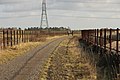
 Cycle track on former railway - geograph.org.uk - 3512997.jpg 640 × 480; 85 KB
-
 Cycle track on former railway - geograph.org.uk - 3513033.jpg 640 × 480; 89 KB
-
 Demolition site - geograph.org.uk - 3044521.jpg 640 × 427; 96 KB
-

-
 Entrance to Fledborough - geograph.org.uk - 3579707.jpg 640 × 482; 70 KB
-
 Entrance to Top Farm - geograph.org.uk - 4243846.jpg 800 × 533; 108 KB
-
 Entrance to Top Farm - geograph.org.uk - 4628436.jpg 3,696 × 2,448; 2.22 MB
-
 Ewe and lambs at Fledborough Holme - geograph.org.uk - 4945619.jpg 800 × 667; 177 KB
-
 Ewes and lambs next to the River Trent - geograph.org.uk - 4945623.jpg 800 × 547; 120 KB
-
 Far Road - geograph.org.uk - 3520296.jpg 640 × 427; 81 KB
-

-
 Farm building, Gibraltar Farm - geograph.org.uk - 2691532.jpg 640 × 480; 74 KB
-
 Farmland off Far Road - geograph.org.uk - 2691545.jpg 640 × 480; 50 KB
-
 Farmland off Green Lane - geograph.org.uk - 2691501.jpg 640 × 480; 57 KB
-
 Farmland west of Fledborough - geograph.org.uk - 3512812.jpg 640 × 480; 92 KB
-
 Farmland, Fledborough - geograph.org.uk - 3513031.jpg 640 × 480; 89 KB
-
 Farmland, Fledborough Farm - geograph.org.uk - 3512825.jpg 640 × 480; 74 KB
-
 Farmland, Fledborough Farm - geograph.org.uk - 3512994.jpg 640 × 480; 89 KB
-
 Field footpath - geograph.org.uk - 5554221.jpg 960 × 1,280; 507 KB
-
 Field near Goodhouses Farm - geograph.org.uk - 5198227.jpg 1,024 × 768; 179 KB
-
 Fields near Wells Farm - geograph.org.uk - 4627069.jpg 3,696 × 2,448; 2.32 MB
-
 Fledborough - geograph.org.uk - 1340428.jpg 640 × 426; 57 KB
-
 Fledborough - geograph.org.uk - 2944718.jpg 640 × 427; 73 KB
-
 Fledborough Beck - geograph.org.uk - 3512811.jpg 640 × 480; 122 KB
-
 Fledborough Beck - geograph.org.uk - 4240831.jpg 4,000 × 2,248; 4.62 MB
-
 Fledborough Beck - geograph.org.uk - 4242088.jpg 3,942 × 2,138; 4.83 MB
-
 Fledborough Beck - geograph.org.uk - 4950032.jpg 800 × 559; 152 KB
-
 Fledborough Farm - geograph.org.uk - 2480478.jpg 640 × 427; 71 KB
-
 Fledborough farmland - geograph.org.uk - 4243844.jpg 800 × 533; 76 KB
-
 Fledborough farmland. - geograph.org.uk - 4461686.jpg 640 × 480; 57 KB
-
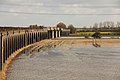
 Fledborough floodbank - geograph.org.uk - 3842523.jpg 800 × 533; 103 KB
-
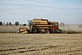
 Fledborough harvest - geograph.org.uk - 1450958.jpg 640 × 426; 104 KB
-
 Fledborough harvest - geograph.org.uk - 1450966.jpg 640 × 426; 75 KB
-
 Fledborough Holme - geograph.org.uk - 1888851.jpg 640 × 426; 94 KB
-
 Fledborough Holme - geograph.org.uk - 4516230.jpg 1,024 × 683; 199 KB
-
 Fledborough postbox - geograph.org.uk - 1450975.jpg 640 × 426; 95 KB
-

-
 Fledborough station - geograph.org.uk - 4242111.jpg 4,000 × 2,248; 6.69 MB
-
 Fledborough viaduct - geograph.org.uk - 3519888.jpg 640 × 427; 194 KB
-
 Fledborough Viaduct - geograph.org.uk - 3792597.jpg 800 × 533; 133 KB
-
 Fledborough Viaduct - geograph.org.uk - 3842371.jpg 800 × 533; 112 KB
-
 Fledborough Viaduct - geograph.org.uk - 3842396.jpg 800 × 533; 118 KB
-
 Fledborough Viaduct - geograph.org.uk - 3842401.jpg 800 × 533; 152 KB
-
 Fledborough Viaduct - geograph.org.uk - 4243852.jpg 800 × 534; 114 KB
-
 Fledborough Viaduct - geograph.org.uk - 4516224.jpg 1,024 × 683; 197 KB
-
 Fledborough Viaduct - geograph.org.uk - 4823972.jpg 1,024 × 672; 219 KB
-
 Fledborough Viaduct - geograph.org.uk - 4823982.jpg 1,024 × 683; 279 KB
-
 Fledborough Viaduct - geograph.org.uk - 5212896.jpg 3,696 × 2,448; 2.21 MB
-
 Fledborough viaduct ahead - geograph.org.uk - 4728448.jpg 1,024 × 768; 238 KB
-

-

-
 Flood bank - geograph.org.uk - 1897982.jpg 640 × 426; 93 KB
-
 Footpath and bridleway meet Green Lane - geograph.org.uk - 2663295.jpg 1,024 × 768; 187 KB
-
 Footpath towards the Trent - geograph.org.uk - 1588786.jpg 640 × 427; 107 KB
-
 Footpath towards Top Farm - geograph.org.uk - 2691543.jpg 640 × 480; 112 KB
-
 Gibraltar - geograph.org.uk - 5554210.jpg 1,280 × 960; 304 KB
-
 Gibraltar Farm - geograph.org.uk - 2691529.jpg 640 × 480; 39 KB
-
 Gibraltar pond - geograph.org.uk - 1186720.jpg 640 × 369; 47 KB
-
 Gibraltar view - geograph.org.uk - 3520329.jpg 640 × 427; 128 KB
-
 Great Mullein - geograph.org.uk - 2480357.jpg 427 × 640; 72 KB
-
 Green Lane - A track - geograph.org.uk - 4627055.jpg 3,696 × 2,448; 2.34 MB
-
 Green Lane - geograph.org.uk - 2663285.jpg 1,024 × 768; 279 KB
-
 Green Lane - geograph.org.uk - 3497632.jpg 640 × 427; 166 KB
-
 Green Lane, Darlton - geograph.org.uk - 5554215.jpg 1,280 × 960; 517 KB
-
 Hedgerow and field - geograph.org.uk - 2691508.jpg 640 × 480; 91 KB
-
 Is that a rhino^ - geograph.org.uk - 654614.jpg 640 × 338; 67 KB
-
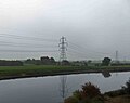
 Landscape with power lines - geograph.org.uk - 3004228.jpg 640 × 480; 55 KB
-
 Lane to Goodhouses Farm - geograph.org.uk - 3497639.jpg 640 × 427; 119 KB
-
 Lane to Woodview - geograph.org.uk - 3497642.jpg 640 × 427; 122 KB
-
 Long Row Cottages - geograph.org.uk - 5242307.jpg 1,024 × 683; 175 KB
-
 Long Row Cottages in Fledborough - geograph.org.uk - 4950038.jpg 800 × 631; 148 KB
-
 Longest Day - geograph.org.uk - 1926838.jpg 640 × 426; 45 KB
-
 Longest Day - geograph.org.uk - 1926847.jpg 640 × 426; 41 KB
-
 Main Street heading south - geograph.org.uk - 3512814.jpg 640 × 480; 69 KB
-
 Marnham farmland - geograph.org.uk - 2132256.jpg 640 × 427; 95 KB
-
 Meanders on the River Trent - geograph.org.uk - 3004338.jpg 640 × 480; 71 KB
-
 Megawatt Valley - geograph.org.uk - 2480482.jpg 640 × 427; 57 KB
-
 Narrowboat on the Trent - geograph.org.uk - 3004324.jpg 640 × 480; 69 KB
-
 NCN route 647 - geograph.org.uk - 1895116.jpg 640 × 426; 116 KB
-
 No through road - geograph.org.uk - 1588805.jpg 640 × 427; 72 KB
-

-
 Oilseed Rape at Fledborough - geograph.org.uk - 2944714.jpg 640 × 427; 110 KB
-
 Oilseed rape near Fledborough - geograph.org.uk - 3492196.jpg 640 × 427; 100 KB
-
 Old course of the River Trent - geograph.org.uk - 4141827.jpg 1,280 × 819; 255 KB
-
 Old course of the River Trent - geograph.org.uk - 4141836.jpg 1,280 × 960; 406 KB
-
 Old course of the Trent - geograph.org.uk - 3047623.jpg 1,024 × 768; 181 KB
-
 Old River Trent - geograph.org.uk - 3044753.jpg 640 × 427; 106 KB
-
 On the Fledborough Viaduct - geograph.org.uk - 4950103.jpg 800 × 519; 114 KB
-
 Partially ploughed field - geograph.org.uk - 5554225.jpg 1,280 × 960; 361 KB
-

-
 Ploughed field by Ragnall road - geograph.org.uk - 1588806.jpg 640 × 427; 85 KB
-
 Postbox on lane to Fledborough - geograph.org.uk - 1171035.jpg 640 × 238; 27 KB
-
 Power line works - geograph.org.uk - 3491357.jpg 640 × 427; 53 KB
-
 Public Footpath off Far Road - geograph.org.uk - 4627214.jpg 4,948 × 3,280; 4.36 MB
-
 Pumping station on Fledborough Beck - geograph.org.uk - 4947281.jpg 800 × 509; 128 KB
-
-
 River Trent - geograph.org.uk - 3276734.jpg 640 × 427; 81 KB
-
 River Trent at Fledborough - geograph.org.uk - 3160643.jpg 640 × 382; 162 KB
-
 River Trent from Fledborough Viaduct - geograph.org.uk - 4240847.jpg 2,787 × 2,236; 3.44 MB
-
 River Trent in spate - geograph.org.uk - 3842387.jpg 800 × 533; 78 KB
-
 River Trent in spate - geograph.org.uk - 3842480.jpg 800 × 533; 87 KB
-
 River Trent near North Clifton - geograph.org.uk - 4242223.jpg 3,992 × 2,234; 6.15 MB
-
 River Trent past Fledborough - geograph.org.uk - 3160644.jpg 640 × 427; 132 KB
-
 Road at Station Cottages, Fledborough - geograph.org.uk - 4941874.jpg 692 × 800; 207 KB
-
 Road junction leading to Fledborough - geograph.org.uk - 4240836.jpg 3,932 × 2,118; 5.1 MB
-
 Road towards Low Marnham - geograph.org.uk - 3512827.jpg 640 × 480; 56 KB
-
 Route 647 - geograph.org.uk - 1895174.jpg 640 × 426; 114 KB
-
 Route 647 - geograph.org.uk - 3321418.jpg 640 × 427; 149 KB
-
 Route 647 - geograph.org.uk - 3321532.jpg 640 × 427; 80 KB
-
 Route 647 - geograph.org.uk - 3491349.jpg 640 × 427; 107 KB
-
 Route 647 - geograph.org.uk - 3491352.jpg 640 × 427; 137 KB
-
 Route 647 - geograph.org.uk - 3492201.jpg 640 × 427; 106 KB
-
 Running the gauntlet - geograph.org.uk - 2480344.jpg 640 × 427; 144 KB
-
 Sheep at Fledborough Holme - geograph.org.uk - 4945626.jpg 800 × 570; 118 KB
-
 Sheep near Fledborough - geograph.org.uk - 4947268.jpg 800 × 581; 131 KB
-
 Site of Fledborough railway station - geograph.org.uk - 4243847.jpg 800 × 533; 162 KB
-
 Site of Fledborough Station - geograph.org.uk - 4141848.jpg 994 × 1,280; 324 KB
-
 Station Cottages - geograph.org.uk - 1888988.jpg 640 × 426; 101 KB
-
 Station Cottages, Fledborough - geograph.org.uk - 4141851.jpg 1,280 × 960; 313 KB
-
 Station Cottages, Fledborough - geograph.org.uk - 4242100.jpg 4,000 × 2,248; 4.82 MB
-
 Station House - geograph.org.uk - 1895121.jpg 640 × 426; 90 KB
-
 Station Road - geograph.org.uk - 2776334.jpg 640 × 427; 73 KB
-
 Stile and Footpath entrance - geograph.org.uk - 4628460.jpg 3,696 × 2,448; 2.22 MB
-

-
 Sunlight after the rain - geograph.org.uk - 4141820.jpg 1,280 × 1,280; 681 KB
-

-
 Swan in the Fledborough Beck - geograph.org.uk - 4947258.jpg 800 × 570; 149 KB
-
 The approach to Fledborough Station - geograph.org.uk - 4141842.jpg 1,280 × 870; 316 KB
-
 The Fledborough Viaduct - geograph.org.uk - 4945599.jpg 800 × 576; 102 KB
-
 The Fledborough Viaduct - geograph.org.uk - 4950093.jpg 800 × 590; 123 KB
-
 The Fledborough viaduct and bridge - geograph.org.uk - 2587502.jpg 4,000 × 3,000; 2.93 MB
-
 The former Marnham power station site - geograph.org.uk - 4728444.jpg 1,024 × 768; 195 KB
-
 The former station platform at Fledborough - geograph.org.uk - 4728434.jpg 1,024 × 768; 315 KB
-
 The magnificent Trent (Fledborough) viaduct - geograph.org.uk - 4728450.jpg 1,024 × 768; 154 KB
-

-
 The road to Gibraltar - geograph.org.uk - 4461696.jpg 640 × 480; 55 KB
-

-
 The Trent Viaduct - geograph.org.uk - 3513038.jpg 1,024 × 730; 177 KB
-

-
 This was High Marnham Power Station - geograph.org.uk - 4243851.jpg 800 × 533; 117 KB
-
 Top Farm lane - geograph.org.uk - 4461689.jpg 640 × 480; 64 KB
-
 Track to Wells Farm - geograph.org.uk - 4627060.jpg 3,696 × 2,448; 2.28 MB
-
 Track to Woodcoates - geograph.org.uk - 2663271.jpg 1,024 × 768; 161 KB
-
 Track towards Fledborough Holme - geograph.org.uk - 3512821.jpg 640 × 480; 85 KB
-
 Tree near the Fledborough Viaduct - geograph.org.uk - 4945592.jpg 800 × 600; 159 KB
-
 Trent Flood - geograph.org.uk - 4824001.jpg 1,024 × 683; 197 KB
-
 Trent floodbank - geograph.org.uk - 3276411.jpg 640 × 427; 86 KB
-
 Trent floodbank - geograph.org.uk - 3320509.jpg 640 × 427; 94 KB
-
 Trent floodplain - geograph.org.uk - 3276414.jpg 640 × 427; 77 KB
-
 Trent floodplain - geograph.org.uk - 3842495.jpg 800 × 533; 112 KB
-
 Trent floodplain - geograph.org.uk - 3842501.jpg 800 × 533; 124 KB
-
 Trent floodplain - geograph.org.uk - 3842511.jpg 800 × 533; 100 KB
-
 Trent floods - geograph.org.uk - 3244859.jpg 640 × 427; 43 KB
-
 Trent floods - geograph.org.uk - 3244903.jpg 640 × 427; 77 KB
-
 Trent floods - geograph.org.uk - 3244905.jpg 640 × 427; 55 KB
-
 Trent floods - geograph.org.uk - 3276258.jpg 640 × 429; 107 KB
-
 Trent floodwater - geograph.org.uk - 4824561.jpg 1,024 × 683; 210 KB
-
 Trent floodwater - geograph.org.uk - 4824576.jpg 1,024 × 683; 254 KB
-
 Trent Lane - geograph.org.uk - 3044758.jpg 640 × 427; 129 KB
-
 Trent Valley pylons - geograph.org.uk - 3276722.jpg 640 × 432; 84 KB
-
 Trent Viaduct - geograph.org.uk - 3160653.jpg 640 × 386; 152 KB
-
 Two lambs at Fledborough Holme - geograph.org.uk - 4945620.jpg 800 × 488; 95 KB
-
 View from end of the road - geograph.org.uk - 1588797.jpg 640 × 427; 102 KB
-
 View to Fledborough - geograph.org.uk - 3828743.jpg 800 × 533; 117 KB
-
 View to Wells Farm - geograph.org.uk - 2663304.jpg 1,024 × 768; 143 KB
-
 View towards Feldborough Farm - geograph.org.uk - 3047611.jpg 1,024 × 768; 161 KB
-
 View towards Fledborough Viaduct - geograph.org.uk - 4141829.jpg 1,280 × 960; 414 KB
-
 View towards Lodge Farm - geograph.org.uk - 5199044.jpg 1,024 × 768; 165 KB
-
 View towards North Farm and Top Farm - geograph.org.uk - 3047616.jpg 1,024 × 768; 160 KB
-
 View towards the cooling towers at High Marnham - geograph.org.uk - 2663277.jpg 1,024 × 768; 199 KB
-
 Wells Farm - geograph.org.uk - 3520325.jpg 640 × 427; 104 KB
-
 Winter sunset over the Trent - geograph.org.uk - 5212894.jpg 4,948 × 3,280; 6.06 MB
-
 Fledborough farmland - geograph.org.uk - 371318.jpg 640 × 427; 75 KB


.jpg)


_viaduct_-_geograph.org.uk_-_4728450.jpg)


