Category:Flagg
Jump to navigation
Jump to search
English: Flagg is a small Peak District village, set in the Derbyshire Dales, halfway between the small market town of Bakewell and the spa town of Buxton, in the area officially known as "The White Peak". 1000 feet above sea level, Flagg is recorded in the Domesday Book as "Flagun", and is believed to have originally been a Viking settlement engaged primarily in lead mining, the evidence of which can still be seen today with many spoil heaps and disused mine shafts in the area.
village and civil parish in Derbyshire Dales district, Derbyshire, England  | |||||
| Upload media | |||||
| Instance of | |||||
|---|---|---|---|---|---|
| Location | Derbyshire Dales, Derbyshire, East Midlands, England | ||||
 | |||||
Subcategories
This category has the following 2 subcategories, out of 2 total.
B
- Bull i' th' Thorn (14 F)
O
Media in category "Flagg"
The following 138 files are in this category, out of 138 total.
-
 'Railway' Bridge over High Peak Trail - geograph.org.uk - 106280.jpg 640 × 480; 113 KB
-
 All ears in Flagg - geograph.org.uk - 3245279.jpg 3,318 × 2,674; 3.52 MB
-
 Approaching Flagg - geograph.org.uk - 2561015.jpg 1,024 × 768; 203 KB
-
 Approaching Flagg from the west - geograph.org.uk - 3665249.jpg 3,559 × 2,542; 1.94 MB
-
 At the crossroads near Nether Wheal - geograph.org.uk - 3496978.jpg 2,662 × 3,327; 1.86 MB
-
 Barns on Stonebench Lane - geograph.org.uk - 5453547.jpg 640 × 427; 66 KB
-
 Blue sky at Flagg - geograph.org.uk - 3899800.jpg 4,912 × 3,264; 4.06 MB
-
 Bus shelter in Flagg - geograph.org.uk - 4592238.jpg 640 × 480; 105 KB
-
 Bus Shelter, Phone Box and Postbox - geograph.org.uk - 2483652.jpg 640 × 427; 239 KB
-
 Capped Mine Shaft near High Stool Farm - geograph.org.uk - 2552701.jpg 3,296 × 2,472; 1.12 MB
-
 Caravanning in Derbyshire - geograph.org.uk - 3665232.jpg 3,510 × 2,507; 1.9 MB
-
 Cattle Near Pomeroy - geograph.org.uk - 5447363.jpg 640 × 471; 62 KB
-
 Copse in Flagg - geograph.org.uk - 5453527.jpg 640 × 427; 77 KB
-
 Cottages at Town Head - geograph.org.uk - 2561003.jpg 1,024 × 768; 257 KB
-
 Country lane from Flagg. - geograph.org.uk - 5301499.jpg 640 × 427; 75 KB
-
 Crossroads - geograph.org.uk - 5455658.jpg 640 × 427; 48 KB
-
 Crossroads near Town Head - geograph.org.uk - 5452954.jpg 640 × 427; 72 KB
-
 Crumbling Dry Stone Wall, Flagg Lane - geograph.org.uk - 5455603.jpg 640 × 427; 85 KB
-
 Cut meadows above Hubber Dale, Flagg - geograph.org.uk - 3003020.jpg 4,608 × 3,072; 3.2 MB
-
 Derbyshire UK parish map highlighting Flagg.svg 888 × 1,308; 2.34 MB
-
 Donkey Sanctuary stables - geograph.org.uk - 1759291.jpg 640 × 480; 51 KB
-
 Donkeys by a wall - geograph.org.uk - 1759286.jpg 640 × 479; 52 KB
-
 Drinking trough in a wall - geograph.org.uk - 1759711.jpg 640 × 480; 58 KB
-
 Electrical Substation near Flagg - geograph.org.uk - 5460847.jpg 640 × 427; 70 KB
-
 Entrance to High Stool Farm, Flagg - geograph.org.uk - 1759847.jpg 640 × 480; 66 KB
-
 Farm buildings at Hobson Croft, Flagg - geograph.org.uk - 2613385.jpg 1,024 × 696; 381 KB
-
 Farmland north of Flagg - geograph.org.uk - 1759765.jpg 640 × 480; 56 KB
-
 Farmland north of Stonebench Lane - geograph.org.uk - 3175859.jpg 1,024 × 768; 381 KB
-
 Field Gateway - geograph.org.uk - 5460837.jpg 640 × 427; 98 KB
-
 Field System off the Pippenwell Road - geograph.org.uk - 1948825.jpg 640 × 427; 244 KB
-
 Fields at Moor Lane - geograph.org.uk - 5453806.jpg 640 × 427; 82 KB
-
 Fields Near Pomeroy - geograph.org.uk - 5447358.jpg 640 × 427; 61 KB
-
 Fields on Flagg Moor - geograph.org.uk - 2613391.jpg 1,024 × 669; 345 KB
-
 Flagg , Derbyshire - geograph.org.uk - 3663880.jpg 1,024 × 768; 211 KB
-
 Flagg - Main Road - geograph.org.uk - 1368967.jpg 640 × 480; 55 KB
-
 Flagg Lane - geograph.org.uk - 2200885.jpg 3,296 × 2,472; 1.06 MB
-
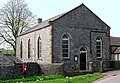
 Flagg Methodist Chapel - geograph.org.uk - 165068.jpg 640 × 480; 133 KB
-
 Flagg Methodist Chapel - photoshopped 165068.jpg 578 × 398; 279 KB
-
 Flagg Methodist Chapel and Nursery School - geograph.org.uk - 5361249.jpg 1,600 × 1,200; 449 KB
-
 Flagg turn-off, January morning - geograph.org.uk - 2216097.jpg 1,024 × 640; 110 KB
-
 Flagg village hall - geograph.org.uk - 2613405.jpg 1,024 × 732; 398 KB
-
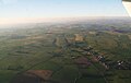 Flagg, aerial 2015 - geograph.org.uk - 4697302.jpg 640 × 406; 39 KB
-
 Flagg, aerial 2015 - geograph.org.uk - 4697307.jpg 640 × 416; 53 KB
-
 Flagg, aerial 2015 - geograph.org.uk - 4697311.jpg 640 × 407; 54 KB
-
 Footpath off the Midshires Way - geograph.org.uk - 1369047.jpg 640 × 480; 101 KB
-

-
 Footpath towards Chelmorton - geograph.org.uk - 2385580.jpg 640 × 480; 157 KB
-
 Footpath towards High Stool Farm - geograph.org.uk - 2385591.jpg 640 × 480; 147 KB
-
 Former Unitarian Chapel in Flagg - erected 1838 - geograph.org.uk - 3003053.jpg 4,608 × 3,072; 3.56 MB
-
 Four fields meet - geograph.org.uk - 1759644.jpg 640 × 480; 83 KB
-
 Gate, stile and dry stone walls - geograph.org.uk - 1759791.jpg 640 × 480; 74 KB
-
 Gates and drive of the Old Farm House - geograph.org.uk - 2561024.jpg 1,024 × 768; 300 KB
-
 Grassland Bordering Flagg Village - geograph.org.uk - 3351322.jpg 4,000 × 3,000; 3.26 MB
-
 Green Lane near Flagg - geograph.org.uk - 2847667.jpg 1,024 × 887; 226 KB
-
 Hade Lane - geograph.org.uk - 5454126.jpg 640 × 427; 72 KB
-
 Heading for Milking - geograph.org.uk - 1951511.jpg 640 × 427; 295 KB
-
 High Peak Trail - geograph.org.uk - 106306.jpg 640 × 480; 113 KB
-
 High Stool Farm, Flagg - geograph.org.uk - 5361250.jpg 1,600 × 1,200; 422 KB
-
 Highfield Farm, Flagg - geograph.org.uk - 3496991.jpg 3,484 × 2,489; 1.65 MB
-
 House at Town Head - geograph.org.uk - 5453820.jpg 640 × 454; 69 KB
-
 Houses in Flagg - geograph.org.uk - 2613395.jpg 1,024 × 634; 299 KB
-
 Hubber Dale - geograph.org.uk - 5455594.jpg 640 × 427; 74 KB
-
 In Flagg, Derbyshire - geograph.org.uk - 3003034.jpg 640 × 457; 60 KB
-
 Junction at the end of Hade Lane - geograph.org.uk - 2847673.jpg 1,024 × 768; 199 KB
-
 Junction of paths and calves in Flagg - geograph.org.uk - 3003054.jpg 4,298 × 3,070; 3.58 MB
-
 Lane east of Flagg - geograph.org.uk - 2613382.jpg 1,024 × 579; 320 KB
-
 Lane junction near Flagg - geograph.org.uk - 2847659.jpg 1,024 × 571; 119 KB
-
 Lane to Back O Th Hill farm - geograph.org.uk - 311570.jpg 640 × 384; 100 KB
-
 Laneside Cottage - geograph.org.uk - 3138851.jpg 800 × 600; 91 KB
-
 Limestone uplands and a weathered signpost - geograph.org.uk - 3665219.jpg 3,648 × 2,736; 2.21 MB
-
 Little Back o' the Hill Farm, Flagg - geograph.org.uk - 3665267.jpg 3,521 × 2,348; 1.53 MB
-

-
 Looking north to Flagg Lane - geograph.org.uk - 3003029.jpg 4,608 × 3,072; 3.49 MB
-
 Main Road in Flagg Village - geograph.org.uk - 3351350.jpg 4,000 × 3,000; 3.46 MB
-
 March hare takes off - geograph.org.uk - 3899788.jpg 2,789 × 2,185; 1.2 MB
-
 Mycock Lane - geograph.org.uk - 2483654.jpg 640 × 427; 249 KB
-
 Nether Wheal - geograph.org.uk - 5455621.jpg 640 × 427; 76 KB
-
 Never look back - geograph.org.uk - 434806.jpg 640 × 480; 64 KB
-
 New Buildings Farm & Cottage - geograph.org.uk - 2561036.jpg 1,024 × 768; 285 KB
-
 Newly mown meadow north of Hubber Dale Farm - geograph.org.uk - 3003014.jpg 4,608 × 3,072; 3.08 MB
-
 Old Chapel in Flagg. - geograph.org.uk - 5301492.jpg 640 × 427; 119 KB
-
 Old mine workings near Town Head, Flagg - geograph.org.uk - 3003065.jpg 4,608 × 3,072; 3.19 MB
-
 Old shafts - geograph.org.uk - 434804.jpg 640 × 480; 99 KB
-
 On a path eastwards to Flagg - geograph.org.uk - 3665224.jpg 2,736 × 3,648; 2.14 MB
-
 On the path to Flagg - from High Stool Farm - geograph.org.uk - 3665259.jpg 3,536 × 2,122; 1.39 MB
-
 Over the fields to Back O Th Hill farm - geograph.org.uk - 311499.jpg 640 × 480; 125 KB
-
 Over the fields to Flagg - geograph.org.uk - 311532.jpg 640 × 480; 136 KB
-
 Pasture Barn near Pomeroy - geograph.org.uk - 2561056.jpg 1,024 × 768; 289 KB
-
 Pasture Barn, or what's left of it - geograph.org.uk - 3245284.jpg 3,648 × 2,736; 4.8 MB
-
 Pasture Lane - geograph.org.uk - 1948836.jpg 427 × 640; 286 KB
-
 Pasture Lane - geograph.org.uk - 1960018.jpg 427 × 640; 276 KB
-
 Pasture Lane - geograph.org.uk - 1960210.jpg 427 × 640; 278 KB
-
 Pasture Lane and Back o'the Hill Farm - geograph.org.uk - 2552678.jpg 3,296 × 2,472; 1.15 MB
-
 Pasture Lane near Town Head Farm - geograph.org.uk - 1368960.jpg 640 × 480; 81 KB
-
 Path between Chelmorton and Flagg - geograph.org.uk - 5361253.jpg 1,600 × 1,200; 449 KB
-
 Pond in the middle of a Derbyshire meadow - geograph.org.uk - 3665287.jpg 3,494 × 2,621; 1.98 MB
-
 Public Footpath near Pomeroy - geograph.org.uk - 2552617.jpg 3,296 × 2,472; 1.05 MB
-
 Road Junction - geograph.org.uk - 1368978.jpg 640 × 480; 89 KB
-
 Road junction. - geograph.org.uk - 5301490.jpg 640 × 427; 46 KB
-
 Roadsign at Pomeroy - geograph.org.uk - 1960036.jpg 640 × 427; 311 KB
-
 Rockfield House, Flagg - geograph.org.uk - 3003024.jpg 640 × 427; 65 KB
-
 Rush hour in Flagg - geograph.org.uk - 4632744.jpg 640 × 480; 58 KB
-
 Site of Pasture Barn between Flagg and Pomeroy - geograph.org.uk - 3665282.jpg 3,524 × 2,643; 2.17 MB
-
 Small green notice in a small copse - geograph.org.uk - 1759748.jpg 480 × 640; 152 KB
-
 Snowdrop lined drive - geograph.org.uk - 1759720.jpg 640 × 480; 132 KB
-
 Spot the hare - geograph.org.uk - 3899783.jpg 2,803 × 2,407; 1.56 MB
-
 Standarte Wikipicnic.jpg 3,264 × 4,928; 3.08 MB
-
 Stone trough and dry stone walls - geograph.org.uk - 3175867.jpg 1,024 × 768; 461 KB
-
 T' Council better 'd fill that bin up - geograph.org.uk - 1759731.jpg 640 × 480; 104 KB
-
 Telephone box, postbox and bus shelter, Flagg - geograph.org.uk - 2613402.jpg 1,024 × 614; 339 KB
-
 The Centre of Flagg Village - geograph.org.uk - 3351344.jpg 3,918 × 2,886; 2.42 MB
-
 The disappearing past - geograph.org.uk - 1759804.jpg 640 × 480; 81 KB
-
 The Jarnett - geograph.org.uk - 3138853.jpg 800 × 600; 119 KB
-
 The Jarnett - Road to Taddington - geograph.org.uk - 1368987.jpg 640 × 480; 55 KB
-
 The Plough Inn at Flagg - geograph.org.uk - 768226.jpg 640 × 426; 94 KB
-
 The road to Flagg - geograph.org.uk - 3138857.jpg 800 × 600; 93 KB
-
 The Wood - geograph.org.uk - 2514093.jpg 640 × 427; 237 KB
-
 Towards Townend Farm - geograph.org.uk - 3138842.jpg 800 × 600; 97 KB
-
 Town Head Farm - geograph.org.uk - 434802.jpg 640 × 480; 68 KB
-
 Town Head, Flagg - geograph.org.uk - 5452941.jpg 640 × 427; 82 KB
-
 Town Head, near Flagg - geograph.org.uk - 25407.jpg 601 × 393; 131 KB
-
 Townend Farm, near Flagg - geograph.org.uk - 5361244.jpg 1,600 × 1,200; 399 KB
-
 Track to Pasture Barn - geograph.org.uk - 1948815.jpg 640 × 427; 264 KB
-
 Track towards Flagg - geograph.org.uk - 2847974.jpg 1,024 × 768; 137 KB
-
 Turn left for Flagg - geograph.org.uk - 1370675.jpg 640 × 480; 65 KB
-
 Unmetalled road towards Chelmorton - geograph.org.uk - 311811.jpg 640 × 480; 115 KB
-
 Upland farming near Flagg - geograph.org.uk - 2613375.jpg 1,024 × 709; 301 KB
-
 View across the fields south of Nether Wheal - geograph.org.uk - 3496984.jpg 3,533 × 2,524; 1.82 MB
-
 View from Flagg to Pomeroy - geograph.org.uk - 3899804.jpg 4,912 × 3,264; 4.04 MB
-
 Waiting for milking - geograph.org.uk - 1759754.jpg 640 × 480; 114 KB
-
 Whitefield Lane - geograph.org.uk - 2200869.jpg 3,296 × 2,472; 1.08 MB
-
 Whitefield Lane - geograph.org.uk - 5453856.jpg 640 × 427; 54 KB
-
 Flagg Lane. - geograph.org.uk - 157949.jpg 640 × 480; 72 KB
-
 Flagg recycling centre. - geograph.org.uk - 157924.jpg 640 × 480; 135 KB
-
 Moor Lane. - geograph.org.uk - 157941.jpg 640 × 480; 84 KB
-
 Road junction at Townend Farm. - geograph.org.uk - 157931.jpg 640 × 480; 106 KB
-
 Rockfield House - geograph.org.uk - 165070.jpg 640 × 480; 119 KB
-
 Zwartble sheep at High Stool Farm, Flagg - geograph.org.uk - 3665243.jpg 3,418 × 2,734; 1.96 MB


