Category:Five Oaks
Jump to navigation
Jump to search
English: Five Oaks is a large hamlet in the Billinghurst civil parish of the Horsham District of West Sussex, England. It lies about 1.7 miles (2.8 km) north of Billingshurst on the roman road of Stane Street (now the A29) at the junction with the Western end of the A264.
village in West Sussex, England, UK  | |||||
| Upload media | |||||
| Instance of | |||||
|---|---|---|---|---|---|
| Location | Billingshurst, Horsham, West Sussex, South East England, England | ||||
 | |||||
Media in category "Five Oaks"
The following 35 files are in this category, out of 35 total.
-
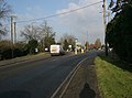 A29 at five Oaks - geograph.org.uk - 83071.jpg 600 × 447; 95 KB
-
 Barn at Pear Tree Farm - geograph.org.uk - 529989.jpg 640 × 482; 80 KB
-
 Barn close to A264 at Five Oaks - geograph.org.uk - 1354277.jpg 640 × 480; 69 KB
-
 Barns at Gemsbrook - geograph.org.uk - 1492530.jpg 640 × 480; 66 KB
-
 Bullocks in field at Pear Tree Farm - geograph.org.uk - 528735.jpg 640 × 482; 109 KB
-
 Cottage on Okehurst Road - geograph.org.uk - 258903.jpg 640 × 480; 91 KB
-
 Entrance to Grainingfold farm - geograph.org.uk - 83069.jpg 600 × 447; 140 KB
-

-
 Lower Lodge, driveway and grounds - geograph.org.uk - 672435.jpg 640 × 480; 78 KB
-
 Lower Wood House - geograph.org.uk - 530791.jpg 640 × 482; 84 KB
-
 Newhill Farm seen from New Road - geograph.org.uk - 263750.jpg 640 × 480; 58 KB
-
 Okehurst - geograph.org.uk - 257765.jpg 640 × 480; 79 KB
-
 Old elevator - geograph.org.uk - 530040.jpg 640 × 482; 112 KB
-
 Open gate to Pond Cottage - geograph.org.uk - 1354348.jpg 640 × 480; 103 KB
-

-
 Over Grown - geograph.org.uk - 530782.jpg 640 × 482; 73 KB
-
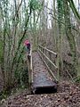
 Overgrown Footpath - geograph.org.uk - 531121.jpg 640 × 482; 145 KB
-
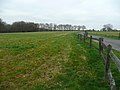
 Pastoral view - geograph.org.uk - 672442.jpg 640 × 278; 49 KB
-
 Pear Tree Copse - geograph.org.uk - 530053.jpg 640 × 482; 127 KB
-
 Pear Tree Farm - geograph.org.uk - 530002.jpg 640 × 482; 81 KB
-
 Pond on Okehurst Road - geograph.org.uk - 258273.jpg 640 × 480; 109 KB
-
 Roof of Frogs Hole Cottage - geograph.org.uk - 1356585.jpg 640 × 480; 123 KB
-
 Rotating horse trainer^ - geograph.org.uk - 1594075.jpg 640 × 480; 110 KB
-
 Shooting Range - geograph.org.uk - 530777.jpg 640 × 482; 72 KB
-
 Spurland - geograph.org.uk - 257763.jpg 640 × 480; 101 KB
-
 Stream in the Woods - geograph.org.uk - 293741.jpg 480 × 640; 187 KB
-
 Tree Line at Ridges Hanger - geograph.org.uk - 293748.jpg 640 × 217; 36 KB
-
 Water trough out of use - geograph.org.uk - 1354247.jpg 640 × 480; 163 KB
-
 Bridleway 1358 from Haven Road - geograph.org.uk - 243420.jpg 480 × 640; 375 KB
-
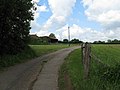
 Eastlands Gateway - geograph.org.uk - 166024.jpg 640 × 480; 75 KB
-
 Five Oaks Hamlet - geograph.org.uk - 58360.jpg 640 × 432; 123 KB
-
 Footbridge Near Sortloes Farm - geograph.org.uk - 102539.jpg 480 × 640; 133 KB
-
 Lake on Marles Lane - geograph.org.uk - 102531.jpg 640 × 480; 78 KB
-
 Priors Ponds - geograph.org.uk - 166027.jpg 640 × 480; 59 KB
-
 Sothebys auction house - geograph.org.uk - 83073.jpg 600 × 447; 170 KB


