Category:Five Oak Green
Jump to navigation
Jump to search
English: Five Oak Green is a village near Tonbridge, Kent in the parish of Capel. It was a centre for hop growing and in the 19th century" The Rose and crown" public house was converted to a hospital to treat the many hop pickers who resided in the village and its surroundings in the late summer. The pub was renamed "The Little Hoppers Hospital" by a London priest who added to the pubs sign "No beer sold here" so no one should have any doubt of its changed role.
village in Kent, United Kingdom | |||||
| Upload media | |||||
| Instance of | |||||
|---|---|---|---|---|---|
| Location | Capel, Tunbridge Wells, Kent, South East England, England | ||||
 | |||||
Subcategories
This category has only the following subcategory.
O
Media in category "Five Oak Green"
The following 24 files are in this category, out of 24 total.
-
 5 oaks are these the ones.jpg 1,028 × 556; 373 KB
-
 5 oaks are these the ones.pdf 1,754 × 1,239; 390 KB
-
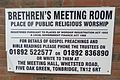 Brethren Meeting Hall, Five Oak Green (Information Sign).JPG 2,400 × 1,600; 1.03 MB
-
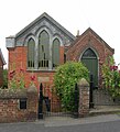
 Brethren Meeting Hall, Five Oak Green.JPG 2,400 × 1,800; 1.47 MB
-
 Bridge Hall - geograph.org.uk - 1212301.jpg 640 × 480; 94 KB
-
 Canoe view of Ford Green Bridge - geograph.org.uk - 4606222.jpg 640 × 480; 78 KB
-
 Five Oak Green United Church, Five Oak Green.JPG 2,500 × 1,800; 1.51 MB
-
 Five Oak Green Village Sign - geograph.org.uk - 1212307.jpg 480 × 640; 64 KB
-
 Five Oak Green village sign - geograph.org.uk - 336369.jpg 480 × 640; 77 KB
-
 Former Capel Congregational Chapel, Five Oak Green.JPG 1,900 × 2,100; 1.31 MB
-
 Former St Luke's Mission Church, Five Oak Green.JPG 2,592 × 1,944; 1.59 MB
-
 St Luke's Cottages - geograph.org.uk - 1212334.jpg 640 × 480; 85 KB
-

-
 United Church, Five Oak Green - geograph.org.uk - 1212346.jpg 640 × 480; 77 KB
-
 Bank Farm - geograph.org.uk - 1436476.jpg 640 × 480; 95 KB
-
 Bullrush Pond - geograph.org.uk - 1436456.jpg 640 × 480; 147 KB
-
 Footbridge and stile near Pheasant Wood - geograph.org.uk - 1436487.jpg 640 × 480; 125 KB
-
 Footbridge near Brook Farm - geograph.org.uk - 1436403.jpg 640 × 480; 135 KB
-
 Footpath junction in Pheasant Wood - geograph.org.uk - 1436490.jpg 640 × 480; 142 KB
-
 Footpath junction near Bank Farm - geograph.org.uk - 1436465.jpg 640 × 480; 127 KB
-
 Footpath on Church Lane - geograph.org.uk - 1436424.jpg 640 × 480; 103 KB
-
 Footpath to Pheasant Wood - geograph.org.uk - 1436484.jpg 640 × 480; 107 KB
-
 Footpath to Sherenden Road - geograph.org.uk - 1436451.jpg 640 × 480; 114 KB
-


.JPG)


