Category:Finmere
Jump to navigation
Jump to search
village and civil parish in Cherwell district, Oxfordshire, England  | |||||
| Upload media | |||||
| Instance of | |||||
|---|---|---|---|---|---|
| Location | Cherwell, Oxfordshire, South East England, England | ||||
| Population |
| ||||
| Area |
| ||||
| Said to be the same as | Finmere (Wikimedia duplicated page, civil parish) | ||||
| official website | |||||
 | |||||
English: Finmere is a village and civil parish in Oxfordshire, south of the River Great Ouse. It is almost east of Brackley in Northamptonshire.
Subcategories
This category has the following 3 subcategories, out of 3 total.
C
F
- Finmere railway station (17 F)
- Finmere War Memorial (2 F)
Media in category "Finmere"
The following 79 files are in this category, out of 79 total.
-

-
 A421 bend south west of Finmere - geograph.org.uk - 3154370.jpg 640 × 456; 82 KB
-
 Aylesbury Vale , The A421 - geograph.org.uk - 6113575.jpg 6,000 × 4,000; 2.82 MB
-
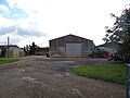
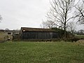
 Barn, Finmere - geograph.org.uk - 6281950.jpg 640 × 480; 111 KB
-
 Bend on road from Finmere to Westbury - geograph.org.uk - 5948566.jpg 1,024 × 684; 325 KB
-
 Bridleway alongside Widmore Plantation - geograph.org.uk - 4390964.jpg 1,024 × 768; 161 KB
-
 Bridleway to Shellswell Park - geograph.org.uk - 4941305.jpg 1,600 × 1,066; 451 KB
-
 Cherwell , The A421 - geograph.org.uk - 6113571.jpg 6,000 × 4,000; 2.53 MB
-
 Cherwell , The A421 - geograph.org.uk - 6113572.jpg 6,000 × 4,000; 3.78 MB
-
 Cherwell , The A421 - geograph.org.uk - 6113573.jpg 6,000 × 4,000; 2.48 MB
-
 Cherwell , The Oaks Farm - geograph.org.uk - 6113569.jpg 6,000 × 4,000; 7.86 MB
-
 Cottage on Fulwell Road, Finmere - geograph.org.uk - 6281959.jpg 800 × 559; 100 KB
-
 County Boundary marker Bucks and Oxfordshire at Finmere - geograph.org.uk - 2564174.jpg 1,174 × 1,348; 594 KB
-
 Course of dismantled railway - geograph.org.uk - 6106313.jpg 1,600 × 1,066; 724 KB
-
 Cycle path towards Tingewick - geograph.org.uk - 4941240.jpg 1,600 × 1,066; 503 KB
-
 Disused railway near Finmere - geograph.org.uk - 393644.jpg 640 × 427; 143 KB
-
 Entrance to Widmore Farm from A421 - geograph.org.uk - 3154530.jpg 640 × 421; 55 KB
-
 E^H Roberts Standpipe - geograph.org.uk - 3818527.jpg 480 × 640; 150 KB
-
 E^H Roberts Standpipe - geograph.org.uk - 3818547.jpg 480 × 640; 96 KB
-
 Falling but not yet fallen - geograph.org.uk - 5487579.jpg 1,024 × 768; 218 KB
-
 Field by the River Great Ouse - geograph.org.uk - 5507860.jpg 1,024 × 768; 175 KB
-

-
 Field near Bacon's house Farm - geograph.org.uk - 6282008.jpg 800 × 600; 148 KB
-
 Old School, Finmere - geograph.org.uk - 1046108.jpg 640 × 480; 85 KB
-
 Finmere Church - geograph.org.uk - 5079190.jpg 1,600 × 1,200; 568 KB
-
 Finmere Cottages - geograph.org.uk - 5079201.jpg 1,600 × 1,200; 445 KB
-
 Finmere Grounds Farm - geograph.org.uk - 6281960.jpg 800 × 600; 96 KB
-
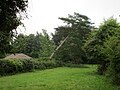
 Finmere recreation ground - geograph.org.uk - 2737788.jpg 640 × 480; 59 KB
-
 Finmere Village Pond - geograph.org.uk - 4940778.jpg 1,600 × 1,066; 642 KB
-
 Footpath across the field - geograph.org.uk - 4940695.jpg 1,600 × 1,066; 538 KB
-
 Footpath to Finmere - geograph.org.uk - 4941295.jpg 1,600 × 1,066; 461 KB
-
 Footpath to Finmere - geograph.org.uk - 6106425.jpg 1,600 × 1,066; 463 KB
-
 Former A421 at Finmere - geograph.org.uk - 1046039.jpg 640 × 480; 62 KB
-
 Former Great Central main line - geograph.org.uk - 4390940.jpg 1,024 × 768; 177 KB
-
 Former main road, Finmere - geograph.org.uk - 5216103.jpg 640 × 428; 166 KB
-
 Former R.A.F. Finmere, aerial 2017 - geograph.org.uk - 5436869.jpg 640 × 427; 48 KB
-
 Fulwell Road Finmere - geograph.org.uk - 4940775.jpg 1,600 × 1,066; 482 KB
-
 Gate into woodland - geograph.org.uk - 4384422.jpg 1,024 × 768; 340 KB
-
 Gated Footpath, Churchyard, Finmere - geograph.org.uk - 1046017.jpg 640 × 480; 105 KB
-
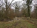
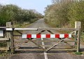
 Gated Road, Finmere - geograph.org.uk - 1046026.jpg 640 × 478; 88 KB
-
 Grazing field by Warren Farm - geograph.org.uk - 4941282.jpg 1,600 × 1,066; 539 KB
-
 Grazing near Tile House Farm - geograph.org.uk - 6281938.jpg 800 × 597; 86 KB
-
 Grazing, Finmere - geograph.org.uk - 6281953.jpg 800 × 600; 137 KB
-
 Great Ouse and pasture - geograph.org.uk - 6106346.jpg 1,600 × 1,066; 514 KB
-
 Great Ouse near Water Stratford - geograph.org.uk - 6106304.jpg 1,600 × 1,066; 525 KB
-
 Lane from the church, Finmere - geograph.org.uk - 1046098.jpg 640 × 475; 86 KB
-
 Lane to the church, Finmere - geograph.org.uk - 1046089.jpg 640 × 480; 95 KB
-
 Lane to the church, Finmere - geograph.org.uk - 5487568.jpg 1,024 × 768; 246 KB
-
 Little Tingewick-The Red Lion - geograph.org.uk - 5079196.jpg 1,600 × 1,200; 478 KB
-
 Mere Road Finmere - geograph.org.uk - 4941236.jpg 1,600 × 1,066; 510 KB
-

-
 Minor road towards Finmere - geograph.org.uk - 6281952.jpg 640 × 480; 90 KB
-
 Minor road towards Water Stratford - geograph.org.uk - 6282005.jpg 640 × 480; 66 KB
-
 Minor road towards Water Stratford - geograph.org.uk - 6282012.jpg 800 × 600; 228 KB
-
 New farm building, Finmere - geograph.org.uk - 5216112.jpg 640 × 480; 182 KB
-
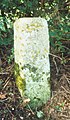 Old Milestone (geograph 6114472).jpg 890 × 1,532; 183 KB
-
 Old School, Finmere - geograph.org.uk - 4306224.jpg 4,320 × 3,240; 4.56 MB
-
 Pond near Widmore Farm - geograph.org.uk - 4384406.jpg 1,024 × 768; 209 KB
-
 Public footpath to Mixbury - geograph.org.uk - 4941290.jpg 1,066 × 1,600; 575 KB
-
 Pylon by the bridleway to Finmere - geograph.org.uk - 4941301.jpg 1,600 × 1,066; 320 KB
-
 Road to Finmere by Tile House Farm - geograph.org.uk - 2737780.jpg 640 × 480; 129 KB
-
 Seven Shires Way - geograph.org.uk - 2737798.jpg 640 × 480; 68 KB
-
 Shed at Widmore Farm - geograph.org.uk - 4390957.jpg 1,024 × 768; 207 KB
-
 Sheep grazing, Finmere - geograph.org.uk - 6281957.jpg 800 × 510; 97 KB
-
 Sign Post at Finmere - geograph.org.uk - 2564159.jpg 1,968 × 1,504; 817 KB
-
 Stand of trees by River Great Ouse - geograph.org.uk - 5216126.jpg 640 × 480; 153 KB
-
 Stile and Ponies, Finmere - geograph.org.uk - 1046033.jpg 640 × 480; 74 KB
-

-
 The old main road at Finmere - geograph.org.uk - 393624.jpg 640 × 446; 126 KB
-
 The River Great Ouse near Water Stratford - geograph.org.uk - 5484945.jpg 1,024 × 768; 275 KB
-
 Tree lined avenue towards Finmere - geograph.org.uk - 6106342.jpg 1,066 × 1,600; 435 KB
-
 Triangle and Junction, Finmere - geograph.org.uk - 1046057.jpg 640 × 480; 53 KB
-
 Triangular Junction, Finmere - geograph.org.uk - 1046072.jpg 640 × 480; 64 KB
-
 Widmore Farm - geograph.org.uk - 4390950.jpg 1,024 × 768; 200 KB
-
 Bridleway near Barton Hartshorn - geograph.org.uk - 135011.jpg 640 × 480; 81 KB
-
 Cutting through the crops - geograph.org.uk - 715408.jpg 640 × 425; 85 KB
-
 Finmere Grounds Farm - geograph.org.uk - 464773.jpg 640 × 425; 66 KB
-
 Mixbury Plantation - geograph.org.uk - 393651.jpg 640 × 427; 169 KB
-
 Spilsmere Wood - geograph.org.uk - 464850.jpg 640 × 425; 80 KB


.jpg)


