Category:Fingerposts
Jump to navigation
Jump to search
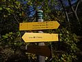
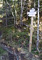
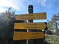
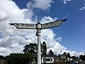
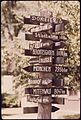
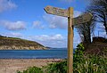
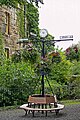
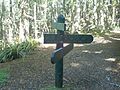
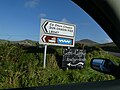
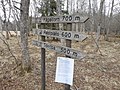
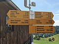
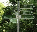
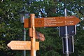
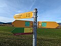
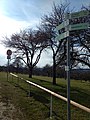
English: Fingerposts (sometimes referred to as a guide post) are posts with one or more arms — known as fingers — pointing in the direction of travel to named places on the fingers. Sometimes, fingerposts will also show the distance to the location.
Français : Poteaux indicateurs
sign post pointing in the direction of travel  | |||||
| Upload media | |||||
| Subclass of | |||||
|---|---|---|---|---|---|
| |||||
Subcategories
This category has the following 10 subcategories, out of 10 total.
Media in category "Fingerposts"
The following 200 files are in this category, out of 213 total.
(previous page) (next page)-
 1905 fingerpost.jpg 2,736 × 3,648; 2.61 MB
-
 2015 Nebory krizovatka.JPG 1,917 × 1,156; 723 KB
-
 20230610 Boukhara094.jpg 6,000 × 4,000; 7.22 MB
-
 80-G-401008.jpg 931 × 919; 264 KB
-
 A sign.jpg 6,000 × 4,000; 8.94 MB
-
 Abri de la Roize.jpg 4,608 × 3,456; 6.47 MB
-
 Alter Wegweiser Nach Eichberg.jpg 6,000 × 8,000; 15.08 MB
-

-
 Anoriant signs.jpg 223 × 326; 70 KB
-
 Anwb bord voorbeeld TN.JPG 1,100 × 1,650; 427 KB
-
 ANWB-wegwijzer-curacao.jpg 427 × 639; 62 KB
-
 Armboth sign.jpg 960 × 960; 193 KB
-
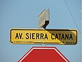 Avenida Sierra Catana.jpg 4,896 × 3,672; 3.6 MB
-
 Belvédère de Mayreste.jpg 5,184 × 3,888; 6.77 MB
-
 Bois de Félines.jpg 5,184 × 3,888; 6.16 MB
-
 Bonn rhein fingerpost.jpg 1,846 × 4,000; 3.32 MB
-
 Botanic Garden - Cluj-Napoca 6.jpg 4,752 × 3,168; 6.21 MB
-
 BrazavilleHinobaan.jpg 3,000 × 4,000; 3.82 MB
-
 BymarkaSignpost 2015-05.jpg 2,568 × 3,661; 10.14 MB
-
 CAI Signpost Monte Mauro.jpg 5,152 × 3,864; 6.45 MB
-
 Cartello segnavia.jpg 2,592 × 1,944; 989 KB
-
 Chamechaude depuis le habert.jpg 600 × 800; 195 KB
-
 Charminelle.jpg 4,608 × 3,456; 6.94 MB
-
 Col de l'âne.jpg 5,184 × 3,888; 7.53 MB
-
 Col de la Sûre.jpg 4,608 × 3,456; 8.15 MB
-
 Col de Plein Voir.jpg 5,184 × 3,888; 5.69 MB
-
 Colline du Château de Nice - panoramio (14).jpg 2,592 × 1,936; 1.81 MB
-
 Colline du Château de Nice - panoramio (9).jpg 2,272 × 1,704; 1.17 MB
-
 Crossroad Moshi.jpg 2,592 × 3,888; 4.06 MB
-
 Cyprus - Famagusta Varosha 01.JPG 4,416 × 3,312; 7.09 MB
-
 Dagverdarneskirkja2012.JPG 3,264 × 2,448; 1.98 MB
-
 Die Gartenlaube (1882) b 792.jpg 3,690 × 1,871; 2.23 MB
-
 Diekirch-Militärmuseum 046.jpg 480 × 640; 123 KB
-
 Dillingen an der Donau - Wegweiser an einem Holzhaus.JPG 3,584 × 2,016; 1.24 MB
-
 Direction of Wat Phnom.JPG 2,248 × 4,000; 2.58 MB
-
 Direction sign @ Plateau du Revard (49821434781).jpg 3,648 × 5,472; 5.18 MB
-
 Direction signs in North Nicosia.jpg 720 × 1,080; 628 KB
-
 Directions Poll at the Heritage Park in Abu Dhabi, UAE.JPG 3,456 × 4,608; 7.64 MB
-
 Disambiguation banner1.jpg 3,600 × 514; 1,000 KB
-
 Distances-sign-pacific-1944.jpg 267 × 324; 43 KB
-
 Djemila جميلة - panoramio (12).jpg 2,500 × 1,667; 1.21 MB
-
 Don't Follow.JPG 4,896 × 3,672; 6.38 MB
-
 Départ Sentier du Bastidon.jpg 5,184 × 3,888; 6.51 MB
-
 Ehnen Signposts R01.jpg 4,684 × 3,227; 11.09 MB
-
 El Suero Lagoon, Sierra Nevada.JPG 4,320 × 3,240; 5.91 MB
-
 Elfbergen Gaasterland. Ruiterpad.JPG 4,608 × 3,456; 16.12 MB
-
 Entre Montbau i la Rabassada P1050967.jpg 3,264 × 2,448; 3.94 MB
-
 Entscheidungen (4809919586).jpg 4,288 × 2,848; 3.15 MB
-
 Evasion Mont Blanc, Saint-Gervais-les-Bains (P1070987).jpg 4,000 × 3,000; 4.01 MB
-
 Festival Sudoeste IV, este é o cruzamento com indicações mais perto do Festival.jpg 1,456 × 1,849; 377 KB
-
 Fietswegwijzer Woerden 2015.jpg 2,490 × 1,959; 1.86 MB
-

-
 Fingerpost Payerne Gare (SW) 2023-03-18.jpg 4,000 × 3,000; 2.38 MB
-
 Fogrey-Raad-ny-Foillan.jpg 3,264 × 2,448; 1.76 MB
-
 Fulltofta strövområde.jpg 4,256 × 2,832; 6.56 MB
-
 German-Italian signpost at Tobruk 1942.jpg 3,622 × 3,361; 6.73 MB
-
 Giethoorn Netherlands Bovenwijde-06.jpg 3,152 × 4,728; 8.9 MB
-
 Go Left (50004703718).jpg 5,613 × 3,742; 8.55 MB
-
 GR 10 Auzat 23.jpg 3,124 × 4,811; 13.57 MB
-
 GR10 guidepost 01.jpg 3,238 × 5,630; 20.03 MB
-
 GR10 guidepost 02.jpg 4,440 × 2,960; 12.17 MB
-
 GR10 guidepost 04.jpg 3,161 × 4,741; 11.45 MB
-
 Guidepost Anzasco.jpg 2,413 × 1,930; 731 KB
-

-
 Hampton Lucy signpost Feb 2021.jpg 3,024 × 4,032; 4.11 MB
-
 Handwijzer. Locatie, Tuinen Mien Ruys.jpg 2,718 × 3,267; 6.41 MB
-
 Hiking guidepost in Piuro, Italy.jpg 3,000 × 4,000; 7.06 MB
-
 Historischer Kilometerstein Wegweiser Oberfrohnreuth.jpg 2,906 × 3,885; 3.38 MB
-
 Historischer Wegweiser Meilenstein.jpg 2,304 × 4,096; 1.85 MB
-
 Homo Monument (204529326).jpg 800 × 533; 107 KB
-
 Incrocio CAI 515 511.jpg 5,152 × 3,864; 5.78 MB
-

-
 It-pr-ldpC34.jpg 1,200 × 1,600; 189 KB
-
 It-pr-ldpM23.jpg 1,140 × 1,520; 776 KB
-
 Jazyková škola, Husovo nám. čp. 78, Beroun, okr. Beroun, Středočeský kraj.JPG 717 × 1,077; 528 KB
-
 Jenštejnský dům, Husovo náměstí 87, Beroun, okr. Beroun, Středočeský kraj.jpg 1,200 × 799; 445 KB
-
 Kalottireitti.JPG 2,592 × 3,456; 2.1 MB
-
 Kangerlussuaq-airport-distance-signpost.jpg 2,176 × 3,872; 1.38 MB
-
 Kingston Gorse 01.jpg 640 × 480; 89 KB
-
 Kirstenbosch National Botanical Garden, Cape Town (P1060074).jpg 3,000 × 4,000; 7.22 MB
-
 Krvavi Most x.JPG 524 × 909; 108 KB
-
 Lipno zapora, cesty.jpg 3,539 × 2,559; 1.71 MB
-
 London MMB B7 London Mathematical Society.jpg 2,536 × 3,756; 2.81 MB
-
 LUX Ettelbruck 020 1016.jpg 3,264 × 2,448; 1.98 MB
-
 Messel (3).JPG 2,601 × 4,000; 2.26 MB
-
 Minieurope 2007 012.JPG 1,704 × 2,272; 760 KB
-
 Nakpanduri crossroads.jpg 2,592 × 1,944; 644 KB
-
 Neandertal in 052018 12 56 51 840000.jpeg 1,440 × 1,080; 876 KB
-
 Nijverdal Zwolle voor iedereen, Rijssen Almelo voor auto's.JPG 2,065 × 1,185; 334 KB
-
 NP Fruška Gora, Direk, rozcestník.jpg 3,178 × 4,770; 1.99 MB
-
 NP Fruška Gora, ukazatel.jpg 4,770 × 3,178; 1.85 MB
-
 NP Fruška Gora, značení na stromě.jpg 3,178 × 4,770; 2.11 MB
-
 Old Bank, Bastimento, Panama - panoramio (7).jpg 2,855 × 3,809; 5.51 MB
-
 Pakiršinys, rodyklės.JPG 5,184 × 3,888; 5.69 MB
-
 Pathway Signage on Ham Lands, England.jpg 2,992 × 4,000; 3.76 MB
-
 Plateau de Barbin.jpg 5,184 × 3,888; 6.65 MB
-
 Pointing the way to the Meadow in the snow.jpg 2,452 × 1,839; 2.68 MB
-
 Public Way fingerpost.JPG 2,560 × 1,920; 808 KB
-
 Putokaz 0161.jpg 1,082 × 720; 301 KB
-
 Putokaz 0275.jpg 478 × 720; 152 KB
-
 Putokaz 0719.jpg 478 × 720; 105 KB
-
 Putokaz 0927.jpg 1,082 × 720; 196 KB
-
 Putokaz 0931.jpg 1,082 × 720; 254 KB
-
 Putokaz kod Doma Žitnica.jpg 4,032 × 3,024; 4.83 MB
-
 Quo vadis?.jpg 3,008 × 2,000; 2.53 MB
-
 R Gregorius Hund und Katz und der himmlische Beistand.jpg 1,548 × 1,905; 418 KB
-
 Raccordo CAI 513 Lugo.jpg 5,152 × 3,864; 6.94 MB
-
 Radwegbeschilderung nach FGSV-Standard.jpg 1,176 × 885; 573 KB
-
 Radwegweiser 15 Iden.jpg 4,032 × 3,024; 4.94 MB
-
 Radwegweiser 20 Geestgottberg Nord.jpg 4,032 × 3,024; 4.71 MB
-
 Radwegweiser 20 Geestgottberg.jpg 4,032 × 3,024; 4.64 MB
-
 Radwegweiser 22 Rengerslage.jpg 4,032 × 3,024; 5.87 MB
-
 Radwegweiser 41 Seehausen Knoten.jpg 4,032 × 3,024; 3.1 MB
-
 Radwegweiser 49 Schönberg Deich.jpg 4,032 × 3,024; 1.63 MB
-
 Radwegweiser 53 Beuster.jpg 4,032 × 3,024; 2.63 MB
-
 Radwegweiser 60 Wendemark.jpg 4,032 × 3,024; 1.53 MB
-
 Radwegweiser 75 Oberkamps.jpg 4,032 × 3,024; 3.86 MB
-
 Radwegweiser 76 Elbbrücke.jpg 4,032 × 3,024; 3.98 MB
-
 Radwegweiser 90 Rengerslage.jpg 4,032 × 3,024; 4.63 MB
-
 Radwegweiser 93 Seehausen.jpg 4,032 × 3,024; 1.68 MB
-
 Radwegweiser Kreuzung Steinfeld.jpg 4,032 × 3,024; 5.5 MB
-
 Radwegweiser Uenglingen.jpg 4,032 × 3,024; 2.61 MB
-
 Radwegweiser Wendemark.jpg 4,032 × 3,024; 2.27 MB
-
 Rittergut Adlershof zu Oberlauterbach - Profilbild NUZ © Jens Reiher.jpg 1,195 × 1,153; 524 KB
-
 Rozcestnik Tasov.jpg 1,302 × 1,787; 540 KB
-
 Rozcestník na návsi, Rovné (Krabčice), okr. Litoměřice, Ústecký kraj.JPG 1,600 × 1,065; 781 KB
-

-
 Schild Starnberger Reibn alt.jpg 3,953 × 951; 487 KB
-
 Segnaleticaverticale Trentino Passo Rolle (3).jpg 3,264 × 2,448; 3.45 MB
-
 Segnavia CAI Crinale Grotta Banditi.jpg 5,152 × 3,864; 6.45 MB
-
 Sign post in Rosemary Plain.jpg 2,988 × 5,312; 7.92 MB
-
 Signpost (2399284846).jpg 1,710 × 1,711; 3.44 MB
-
 Signpost (3177946134).jpg 1,920 × 2,560; 4.88 MB
-
 Signpost (3199024949).jpg 1,542 × 2,162; 3.18 MB
-
 Signpost (3379653927).jpg 1,848 × 1,390; 3.12 MB
-
 Signpost (3459710581).jpg 1,662 × 2,493; 2.98 MB
-
 Signpost (3648166216).jpg 1,920 × 2,560; 3.36 MB
-
 Signpost (3724532368).jpg 1,602 × 2,403; 3.76 MB
-
 Signpost - panoramio (3).jpg 3,240 × 2,160; 1.61 MB
-
 Signpost along Clawson Lane - geograph.org.uk - 959553.jpg 640 × 468; 106 KB
-
 Signpost along public bridleway - panoramio.jpg 2,560 × 1,920; 2.09 MB
-
 Signpost and a military sign in Akamas Peninsula, Cyprus 03.jpg 5,472 × 3,648; 16.54 MB
-

-
 Signpost at junction with Fairwater Road, Fairwater, August 2019 01.jpg 4,032 × 3,024; 2.63 MB
-
 Signpost at junction with Fairwater Road, Fairwater, August 2019 02.jpg 4,032 × 3,024; 2.36 MB
-
 Signpost at junction with Fairwater Road, Fairwater, August 2019 03.jpg 4,032 × 3,024; 2.45 MB
-
 Signpost at junction with Fairwater Road, Fairwater, August 2019 04.jpg 1,536 × 2,048; 840 KB
-
 Signpost at junction with Fairwater Road, Fairwater, August 2019 05.jpg 4,032 × 3,024; 2.84 MB
-
 Signpost at junction with Fairwater Road, Fairwater, August 2019 06.jpg 4,032 × 3,024; 2.72 MB
-
 Signpost at the crossroads with dog by road.jpg 2,000 × 3,000; 462 KB
-
 Signpost in Salles-la-Source.jpg 2,564 × 3,846; 8.21 MB
-
 Signpost in Tbilisi April 2007.jpg 2,019 × 3,038; 933 KB
-
-
 Signpost on Hickling Lane - geograph.org.uk - 944237.jpg 502 × 640; 106 KB
-

-
 Signpost on the South West Coast Path (2387484335).jpg 2,504 × 1,701; 2.86 MB
-

-
 Signpost, Burley in Wharfedale (2685605175).jpg 1,661 × 2,491; 5.65 MB
-
 Signpost, Foulridge (5927511656).jpg 2,246 × 4,071; 4.66 MB
-
 Signpost, Hightown, Cleckheaton (7171954078).jpg 2,090 × 3,232; 6.1 MB
-
 Signpost, Kipping Gardens, Thornton (5484846193).jpg 3,156 × 3,000; 7.66 MB
-
 Signpost, Neiafu - panoramio.jpg 2,112 × 2,816; 2.89 MB
-
 Signposts in Eves Park - panoramio.jpg 1,920 × 1,080; 886 KB
-
 Signposts in Hickling - geograph.org.uk - 944587.jpg 640 × 502; 141 KB
-
 Signs - panoramio (1).jpg 3,200 × 2,400; 3.21 MB
-
 Signs - panoramio.jpg 3,648 × 2,736; 4.94 MB
-
 Signs in Helvetica in Olympic Forest - panoramio.jpg 4,320 × 3,240; 5.48 MB
-
 Signs In Tashkent Botanical Garden.jpg 4,000 × 3,000; 8.89 MB
-
 Signs in Tashkent botanical garden.jpg 6,000 × 4,000; 16.68 MB
-
 Signs Zoo Tashkent.JPG 4,272 × 2,848; 2.11 MB
-
 Signs-1100730, Dingle Peninsula, Co. Kerry, Ireland.jpg 4,896 × 3,672; 2.89 MB
-
 Sihlsprung Wegweiser, Spitzen ZH 20180708-jag9889.jpg 3,456 × 4,608; 17.41 MB
-
 Slightly mossy public footpath sign near West Rudham, Norfolk, England.jpg 2,250 × 4,000; 5.9 MB
-
 St-Prex-Lausanne-Ouchy (12.12.12) 30 (8270459648).jpg 2,208 × 1,656; 537 KB
-
 Stornäsets naturreservat 02.jpg 3,648 × 2,736; 2.05 MB
-
 Swiss Hiking Network - Guidepost - Niederried.jpg 4,032 × 3,024; 1.76 MB
-
 Swiss Hiking Network - Guidepost - Saanenmündung.jpg 4,032 × 3,024; 6.45 MB
-
 Swiss Hiking Network - Guidepost - Stausee Niederried.jpg 4,032 × 3,024; 4.24 MB
-
 Swiss Hiking Network - Guidepost - Tannmattegg.jpg 4,032 × 3,024; 3.59 MB
-
 Swiss Hiking Network - Guidepost - Wilerau.jpg 4,032 × 3,024; 2.4 MB
-
 Swiss Hiking Network - Signpost - Schwang.jpg 4,032 × 3,024; 3.76 MB
-
 Swiss Hiking Network - Signpost - Tufftbrunnen.jpg 4,032 × 3,024; 5.58 MB
-
 Swiss Hiking Network - Signpost - Wolfsschlucht.jpg 4,032 × 3,024; 4.37 MB
-
 Swiss Hiking Networl - Guidepost - Mieschegg.jpg 4,032 × 3,024; 2.43 MB
-
 Thatched cottages at Powerstock-geograph-5476398-by-Derek-Harper.jpg 3,072 × 2,048; 1.69 MB
-
 Tipton Junction - Birmingham Canal Navigations Old Main Line - Tipton (23921577137).jpg 4,608 × 3,456; 5.87 MB
-

-
-
 Toshkent botanika bog'i ekspozitsiyalar taxtasi.jpg 1,960 × 4,032; 4.64 MB
-
 TriStudnicky10Slovakia1.JPG 2,304 × 3,072; 1.22 MB
-
 Tuzla - Pannonian Lakes 4 (2019).jpg 3,016 × 4,032; 5.55 MB
-
 Villethierry-FR-89-panneaux indicateurs-01.jpg 4,032 × 3,024; 2.66 MB
-
 Wander Wegweiser Kirch und Schulweg.jpg 2,304 × 4,096; 2.3 MB
-
 Wanderwegweiser Königshainer Berge Kreuzung zur Gaststätte und Museum.webp 1,152 × 2,048; 366 KB
-
 Wanderwegweiser Saale-Unstrut bei Almrich.jpg 4,660 × 4,000; 5.06 MB
-
 Wayfinding signage in Plymouth, England.jpg 4,896 × 3,672; 6.25 MB
-
 Wegweiser (2).jpg 3,008 × 2,000; 2.78 MB
-
 Wegweiser Diepoldsau Alter Rhein, Schweiz.jpg 4,080 × 3,072; 3.27 MB
-
 Wegweiser Obere Tabakäcker.jpg 3,456 × 4,608; 7.73 MB
-
 Wegweiser Radweg.jpg 2,362 × 5,472; 11.4 MB


.jpg)
.jpg)


_b_792.jpg)


.jpg)


.jpg)


.jpg)
.jpg)


_2023-03-18.jpg)


.jpg)


.jpg)


.jpg)


.JPG)


.jpg)


,_okr._Litom%C4%9B%C5%99ice,_%C3%9Asteck%C3%BD_kraj.JPG)
.jpg)


.jpg)
.jpg)
.jpg)
.jpg)
.jpg)
.jpg)
.jpg)
.jpg)


.jpg)

.jpg)
.jpg)
.jpg)
.jpg)


.jpg)


_30_(8270459648).jpg)


.jpg)
.jpg)
.jpg)


.jpg)


.jpg)


