Category:Findon, West Sussex
Jump to navigation
Jump to search
English: Findon is a village and civil parish in the Arun District of West Sussex, England, four miles (6.4 km) north of Worthing. The parish has an area of 16.41 km² and a population of 1848 persons (2001 census).
village in West Sussex, England, UK  | |||||
| Upload media | |||||
| Instance of | |||||
|---|---|---|---|---|---|
| Location | Arun, West Sussex, South East England, England | ||||
| Area |
| ||||
 | |||||
Subcategories
This category has the following 7 subcategories, out of 7 total.
Media in category "Findon, West Sussex"
The following 200 files are in this category, out of 759 total.
(previous page) (next page)-
 (TQ)1010 @ 10-10 on 10-10-10 - geograph.org.uk - 2104339.jpg 640 × 480; 64 KB
-

-
 A corner of Findon cemetery - geograph.org.uk - 1726562.jpg 640 × 428; 138 KB
-
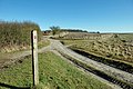 A junction of ways - geograph.org.uk - 1730683.jpg 640 × 428; 113 KB
-
 A summer's morning on the South Downs - geograph.org.uk - 2497455.jpg 4,000 × 3,000; 4.14 MB
-
 A tree in a field - geograph.org.uk - 1730707.jpg 640 × 428; 69 KB
-
 A280 descending to Findon - geograph.org.uk - 2205770.jpg 3,264 × 2,448; 4.01 MB
-
 Access land above Long Furlong - geograph.org.uk - 2635739.jpg 4,000 × 3,000; 3.83 MB
-
 Always closed - geograph.org.uk - 1987930.jpg 800 × 434; 99 KB
-
 Apiary in the bushes - geograph.org.uk - 1730663.jpg 640 × 428; 142 KB
-
 Approach to New Barn - geograph.org.uk - 2204505.jpg 3,264 × 2,448; 4.01 MB
-
 Approaching Cissbury Ring - geograph.org.uk - 5948826.jpg 1,600 × 924; 359 KB
-
 Approaching Woodland - geograph.org.uk - 5946670.jpg 1,600 × 1,073; 505 KB
-
 Arundel End Field - geograph.org.uk - 3511195.jpg 640 × 480; 80 KB
-
 Ash Close - geograph.org.uk - 3573245.jpg 640 × 480; 98 KB
-
 Ash Field - geograph.org.uk - 3631225.jpg 640 × 480; 73 KB
-

-
 Bales, Canada Bottom - geograph.org.uk - 3554685.jpg 640 × 480; 69 KB
-
 Barn below Cissbury Ring - geograph.org.uk - 1327851.jpg 640 × 426; 190 KB
-
 Barn Field - geograph.org.uk - 3499272.jpg 640 × 480; 81 KB
-
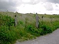
 Barrier on bridleway - geograph.org.uk - 5483692.jpg 640 × 428; 134 KB
-
 Beech Close - geograph.org.uk - 3558273.jpg 640 × 480; 63 KB
-
 Beech Road - geograph.org.uk - 3511106.jpg 640 × 480; 84 KB
-
 Beech Road - geograph.org.uk - 3558277.jpg 640 × 480; 63 KB
-
 Beechwood edge near Cissbury Ring - geograph.org.uk - 3217892.jpg 764 × 1,024; 340 KB
-
 Below Cissbury Ring - geograph.org.uk - 1326717.jpg 640 × 427; 203 KB
-
 Black Horse Pond - geograph.org.uk - 3573354.jpg 640 × 480; 128 KB
-
 Blackpatch Hill - geograph.org.uk - 3499364.jpg 640 × 480; 64 KB
-
 Boundary of paths on the South Downs - geograph.org.uk - 2497444.jpg 4,000 × 3,000; 4.08 MB
-
 Braeside Close - geograph.org.uk - 3573237.jpg 640 × 480; 130 KB
-
 Bridlegate below Cissbury Ring - geograph.org.uk - 3040644.jpg 800 × 600; 156 KB
-
 Bridleway 2062 towards car park at Cissbury Ring - geograph.org.uk - 2639949.jpg 4,000 × 3,000; 3.44 MB
-

-
 Bridleway 3131 descending to car park at Cissbury Ring - geograph.org.uk - 2639889.jpg 4,000 × 3,000; 3.21 MB
-
 Bridleway above the Longfurlong - geograph.org.uk - 6058903.jpg 1,024 × 768; 244 KB
-
 Bridleway and Byway Junction - geograph.org.uk - 3564096.jpg 480 × 640; 105 KB
-

-

-
 Bridleway at the north of Findon - geograph.org.uk - 2986642.jpg 800 × 600; 145 KB
-
 Bridleway connecting the South Downs Way with Cissbury Ring - geograph.org.uk - 2202899.jpg 3,264 × 2,448; 3.67 MB
-
 Bridleway crosses byway north of Findon - geograph.org.uk - 2987882.jpg 800 × 600; 140 KB
-
 Bridleway descent to Findon Park House - geograph.org.uk - 2204485.jpg 3,264 × 2,448; 3.93 MB
-
 Bridleway entering wood - geograph.org.uk - 870329.jpg 640 × 480; 132 KB
-
 Bridleway Fork - geograph.org.uk - 3094201.jpg 4,000 × 3,000; 4.21 MB
-
 Bridleway from Church Hill to Clapham Wood - geograph.org.uk - 2635757.jpg 4,000 × 3,000; 3.52 MB
-

-

-
 Bridleway going south from No Man's Land - geograph.org.uk - 2986776.jpg 800 × 600; 135 KB
-
 Bridleway heading past Cissbury Ring - geograph.org.uk - 5948818.jpg 1,024 × 688; 275 KB
-
 Bridleway heading towards Clapham - geograph.org.uk - 6058902.jpg 1,600 × 1,200; 490 KB
-
 Bridleway joins road east of North End - geograph.org.uk - 2987890.jpg 800 × 600; 158 KB
-
 Bridleway junction - geograph.org.uk - 5465548.jpg 4,608 × 3,456; 5.05 MB
-
 Bridleway junction - geograph.org.uk - 5468191.jpg 4,608 × 3,456; 4.11 MB
-
 Bridleway junction near Gallops Farm - geograph.org.uk - 1989746.jpg 800 × 600; 199 KB
-
 Bridleway junction near Lions bank - geograph.org.uk - 2221324.jpg 3,264 × 2,448; 4.79 MB
-
 Bridleway junction north east of Findon - geograph.org.uk - 2986657.jpg 800 × 600; 192 KB
-
 Bridleway junction north of Gallops Farm - geograph.org.uk - 1989767.jpg 800 × 600; 119 KB
-
 Bridleway junction south of Stump Barn - geograph.org.uk - 2204449.jpg 3,264 × 2,448; 3.18 MB
-
 Bridleway Junctions, Church Hill - geograph.org.uk - 3573667.jpg 640 × 480; 77 KB
-

-

-
 Bridleway meets the lane - geograph.org.uk - 2575998.jpg 1,600 × 1,200; 816 KB
-
 Bridleway near Findon Pest House - geograph.org.uk - 1989813.jpg 800 × 600; 145 KB
-
 Bridleway near Muntham Farm - geograph.org.uk - 870632.jpg 640 × 480; 80 KB
-
 Bridleway north from Cissbury Ring - geograph.org.uk - 5483688.jpg 640 × 428; 136 KB
-
 Bridleway north of Gallops Farm - geograph.org.uk - 1989761.jpg 800 × 600; 111 KB
-

-
 Bridleway reaches A24 at Findon - geograph.org.uk - 1987922.jpg 600 × 800; 157 KB
-
 Bridleway south of Buddington Bottom - geograph.org.uk - 4626601.jpg 800 × 600; 159 KB
-
 Bridleway to Gallops Farm - geograph.org.uk - 1989742.jpg 800 × 548; 106 KB
-
 Bridleway to Muntham Farm - geograph.org.uk - 5466384.jpg 4,608 × 3,456; 5.81 MB
-
 Bridleway to Nepcote Green - geograph.org.uk - 3554831.jpg 640 × 480; 61 KB
-
 Bridleway to New Barn near Findon Park House - geograph.org.uk - 2204455.jpg 3,264 × 2,448; 4.22 MB
-
 Bridleway to New Buildings off lane to New Barn - geograph.org.uk - 2204676.jpg 3,264 × 2,448; 3.54 MB
-
 Bridleway to North Farm - geograph.org.uk - 3511433.jpg 480 × 640; 134 KB
-
 Bridleway to Steyning - geograph.org.uk - 3499127.jpg 640 × 480; 95 KB
-
 Bridleway to Worthing - geograph.org.uk - 3512953.jpg 480 × 640; 99 KB
-
 Bridleway, Buddington Bottom - geograph.org.uk - 3563920.jpg 480 × 640; 123 KB
-
 Broad Wood - geograph.org.uk - 3499211.jpg 480 × 640; 129 KB
-
 Broadwoods, North End - geograph.org.uk - 3563833.jpg 640 × 480; 68 KB
-
 Buddington Bottom - geograph.org.uk - 3563917.jpg 640 × 480; 65 KB
-
 Buddington Bottom - geograph.org.uk - 3563938.jpg 640 × 480; 78 KB
-
 Buddington Bottom - geograph.org.uk - 3563944.jpg 640 × 480; 78 KB
-
 Bus route 1 at the bus stop - geograph.org.uk - 1726573.jpg 640 × 428; 112 KB
-
 Bus shelter at North End - geograph.org.uk - 2204686.jpg 3,264 × 2,448; 3.61 MB
-
 Butter and eggs by the Monarch's Way - geograph.org.uk - 1983801.jpg 600 × 800; 101 KB
-
 Byway beside Church Hill - geograph.org.uk - 6067537.jpg 1,024 × 768; 316 KB
-
 Byway descends to No Man's Land - geograph.org.uk - 2986705.jpg 800 × 600; 133 KB
-
 Byway east of Cissbury Ring car park - geograph.org.uk - 1327858.jpg 640 × 426; 195 KB
-

-
 Byway on the South Downs (1) - geograph.org.uk - 2987849.jpg 800 × 600; 180 KB
-
 Byway on the South Downs (2) - geograph.org.uk - 2987851.jpg 600 × 800; 107 KB
-
 Byway on the South Downs (3) - geograph.org.uk - 2987875.jpg 800 × 600; 143 KB
-
 Byway to Findon - geograph.org.uk - 1990174.jpg 800 × 600; 101 KB
-
 Byway to Steyning - geograph.org.uk - 3554809.jpg 480 × 640; 60 KB
-
 Byway to Steyning - geograph.org.uk - 3564120.jpg 640 × 480; 86 KB
-
 Byway towards Canada Bottom - geograph.org.uk - 1327848.jpg 640 × 427; 183 KB
-
 Byway towards Findon - geograph.org.uk - 5483853.jpg 640 × 428; 151 KB
-
 Byway towards Steyning - geograph.org.uk - 5483815.jpg 640 × 428; 172 KB
-
 Calves on the South Downs in the early morning sunshine - geograph.org.uk - 2497409.jpg 4,000 × 3,000; 4.42 MB
-
 Canada Barn - geograph.org.uk - 3554669.jpg 640 × 480; 54 KB
-
 Canada Bottom - geograph.org.uk - 3554649.jpg 640 × 480; 67 KB
-
 Cattle below Cissbury Ring - geograph.org.uk - 5948807.jpg 1,600 × 1,075; 427 KB
-
 Cattle feeding in clump of trees at Muntham farm - geograph.org.uk - 2205079.jpg 3,264 × 2,448; 4.13 MB
-
 Cattle near Tolmare Farm - geograph.org.uk - 1983749.jpg 640 × 633; 87 KB
-
 Cattle resting - geograph.org.uk - 5368296.jpg 4,608 × 3,456; 5.34 MB
-
 Chalk track near Findon - geograph.org.uk - 4035290.jpg 1,600 × 1,224; 321 KB
-
 Chalk Tracks - geograph.org.uk - 5944751.jpg 1,600 × 1,011; 455 KB
-
 Chanctonbury Ring from the south - geograph.org.uk - 4383567.jpg 4,608 × 3,456; 5.67 MB
-
 Cherry Croft, Nepcote Lane - geograph.org.uk - 3573283.jpg 640 × 480; 86 KB
-
 Choice of Tracks - geograph.org.uk - 5946951.jpg 4,032 × 2,897; 4.21 MB
-
 Chucks Gate - geograph.org.uk - 3511409.jpg 640 × 480; 162 KB
-
 Church access road, Findon - geograph.org.uk - 4033748.jpg 1,600 × 931; 480 KB
-
 Church Hill - geograph.org.uk - 3499623.jpg 640 × 480; 54 KB
-
 Church Hill - geograph.org.uk - 3535362.jpg 640 × 480; 83 KB
-
 Church Hill - geograph.org.uk - 3568121.jpg 640 × 480; 79 KB
-
 Church Hill - geograph.org.uk - 3573655.jpg 640 × 480; 113 KB
-
 Church Hill - geograph.org.uk - 3573673.jpg 640 × 480; 97 KB
-
 Church Hill - geograph.org.uk - 5986594.jpg 2,048 × 1,536; 1.33 MB
-
 Church Hill Shaw - geograph.org.uk - 3535354.jpg 640 × 480; 134 KB
-
 Cissbury Barns for a wedding or a large do - geograph.org.uk - 5587067.jpg 5,152 × 3,864; 6.56 MB
-

-
 Cissbury Ring - geograph.org.uk - 3516363.jpg 640 × 480; 40 KB
-
 Cissbury Ring - geograph.org.uk - 3570795.jpg 640 × 541; 75 KB
-
 Cissbury Ring - geograph.org.uk - 3573680.jpg 640 × 397; 55 KB
-
 Cissbury Ring Car Park - geograph.org.uk - 3512936.jpg 640 × 480; 68 KB
-
 Clay with flints soil, South Downs - geograph.org.uk - 5483840.jpg 640 × 428; 151 KB
-
 Clock on school building at Findon - geograph.org.uk - 1987946.jpg 600 × 800; 115 KB
-
 Clump of trees covering underground reservoir - geograph.org.uk - 2205635.jpg 3,264 × 2,448; 3.33 MB
-
 Common poppies by the Monarch's Way - geograph.org.uk - 1983785.jpg 800 × 600; 202 KB
-
 Communication and Transmitter Masts - geograph.org.uk - 5986578.jpg 1,600 × 1,095; 300 KB
-
 Concrete road from the A24 to Muntham Farm and Cobden Farm - geograph.org.uk - 2205067.jpg 3,264 × 2,448; 4.65 MB
-
 Constable - A cottage by a wood at Findon, Sussex, 228-1888.jpg 2,500 × 1,582; 997 KB
-
 Convent Drive - geograph.org.uk - 3572609.jpg 640 × 480; 85 KB
-
 Converging Bridleways - geograph.org.uk - 3512906.jpg 640 × 480; 76 KB
-
 Cottage at Findon - geograph.org.uk - 1987924.jpg 800 × 785; 141 KB
-
 Cottages, Nepcote - geograph.org.uk - 3551817.jpg 640 × 480; 82 KB
-
 Cottages, Nepcote - geograph.org.uk - 3575356.jpg 480 × 640; 47 KB
-
 Coventry Plantation - geograph.org.uk - 3511247.jpg 640 × 480; 79 KB
-
 Coventry Plantation - geograph.org.uk - 5986596.jpg 1,600 × 1,200; 507 KB
-
 Covered Reservoir, Muntham Down - geograph.org.uk - 3511391.jpg 480 × 640; 101 KB
-
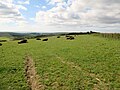
 Cow Down (2) - geograph.org.uk - 3485636.jpg 640 × 480; 56 KB
-
 Cricket on sock - geograph.org.uk - 1983755.jpg 800 × 600; 130 KB
-

-
 Cross Lane - geograph.org.uk - 3501260.jpg 640 × 480; 72 KB
-
 Cross Lane - geograph.org.uk - 3573311.jpg 480 × 640; 118 KB
-
 Cross tracks on the South Downs - geograph.org.uk - 1989824.jpg 800 × 500; 88 KB
-
 Crossing lanes in Findon - geograph.org.uk - 1987925.jpg 640 × 480; 94 KB
-
 Crossing the A280 - geograph.org.uk - 6067547.jpg 1,024 × 768; 197 KB
-
 Crosstracks near Highden Beeches - geograph.org.uk - 1983125.jpg 800 × 600; 112 KB
-
 Crossways east of Findon - geograph.org.uk - 2986674.jpg 800 × 600; 117 KB
-
 Cyclist at track junction - geograph.org.uk - 5367078.jpg 4,608 × 3,456; 4.48 MB
-

-

-
 Denshire Field - geograph.org.uk - 3554713.jpg 640 × 442; 49 KB
-
 Dew Pond, Nepcote Green - geograph.org.uk - 3510968.jpg 480 × 640; 133 KB
-
 Dew Pond, Nepcote Green - geograph.org.uk - 3572551.jpg 640 × 480; 122 KB
-
 Disused lime kiln - geograph.org.uk - 6068507.jpg 1,024 × 768; 331 KB
-
 Divergence of tracks south of Stump Barn - geograph.org.uk - 1990148.jpg 800 × 600; 159 KB
-
 Downhill towards No Man's Land - geograph.org.uk - 3218587.jpg 1,024 × 753; 117 KB
-
 Downland bridleway - geograph.org.uk - 1989816.jpg 800 × 600; 105 KB
-
 Downland Close - geograph.org.uk - 3511096.jpg 640 × 480; 79 KB
-
 Downland trees below Cissbury Ring - geograph.org.uk - 3218236.jpg 1,024 × 820; 244 KB
-
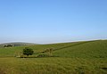
 Downland view across dry valley - geograph.org.uk - 1513498.jpg 640 × 480; 84 KB
-

-
 Downs above Findon - geograph.org.uk - 5483684.jpg 640 × 428; 113 KB
-
 Downview Road - geograph.org.uk - 3564172.jpg 640 × 480; 76 KB
-
 Downview Road looking east - geograph.org.uk - 2986629.jpg 800 × 600; 149 KB
-
 Drive to Cobden Farm - geograph.org.uk - 3656268.jpg 640 × 480; 62 KB
-
 Earthwork on the slope of Canada Bottom - geograph.org.uk - 2203176.jpg 3,264 × 2,448; 4.86 MB
-
 East Lodge, High Street - geograph.org.uk - 3573319.jpg 640 × 480; 85 KB
-
 East Tenantry Down (2) - geograph.org.uk - 3554802.jpg 640 × 480; 75 KB
-
 East Tenantry Down (3) - geograph.org.uk - 3554817.jpg 640 × 480; 42 KB
-
 East Tenantry Down (4) - geograph.org.uk - 3564103.jpg 640 × 480; 74 KB
-
 East Tenantry Down - geograph.org.uk - 3499162.jpg 640 × 480; 73 KB
-
 East up Nepcote Lane - geograph.org.uk - 2202792.jpg 3,264 × 2,448; 3.44 MB
-
 Elder Cottages, Nepcote - geograph.org.uk - 3575350.jpg 640 × 480; 93 KB
-
 Elm Rise - geograph.org.uk - 3573248.jpg 640 × 480; 93 KB
-
 Entrance to Gallops Farm - geograph.org.uk - 5986513.jpg 1,600 × 1,120; 862 KB
-
 Extra restricted byway - geograph.org.uk - 1983780.jpg 600 × 800; 155 KB
-
 Farm gate at a junction of bridleways - geograph.org.uk - 870639.jpg 640 × 480; 90 KB
-

-
 Farm tanker at Highden Barn - geograph.org.uk - 1513456.jpg 640 × 480; 92 KB
-
 Farm Track - geograph.org.uk - 3094218.jpg 4,000 × 3,000; 4.22 MB
-
 Farm track to Highden Barn - geograph.org.uk - 5468228.jpg 4,608 × 3,456; 5.07 MB
-
 Farm track to New Barn - geograph.org.uk - 1514839.jpg 640 × 480; 106 KB
-
 Farmland near Findon - geograph.org.uk - 870644.jpg 640 × 480; 71 KB
-
 Field Corner - geograph.org.uk - 5946792.jpg 1,600 × 1,105; 503 KB
-
 Field gate on the Monarch's Way - geograph.org.uk - 1983804.jpg 800 × 600; 123 KB
-
 Field near Cissbury Hill - geograph.org.uk - 1990192.jpg 800 × 582; 81 KB
-
 Field of sheep west of Stump Bottom - geograph.org.uk - 2986913.jpg 800 × 600; 70 KB
-
 Field opposite The Gallops - geograph.org.uk - 2525922.jpg 1,600 × 1,200; 698 KB
-
 Field path on the South Downs - geograph.org.uk - 2497440.jpg 4,000 × 3,000; 4.19 MB
-
 Fields near Findon - geograph.org.uk - 5986515.jpg 1,600 × 1,200; 657 KB
-
 Fields near to Cissbury Ring - geograph.org.uk - 5944726.jpg 1,600 × 1,051; 341 KB
-
 Findon By-Pass - geograph.org.uk - 3501256.jpg 640 × 480; 119 KB
-
 Findon By-Pass - geograph.org.uk - 3573382.jpg 640 × 480; 89 KB
-
 Findon Bypass - geograph.org.uk - 3558292.jpg 640 × 480; 84 KB
-
 Findon Bypass - geograph.org.uk - 5870818.jpg 1,600 × 1,205; 623 KB
-
 Findon CC pavilion - geograph.org.uk - 2202560.jpg 3,264 × 2,448; 3.78 MB
1010_@_10-10_on_10-10-10_-_geograph.org.uk_-_2104339.jpg)


_-_geograph.org.uk_-_2987849.jpg)
_-_geograph.org.uk_-_2987851.jpg)
_-_geograph.org.uk_-_2987875.jpg)


_-_geograph.org.uk_-_3485636.jpg)


_-_geograph.org.uk_-_3554802.jpg)
_-_geograph.org.uk_-_3554817.jpg)
_-_geograph.org.uk_-_3564103.jpg)


