Category:Filialkirche zur Kreuzerhöhung, Stöttera
Jump to navigation
Jump to search
| Object location | | View all coordinates using: OpenStreetMap |
|---|
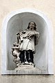
| This category shows the protected monument with the number 20486 in Austria. (Commons, de, Wikidata) |
church building in Zemendorf-Stöttera, Austria .jpg) | |||||
| Upload media | |||||
| Instance of | |||||
|---|---|---|---|---|---|
| Location | Zemendorf-Stöttera, Mattersburg District, Burgenland, Austria | ||||
| Street address |
| ||||
| Heritage designation | |||||
 | |||||
Media in category "Filialkirche zur Kreuzerhöhung, Stöttera"
The following 5 files are in this category, out of 5 total.
-
 Filialkirche zur Kreuzerhöhung Stöttera 01.jpg 3,733 × 5,599; 6.29 MB
-
 Zemendorf-Stöttera - Stöttera, Filialkirche Zur Kreuzerhöhung (01).jpg 2,000 × 3,000; 1.04 MB
-
 Zemendorf-Stöttera - Stöttera, Filialkirche Zur Kreuzerhöhung (02).jpg 2,000 × 3,000; 1.2 MB
-
 Zemendorf-Stöttera - Stöttera, Filialkirche Zur Kreuzerhöhung (03).jpg 2,000 × 3,000; 1.66 MB
-
 Zemendorf-Stöttera - Stöttera, Filialkirche Zur Kreuzerhöhung (04).jpg 3,000 × 2,000; 1.28 MB

.jpg)
.jpg)
.jpg)