Category:Files with coordinates missing SDC location of creation (55° N, 2° W)
Jump to navigation
Jump to search
Media in category "Files with coordinates missing SDC location of creation (55° N, 2° W)"
The following 200 files are in this category, out of 366 total.
(previous page) (next page)-
 1, Percy Terrace.jpg 3,179 × 3,010; 2.55 MB
-
 1, South Street.jpg 4,160 × 3,120; 4.09 MB
-
 1-7, Prudhoe Street.jpg 4,160 × 3,120; 3.84 MB
-
 10 and 11, Percy Terrace.jpg 4,160 × 3,120; 3.83 MB
-
 12 And 14, Green Batt.jpg 4,160 × 3,120; 3.75 MB
-
 13, Percy Terrace.jpg 3,120 × 4,160; 3.52 MB
-
 14, Bailiffgate.jpg 3,120 × 4,160; 3.29 MB
-
 15.08.21 Middle Engine Lane 08915 (51399822753).jpg 6,016 × 3,323; 13.21 MB
-
 16-20, Bailiffgate.jpg 4,124 × 2,626; 4.57 MB
-
 18, Narrowgate.jpg 2,458 × 3,686; 6.08 MB
-
 19-23, Green Batt.jpg 4,160 × 3,120; 2.9 MB
-
 A Glimpse of Cragside - geograph.org.uk - 976583.jpg 426 × 640; 373 KB
-
 A smiling fox - Eshott Heugh Animal Park, Felton, Northumberland (7169703605).jpg 3,888 × 2,592; 2.12 MB
-

-

-
 Along the trackbed towards the viaduct (geograph 6234932).jpg 1,024 × 683; 620 KB
-
 Amble Harbour Panorama – Northumberland (31135351171).jpg 3,125 × 874; 2.34 MB
-
 Arable field - geograph.org.uk - 1830701.jpg 640 × 480; 59 KB
-
 Arable Field by Low Stead Links - geograph.org.uk - 3210871.jpg 4,320 × 3,240; 2.36 MB
-
 Arctic Tern - Farne Is - FJ0A3086 (35525149773).jpg 1,280 × 640; 240 KB
-
 Arctic Tern - Farne Is - FJ0A3104 (35525150623).jpg 1,280 × 640; 219 KB
-
 Arctic Tern - Farne Is - FJ0A3917 (35498002344).jpg 1,280 × 853; 241 KB
-
 Arctic Tern - Farne Is - FJ0A3922 (35498003164).jpg 1,280 × 853; 199 KB
-
 Arctic Tern - Farne Is - FJ0A4181 (36165089872).jpg 1,280 × 853; 214 KB
-
 Arctic Tern - Farne Is - FJ0A4258 (36165090392).jpg 1,280 × 853; 219 KB
-
 Arctic Tern - Farne Is -FJ0A2270 (35497987024).jpg 1,280 × 853; 268 KB
-
 Arctic Tern - Farne Is FJ0A4087 (35937283840).jpg 1,280 × 853; 221 KB
-
 Arctic Tern chick - Farne Is - FJ0A3857 (35525541483).jpg 1,280 × 853; 272 KB
-
 Atlantic Puffin - Farne Is - FJ0A1339 (36333616265).jpg 1,280 × 853; 228 KB
-
 Atlantic Puffin - Farne Is - FJ0A2041 (36197213661).jpg 1,280 × 853; 292 KB
-
 Atlantic Puffin - Farne Is - FJ0A2583 (36333609365).jpg 1,280 × 853; 270 KB
-
 Atlantic Puffin - Farne Is - FJ0A2680 (36164960592).jpg 853 × 1,280; 249 KB
-
 Atlantic Puffin - Farne Is - FJ0A4576 (35497855334).jpg 853 × 1,280; 271 KB
-
 Atlantic Puffin - Farne Is - FJ0A4578 (35497855204).jpg 853 × 1,280; 282 KB
-
 Atlantic Puffin - Farne Is - FJ0A4626 (36197232561).jpg 1,280 × 853; 211 KB
-
 Atlantic Puffin - Farne Is - FJ0A4842 (35937180110).jpg 1,280 × 853; 243 KB
-
 Atlantic Puffin - Farne Is - FJ0A4858 (36197181501).jpg 853 × 1,280; 298 KB
-
 Atlantic Puffin - Farne Is - FJ0A4924 (35497859894).jpg 1,280 × 853; 239 KB
-
 Atlantic Puffin - Farne Is - FJ0A6037 (36333635305).jpg 1,280 × 853; 217 KB
-
 Atlantic Puffin - Farne Is - FJ0A6228 (36164970472).jpg 1,280 × 853; 296 KB
-
 Autumn Colours - Cragside, Rothbury, Northumberland.jpg 4,032 × 3,024; 6.08 MB
-
 Bambrugh sunrise (8329665910).jpg 5,177 × 2,926; 5.27 MB
-
 Bamburgh Castle - geograph.org.uk - 948320.jpg 640 × 480; 100 KB
-
 Bamburgh Castle - geograph.org.uk - 950437.jpg 640 × 480; 70 KB
-
 Bamburgh Castle - geograph.org.uk - 950444.jpg 640 × 480; 94 KB
-
 Bamburgh Castle on a sunny day - geograph.org.uk - 948311.jpg 640 × 480; 86 KB
-
 Bamburgh Castle War Memorial (9325271621).jpg 2,336 × 3,504; 2.82 MB
-

-

-
 Bamburgh War Memorial - geograph.org.uk - 950442.jpg 640 × 480; 114 KB
-
 Berwick upon Tweed beacon - geograph.org.uk - 741439.jpg 640 × 480; 61 KB
-
 Berwick-upon-Tweed walls (two churches) - geograph.org.uk - 741427.jpg 640 × 480; 146 KB
-
 Berwick-upon-Tweed walls (Barracks) - geograph.org.uk - 741429.jpg 640 × 480; 81 KB
-

-

-
 Berwick-upon-Tweed walls - geograph.org.uk - 741425.jpg 640 × 480; 104 KB
-
 Berwick-upon-Tweed walls - geograph.org.uk - 741443.jpg 640 × 480; 98 KB
-
 Birdwatchers in Staples Is - Farne Is - FJ0A1492 (35498707004).jpg 1,280 × 853; 280 KB
-
 Blyth pier - HDR (8279754151).jpg 2,047 × 1,361; 336 KB
-
 Blyth pier2 (8279541007).jpg 5,199 × 3,461; 12.7 MB
-
 Boats in the gut (8545104884).jpg 5,184 × 3,456; 1.65 MB
-
 Boulmer Haven - geograph.org.uk - 3210607.jpg 4,320 × 3,240; 4.49 MB
-
 Boys Brigade building, Morpeth - geograph.org.uk - 948298.jpg 640 × 480; 87 KB
-
 Bradley Wiggins - Beaumont Trophy 2009 AB1.jpg 2,592 × 3,888; 3.88 MB
-
 Breeding birds, East Wideopen - geograph.org.uk - 2678022.jpg 640 × 430; 54 KB
-
 Cambois Staithes 2 (Explored) - Flickr - wazimu0.jpg 5,010 × 2,783; 3.49 MB
-
 Cantharis cf. nigricans - Flickr - S. Rae.jpg 1,930 × 1,762; 459 KB
-

-
 Carlisle Park and Coat of Arms - geograph.org.uk - 943732.jpg 640 × 480; 91 KB
-

-
 Chathill running-in board.jpg 5,174 × 2,787; 1.92 MB
-
 Chisholm Bookmakers, Market Square - geograph.org.uk - 943710.jpg 640 × 480; 91 KB
-
 Classic Car show 2005 (2600811257).jpg 2,856 × 2,142; 2.32 MB
-
 Classic Car show 2005 (2600860181).jpg 2,856 × 2,142; 3.24 MB
-
 Classic Car show 2005 (2600963977).jpg 2,856 × 1,904; 2.36 MB
-
 Classic Car show 2005 (2600998337).jpg 2,856 × 1,904; 2.1 MB
-
 Classic Car show 2005 (2601721722).jpg 2,856 × 1,904; 2.91 MB
-
 Classic Car show 2005 (2601782010).jpg 2,856 × 1,904; 2.56 MB
-
 Close-up of the inscription (OpenBenches 1412).jpg 4,128 × 3,096; 4.3 MB
-
 Coastal erosion (12599117254).jpg 4,928 × 3,264; 3.06 MB
-
 Common Guillemot - Farne Is - FJ0A4774 (36290042336).jpg 853 × 1,280; 234 KB
-
 Common Guillemot - Farne Is -FJ0A5474 (35937301400).jpg 1,280 × 853; 239 KB
-
 Common Guillemot - Farne Is -FJ0A6556 (35525178193).jpg 1,280 × 853; 251 KB
-
 Common Guillemots - Farne Is - FJ0A3467 (35498726764).jpg 1,280 × 640; 244 KB
-
 Common Guillemots - Farne Is - FJ0A3615 (35498729774).jpg 1,280 × 640; 269 KB
-
 Common Guillemots - Farne Is - FJ0A3628 (35526014213).jpg 1,280 × 640; 243 KB
-
 Common Kittiwake - Farne Is - FJ0A4778 (36290053076).jpg 853 × 1,280; 237 KB
-
 Common Kittiwake - Farne Is - FJ0A5481 (35525170633).jpg 1,280 × 853; 270 KB
-
 Construction of Greenrigg Halt (geograph 6234983).jpg 1,024 × 683; 487 KB
-
 Corn field02 (8141387604).jpg 5,201 × 3,463; 12.98 MB
-
 Courtyard of the visitor centre Cragside - geograph.org.uk - 919934.jpg 640 × 480; 104 KB
-
 Courtyard of the visitor centre Cragside - geograph.org.uk - 919939.jpg 640 × 557; 152 KB
-
 Cragside (208097687).jpg 600 × 800; 151 KB
-
 Cragside (31764049498).jpg 6,016 × 4,000; 21.56 MB
-
 Cragside (50449188373).jpg 4,032 × 3,024; 2.86 MB
-
 Cragside - geograph.org.uk - 248211.jpg 640 × 434; 87 KB
-
 Cragside and Sloping Garden - geograph.org.uk - 576421.jpg 480 × 640; 159 KB
-
 Cragside Estate - geograph.org.uk - 920040.jpg 480 × 640; 122 KB
-

-
 Cragside from the Debdon Burn - geograph.org.uk - 475087.jpg 640 × 423; 72 KB
-
 Cragside house (50449197898).jpg 4,032 × 3,024; 2.24 MB
-
 Cragside House - geograph.org.uk - 1193749.jpg 640 × 480; 96 KB
-
 Cragside House - geograph.org.uk - 1254346.jpg 640 × 480; 127 KB
-
 Cragside House - geograph.org.uk - 920153.jpg 480 × 640; 94 KB
-
 Cragside House - geograph.org.uk - 920156.jpg 640 × 480; 133 KB
-
 Cragside House - geograph.org.uk - 950756.jpg 640 × 434; 87 KB
-
 Cragside house and the Iron Bridge - geograph.org.uk - 1387553.jpg 600 × 429; 132 KB
-
 Cragside House from below - geograph.org.uk - 950759.jpg 640 × 429; 92 KB
-
 Cragside House from the Burn - geograph.org.uk - 950786.jpg 436 × 640; 87 KB
-

-
 Cragside towering above the valley - geograph.org.uk - 570868.jpg 640 × 480; 122 KB
-
 Cragside, Northumberland - The Drawing Room.jpg 4,000 × 3,000; 4.11 MB
-

-
 Cramlington banner Northumberlandia 2.jpg 2,590 × 370; 416 KB
-
 Craster Harbour Memorial Plaque - geograph.org.uk - 982142.jpg 640 × 480; 163 KB
-
 Crown and Anchor Inn, Holy Island - geograph.org.uk - 741702.jpg 640 × 480; 99 KB
-
 Crown and Anchor Inn, Holy Island - geograph.org.uk - 741703.jpg 640 × 480; 71 KB
-
 Russell Downing AB1.jpg 1,414 × 2,129; 688 KB
-
 Dunstanburgh castle (9833136136).jpg 5,608 × 3,253; 5.24 MB
-
 East Wideopen - geograph.org.uk - 2678013.jpg 640 × 306; 37 KB
-
 East Wideopen - geograph.org.uk - 2678025.jpg 640 × 430; 51 KB
-
 East wing (geograph 3594430).jpg 640 × 428; 90 KB
-

-
 Embleton house painted as the John Barleycorn pub.jpg 3,867 × 2,900; 6.81 MB
-
 Embleton Tower (cropped).jpg 476 × 397; 73 KB
-
 Entrance screen for St James Morpeth.jpg 4,128 × 3,096; 3.69 MB
-
 Entrance to Bamburgh Castle - geograph.org.uk - 948304.jpg 640 × 480; 78 KB
-
 Entrance to Carlisle Park - geograph.org.uk - 943730.jpg 640 × 480; 68 KB
-
 Entrance to Church, Bridge Street - geograph.org.uk - 943679.jpg 640 × 480; 88 KB
-
 Eurasian Oystercatcher - Farne Is - FJ0A2315 (36333758385).jpg 1,280 × 853; 286 KB
-
 Eurasian Oystercatcher - Farne Is FJ0A2380 (36333759005).jpg 1,280 × 853; 260 KB
-
 European Shag - Farne Is - FJ0A4997 (36165096642).jpg 1,280 × 853; 249 KB
-
 Falkland House.jpg 2,854 × 1,903; 3.92 MB
-
 Farne View.jpg 3,086 × 4,629; 8.83 MB
-
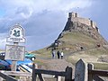
 First view of Lindisfarne Castle - geograph.org.uk - 741655.jpg 640 × 480; 59 KB
-
 Fishing-2.psd (40923993961).jpg 7,940 × 3,528; 1.56 MB
-

-
 Front of Seaton Delaval (geograph 3594423).jpg 640 × 428; 93 KB
-
 Front of Seaton Delaval Hall (geograph 3427277).jpg 640 × 480; 120 KB
-
 Fuel tank from B-17G Flying Fortress -44-6504 PU-M- (25896649308).jpg 4,555 × 3,499; 9.54 MB
-
 G-BGDD Boeing 737-200 British Airways Newcastle 29-05-1991 (46431282804).jpg 1,795 × 1,197; 1.49 MB
-
 G-BGYL Boeing 737-200 Britannia Newcastle 29-05-1991 (40200021093).jpg 2,340 × 1,560; 2.49 MB
-
 G-BHVT B727 Dan Air Newcastle 01-06-91 (33779243893).jpg 2,435 × 1,624; 941 KB
-
 G-BHVT B727 Dan Air Newcastle 29-05-1991 (46461749434).jpg 2,405 × 1,604; 2.49 MB
-
 G-TREN Boeing 737-400 Dan Air Newcastle 25-05-1991 (46250755155).jpg 2,389 × 1,593; 2.55 MB
-
 Gardens in Carlisle Park - geograph.org.uk - 943736.jpg 640 × 480; 123 KB
-
 Grace Darling (10132313243).jpg 3,648 × 2,736; 7.7 MB
-
 Greater Black-backed Gull - Farne Is - FJ0A1192 (36334098915).jpg 1,280 × 853; 247 KB
-
 Greater Black-backed Gull - Farne Is - FJ0A6792 (36197410991).jpg 1,280 × 853; 217 KB
-
 Greenhouse, Cragside - geograph.org.uk - 1437046.jpg 640 × 482; 102 KB
-
 Greenrigg Halt (geograph 6308050).jpg 1,024 × 683; 601 KB
-
 Grey Seal - Farne Is - FJ0A3328 (35498725744).jpg 1,280 × 640; 271 KB
-
 Grey Seal - Farne Is - FJ0A3345 (35498726044).jpg 1,280 × 640; 254 KB
-
 Grey Seal - Farne Is - FJ0A3410 (35498725854).jpg 1,280 × 853; 298 KB
-
 Grey Seal - Farne Is - FJ0A3780 (35526017473).jpg 1,280 × 640; 270 KB
-
 Grey Seal - Farne Is - FJ0A3834 (35526017713).jpg 1,280 × 640; 288 KB
-
 Grey Seal - Farne Is - FJ0A6712 (35938099900).jpg 1,280 × 853; 273 KB
-
 Guillemots on Staple Island - geograph.org.uk - 2678341.jpg 640 × 430; 118 KB
-
 Herring Gull - Farne Is - FJ0A3160 (35525150783).jpg 1,280 × 853; 219 KB
-
 Herring Gull - Farne Is - FJ0A4915 (35498012394).jpg 1,280 × 853; 256 KB
-
 High Buston (2021-05-25) 13.jpg 5,568 × 3,712; 16.94 MB
-
 High light and low light on tyne (8352523135).jpg 9,000 × 1,350; 10.21 MB
-
 Holy Island - telephone exchange - geograph.org.uk - 741642.jpg 640 × 480; 75 KB
-
 Holy Island - tidal warning sign - geograph.org.uk - 741637.jpg 640 × 480; 91 KB
-
 Holy Island Post Office - geograph.org.uk - 741678.jpg 640 × 480; 105 KB
-

-
 Holy Island telephone kiosk - geograph.org.uk - 741685.jpg 640 × 480; 109 KB
-
 Holy Island.jpg 4,676 × 3,118; 10.05 MB
-

-
 House Occupied By Miss Selby Sinton.jpg 5,069 × 3,379; 11.98 MB
-
 House Occupied By Miss Wallace.jpg 4,496 × 2,997; 9.91 MB
-
 Inner Farne - Farne Is - FJ0A2973 (36165831962).jpg 1,280 × 853; 300 KB
-
 Inner Farne - Farne Is - FJ0A4565 (35526019743).jpg 1,280 × 853; 274 KB
-
 Inner Farne - Farne Is - FJ0A5025 (36165880872).jpg 1,280 × 853; 267 KB
-
 Inner Farne - Farne Is Is - FJ0A2857 (36334571525).jpg 853 × 1,280; 299 KB
-
 Inner Farne - Farne Is Is - FJ0A4751 (35526021443).jpg 1,280 × 853; 274 KB
-
 Inner Farne - Frane Is - FJ0A0977 (36334559975).jpg 1,280 × 640; 236 KB
-
 Inner Farne - geograph.org.uk - 2678008.jpg 640 × 430; 50 KB
-
 Inner Farne - geograph.org.uk - 2678249.jpg 640 × 347; 37 KB
-
 Kestrel, Tynemouth, Northumberland (8175255896).jpg 5,184 × 3,456; 4 MB
-
 Lesser Black-backed Gull - Farne Is - FJ0A1432 (36333753535).jpg 1,280 × 853; 290 KB
-
 Light house (8279454109).jpg 2,048 × 1,365; 277 KB
-
 Light house (8503485340).jpg 5,164 × 2,775; 653 KB
-
 Light house03 (8279562121).jpg 5,196 × 3,461; 19.35 MB
-
 Lighthouse on the Inner Farne (27236262676).jpg 2,592 × 1,936; 1.35 MB
-
 Lighthouse, Inner Farne - geograph.org.uk - 2678002.jpg 640 × 430; 52 KB
-
 Lily... (33501587131).jpg 1,164 × 1,501; 262 KB
-
 Lindisfarne Castle (2008) - geograph.org.uk - 741654.jpg 640 × 480; 74 KB
-

-
 Lindisfarne Castle - rear view - geograph.org.uk - 741670.jpg 640 × 480; 83 KB
-
 Lindisfarne Castle - steps up to castle - geograph.org.uk - 741675.jpg 640 × 480; 108 KB
-
 Lindisfarne Causeway.jpg 5,737 × 3,360; 6.58 MB
-

-
 Lindisfarne Heritage Centre sign - geograph.org.uk - 741632.jpg 640 × 480; 93 KB
-
 Lindisfarne Priory (8521930588).jpg 2,336 × 3,504; 1.73 MB
-
 Lindisfarne Priory - geograph.org.uk - 741692.jpg 640 × 480; 90 KB
-
 Lindisfarne Priory - geograph.org.uk - 741695.jpg 640 × 480; 99 KB
-
 Lindisfarne Priory - geograph.org.uk - 741696.jpg 640 × 480; 81 KB
-
-
 Little Comets - London 2012 1.jpg 3,888 × 2,592; 1.97 MB


.jpg)


.jpg)


.jpg)


.jpg)
.jpg)
.jpg)
.jpg)
.jpg)
.jpg)
.jpg)
.jpg)
.jpg)
.jpg)
.jpg)
.jpg)
.jpg)
.jpg)
.jpg)
.jpg)
.jpg)
.jpg)
.jpg)
.jpg)
.jpg)

.jpg)


.jpg)


_-_geograph.org.uk_-_741427.jpg)
_-_geograph.org.uk_-_741429.jpg)
_-_geograph.org.uk_-_741438.jpg)
_-_geograph.org.uk_-_741449.jpg)


.jpg)
.jpg)
.jpg)
.jpg)


_-_Flickr_-_wazimu0.jpg)


.jpg)
.jpg)
.jpg)
.jpg)
.jpg)
.jpg)
.jpg)
.jpg)
.jpg)
.jpg)
.jpg)
.jpg)
.jpg)
.jpg)
.jpg)
.jpg)
.jpg)
.jpg)


.jpg)
.jpg)
.jpg)


.jpg)

.jpg)


.jpg)


.jpg)


.jpg)


.jpg)
.jpg)
.jpg)


.jpg)

.jpg)
.jpg)
.jpg)
.jpg)
.jpg)
.jpg)
.jpg)
.jpg)

.jpg)
.jpg)
.jpg)

.jpg)
.jpg)
.jpg)
.jpg)
.jpg)
.jpg)
.jpg)

.jpg)
.jpg)
_13.jpg)


.jpg)
.jpg)
.jpg)
.jpg)
.jpg)
.jpg)


.jpg)
.jpg)
.jpg)
.jpg)
.jpg)
.jpg)

.jpg)
_-_geograph.org.uk_-_741654.jpg)


_-_cropped.jpg)

.jpg)


&filefrom=Llmmm+%288503605474%29.jpg#mw-category-media)
.jpg)
.jpg)