Category:Files moved to Commons requiring review as of 18 November 2012
Jump to navigation
Jump to search
| Files in this category have not yet been checked as of 18 November 2012.
When every file in this category is checked (the category is empty), you can nominate this category for speedy deletion.
|
Media in category "Files moved to Commons requiring review as of 18 November 2012"
The following 200 files are in this category, out of 769 total.
(previous page) (next page)-
 Hebrides map.png 1,200 × 2,864; 354 KB
-
 Hedmark.png 1,472 × 2,620; 1.03 MB
-
 Hedmark.svg 744 × 1,052; 2.24 MB
-
 Heilongjiang.svg 744 × 1,052; 2.02 MB
-
 Herefordshire map.png 1,051 × 1,186; 27 KB
-
 Hertfordshire map.png 1,232 × 987; 32 KB
-
 Highlands map.png 1,200 × 2,131; 232 KB
-
 Hildesheim.png 800 × 600; 84 KB
-
 Hiroden map.png 3,008 × 1,709; 464 KB
-
 Hiroden map.svg 619 × 356; 77 KB
-
 Hiroshima city map.png 2,500 × 1,465; 1.51 MB
-
 Hiroshima city map.svg 744 × 1,052; 2.92 MB
-
 HK Districts of New Territories.png 1,677 × 1,074; 185 KB
-
 HK Kowloon.PNG 1,344 × 1,168; 126 KB
-
 Hong Kong New Territories including Islands District.PNG 1,344 × 1,168; 131 KB
-
 Honolulu districts map.svg 1,649 × 688; 2.76 MB
-
 Idaho public lands map.png 1,106 × 1,707; 840 KB
-
 Idaho regions map.png 1,106 × 1,707; 617 KB
-
 Idaho regions map.svg 612 × 792; 6.73 MB
-
 Ifrane map with listings.png 1,748 × 2,480; 208 KB
-
 Image-Roma districts map.svg 1,438 × 1,341; 56 KB
-
 India colour.png 978 × 1,144; 73 KB
-
 India map ru.png 1,155 × 1,585; 209 KB
-
 Indre by.png 1,820 × 1,224; 1.41 MB
-
 Inner Hebrides map.png 649 × 1,487; 55 KB
-
 Inner London districts map.png 3,000 × 2,077; 2.03 MB
-
 Inner London tube map.png 3,000 × 2,077; 1.38 MB
-
 Inner Montgomery County map.png 3,000 × 2,399; 4.48 MB
-
 Inner Montgomery County map.svg 943 × 771; 1.76 MB
-
 Inner Seychelles regions map.png 2,208 × 3,008; 735 KB
-
 Intramuros map captioned.png 1,024 × 828; 407 KB
-
 Intramuros map captioned.svg 1,548 × 1,253; 1.3 MB
-
 Intramuros map.png 1,024 × 828; 323 KB
-
 Intramuros map.svg 1,548 × 1,253; 1.25 MB
-
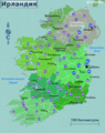 Ireland regions map (ru).png 1,986 × 2,500; 1.44 MB
-
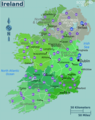 Ireland regions map2.png 1,986 × 2,500; 1.47 MB
-
 Isha yoga center map.png 3,435 × 2,016; 806 KB
-
 Isha yoga center map.svg 744 × 1,052; 1.27 MB
-
 Island of Rügen OSM map.png 695 × 729; 125 KB
-
 Island of Öland OSM map north.png 695 × 729; 71 KB
-
 Island of Öland OSM map south.png 695 × 729; 67 KB
-
 Isle of Wight map.png 1,383 × 831; 27 KB
-
 IT Venice district map (ru).png 1,160 × 944; 202 KB
-
 Italy regions(pt).png 2,419 × 1,420; 735 KB
-
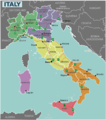 Italy regions.png 2,289 × 2,583; 983 KB
-
 Italy regions.svg 1,200 × 1,500; 767 KB
-
 Iya valley pt.png 2,989 × 1,704; 626 KB
-
 Izmail map.svg 744 × 1,052; 170 KB
-
 Izmail ru.png 2,787 × 2,688; 983 KB
-
 Izmail-center map.svg 744 × 1,052; 255 KB
-
 Izmail-center ru.png 3,126 × 3,658; 1.83 MB
-
 Japan colour.png 699 × 797; 53 KB
-
 Japan Niigata Pref Map.png 1,459 × 1,500; 405 KB
-
 Japan Okinawa map.png 3,000 × 2,659; 910 KB
-
 Jeju Hallasan Trails.png 780 × 780; 150 KB
-
 Jeju Map 1-300000.png 1,490 × 992; 312 KB
-
 Jeju Map 1-300000.svg 1,490 × 991; 590 KB
-
 JP Aomori Prefecture Regions.png 1,495 × 1,060; 48 KB
-
 JP Chiba Prefecture Regions.png 1,066 × 688; 25 KB
-
 JP Fukuoka Prefecture Regions.png 1,066 × 688; 32 KB
-
 JP Hiroshima Prefecture Regions.png 1,066 × 688; 36 KB
-
 JP Hokkaido Prefecture Regions.png 1,257 × 759; 43 KB
-
 JP Hyogo Prefecture Regions.png 1,066 × 688; 36 KB
-
 JP Nagano Prefecture Regions.png 1,066 × 688; 33 KB
-
 JP Nara Prefecture Regions.png 1,066 × 688; 28 KB
-
 JP Okinawa Island Regions.png 1,351 × 1,206; 32 KB
-
 JP Osaka Prefecture Regions.png 1,066 × 688; 28 KB
-
 JP Saitama Prefecture Regions.png 1,066 × 688; 31 KB
-
 Kamloops flight times.svg 1,304 × 1,263; 22 KB
-
 Kamloops travel times.png 677 × 683; 46 KB
-
 Karlskrona OSM street map.png 966 × 619; 220 KB
-
 Kazbegi map.png 3,008 × 1,709; 477 KB
-
 Kazbegi map.svg 1,429 × 1,013; 569 KB
-
 Kensington map.png 2,132 × 1,942; 1.13 MB
-
 Kensington map.svg 744 × 1,052; 354 KB
-
 Kensington print map.png 2,000 × 1,377; 818 KB
-
 Kent map.png 1,254 × 809; 28 KB
-
 KeralaRegions.png 1,448 × 2,582; 747 KB
-
 Khabarovsk map.png 1,709 × 3,010; 1.23 MB
-
 Khabarovsk map.svg 1,080 × 1,902; 724 KB
-
 Kholmsk map.svg 1,675 × 2,968; 113 KB
-
 Kholmsk-Map.png 1,709 × 3,010; 876 KB
-
 Ko Tao map.png 712 × 1,024; 77 KB
-
 Kochi map.png 2,000 × 2,756; 1.14 MB
-
 Komsomolsk map ru.png 1,681 × 2,958; 1.28 MB
-
 Komsomolsk map.png 1,709 × 3,008; 1.26 MB
-
 Komsomolsk map.svg 1,081 × 1,902; 772 KB
-
 Korsakov map.png 1,347 × 1,355; 367 KB
-
 Krakow Kazimierz map.png 1,458 × 1,429; 541 KB
-
 Krakow map.svg 2,974 × 1,750; 11 MB
-
 Kununurra-wider.png 1,864 × 1,937; 299 KB
-
 La Macarena map.png 1,500 × 1,471; 348 KB
-
 La Macarena map.svg 1,034 × 1,014; 593 KB
-
 Lakeview and Lakefront map.png 3,008 × 1,709; 1.92 MB
-
 Lancashire map.png 869 × 1,060; 24 KB
-
 Langeland.png 2,011 × 2,753; 796 KB
-
 Langeland.svg 744 × 1,052; 898 KB
-
 Larache map with listings.png 1,748 × 2,480; 184 KB
-
 Large NT Map.png 1,128 × 1,786; 522 KB
-
 Leicester Square map.png 1,709 × 3,008; 1.69 MB
-
 Leicester Square OSM map.png 1,892 × 2,000; 1.66 MB
-
 Leicester Square OSM map.svg 926 × 804; 1,005 KB
-
 Leicestershire map.png 1,024 × 1,044; 85 KB
-
 Lemans map.png 1,399 × 2,651; 561 KB
-
 Lemans map.svg 1,067 × 1,772; 107 KB
-
 Leningrad oblast regions.png 1,000 × 674; 127 KB
-
 Leningrad oblast regions.svg 1,052 × 744; 127 KB
-
 Lincolnshire map.png 829 × 1,122; 68 KB
-
 Litchfield map.png 1,641 × 1,560; 1.78 MB
-
 Liverpoolone.svg 1,052 × 744; 202 KB
-
 Lolland.png 2,676 × 2,261; 1.86 MB
-
 LollandFalster.png 2,530 × 1,479; 832 KB
-
 London Bloomsbury district.png 2,991 × 2,715; 2.36 MB
-
 London Soho district map.png 3,008 × 1,709; 1.82 MB
-
 London Soho district map.svg 1,154 × 956; 949 KB
-
 London Wandsworth-South border.png 5,000 × 2,363; 3.91 MB
-
 Lothians map.png 1,128 × 487; 18 KB
-
 Loveland Bike Trail Basic.svg 744 × 1,052; 37 KB
-
 Loveland Bike Trail.png 744 × 1,052; 77 KB
-
 Lower Ninth Ward map.png 1,709 × 3,008; 1.36 MB
-
 Lower Ninth Ward map.svg 963 × 1,200; 674 KB
-
 Lyngby-Holte.png 3,460 × 3,006; 3.2 MB
-
 LyonDistricts.png 1,200 × 1,200; 217 KB
-
 LyonDistricts2.png 1,096 × 1,192; 319 KB
-
 LyonDistricts2.svg 1,117 × 1,217; 135 KB
-
 M'zab Valley map.png 2,785 × 1,709; 276 KB
-
 M'zab Valley map.svg 1,733 × 1,675; 462 KB
-
 MaeSalong.png 3,008 × 1,730; 142 KB
-
 MaeSalong.svg 301 × 173; 222 KB
-
 Mahe map.png 2,597 × 3,008; 719 KB
-
 MaineRegionsMap.gif 418 × 599; 28 KB
-
 Maldives regions map.png 1,233 × 4,500; 886 KB
-
 Maldives regions map.svg 330 × 2,519; 784 KB
-
 Maldives with or without gradients.png 3,000 × 3,215; 1.17 MB
-
 Mallorca regions.png 425 × 334; 37 KB
-
 Mallorca regions.svg 440 × 413; 383 KB
-
 Manchester District map.png 852 × 760; 208 KB
-
 Manchester District map.svg 835 × 746; 42 KB
-
 Map - Apple Country NY.png 3,418 × 2,579; 1.21 MB
-
 Map - Apple Country NY.svg 805 × 607; 3.35 MB
-
 Map - Childs NY.png 1,709 × 1,504; 352 KB
-
 Map - Childs NY.svg 1,709 × 1,504; 1.13 MB
-
 Map - Monroe County NY.png 3,418 × 3,008; 1.62 MB
-
 Map - Monroe County NY.svg 3,418 × 3,008; 4.85 MB
-
 Map - Niagara Falls NY - Downtown.png 3,600 × 2,800; 1.71 MB
-
 Map - Niagara Falls NY - Downtown.svg 900 × 700; 1.33 MB
-
 Map - Niagara Falls NY.png 2,640 × 3,000; 1.64 MB
-
 Map - Niagara Falls NY.svg 2,640 × 3,000; 1.15 MB
-
 Map - Orleans County NY.png 3,418 × 3,008; 1.15 MB
-
 Map - Orleans County NY.svg 3,418 × 3,008; 3.66 MB
-
 Map - Rochester NY - Amtrak.png 565 × 432; 62 KB
-
 Map - Rochester NY - Amtrak.svg 744 × 1,052; 740 KB
-
 Map - Rochester NY - overview.png 3,008 × 3,418; 1.79 MB
-
 Map - Rochester NY - overview.svg 1,628 × 1,850; 1.47 MB
-
 Map - Rochester NY Downtown - big icons.png 1,840 × 1,331; 954 KB
-
 Map - Rochester NY Downtown - big icons.svg 1,658 × 1,201; 943 KB
-
 Map - Rochester NY Downtown 2.png 2,709 × 1,468; 849 KB
-
 Map - Rochester NY Downtown 2.svg 744 × 1,052; 972 KB
-
 Map - Rochester NY Downtown.png 3,578 × 2,666; 1.85 MB
-
 Map - Rochester NY Downtown.svg 744 × 1,052; 982 KB
-
 Map - Saint Marys PA.png 2,278 × 2,395; 791 KB
-
 Map - Saint Marys PA.svg 1,139 × 1,198; 991 KB
-
 Map - Skaneateles.png 2,753 × 1,861; 486 KB
-
 Map - Skaneateles.svg 744 × 1,052; 1.01 MB
-
 Map Funen.png 1,000 × 1,269; 287 KB
-
 Map Funen.svg 458 × 581; 859 KB
-
 Map of Arctic Islands.png 936 × 935; 257 KB
-
 Map of Arctic Ocean.svg 744 × 1,052; 582 KB
-
 Map of Denali.png 1,000 × 641; 142 KB
-
 Map of Denali.svg 744 × 1,052; 1.53 MB
-
 Map of Dominican Republic.png 1,608 × 1,001; 172 KB
-
 Map of Flores.png 884 × 1,000; 253 KB
-
 Map of Flores.svg 744 × 1,052; 569 KB
-
 Map of Florida Regions with Cities (ru).png 2,028 × 1,973; 465 KB
-
 Map of Florida Regions with Cities.svg 7,342 × 7,321; 1.51 MB
-
 Map of Florida Regions.png 2,203 × 2,196; 435 KB
-
 Map of Karelia ru.png 1,323 × 1,871; 231 KB
-
 Map of Karelia ru.svg 744 × 1,052; 122 KB
-
 Map of Massachusetts Regions.png 3,040 × 1,874; 487 KB
-
 Map of Massachusetts Regions.svg 2,976 × 1,819; 1,000 KB
-
 Map of McLeod Ganj.png 1,483 × 1,738; 316 KB
-
 Map of McLeod Ganj.svg 744 × 1,052; 534 KB
-
 Map of Ohio Regions.png 1,853 × 2,013; 389 KB
-
 Map of Ohio Regions.svg 3,675 × 3,995; 131 KB
-
 Map of Rhode Island Regions.png 1,426 × 2,180; 214 KB
-
 Map of Rhode Island Regions.svg 1,080 × 1,080; 69 KB
-
 Map of Saint Martins Island.png 1,974 × 3,577; 847 KB
-
 Map of Saint Martins Island.svg 744 × 1,052; 762 KB
-
 Map of shunan city en.PNG 289 × 360; 9 KB
-
 Map of Taipei districts.svg 350 × 461; 72 KB
-
 Map of the Sandpoint Idaho Region.png 707 × 571; 64 KB
-
 Map of the Sandpoint Idaho Region.svg 707 × 582; 614 KB
-
 Map of Tobacco Caye portuguese.png 1,000 × 945; 149 KB
-
 Map of Yamaguchi city en.PNG 430 × 345; 9 KB
-
 Map RSA WesternCape1.svg 744 × 1,052; 1.16 MB
-
 Map showing the location of Raglan.jpg 552 × 822; 111 KB
-
 Map To Isha Yoga Center.png 3,262 × 2,233; 549 KB
-
 Map-Gifhorn.svg 827 × 1,169; 298 KB
-
 Map-India-Delhi01.png 1,024 × 824; 517 KB
-
 Map-India-Delhi01.svg 744 × 1,052; 701 KB


.png)


.png)
.png)


.png)


