Category:Files from armenica.org
Jump to navigation
Jump to search
Media in category "Files from armenica.org"
The following 131 files are in this category, out of 131 total.
-
 105ByzantExpan3-966-1064.png 700 × 473; 67 KB
-
 116IlkanidDomin1256-1335.gif 700 × 475; 57 KB
-
 128TurkomanDomin1378-1502.JPG 700 × 476; 286 KB
-
 129OttomanSafavid1502-1590.gif 700 × 476; 55 KB
-
 13-Urartu-9-6mta.gif 700 × 474; 45 KB
-
 163treaties1800.gif 700 × 587; 37 KB
-
 164BeforeWWI1878-1914s.gif 700 × 473; 61 KB
-
 219turkish-arm1914.gif 700 × 512; 44 KB
-
 265nakhichevan-assr.gif 700 × 633; 49 KB
-
 73artzrounis.png 700 × 653; 53 KB
-
 81ArabAbbasidPeriod750-885.gif 700 × 456; 51 KB
-
 87EarlyBagratid884-962 (1).gif 700 × 457; 69 KB
-
 87EarlyBagratid884-962-pt.svg 512 × 330; 69 KB
-
 87EarlyBagratid884-962.gif 700 × 457; 62 KB
-
 93-vaspurakan908-1021.gif 700 × 486; 61 KB
-
 Adana 1909.png 676 × 463; 185 KB
-
 Akdamar isle.gif 699 × 445; 15 KB
-
 Akdamar isle.png 700 × 465; 14 KB
-
 AniMap.gif 700 × 693; 97 KB
-
 AniMapHE.gif 730 × 997; 197 KB
-
 Archuvakchurcha.jpg 500 × 333; 22 KB
-
 Areni-v-svn02-l.jpg 496 × 650; 33 KB
-
 Armenia Throughout History.gif 700 × 525; 38 KB
-
 Armenia, 1914.png 700 × 472; 72 KB
-
 Armenia, beginning of the 13th Century.png 700 × 476; 172 KB
-
 Armenia, Late 18th century till late 19th century.png 700 × 480; 65 KB
-
 Armenian regions-expansion of the House of Mamikonian.gif 668 × 393; 35 KB
-
 Armenian4thcenturies.gif 699 × 456; 49 KB
-
 Armeniangenocidemap.gif 698 × 344; 51 KB
-
 Armenianhighlandorg.png 700 × 472; 138 KB
-
 Armenianmeds.gif 699 × 471; 56 KB
-
 ArmenianOblast.jpg 700 × 457; 87 KB
-
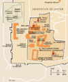
 Armeniquarter-BLANK.png 650 × 782; 28 KB
-
 Armeniquarter-HE.png 650 × 780; 31 KB
-
 Armeniquarter.gif 649 × 780; 56 KB
-
 Armeniquarter.png 649 × 780; 55 KB
-
 Arsacid (Arshakouni) Armenia, 63-299 A.D..png 700 × 473; 63 KB
-
 Artzrounis-pt.svg 677 × 612; 80 KB
-
 Aruchavank-cat-in-vgn01.jpg 500 × 333; 21 KB
-
 Aruchavank-cat-in-vgn02.jpg 500 × 333; 23 KB
-
 Aruchavank-cat-v-vgn04.jpg 341 × 500; 28 KB
-
 Aruchavank-cat-v-vgn05.jpg 500 × 333; 27 KB
-
 Aruchavank-map.png 500 × 439; 32 KB
-
 Bagaratidarmeni.gif 698 × 499; 61 KB
-
 Bagratid Armenia, 962-1064.gif 700 × 472; 61 KB
-
 Bagratid Iberia (Tao–Klarjeti).gif 700 × 673; 67 KB
-
 Baku in 1914.png 700 × 666; 160 KB
-
 Battle of Avarayr.gif 700 × 493; 33 KB
-
 Caucasiamapussr-ar.gif 739 × 623; 199 KB
-
 Caucasiamapussr.gif 700 × 590; 81 KB
-
 Caucasus, 884-962.gif 700 × 473; 67 KB
-
 Church of St. Amenaprkitch (3) and its gavit (4) Sanahin Monastery.jpg 1,240 × 700; 229 KB
-
 Cilician Armenia-ar.svg 2,508 × 1,789; 848 KB
-
 Cilician Armenia-en.svg 2,508 × 1,789; 713 KB
-
 Cilician Armenia-fr.svg 1,458 × 991; 374 KB
-
 ErevanKhanate.gif 700 × 572; 47 KB
-
 Etchmiadzin Cathedral 5th century plan.png 433 × 423; 26 KB
-
 Geghard-gp-ares6-l.jpg 800 × 543; 84 KB
-
 Geghard-map.jpg 499 × 438; 37 KB
-
 Goshavank-map.gif 500 × 439; 31 KB
-
 Haghbad-kk-sur-03-m.jpg 150 × 239; 8 KB
-
 Hakhpat-gp-ares1-l.jpg 2,501 × 2,480; 580 KB
-
 Harchivancurc.jpg 500 × 364; 57 KB
-
 Historiska gränser Armenien.gif 698 × 507; 38 KB
-
 House of Mengüjek (territories).jpg 1,396 × 910; 1.38 MB
-
 Hovhanavank-v-vgn09.jpg 385 × 500; 33 KB
-
 Hpa-tigranakertbattle69.gif 700 × 418; 31 KB
-
 Jorgat harasm.gif 700 × 579; 73 KB
-
 Julfa-khachkars.jpg 500 × 398; 83 KB
-
 Kasmaratalin.jpg 552 × 700; 203 KB
-
 Killikiadana.gif 700 × 520; 52 KB
-
 Kosh-castle-vgn09-l.jpg 800 × 532; 68 KB
-
 Kosh-gevorg-v-vgn01-l.jpg 800 × 532; 71 KB
-
 Kosh-lus-in-svn08.jpg 500 × 296; 27 KB
-
 Kosh-map.gif 500 × 439; 18 KB
-
 Koshsoutheast.jpg 500 × 333; 38 KB
-
 Map of Amberd.gif 500 × 439; 32 KB
-
 Map of Byzantine Armenia, 387-536.gif 671 × 503; 42 KB
-
 Map of Etchmiadzin.gif 695 × 521; 105 KB
-
 Map of Etchmiadzin.jpg 495 × 372; 97 KB
-
 Map of Geghard.gif 499 × 438; 20 KB
-
 Map of Haghpat.gif 500 × 440; 27 KB
-
 Map of Haghpat.jpg 500 × 440; 41 KB
-
 Map of Noravank.gif 500 × 438; 31 KB
-
 Map of Qara Kelisa-he.jpg 416 × 209; 33 KB
-
 Map of Qara Kelisa.gif 433 × 352; 34 KB
-
 Map of Saghmosavankgif.gif 500 × 439; 26 KB
-
 Map of Soviet Armenia.gif 700 × 517; 64 KB
-
 Map of Zvartnots.gif 500 × 438; 40 KB
-
 Map of Zvartnots.jpg 500 × 438; 65 KB
-
 Maps of the Armenian Empire of Tigranes-he.svg 512 × 506; 38 KB
-
 Maps of the Armenian Empire of Tigranes.gif 673 × 669; 56 KB
-
 Mastara-v-vgn04.jpg 500 × 333; 25 KB
-
 Mpa of Haghardzin.gif 500 × 439; 47 KB
-
 Musa-dagh.gif 700 × 607; 62 KB
-
 Nagorno-Karabakh as of summer 1992.png 476 × 417; 53 KB
-
 Northwestthaddes.jpg 500 × 313; 182 KB
-
 Persian Armenia.gif 698 × 455; 53 KB
-
 Present-day plan of the Etchmiadzin Cathedral.png 459 × 319; 22 KB
-
 Republic of Armenia (since 1991).gif 700 × 517; 58 KB
-
 Saghmoa.jpg 500 × 333; 48 KB
-
 Sanahin-g-plan-ares3-l.jpg 2,773 × 2,480; 579 KB
-
 Sevanavank-v-vgn19-l.jpg 700 × 465; 55 KB
-
 Shaddadid.gif 1,396 × 910; 369 KB
-
 St.gveorkchurch.jpg 500 × 333; 42 KB
-
 Tamanyans Cityplan for Yerevan - 1924.gif 405 × 598; 37 KB
-
 The Alashkert Campaign; July-August 1915.gif 700 × 682; 67 KB
-
 The Armenian Front During the Crimean War, 1853-56.gif 700 × 407; 47 KB
-
 The Barony of Cilician Armenia, 1080-1199.gif 699 × 472; 47 KB
-
 The City of Adana.gif 700 × 488; 72 KB
-
 The City of Diyarbakir.gif 700 × 472; 86 KB
-
 The City of Dvin.gif 700 × 754; 73 KB
-
 The city of Lori and its citadel, Loribert.gif 700 × 769; 102 KB
-
 The city of Manazkert.gif 700 × 500; 23 KB
-
 The City of Van.gif 700 × 501; 78 KB
-
 The City of Yerevan, 1827.gif 700 × 795; 86 KB
-
 The Erzurum Campaign, february 1916.gif 698 × 685; 84 KB
-
 The First Armenian Republic 1918-1920.gif 700 × 473; 64 KB
-
 The Kingdom of Syounik-Baghk, 1020-1166.gif 700 × 627; 67 KB
-
 The map of Yerevan in 1913.gif 700 × 408; 25 KB
-
 The plan of the Etchmiadzin Cathedral.png 504 × 697; 37 KB
-
 The Russo-Turkish War in Caucasia, 1877.gif 700 × 482; 54 KB
-
 The Siege of Kars, 1855.gif 690 × 438; 63 KB
-
 The Town of Zeytoun (Ulnia) in 1862.gif 700 × 476; 43 KB
-
 Tiflis 1914.gif 573 × 800; 95 KB
-
 Uzunhasanempire.gif 700 × 472; 51 KB
-
 Vahramshenchuch.jpg 471 × 347; 29 KB
-
 Vaspurakan kingdom 908-1021 map-fr.svg 1,261 × 1,191; 394 KB
-
 Yerevan 18 century map.png 697 × 404; 48 KB
-
 Yerevan 19 century map.gif 696 × 403; 21 KB
-
 Yervanduni Armenia, IV-II BC.gif 700 × 457; 58 KB


.gif)


_Armenia,_63-299_A.D..png)


.gif)


_and_its_gavit_(4)_Sanahin_Monastery.jpg)


.jpg)


.gif)


_in_1862.gif)


