Category:Fields in Winterton, Lincolnshire
Jump to navigation
Jump to search
Media in category "Fields in Winterton, Lincolnshire"
The following 23 files are in this category, out of 23 total.
-
 B1430 near Old Cliff Farm - geograph.org.uk - 1235416.jpg 640 × 480; 96 KB
-
 Carr Lane - geograph.org.uk - 1311862.jpg 640 × 480; 43 KB
-
 Grazing land off Carr Lane - geograph.org.uk - 1311847.jpg 640 × 480; 72 KB
-
 Ings Lane - geograph.org.uk - 311493.jpg 640 × 348; 62 KB
-
 Lane to Winterton Model Flying Club - geograph.org.uk - 1311850.jpg 640 × 480; 71 KB
-
 Looking towards South Ferriby - geograph.org.uk - 68299.jpg 640 × 480; 94 KB
-
 Looking towards Winterton - geograph.org.uk - 1291863.jpg 640 × 480; 109 KB
-
 Looking towards Winterton - geograph.org.uk - 1470370.jpg 640 × 425; 85 KB
-
 Looking West - geograph.org.uk - 56368.jpg 425 × 640; 110 KB
-
 Maltby Farm - geograph.org.uk - 1310928.jpg 640 × 480; 48 KB
-
 More Pylons - geograph.org.uk - 10827.jpg 640 × 480; 73 KB
-
 Northlands Road - geograph.org.uk - 1310435.jpg 640 × 480; 40 KB
-
 On the Winterton Footpath - geograph.org.uk - 223091.jpg 640 × 480; 143 KB
-
 Pylons near West Halton - geograph.org.uk - 1131603.jpg 640 × 480; 67 KB
-
 Pylons near West Halton - geograph.org.uk - 1131613.jpg 640 × 480; 79 KB
-
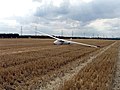 Stubble Field with Glider - geograph.org.uk - 223914.jpg 640 × 480; 116 KB
-
 Towards Winterton Carrs - geograph.org.uk - 1311834.jpg 640 × 480; 40 KB
-
 Winter Wheat - Field off the B1430 - geograph.org.uk - 1235400.jpg 640 × 480; 79 KB
-
 Winterton Carrs - geograph.org.uk - 1310422.jpg 640 × 480; 69 KB
-
 Winterton Carrs - geograph.org.uk - 171394.jpg 640 × 426; 94 KB
-
 Winterton Carrs Plantation - geograph.org.uk - 1310425.jpg 640 × 480; 80 KB
-
 Winterton Ings - geograph.org.uk - 223883.jpg 640 × 480; 132 KB
-
 WintertonView.JPG 2,260 × 1,757; 1,000 KB


