Category:Fields in County Meath
Jump to navigation
Jump to search
Media in category "Fields in County Meath"
The following 24 files are in this category, out of 24 total.
-
 Bales at Danestown, Co. Meath - geograph.org.uk - 905338.jpg 640 × 480; 77 KB
-
 Bales at Flemingtown, Co. Meath - geograph.org.uk - 1002256.jpg 640 × 480; 78 KB
-
 Bodingtown, Co. Meath - geograph.org.uk - 1002241.jpg 640 × 480; 79 KB
-
 Cropland west of the N1 - geograph.org.uk - 1568273.jpg 640 × 339; 35 KB
-
 Demesne at Annesbrook, Co. Meath - geograph.org.uk - 904966.jpg 640 × 480; 88 KB
-
 Field near Ballinabrackey, Co. Meath - geograph.org.uk - 1389228.jpg 640 × 440; 89 KB
-
 Field near Ballivor, Co. Meath - geograph.org.uk - 1390022.jpg 640 × 452; 104 KB
-
 Field near Cappaboggan, Co. Meath - geograph.org.uk - 1387967.jpg 640 × 451; 113 KB
-
 Field of Maize at Grange, Co. Meath - geograph.org.uk - 987490.jpg 640 × 480; 136 KB
-
 Field, Peacockstown, Co Meath - geograph.org.uk - 1743826.jpg 640 × 480; 86 KB
-
 Field, Peacockstown, Co Meath - geograph.org.uk - 1743829.jpg 640 × 480; 68 KB
-
 Fieldscape and Road, Co Meath - geograph.org.uk - 1732893.jpg 640 × 480; 66 KB
-
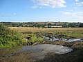
 Fieldscape, Co Meath - geograph.org.uk - 1755821.jpg 640 × 480; 88 KB
-
 Fieldscape, Rathcool, Co Meath - geograph.org.uk - 1743849.jpg 640 × 480; 82 KB
-

-
 Hurcle, Co. Meath - geograph.org.uk - 971852.jpg 640 × 480; 63 KB
-
 IMG LBane2957.jpg 3,888 × 2,261; 3.17 MB
-
 Lacystown, Co. Meath - geograph.org.uk - 977042.jpg 640 × 480; 64 KB
-
 Landscape, Co Meath - geograph.org.uk - 1804977.jpg 640 × 480; 79 KB
-
 Landscape, Co Meath - geograph.org.uk - 1804983.jpg 640 × 480; 77 KB
-
 Landscape, Ratoath manor, Co Meath - geograph.org.uk - 1732876.jpg 640 × 480; 95 KB
-
 Old furrows at Crinstown, Co. Meath - geograph.org.uk - 1753671.jpg 638 × 640; 77 KB
-
 Wheat fields near Beaumont - geograph.org.uk - 451549.jpg 640 × 480; 77 KB
-
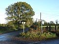 Signpost North of Dunderry, Co. Meath - geograph.org.uk - 601308.jpg 640 × 480; 149 KB


